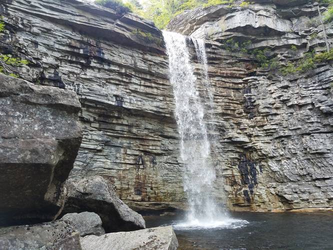
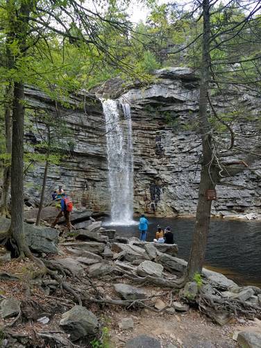
Awosting Falls via Sunset Carriageway Trail at Minnewaska State Park Preserve in Gardiner, New York is a moderate 2.1-mile out-and-back hike featuring a vista point multiple waterfalls, including the popular Awosting Falls.
Hiking to Awosting Falls
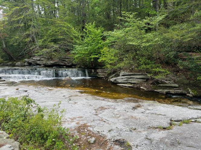
This hike begins at the south side of the visitors center were you'll find the trailhead for the Sunset Carriageway Trail. The path is gravel, well marked, and heads down to several smaller waterfalls before continuing down further to the larger waterfall -- Awosting Falls. The hike is suitable for kids and families. The park as a whole is beautiful and there's a good amount of trails to choose from, just prepare for it to be busy if you're going on the weekend.
Fee: The fee for parking at Minnewaska is $10 per car.
Parking: Parking can be found at the coordinates provided in the upper lot.
Pets: Leashed dogs are allowed on the trail.
Facilities: Near the parking lot there are porta-potties available, as well as a picnic area.
Hiking to Awosting Falls
This hike begins at the south side of the visitors center were you'll find the trailhead for the Sunset Carriageway Trail. The path is gravel, well marked, and heads down to several smaller waterfalls before continuing down further to the larger waterfall -- Awosting Falls. The hike is suitable for kids and families. The park as a whole is beautiful and there's a good amount of trails to choose from, just prepare for it to be busy if you're going on the weekend. Popular Culture
Fans of Apple TV's, Severance, will notice Awosting Falls is the waterfall that the "innies" hike to during their Outdoor Retreat Team Building Occurrence (ORTBO).Fee: The fee for parking at Minnewaska is $10 per car.
Parking: Parking can be found at the coordinates provided in the upper lot.
Pets: Leashed dogs are allowed on the trail.
Facilities: Near the parking lot there are porta-potties available, as well as a picnic area.