Loading...

๐ŸŽ‰ Enjoy a Free 7-Day Supporter Trial and Unlock Exclusive Perks โ€” No Credit Card Required. Learn more.

Arcadia Wildlife Sanctuary Loop Trail

Directions
Map
Pictures
Send to App
Distance:
0.9 Miles / 1.4 km
Type:
Loop
Difficulty:
Easy
Time to Hike:
~27 minutes
Features:
Surface Type:
Dirt
Park:
Arcadia Wildlife Sanctuary
Town:
Easthampton, Massachusetts
Directions:
42.28901, -72.645949
Added:
April 14, 2018
Updated:
April 14, 2018
Copy Trail Link Hiking this trail? Send a friend or family member a link to this trail guide for your own safety. Hike at your own risk (disclaimer)
Loading...
Loading...
157'

Total Change
45'

Ascent
52'

Descent

Download the Trail Route for Offline Use

Supporters get exclusive access to download trail routes to the MyHikes app for offline use. Stay prepared on your adventure, even without an internet connection! Become a Supporter today to unlock this feature and hike with confidence.

Send to App

Arcadia Wildlife Sanctuary Loop Trail

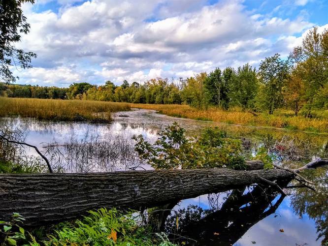
The Massachusetts Audubon Arcadia Wildlife Sanctuary is located in Easthampton Massachusetts and this short 0.9 mile loop trail passes through the woods along a handful of trails and leads out to a small lookout point located by the water. The trail also has a small vernal pond with a boardwalk so visitors can see turtles, frogs and other wildlife. Please note that this recording follows several trails, listed in the notes below.

The sanctuary offers educational resources and is a great place to explore. The grounds are very well maintained with brand new picnic tables and fields for all sort of activities. There are several other trails on the grounds, offering very short to medium length walks for all ages.

Fees: $4 for adults, $3 for kids 3-10.

Trails in this recording: This recording starts off on the Woodcock Trail before taking the Old Coach Road Trail. A short right-hand turn to the Old Trolley Line Trail, then to the Fern Trail and finally to the Tulip Tree Trail and back to parking. For more details on the trails at the park, use the OpenTopoMap tiles in the trail map to see all of the other trails.
Explore 208 trails near Easthampton, MA
  1. Parking

    42.28901, -72.645949
  2. Main Trailhead

    42.28901, -72.645949
  3. View / Overlook / Vista

    42.290741, -72.642638
    View / Overlook / Vista
  4. View / Overlook / Vista

    42.288567, -72.643932
    View / Overlook / Vista
Explore other routes for this Trail guide, added by the MyHikes' community via Trip Reports. To add your own hike as a Community Route for this Trail guide, leave a Trip Report with an attached GPX file.

Hazards

Ticks - Lyme Disease More Info (CDC)

Seasons

All

Trip Reports

Trail Guide By:
Tocra user profile picture
0.9 miles / 1.4 km
2.5 miles / 4.0 km
September 28, 2020

Weather Forecast

In Easthampton, MA

Explore Hiking Trails

You May Also Like

Colorado's Million Dollar Highway - Plan a day's drive adventure along the iconic Million Dollar Highway in Colorado. Explore the best short trails, roadside stops, waterfalls, vistas, ghost towns, and hot springs within a ~6 hour road trip.
Explore

Colorado's Million Dollar Highway

Plan a day's drive adventure along the iconic Million Dollar Highway in Colorado. Explore the best short trails, roadside stops, waterfalls, vistas, ghost towns, and hot springs within a ~6 hour road trip.

Read
Glacier's Going-to-the-Sun Road - Discover the breathtaking beauty of Glacier National Park along the iconic Going-to-the-Sun Road. From stunning roadside stops to picturesque waterfalls and vistas, this engineering marvel offers endless opportunities for exploration.
Explore

Glacier's Going-to-the-Sun Road

Discover the breathtaking beauty of Glacier National Park along the iconic Going-to-the-Sun Road. From stunning roadside stops to picturesque waterfalls and vistas, this engineering marvel offers endless opportunities for exploration.

Read
New York's Best Waterfalls - Whether you're planning a day hike, roadside stop, or a leisurely short walk, this guide provides hikers, travelers, and locals alike with 63 different locations to over 100 scenic waterfalls to help plan your next adventure!
Explore

New York's Best Waterfalls

Whether you're planning a day hike, roadside stop, or a leisurely short walk, this guide provides hikers, travelers, and locals alike with 63 different locations to over 100 scenic waterfalls to help plan your next adventure!

Read

Before you boogie...

Find our trail guides useful? Consider becoming a Supporter to unlock perks!

MyHikes is an indie platform that makes exploring public trails easier for everyone. The platform has no investors, no ads, and is owned and operated by one person, Dave Miller. Dave has personally mapped and written over 1,800 trail guides on MyHikes for the public to explore. MyHikes has helped millions outdoor enthusiasts plan their next adventure.

But it takes a lot of time ๐Ÿ•ฆ, money ๐Ÿ’ฐ, work, and espresso shots โ˜• to run MyHikes, including hiking , mapping , writing , and publishing new trails with high-quality (accurate) information... along with software engineering (coding) the platform like building new features, website and mobile app development (iOS and Android), site maintainance . and much much more.

Supporters unlock website and mobile app perks with an annual one-time payment of $25 (you renew) ๐Ÿ˜Ž๐Ÿ‘. Or you can simply make a Donation of your choice. Otherwise, you can support us by telling your friends about MyHikes - both quick and free ๐ŸŽ‰

Admin user profile picture

Dave Miller
MyHikes Founder