Located in the heart of the Hudson Valley, high above the Bear Mountain Bridge sits the majestic vista on Anthony's Nose—one of the more popular day hike destinations along the Hudson River near Philipstown, New York.
This moderate 2.2-mile out-and-back hike follows the Appalachian Trail and the Camp Smith Trail to reach the summit of Anthony's Nose, featuring several vistas of the Hudson River, Hudson Valley area, and the iconic Bear Mountain Bridge all within
Hudson Valley State Park.
Hiking to Anthony's Nose Vistas
This hike begins at the Appalachian Trail trailhead located on the south side of Bear Mountain-Beacon Highway on the east side of the Bear Mountain Bridge. Hikers will find limited roadside parking - note the sections where "No Parking" signs sit to avoid getting a ticket or towed.
Steep Ascent via AT - Mile 0 to 0.43
From the trailhead, the Appalachian Trail runs up the mountain at a fairly steep elevation grade, following many sections with rock steps. Watch your step on the rocky, root-filled soil as you ascend at relatively slow pace. As of June 2026, the trail had one small section of washed-out rocks where a short, easy scramble was required to continue.
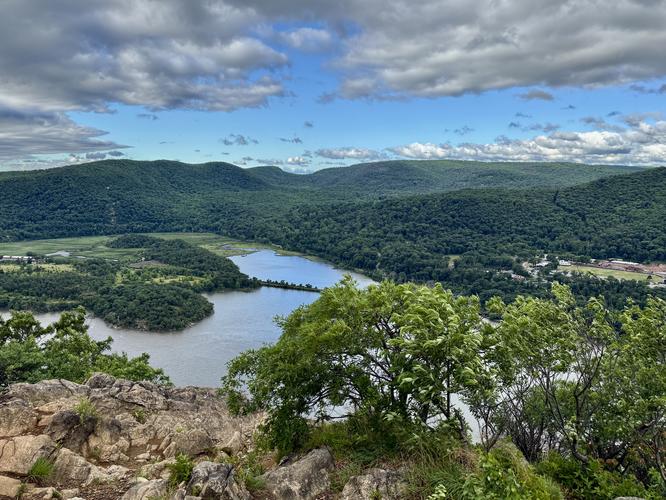
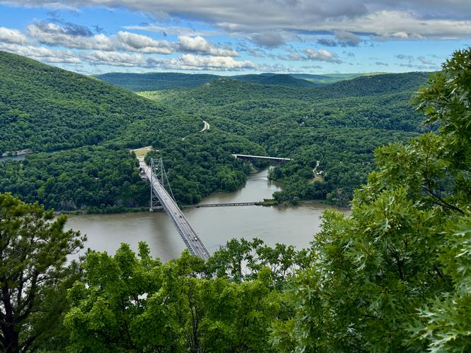
Camp Smith Trail to Vista - Mile 0.43 to 1
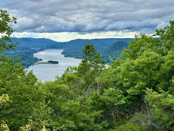
At the very top of the Appalachian Trail, hikers will reach a T-intersection where you'll meet up with the Camp Smith Trail. Take a right-hand turn to head south along the Camp Smith Trail as it undulates its way toward the summit of Anthony's Nose and the vista points that sit high above the Hudson River. As you approach the main bedrock viewpoint area, you'll reach another T-intersection where a right-hand turn will lead along a short path and out to a couple different vista points above the Hudson River. At mile 1, you'll reach the vista points with the Bear Mountain Bridge beneath your feet, Bear Mountain located to the west, and the Hudson River flowing through the valley below. Be sure to bop around the bedrock before you continue onward as you'll find slightly different perspectives and views from the dispersed viewpoints. Watch your step near the edge of any cliffs.
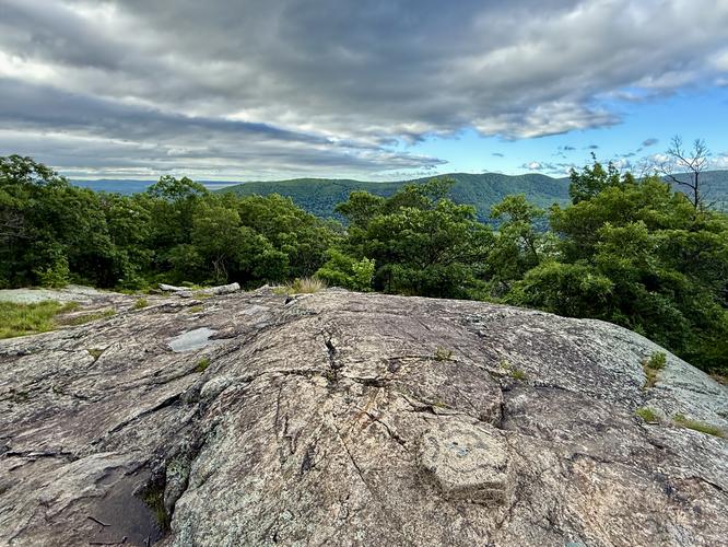
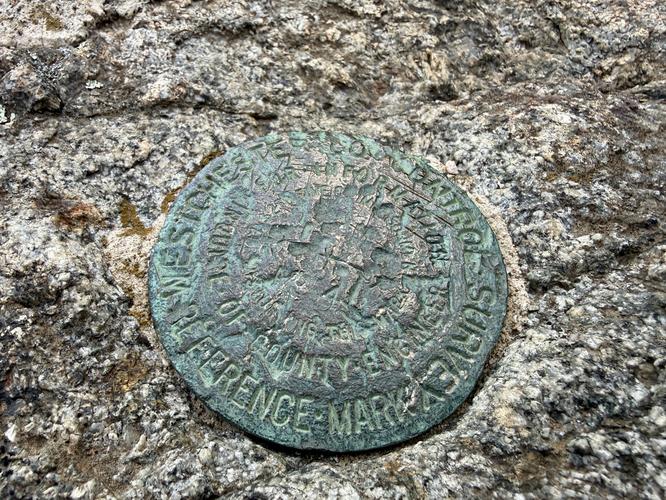
Anthony's Nose Summit - Mile 1.12
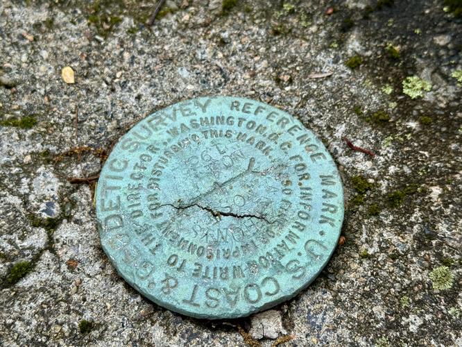
After exploring the viewpoints high above the Bear Mountain Bridge, this route leads to the summit marker for Anthony's Nose, located near mile 1.12. The trail leads up a short rock outcropping before spitting hikers out atop exposed bedrock with nice Hudson River views and a USGS summit marker.
Northern Hudson River Views - Mile 1.26
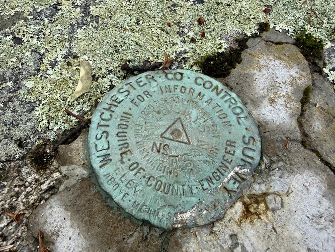
Before you commit to hiking down the mountain and back to parking, consider exploring one more vista point that sits just off of the beaten path of the Camp Smith Trail. As you hike back toward parking, near mile 1.22 sits a discrete path that cuts off of the Camp Smith Trail and runs north, passing what appears to be old concrete fire tower footings with USGS survey markers embedded. Just beyond the old fire tower footings sits a north-facing vista of the Hudson River and the well-known mountain "knob" of Sugarloaf Mountain, located on the east side of the river. This little-known vista is the only north-facing view of the Hudson River on Anthony's Nose, so it's worth the extra effort to explore before hiking out.
Hiking Out - Mile 1.22 to 2.2
After exploring the north-facing Hudson River view, the hike out follows the Camp Smith Trail before taking the AT back down the mountain. Watch your step along the root-filled, rock steps of the Appalachian Trail along the way. Reach the parking area and trailhead at mile 2.2 to wrap up the hike.
Parking
Hikers should be aware that parking for Anthony's Nose, via the Bear Mountain-Beacon Highway can be tricky. Parking can be found along the road on the south side of the highway where there's just enough shoulder room in the breakdown lane. Be aware of the "No Parking" sections along the road, denoted by signage. As of June 2026, there's enough parking for about a dozen vehicles, or slightly more.
Pets
Dogs are allowed only if leashed and must be cleaned up after.
Warning
Steep cliffs: This hike leads to steep cliffs that sit high above the Hudson River. Watch your step and keep back from cliff edges for your own safety.