Loading...

Distance:
0.1 Miles / 0.2 km
Type:
Out-and-Back
Difficulty:
Easy
Time to Hike:
~5 minutes
Features:
Surface Type:
Dirt
Park:
Kanakadea Park
Town:
Hornell, New York
Directions:
42.349781, -77.71041
Added:
February 24, 2024
Updated:
February 29, 2024
Loading...
Loading...
13 '

Total Change
17 '

Ascent
17 '

Descent

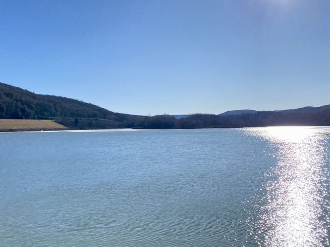
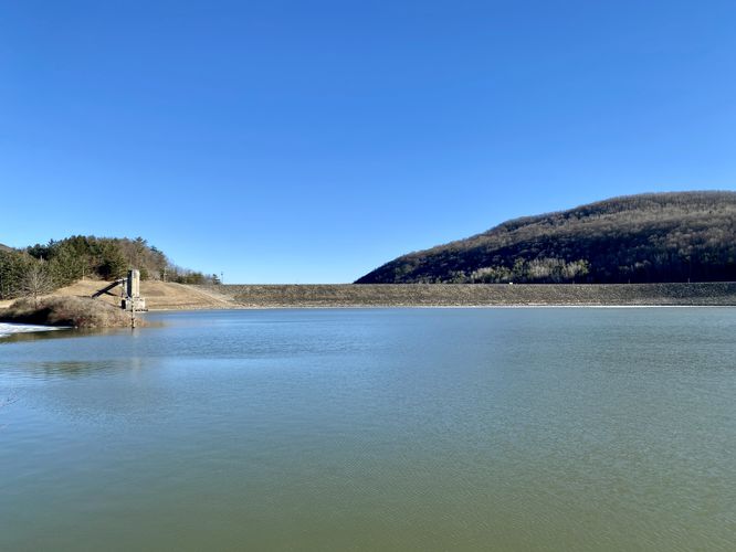
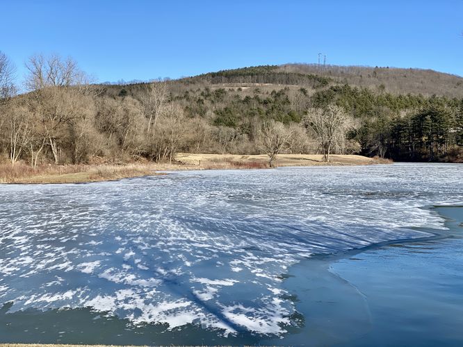
The Almond Lake Overlook at Kanakadea Park in Hornell, New York is an easy 0.1-mile out-and-back walk that leads to an observation deck on the banks of Almond Lake.

This is not a hike but rather a very short walk from the parking area out to the observation deck. From the overlook, visitors will find scenic views of Almond Lake, the Almond Lake Dam, and surrounding hills like Bald Hill to the North and the hills that define Canacadea State Forest (i.e. the Almond-Hornell Overlook), located to the South.

Parking
Visitors will find a very-large parking lot near the coordinates provided, located on the eastern end of the park.

Pets
Dogs are allowed if leashed and must be cleaned up after.

Explore 19 trails near Hornell, NY
  1. Parking

    42.349781, -77.71041
  2. Main Trailhead

    42.3495, -77.710324
  3. View of Almond Lake

    42.349097, -77.710044
    View of Almond Lake
  4. View of the Almond Lake Dam

    42.349097, -77.710031
    View of the Almond Lake Dam
  5. View of Bald Hill and Almond Lake

    42.349247, -77.710197
    View of Bald Hill and Almond Lake
No community routes found. To add your own hike as a Community Route for this Trail guide, leave a Trip Report with an attached GPX file.

Hazards

Ticks - Lyme Disease More Info (CDC)

Seasons

All

Photo Albums

2 Trip Reports

No Star-Ratings
Trail Guide By:
Admin user profile picture
0.1 miles / 0.2 km
Trail added
February 24, 2024
Hiked on
February 24, 2024
Updated on
February 29, 2024
0.1 miles / 0.2 km
February 24, 2024
Dogs Hiking

Weather Forecast

In Hornell, NY

Explore Hiking Trails

New Hikes

Mary's Lake Trail
0.6 Miles
1 km
Easy
Out-and-Back
Beaver Ponds Trail
0.1 Miles
0.2 km
Easy
Out-and-Back
Conklin's Gully Loop
2.4 Miles
3.9 km
Hard
Loop
Lake Estes Trail
0.9 Miles
1.4 km
Easy
Out-and-Back

Before you boogie...

Find our trail guides useful? Consider becoming a Supporter to unlock perks!

MyHikes is an indie platform that makes exploring public trails easier for everyone. The platform has no investors, runs no ads, and is owned and operated by one person, Dave Miller. Dave has personally mapped and written over 1,600 trail guides on MyHikes for the public to explore. As of 2024, MyHikes has helped over 1,300,000 outdoor enthusiasts plan their next adventure.

But it takes a lot of time 🕦, money 💰, and work, and espresso shots ☕ to run MyHikes, including hiking , mapping , writing , and publishing new trails with high-quality (accurate) information... along with software engineering (coding) the platform like building new features, site and mobile app development for iOS and Android, site maintainance . and much much more.

Supporters unlock website and mobile app perks with an annual one-time payment of $25 (you renew) 😎👍. Or you can simply make a Donation of your choice. Otherwise, you can support us by telling your friends about MyHikes - both quick and free 🎉

Admin user profile picture

Dave Miller
MyHikes Founder