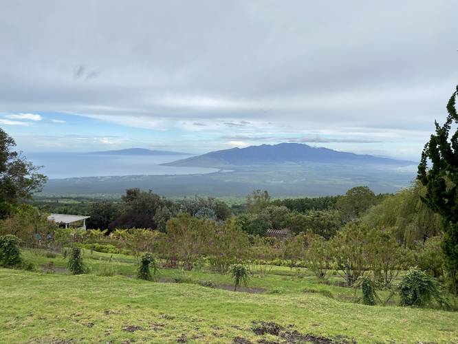
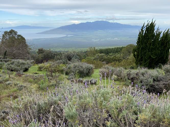
The Ali'i Kula Lavander Loop at the Ali'i Kula Lavander Farm in Kula, Hawaii (Maui) is an easy 0.1-mile walk that leads through the farm's lavender fields and features views of Maui's central valley and the West Maui Mountains.
Walk Description
This is not a hike, but rather a very short walk that passes through a field of lavender. There is not define path, so you can walk about as you see fit.
Lavender Blooms
Note that lavender blooms during the mid-Summer (July - August), but they do have some varieties of lavender that bloom year-round. During this visit in February 2023, there was only one type of lavender in-bloom, but regardless, was worth the visit anyway.
Fees
General Admission is $3 per person, with a $1 off for Seniors, Military, and Kama’aina. Alternatively, Ali'i Kula Lavender supports the Maui Food Bank as an official drop-off location – with a donation of one non-perishable food item per person, admission will be waived. Children 12 and under are free admission.
Hours
Ali’i Kula Lavender is open to the public only on Friday – Monday from 10am to 4pm.
Parking
Upon payment, visitors will park in the farm's main parking lot, which can fit several dozen vehicles. Note that the parking lot is situated on an incline of Haleakala's slopes, thus, can be physically difficult to get in/out of your vehicle.
Paraglide Viewing
There's a separate company on the same slopes of Haleakala that sells visitors paragliding trips from over 4,000-feet down and over the Ali'i Kula Lavender Farm. If you stick around long enough, you might find someone paragliding overhead - note that they'll likely be completely silent, so keep an eye out.
Respecting the Land
Hawaiian land is considered sacred to native Hawaiians and many locals, so please stay on-trail, take nothing but photos, and leave nothing but footprints. Respect the locals - don't stay for long and have a backup hike planned in case the parking lot is full.