Abbott Run is a rugged beautiful run with multiple waterfalls and endless cascades in McIntyre Wild Area near Ralston, Pennsylvania. This hike is off-trail and totals about 3.7 as an out-and-back hike from McIntyre Mountain Road.
Parking:
This hiking route is accessing Abbott Run from the top of the mountain from McIntyre Mountain Road. This is a rough forest road and it is recommended to have a vehicle with AWD/4WD with reasonable clearance. The parking is at 41.532351, -76.930806 a pull off along the road and looking at maps it will appear that there is a road leading towards Abbott Run at this location.
Hike:
This hike starts by following the previously mentioned road from McIntyre Mountain Road towards Abbott Run, however this isn't truly a road, at least not anymore, but is a noticeable path as you start. As you continue into the forest, it at times is difficult to stay on this route, using a GPS device is helpful to maintain your route.
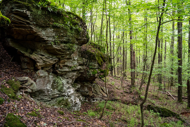
Once you follow this old road/path as best you can and it starts to fade into the forest, you will cut away from it deeper into the forest heading for 41.53818, -76.93803 which is a rock ledge area. This waypoint will get you to a cut in the rocks that allows you to easily descend between the rocks without needing to hike around this rock ledge obstacle.
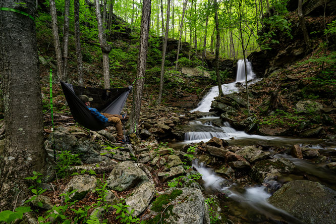
The hike continues descending in the direction of Abbott Run and is steep at times as the sound of cascading water will grow louder as you continue. As you get into Abbott Run, there are multiple old grades that allow you to hike along the run, at times they do seem to disappear, as if this rugged run reclaimed them. This area is extremely rocky and steep in places, use caution and know your limits. The laurel also becomes thick along some the old grades. I have not found any clear continuous route, I use the grades where I can and completely off trail navigating through the rocks and laurel as best I can.
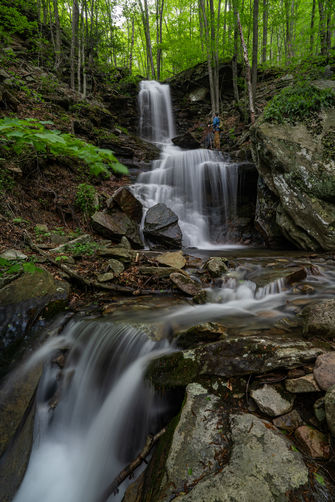
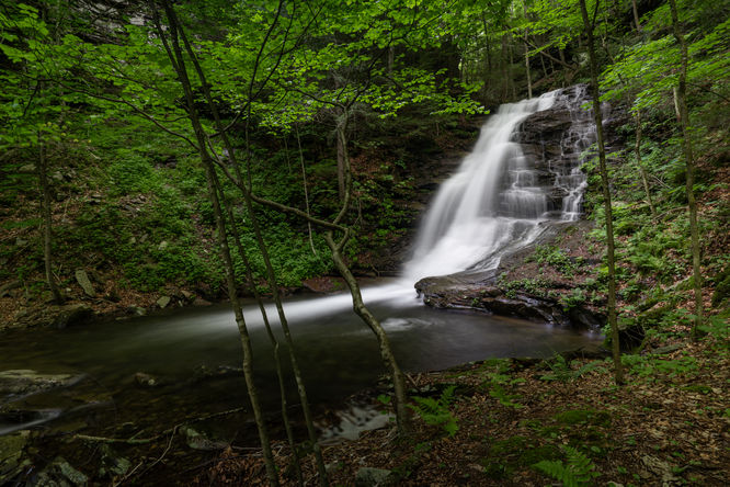
The first waterfall on this route is a large series of cascades that I refer to as Upper Falls (41.53899, -76.94124). The largest portion of the waterfall is near the top, but continues to cascade down to the confluence with the left branch of Abbott Run. At this point you can traverse around the ledges and there will be an immediate small waterfall (41.53912, -76.94165 ) on the left branch. Continue hiking up this branch and roughly 1.2 miles into the hike you will reach a stunning waterfall completely walled in. I am not aware of any official name, but another hiker calls it Wagon Wheel Falls (41.54044, -76.94101 ), since there appears to be remnants possibly of an old wheel near the base of the falls.
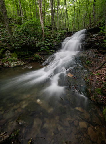
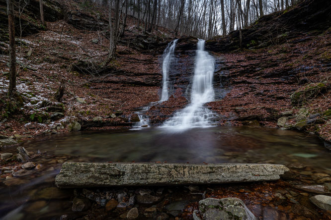
Retrace your steps back to the confluence and choose whatever you feel is the best route to continue down to explore the many cascades of Abbott Run. The next sizable waterfall is a slide like waterfall at 41.53445, -76.94821. At this point my recommendation to hike to the lowest most waterfall is from the slide waterfall, work your way up hill to the east side of Abbott Run. There is some thick laurel, but eventually you should find a path that you can then follow all the way to Abbott Run Falls (41.5331, -76.95083). This path will take you down past the falls and then work back up the run into the gorged in waterfall. This waterfall as a deeper pool surrounded by rock walls.
Once done enjoying the waterfalls, you will retrace your steps as best you can back to the parking at McIntyre Mountain Road.
Parking:
This hiking route is accessing Abbott Run from the top of the mountain from McIntyre Mountain Road. This is a rough forest road and it is recommended to have a vehicle with AWD/4WD with reasonable clearance. The parking is at 41.532351, -76.930806 a pull off along the road and looking at maps it will appear that there is a road leading towards Abbott Run at this location.
Hike:
This hike starts by following the previously mentioned road from McIntyre Mountain Road towards Abbott Run, however this isn't truly a road, at least not anymore, but is a noticeable path as you start. As you continue into the forest, it at times is difficult to stay on this route, using a GPS device is helpful to maintain your route.
Once you follow this old road/path as best you can and it starts to fade into the forest, you will cut away from it deeper into the forest heading for 41.53818, -76.93803 which is a rock ledge area. This waypoint will get you to a cut in the rocks that allows you to easily descend between the rocks without needing to hike around this rock ledge obstacle.
The hike continues descending in the direction of Abbott Run and is steep at times as the sound of cascading water will grow louder as you continue. As you get into Abbott Run, there are multiple old grades that allow you to hike along the run, at times they do seem to disappear, as if this rugged run reclaimed them. This area is extremely rocky and steep in places, use caution and know your limits. The laurel also becomes thick along some the old grades. I have not found any clear continuous route, I use the grades where I can and completely off trail navigating through the rocks and laurel as best I can.
The first waterfall on this route is a large series of cascades that I refer to as Upper Falls (41.53899, -76.94124). The largest portion of the waterfall is near the top, but continues to cascade down to the confluence with the left branch of Abbott Run. At this point you can traverse around the ledges and there will be an immediate small waterfall (41.53912, -76.94165 ) on the left branch. Continue hiking up this branch and roughly 1.2 miles into the hike you will reach a stunning waterfall completely walled in. I am not aware of any official name, but another hiker calls it Wagon Wheel Falls (41.54044, -76.94101 ), since there appears to be remnants possibly of an old wheel near the base of the falls.
Retrace your steps back to the confluence and choose whatever you feel is the best route to continue down to explore the many cascades of Abbott Run. The next sizable waterfall is a slide like waterfall at 41.53445, -76.94821. At this point my recommendation to hike to the lowest most waterfall is from the slide waterfall, work your way up hill to the east side of Abbott Run. There is some thick laurel, but eventually you should find a path that you can then follow all the way to Abbott Run Falls (41.5331, -76.95083). This path will take you down past the falls and then work back up the run into the gorged in waterfall. This waterfall as a deeper pool surrounded by rock walls.
Once done enjoying the waterfalls, you will retrace your steps as best you can back to the parking at McIntyre Mountain Road.