The Zindel Falls and Keller Reservoir Loop at Zindel Park in Lock Haven, Pennsylvania is a moderate 3.1-mile out-and-back/loop (lollipop) hike that features the 6-foot tall, 15-foot wide Zindel Falls, an old rhododendron-lined stone pathway, and beautiful views of the Keller Reservoir with its surrounding mountains.
Hike Description
This hike begins at the main parking lot for Zindel Park and heads in along the main trail, passing the red service road gate with posted signs for hunting and land use rules. The trail is mostly flat here as it passes an old quarry, then a utility building, before reaching a stone bridge that crosses McElhattan Creek.
Rhododendron Path to Zindel Falls - Mile 0.4
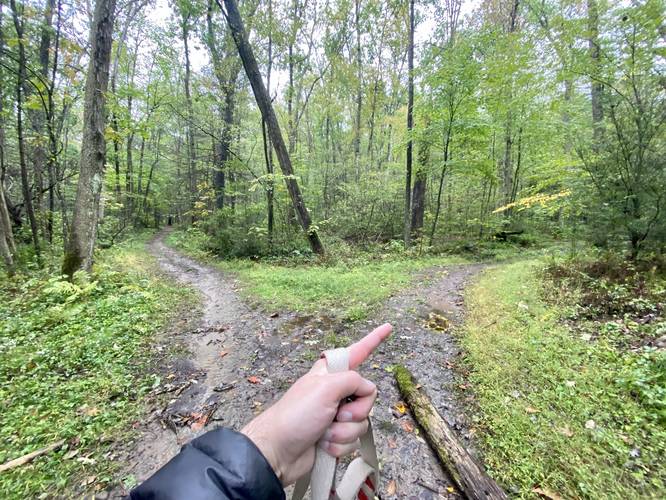
At mile 0.4, hikers will reach a left-hand turn that passes through a section of very-old rhododendron bushes, which appear to be over 10-feet tall. This path leads through the bushes along a stone pathway with a small stone bridge that leads to a common area for Zindel Park that includes an old abandoned park building, Zindel Falls, and a stone "theater" of sorts. This section of Zindel Park is by far one of the most scenic, even for Pennsylvania; however, the abandoned park building and the jagged stone fences and structures give off a somewhat eerie vibe to them. Here is also where you'll find Zindel Falls.
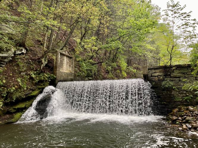
Zindel Falls - Mile 0.5
At mile 0.5, hikers will reach Zindel Falls which is technically a human-made waterfall that was built into the reservoir system. Zindel Falls is about 6-feet tall and 15-feet wide. The waterfall can be viewed from the base, its side, and from the top.
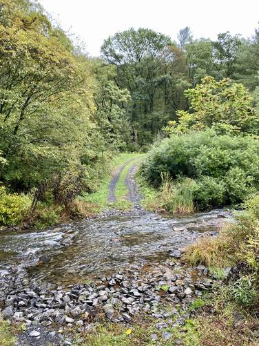
McElhattan Creek - Mile 1.05
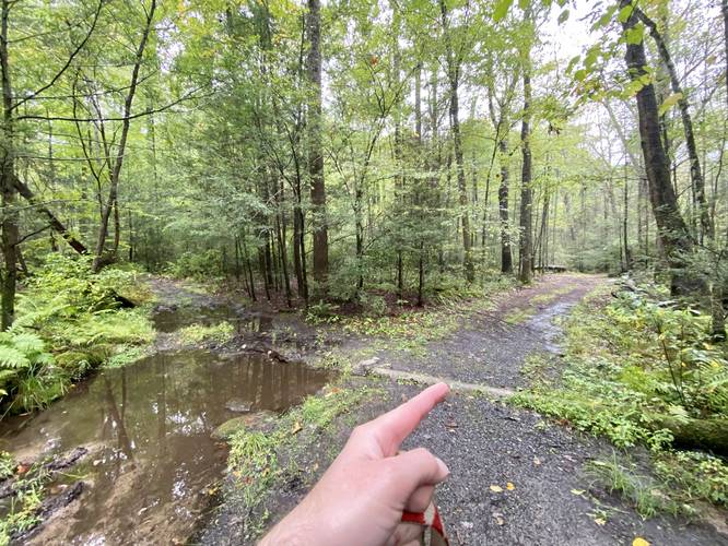
After exploring the main section of Zindel Park, hikers will head south to reach Keller Reservoir. Not knowing where to go, we stayed on the service road; however, quickly found that McElhattan Creek also crosses the service road, around mile 1.05. So we backtracked so hike over the bridge and the Keller Reservoir Spillway.
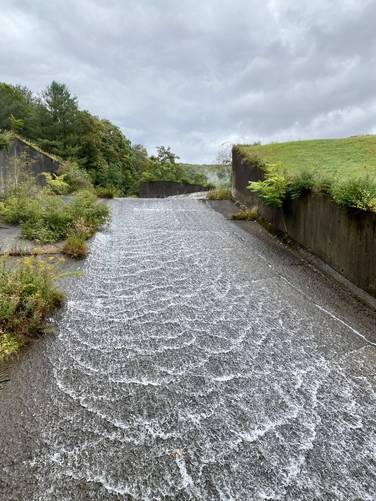
Keller Reservoir Spillway - Mile 1.25
Around mile 1.25, after hiking into the grassy knoll behind the Keller Reservoir dike, hikers will cross the bridge that spans the spillway. Here lies another human-made waterfall, the Keller Reservoir Spillway. The water is mostly silent as it trickles down the concrete to reach the base of the slide further below.
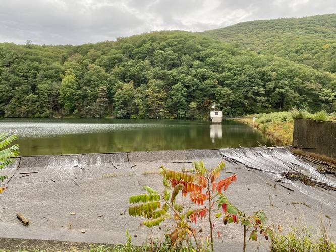
Keller Reservoir View - Mile 1.3
At mile 1.3, after passing the spillway, hikers will get a nice view of the Keller Reservoir. After passing the view, the trail follows the main service road until it crosses a wooden bridge, over McElhattan Creek once more.
Right-Hand Turns - Mile 1.65, 1.7
At miles 1.65 and 1.7, hikers will want to take right-hand turns to head toward the reservoir to keep on the loop.
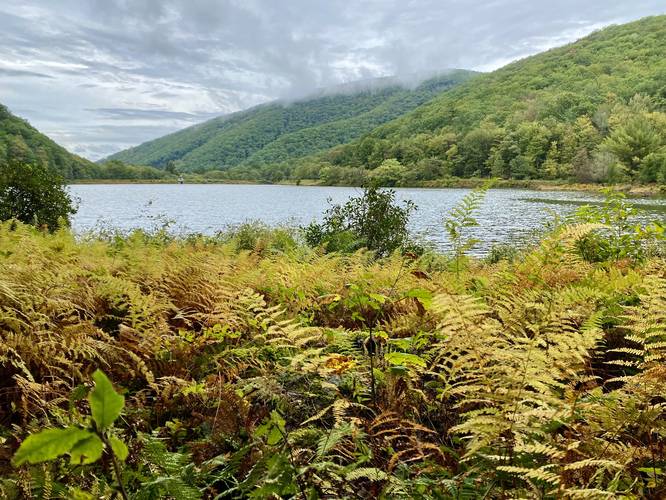
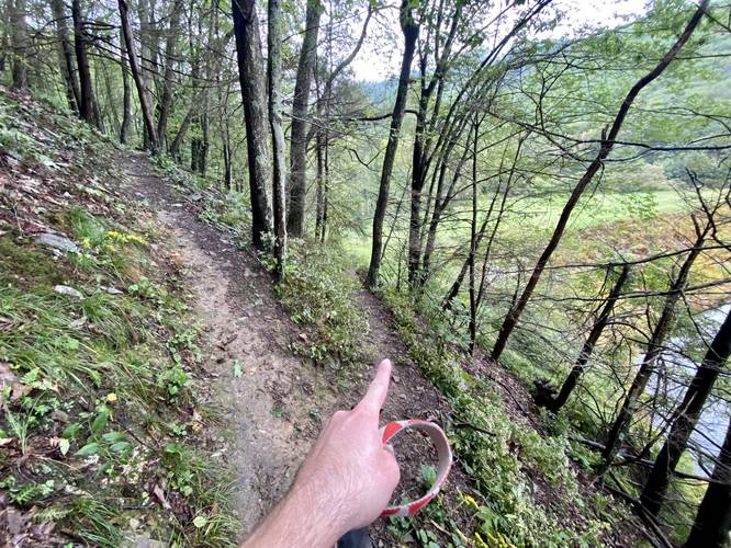
Keller Reservoir Vista - Mile 1.8
After crossing a small wooden footbridge, hikers will reach another vista point on the southwestern corner of Keller Reservoir. This is by far the nicest spot to take in views of the water and the surrounding mountains. Upon our first visit here, we had the pleasure of yellow ferns, misty mountains, and some trickles of foliage.
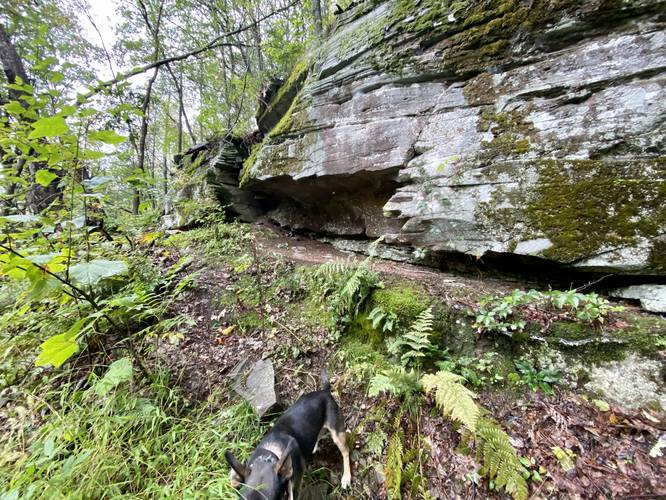
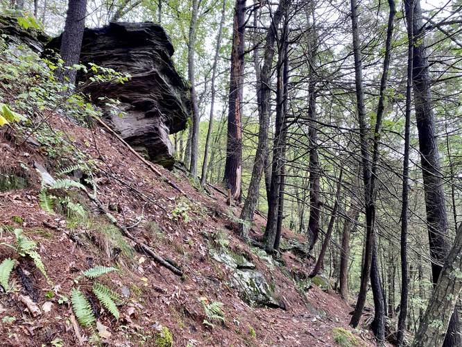
Steep, Narrow Trail - Mile 1.85 to 2.25
After passing the reservoir view, hikers will be faced with a moderate but steep uphill climb as it follows a narrow trail up and around the banks of the water. This part of the hike is by far the most difficult and can be a bit scary for those who are not used to very steep hillside hikes on skinny paths. In some sections, the soil does give way near the edge, so it's good to test your steps before committing in certain ares. Hikers will also pass by some interesting rocky outcroppings along this section of the trail as well.
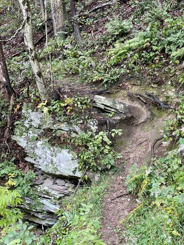
Right-hand Turn to Scramble - Mile 2.25
At mile 2.25, hikers will reach another junction. Stay right to head downhill to reach the northern shores of Keller Reservoir. Note that just beyond this turn is an annoying rock scramble that can be a bit tricky.
Once on the northern side of Keller Reservoir, hikers will follow the same trail back to parking. Take in the views one more time before descending from the dike as they'll be the last views you get on this hike.
Parking
Hikers will find a large parking lot at the coordinates provided. The lot is large enough to fit a couple dozen vehicles.
Pets
Dogs are allowed if leashed and their waste should be carried out by the hiker.
Warnings
Hunting: From October 1 - January 31, hikers should wear blaze orange or yellow since this area is open for hunting.
Popularity
Zindel Park is a very popular, and heavily-trafficked, spot for hikers, especially during the early Spring and Summer. Once hunting season rolls around, it gets a bit quieter, but hikers should remember to wear orange or bright yellow.
Hike Description
This hike begins at the main parking lot for Zindel Park and heads in along the main trail, passing the red service road gate with posted signs for hunting and land use rules. The trail is mostly flat here as it passes an old quarry, then a utility building, before reaching a stone bridge that crosses McElhattan Creek.
Rhododendron Path to Zindel Falls - Mile 0.4
At mile 0.4, hikers will reach a left-hand turn that passes through a section of very-old rhododendron bushes, which appear to be over 10-feet tall. This path leads through the bushes along a stone pathway with a small stone bridge that leads to a common area for Zindel Park that includes an old abandoned park building, Zindel Falls, and a stone "theater" of sorts. This section of Zindel Park is by far one of the most scenic, even for Pennsylvania; however, the abandoned park building and the jagged stone fences and structures give off a somewhat eerie vibe to them. Here is also where you'll find Zindel Falls.
Zindel Falls - Mile 0.5
At mile 0.5, hikers will reach Zindel Falls which is technically a human-made waterfall that was built into the reservoir system. Zindel Falls is about 6-feet tall and 15-feet wide. The waterfall can be viewed from the base, its side, and from the top.
McElhattan Creek - Mile 1.05
After exploring the main section of Zindel Park, hikers will head south to reach Keller Reservoir. Not knowing where to go, we stayed on the service road; however, quickly found that McElhattan Creek also crosses the service road, around mile 1.05. So we backtracked so hike over the bridge and the Keller Reservoir Spillway.
Keller Reservoir Spillway - Mile 1.25
Around mile 1.25, after hiking into the grassy knoll behind the Keller Reservoir dike, hikers will cross the bridge that spans the spillway. Here lies another human-made waterfall, the Keller Reservoir Spillway. The water is mostly silent as it trickles down the concrete to reach the base of the slide further below.
Keller Reservoir View - Mile 1.3
At mile 1.3, after passing the spillway, hikers will get a nice view of the Keller Reservoir. After passing the view, the trail follows the main service road until it crosses a wooden bridge, over McElhattan Creek once more.
Right-Hand Turns - Mile 1.65, 1.7
At miles 1.65 and 1.7, hikers will want to take right-hand turns to head toward the reservoir to keep on the loop.
Keller Reservoir Vista - Mile 1.8
After crossing a small wooden footbridge, hikers will reach another vista point on the southwestern corner of Keller Reservoir. This is by far the nicest spot to take in views of the water and the surrounding mountains. Upon our first visit here, we had the pleasure of yellow ferns, misty mountains, and some trickles of foliage.
Steep, Narrow Trail - Mile 1.85 to 2.25
After passing the reservoir view, hikers will be faced with a moderate but steep uphill climb as it follows a narrow trail up and around the banks of the water. This part of the hike is by far the most difficult and can be a bit scary for those who are not used to very steep hillside hikes on skinny paths. In some sections, the soil does give way near the edge, so it's good to test your steps before committing in certain ares. Hikers will also pass by some interesting rocky outcroppings along this section of the trail as well.
Right-hand Turn to Scramble - Mile 2.25
At mile 2.25, hikers will reach another junction. Stay right to head downhill to reach the northern shores of Keller Reservoir. Note that just beyond this turn is an annoying rock scramble that can be a bit tricky.
Once on the northern side of Keller Reservoir, hikers will follow the same trail back to parking. Take in the views one more time before descending from the dike as they'll be the last views you get on this hike.
Parking
Hikers will find a large parking lot at the coordinates provided. The lot is large enough to fit a couple dozen vehicles.
Pets
Dogs are allowed if leashed and their waste should be carried out by the hiker.
Warnings
Hunting: From October 1 - January 31, hikers should wear blaze orange or yellow since this area is open for hunting.
Popularity
Zindel Park is a very popular, and heavily-trafficked, spot for hikers, especially during the early Spring and Summer. Once hunting season rolls around, it gets a bit quieter, but hikers should remember to wear orange or bright yellow.