The Yellow Loop Trail at Steege Hill Nature Preserve near Corning, New York is a moderate 3.7-mile hike that features pond and pipeline views while passing through a quiet forest.
Trails
This hike follows one trail: Yellow Trail / Yellow Loop which follows yellow blazes as of May 2024.
Hike
This hike begins at the main trailhead at Steege Hill, located on Steege Hill Road. The Yellow Trail leads hikers into the nature preserve along a 0.75-mile one-way spur path as it undulates its way uphill toward the center of the preserve.
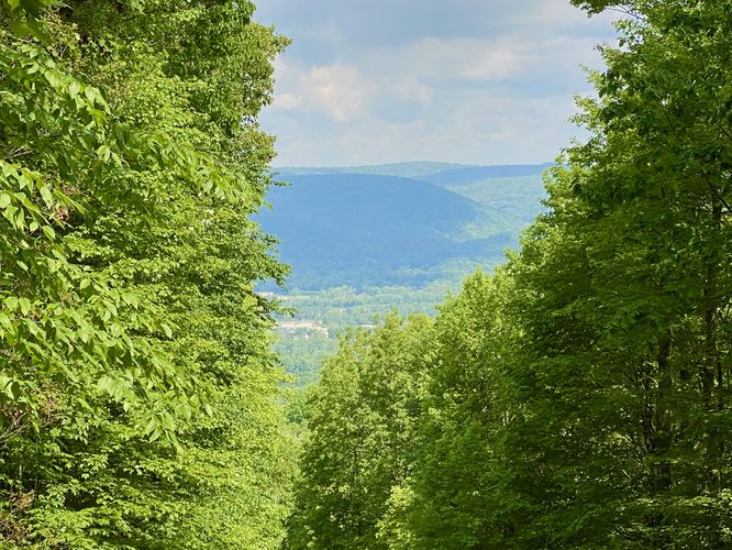
Pipeline View - Mile 0.3
Along the way, around mile 0.3 on the hike in, is a view toward Corning and the Painted Post area of New York, located on a pipeline cutout within the forest. The view isn't spectacular, but provides something to stop at on the hike in and on the hike out. On the hike out, the pipeline view is located around mile 3.45 if you hike this entire route.
Right-Hand Turn - Mile 0.75
Around mile 0.75, hikers will reach a junction with the Yellow Trail where you can choose to follow the trail in a clockwise (head straight east) or counter-clockwise (right-hand turn south) loop. This route brings hikers to the pond first, so the route takes a right-hand turn at the signs to continue following the Yellow Trail.
Hike to the Pond - Mile 0.75 to 1.6
The trail from the junction to the pond is fairly straight forward -- hikers will head south before the trail curves its way northeast to reach the Steege Hill Pond. Along the way, the trail leads downhill before following a mostly-flat undulating grade out to the pond. You know you're reaching the pond once you start hiking in very muddy sections, located about 0.2-miles from the pond.
Steege Hill Pond - Mile 1.6
Around mile 1.6, you'll reach the Steege Hill Pond after trekking through some gnarly muddy spots. The pond is beautiful and nestled away in this quiet forest. If you're here along you can generally hear the bullfrogs calling, crickets chirping, and can watch dragonflies zipping around over the water. On our hike here in late May 2024, we came across a group of Garter snakes basking in the sun on the south side of the pond. That wouldn't be our last encounter with Garter snakes on this trail. After exploring the pond, the trail continues on the southeast side of its banks where it leads down Steege Hill.
Completing the Loop - Mile 1.65 to 3
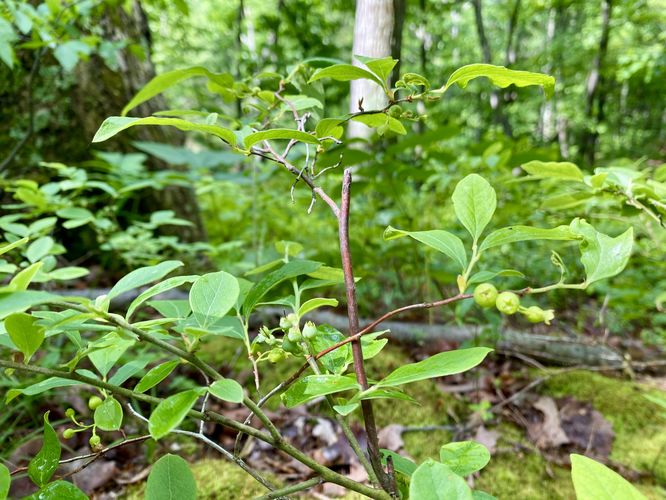
After visiting the Steege Hill Pond, hikers will hike down Steege Hill, following yellow blazes, as the trail descends from the pond. Note that the trail can be muddy in spots along the way, especially just below the pond area. The trail passes through a bountiful blueberry patch around mile 1.9 as well, which spans for a couple-hundred feet along the trail. Plenty of blueberries can be found off-trail here as well. Around mile 2, the trail begins to ascend Steege Hill from its lowest point. Here, the hike becomes more moderate, but overall should not be considered very difficult. If you keep-left at all trail junctions, you'll make your way back to the original junction that you started the main loop at, around mile 3. During our hike here, we encountered one more Garter snake along the trail -- our dog stepped on it, spooking it quite a bit. It then attempted to fight us before giving up and snaking off into the bush.
Hike Out - Mile 3 to 3.7
After completing the loop, hikers will head back out along the spur of the Yellow Trail to hike back to parking. Remember you can stop around mile 3.45 to enjoy the pipeline view before reaching the parking lot at mile 3.7.
Parking
Hikers will find a large parking lot at the coordinates provided, located on the east side of Steege Hill Road. The lot is large enough to fit over a dozen vehicles as of May 2024. During winter, it often takes a while for the parking area to be plowed out, as I've had experience with driving by and having it not be accessible days after snowstorms.
Pets
Dogs are allowed only if leashed and should be cleaned up after.
Wildlife Viewing
Depending on the season, you may be able to spot wildlife on this trail if you're on the lookout. We hiked this trail in late May 2024 and found a ton of salamanders, bullfrogs, spotted four snakes, saw one deer, birds and dragonflies zipping around the pond, and at least one chipmunk.
Warning
Timber rattlesnakes: This area is home to the Timber Rattlesnake which can be found roaming the forest floors between the months of late April and early October. While rare, there's a small chance you could run into one on this trail. If you find any rattlers, give them plenty of space.
Trails
This hike follows one trail: Yellow Trail / Yellow Loop which follows yellow blazes as of May 2024.
Hike
This hike begins at the main trailhead at Steege Hill, located on Steege Hill Road. The Yellow Trail leads hikers into the nature preserve along a 0.75-mile one-way spur path as it undulates its way uphill toward the center of the preserve.
Pipeline View - Mile 0.3
Along the way, around mile 0.3 on the hike in, is a view toward Corning and the Painted Post area of New York, located on a pipeline cutout within the forest. The view isn't spectacular, but provides something to stop at on the hike in and on the hike out. On the hike out, the pipeline view is located around mile 3.45 if you hike this entire route.
Right-Hand Turn - Mile 0.75
Around mile 0.75, hikers will reach a junction with the Yellow Trail where you can choose to follow the trail in a clockwise (head straight east) or counter-clockwise (right-hand turn south) loop. This route brings hikers to the pond first, so the route takes a right-hand turn at the signs to continue following the Yellow Trail.
Hike to the Pond - Mile 0.75 to 1.6
The trail from the junction to the pond is fairly straight forward -- hikers will head south before the trail curves its way northeast to reach the Steege Hill Pond. Along the way, the trail leads downhill before following a mostly-flat undulating grade out to the pond. You know you're reaching the pond once you start hiking in very muddy sections, located about 0.2-miles from the pond.
Steege Hill Pond - Mile 1.6
Around mile 1.6, you'll reach the Steege Hill Pond after trekking through some gnarly muddy spots. The pond is beautiful and nestled away in this quiet forest. If you're here along you can generally hear the bullfrogs calling, crickets chirping, and can watch dragonflies zipping around over the water. On our hike here in late May 2024, we came across a group of Garter snakes basking in the sun on the south side of the pond. That wouldn't be our last encounter with Garter snakes on this trail. After exploring the pond, the trail continues on the southeast side of its banks where it leads down Steege Hill.
Completing the Loop - Mile 1.65 to 3
After visiting the Steege Hill Pond, hikers will hike down Steege Hill, following yellow blazes, as the trail descends from the pond. Note that the trail can be muddy in spots along the way, especially just below the pond area. The trail passes through a bountiful blueberry patch around mile 1.9 as well, which spans for a couple-hundred feet along the trail. Plenty of blueberries can be found off-trail here as well. Around mile 2, the trail begins to ascend Steege Hill from its lowest point. Here, the hike becomes more moderate, but overall should not be considered very difficult. If you keep-left at all trail junctions, you'll make your way back to the original junction that you started the main loop at, around mile 3. During our hike here, we encountered one more Garter snake along the trail -- our dog stepped on it, spooking it quite a bit. It then attempted to fight us before giving up and snaking off into the bush.
Hike Out - Mile 3 to 3.7
After completing the loop, hikers will head back out along the spur of the Yellow Trail to hike back to parking. Remember you can stop around mile 3.45 to enjoy the pipeline view before reaching the parking lot at mile 3.7.
Parking
Hikers will find a large parking lot at the coordinates provided, located on the east side of Steege Hill Road. The lot is large enough to fit over a dozen vehicles as of May 2024. During winter, it often takes a while for the parking area to be plowed out, as I've had experience with driving by and having it not be accessible days after snowstorms.
Pets
Dogs are allowed only if leashed and should be cleaned up after.
Wildlife Viewing
Depending on the season, you may be able to spot wildlife on this trail if you're on the lookout. We hiked this trail in late May 2024 and found a ton of salamanders, bullfrogs, spotted four snakes, saw one deer, birds and dragonflies zipping around the pond, and at least one chipmunk.
Warning
Timber rattlesnakes: This area is home to the Timber Rattlesnake which can be found roaming the forest floors between the months of late April and early October. While rare, there's a small chance you could run into one on this trail. If you find any rattlers, give them plenty of space.