Yellow Dog Falls at Loyalsock State Forest near Trout Run, Pennsylvania is an easy 1.5-mile out-and-back trail that leads to a 10-foot waterfall named Yellow Dog Falls.
Hike Description
Hikers should note that this is partially a bushwhack that follows an unblazed and unmaintained trail. On some maps, this trail is referenced as the Yellow Dog Trail; however, the state forest map does not even show this trail.
Hikers will find the unmarked trailhead on the bend of Yellow Dog Rd, just south of Rock Run Rd. There is no trailhead or blazes and in-fact, the trail does not look like it exists until you get into the woods and follow a small creek upstream where the creek turns into the trail, essentially. Once you pass the creek, the trail should be more obvious as it heads northeast toward Yellow Dog Run and Yellow Dog Falls.
Reaching Yellow Dog Falls
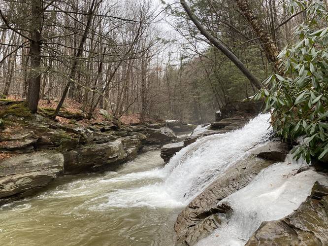
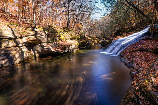
Around mile 0.8-hikers will reach Yellow Dog Run - to your left is the top of Yellow Dog Falls, approximately 10-feet tall. Getting nice photos of this waterfall is not easy since the waterfall cascades down Yellow Dog Run into Rock Run creek. Footing alongside Rock Run creek is sketchy at best, but worse after its rained as the rocks are wet and slippery.
The hike back is identical to the hike in - just follow the unmarked trail back to parking.
Parking
Hikers will find parking along Rock Run Rd, just down the street at the coordinates provided.
Campsites
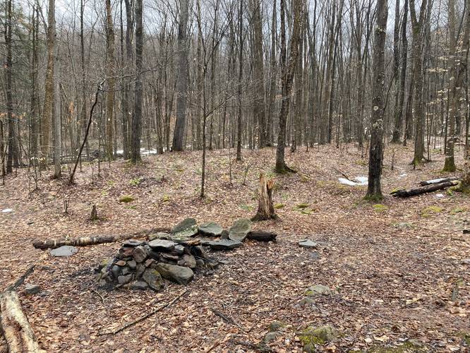
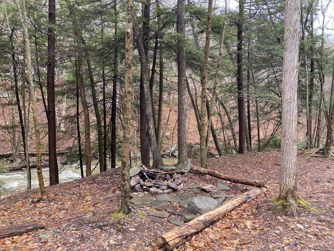
Next to Yellow Dog Falls are 2 fire pits with plenty of room to setup tents and hammocks. Backpackers and hikers must follow all state forest rules and regulations for primitive / backcountry / dispersed camping.
Pets
Dogs are allowed if leashed.
Warning
Rattlesnakes: While rare, the Timber Rattlesnake lives in this area and tends to come down to creeks to cool down or hunt between the end of April through the end of September. Watch your step and give any rattlesnake you see some space.
Uneven terrain: To get the best view of Yellow Dog Falls, hikers will need to scale down some rocks to get a decent view. During colder months, this can be extremely dangerous if you slip and fall into the creek as hypothermia can set in very quickly.
Hike Description
Hikers should note that this is partially a bushwhack that follows an unblazed and unmaintained trail. On some maps, this trail is referenced as the Yellow Dog Trail; however, the state forest map does not even show this trail.
Hikers will find the unmarked trailhead on the bend of Yellow Dog Rd, just south of Rock Run Rd. There is no trailhead or blazes and in-fact, the trail does not look like it exists until you get into the woods and follow a small creek upstream where the creek turns into the trail, essentially. Once you pass the creek, the trail should be more obvious as it heads northeast toward Yellow Dog Run and Yellow Dog Falls.
Reaching Yellow Dog Falls
Around mile 0.8-hikers will reach Yellow Dog Run - to your left is the top of Yellow Dog Falls, approximately 10-feet tall. Getting nice photos of this waterfall is not easy since the waterfall cascades down Yellow Dog Run into Rock Run creek. Footing alongside Rock Run creek is sketchy at best, but worse after its rained as the rocks are wet and slippery.
The hike back is identical to the hike in - just follow the unmarked trail back to parking.
Parking
Hikers will find parking along Rock Run Rd, just down the street at the coordinates provided.
Campsites
Next to Yellow Dog Falls are 2 fire pits with plenty of room to setup tents and hammocks. Backpackers and hikers must follow all state forest rules and regulations for primitive / backcountry / dispersed camping.
Pets
Dogs are allowed if leashed.
Warning
Rattlesnakes: While rare, the Timber Rattlesnake lives in this area and tends to come down to creeks to cool down or hunt between the end of April through the end of September. Watch your step and give any rattlesnake you see some space.
Uneven terrain: To get the best view of Yellow Dog Falls, hikers will need to scale down some rocks to get a decent view. During colder months, this can be extremely dangerous if you slip and fall into the creek as hypothermia can set in very quickly.