The West Monson Road and East Monson Road hike at the Monson Center in Milford, New Hampshire is an easy 2.1-mile loop (lollipop) trail that features pond and field views.
Trail name: West Monson Road, East Monson Road
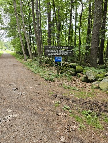
Location: Monson Center, Federal Hill Road, Milford NH at the Hollis/Milford Town line
Allowed activities: Hiking, geocaching, picnicking, nature study, birding, cross country skiing, snowshoeing, horseback riding (horses are not allowed in fields)
Forbidden activities: no motor vehicles, no bicycles, no smoking, no walking on stone walls, do not remove or alter any historical features, no camping, no fires, no fireworks.
Hours: Open Daily Dusk to dawn. Winter parking cannot be guaranteed.
Fees and Parking: There are no fees to park or use the trails. There is ample parking available in three separate parking areas. Do not block the gate at the “Adams Road” parking area. This is a smaller, lower parking area and the gated road is used daily and needs to allow passage.
Pets: Dogs are allowed as long as they are kept on a leash at all times. Waste must packed and be taken with owner. Please do not leave bags of dog waste along the trails “to pick up” on the way back from your hike. Take it with you.
Accessibility: There is a short section leading from the lower parking area to Gould museum house that is passable for a wheelchair, if the chair can traverse uneven, gravely substrate. The trails through the forest are not wheel chair accessible although a sturdy stroller would do fine for those visiting with very small children.
Sanitation: There are no restrooms or trash cans at the parking area or trail head. Please carry out all trash
Length and Trail information: This trail is an easy 2.12 mile hike done as a loop. There is an information Kiosk about a ¼ mile in from the first parking area, where visitors will find a posted map. The trails are not named here, but the main trails are old roads and those are named with plain wooden signs. There are several smaller spur trails off of the main trail that loops around the 269 acre park; visitors could easily make this hike longer by combining some of the spur trails into their visit. The main trail is marked by yellow trail blaze markers. A trail maps are available outside of the Gould house museum. In case the maps have been taken and not refilled, visitors should download and print a map prior to their visit by following the link below:
https://forestsociety.org/sites/default/files/Monson%20Village%20Map.pdf
Near the Thomas Nevins homestead marker visitors will find a picture post. Visitors can participate in helping to document environmental changes in the forest. This post was set up in 2016 and has instructions and how to take pictures and then where to submit them.
History enthusiasts will enjoy the historical significance of this place. The Town of Monson existed as one of the earliest inland settlements from 1737 to 1770 and was once a part of Massachusetts. Along the trail, remnants of 7 homesteads can be found.
Mountain Laurel grows in abundance here and can be seen covering large areas of the forest along the trail. Hikers will also find lady slippers, winterberry, partridge berry, sarsaparilla, sassafras, sheep laurel, wild grapes, blueberries and Indian cucumber growing here as well.
The major attraction for our visit was a stop at the beaver pond and swamp. This is spring time rookery for the Great Blue Heron, we counted 7 nests. Heron chicks could be seen in all but two. In 2010, it was reported that there were 9 nests at this rookery. Bring along a good pair of binoculars and a camera with a tripod and you may just get lucky enough to watch the chicks being fed. There are several benches installed in places around the pond so that visitors can stop and really take in the sights and sounds that make this ecosystem such a treat to visit. We saw swarms of swallows darting in and around the pond catching all kinds of insects. It’s amazing to watch their aerial acrobatics. Other birds could be heard, such as the red winged blackbird, the ever secretive oven bird, warblers and woodpeckers. This spot is a birders paradise.