The Waving Hands Petroglyphs Trail at Canyon Pintado National Historical District
south of Rangely, Colorado is an easy 0.1-mile out-and-back walk that
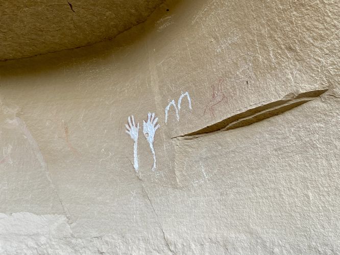
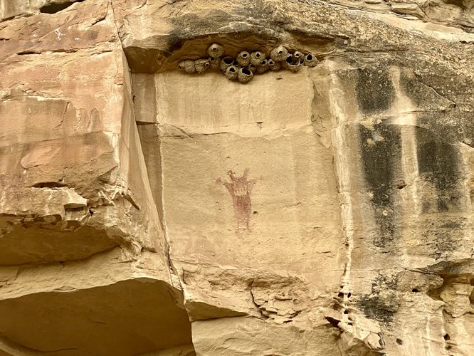
leads to ancient petroglyphs and pictographs which includes white-painted waving hands and the ~2,000 year old pictograph known as The Guardian.
Walk
The Waving Hands Petroglyphs Trail is located on the west side of CO-139 where visitors will find a trailhead on the north side of the dirt parking lot. This route leads in on the main trail before it splits, heading northwest to reach the Waving Hands Petroglyphs and pictographs. The trail terminates here where you can appreciate the ancient artwork from the trail which includes the obvious white-painted hands that sit to the left of a red-painted horse rider. The trail then leads back toward the entrance to follow a path that leads northeast. The trail then terminates at the 2nd set of pictographs -- look up high at the cliff's ledges to find The Guardian. This red-painted human-like figure, known as The Guardian, is neither Classic Fremont nor fully Barrier Canyon artwork, but possibly a transitional style from about 2,000 to 1,500 years ago. After exploring the ancient artwork, the trail ends back at the main trailhead for a short 0.1-mile walk.
Parking
Hikers will find a small parking lot at the coordinates provided, located on the west side of CO-139. The lot is large enough to fit a half-dozen vehicles.
Pets
Dogs are allowed only if leashed and must be cleaned up after.
Warning
Ancient petroglyphs: This trail leads beyond the recorded route provided to ancient petroglyphs and pictographs that were created hundreds of years ago. Please do not touch or attempt to disturb in any way. Only take photos and appreciate the ancient artwork from behind the barriers.
Sun exposure: This trail has very little shade and no water sources. Pack-in all water and wear sun screen and a hat to protect against sun exposure. It's smart to hike either in the early morning or late afternoon to avoid the intense sun.
No water: This trail has no water sources so you must pack-in all water. A general rule of thumb in the desert is 1 gallon of water per person per day.
Rattlesnakes: This trail leads through rattlesnake territory, so be on the lookout and give any rattlers you find plenty of space.