The Twin Falls hike at Olallie State Park near North Bend, Washington is a moderate 2.4-mile out-and-back hike that features beautiful waterfalls, old-growth trees, and views of the South Fork Snoqualmie River.
River swimming: If you plan to take a dip in the river, know that flash flooding can occur here if heavy rainfall sends water rushing downstream. Flash floods happen without warning. Swim at your own risk.
Hike to Twin Falls
This hike begins at the main trailhead within the Twin Falls Natural Area at Olallie State Park where hikers will find a large parking lot just north of the trailhead. The hike begins at the south end of the parking lot where you'll find an easy-to-follow trail as it runs through a lush forest, adjacent to the South Fork Snoqualmie River.River Views - Mile 0.3 to 0.5
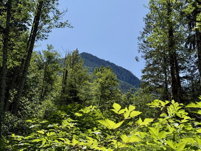
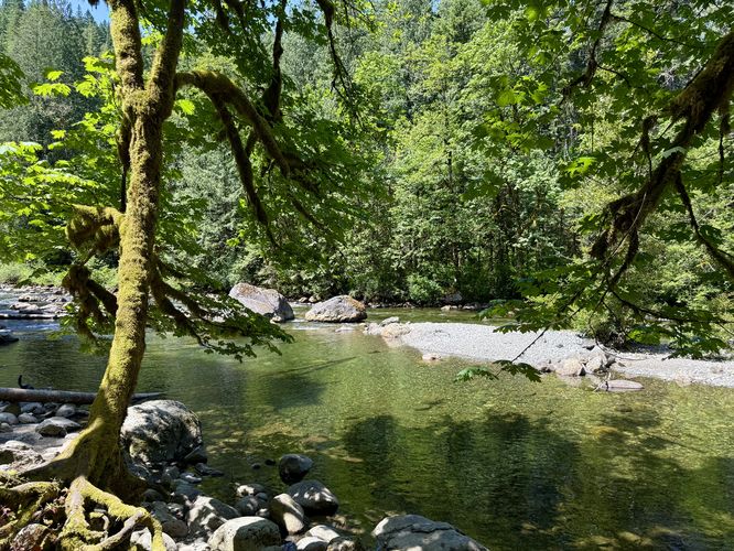
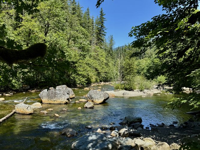
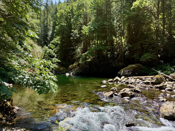
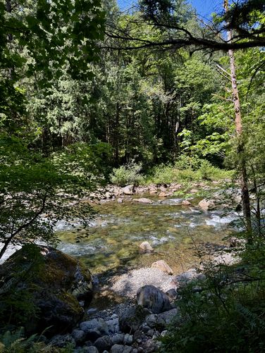
From the trailhead until mile 0.3, there isn't much to see except for a neighboring mountain peak as it pokes up above the trees overhead. Around mile 0.3, however, the river comes into view as it runs along the trail for a short while. Here, you'll find swimming holes and spots to sit along the river banks to enjoy the flow of the water. Just beyond the easy-to-access river banks, around mile 0.4 is a massive boulder (likely a glacial erratic) that sits on-trail and is a fun little spot to explore. Boulderers can use this to practice or find new bouldering routes or kids can climb the north side of the boulder as it's filled with plenty of cracks and hold/foot holds. Just beyond the large boulder, around mile 0.5, is an off-trail walk that leads to a big pool in the river where you'll find crystal-clear turquoise-tinted waters.Lower Twin Falls Vista - Mile 0.75
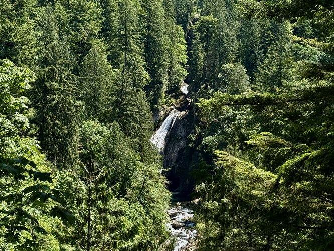
After passing the river views, the trail leads uphill along moderate grade switchbacks. Follow the switchbacks uphill until you find a short spur trail that leads out to a view of Lower Twin Falls which is located further up the river valley. Here, you'll find the large Lower Twin Falls spilling over its cliff. It's a great spot to enjoy the scenery, but the best views are yet to come.Old-growth Tree - Mile 0.9
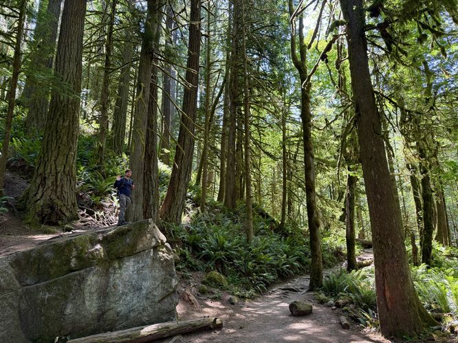
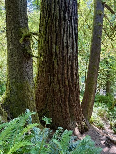
The trail continues to wind through the forest as it undulates high above the South Fork Snoqualmie River. Around mile 0.9, however, is a noteworthy old-growth tree that sits just off-trail. This is yet another example of why preserving these ancient trees is important as it was one of the very-few trees in the Pacific Northwest that were not touched during the logging era of the late 1880's.Uphill Hike to Middle Twin Falls - Mile 0.9 to 1.23
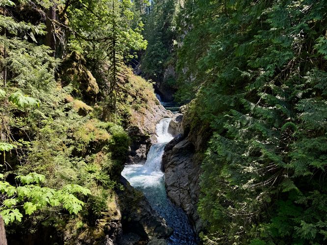
After passing the old-growth, you'll be in for a difficult uphill hike that follows a couple of switchbacks as it ascends the hill. This is the hardest part of the hike, but should likely be considered "moderate" difficulty for most hikers. This is also where the trail is the most exposed, so plan to drink plenty of water along this section. At mile 1.14 you can take the staircase to reach Lower Twin Falls and its overlook, however, we hiked to Middle Twin Falls first. Following this route / guide, hikers will follow the trail downhill to reach a footbridge that spans the river, approximately 60-feet high, with a view of the scenic turquoise-tinted Middle Twin Falls, located near mile 1.23. Middle Twin Falls is a spectacular waterfall with two tiers and turquoise hues in its waters. On the opposite side of the footbridge is a view from the top of Lower Twin Falls, but the view upstream of the middle cascade is by far the most scenic. Note that during this hike, we completely skipped Upper Twin Falls and instead backtracked to Lower Twin Falls.Lower Twin Falls & Old-growths - Mile 1.35
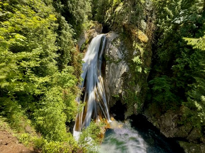
After exploring Middle Twin Falls (and/or Upper), you'll want to save the best waterfall for last, which is Lower Twin Falls. Lower Twin Falls can be found at the very end of the long staircase which you previously hiked past. In this route, you'll reach Lower Twin Falls around mile 1.35 where you'll be standing at the very end of the staircase at an overlook platform that sits high above the river. It's unclear how tall Lower Twin Falls is, but this massive waterfall sends the river down its steep but gradual slopes which creates scenic photo opportunities for long exposures as the waterfall's tendrils spread across the sloped bedrock. You'll also be surrounded by old-growth trees which simply add to the scenery on this section of the hike.Hiking Out - Mile 1.35 to 2.4
From Lower Twin Falls to parking, the hike is straight forward. You'll have to hike through the more-exposed area downhill before the trail climbs slightly back to the downstream vista area of Lower Twin Falls. From there, take the switchbacks downhill, then follow the trail as it runs along the river. Reach the parking area at mile 2.4 for a moderate hike to these spectacular waterfalls within Snoqualmie Pass.Parking
Hikers will find a very large parking lot at the coordinates provided, located at the end of SE 159th Street in North Bend, WA. The lot is large enough to fit several dozen vehicles as of June 2025.Pets
Dogs are allowed on this trail if leashed and must be cleaned up after.Warning
Steep terrain & cliffs: This hike follows very-steep terrain with various cliffs that can be found just off-trail. For your own safety, always stay on-trail to ensure you do not fall down one of these very-tall cliffs as it will result in injury or death.River swimming: If you plan to take a dip in the river, know that flash flooding can occur here if heavy rainfall sends water rushing downstream. Flash floods happen without warning. Swim at your own risk.