The Twain Trail at Tanglewood Nature Center's Gleason Meadows in Elmira, New York is a difficult 3.3-mile loop hike that features two vistas of the Chemung River and the surrounding mountains.
Hike Description
This hike begins at the main parking lot for Tanglewood Nature Center's Gleason Meadows and heads in via the main trailhead. This GPS track heads in a counter-clockwise direction, so if following this route exactly, hikers will start by heading down into the meadow behind the main trailhead and will follow red blazes along the way. The trail starts off scenic with meadow and rolling mountain views - during warmer months, hikers can enjoy wildflowers and singing birds along their way downhill. The views don't last for long as the trail shortly heads into the woods.
Keep-Right - Mile 0.25
Shortly after getting into the woods from the first meadow, hikers will want to keep right at the fork around mile 0.25.
Downhill Hike - Mile 0 to 0.8
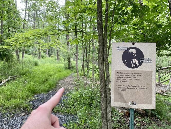
Once in the woods, there's not much to see along the way outside of signage for either fossils or Mark Twain quotes; however, the hike is all downhill from the start to mile 0.8 with some shale rock sections that can be a bit annoying to walk on.
Uphill Hiking (Fossil Hunting) - Mile 0.8 to 1.5
From miles 0.8 to 1.5, the hike changes to an uphill climb with at least one short bench (flat spot) in the trail where you can rest. Note that the trail is littered with small rocks and a lot of them are filled with ancient sea creature fossils like Trilobites, Gastropots, Brachiopods, and Corals - so be on the lookout for odd-shaped rocks or weird patterns in the rocks as you slowly ascend the mountain.
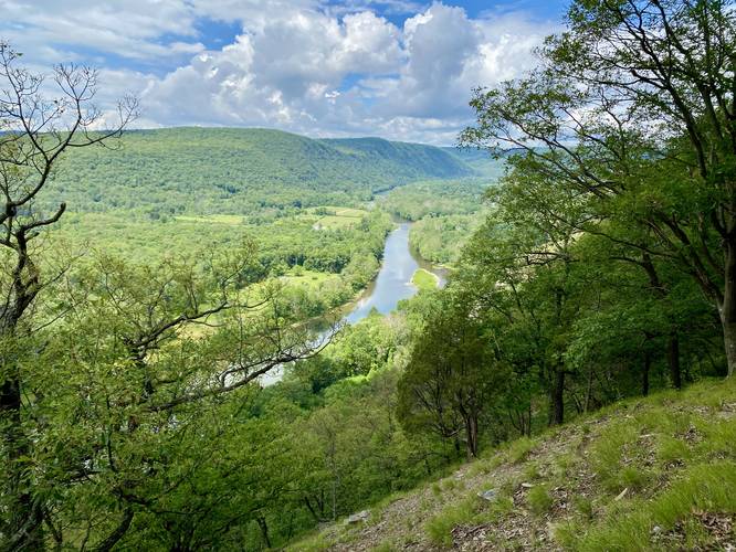
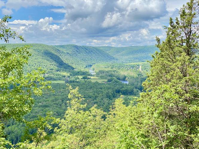
Chemung River View - Mile 1.5
At mile 1.5, hikers will reach the first view of the Chemung River on the steep slopes of the mountainside. The shale rock has made for an opening where trees don't grow - giving hikers a nice view of the Chemung River, the valley, and surrounding mountains. The views aren't over here though, so keep hiking up following the red blazes. Watch out for rattlesnakes here.
Chemung River Vista - Mile 1.95
Around mile 1.95, hikers will reach the southern-most vista of the Chemung River. Here, hikers can take a break at a nearby bench to relax and take in the views of neighboring mountains and hillsides. There are a couple of different vantage points at this vista - mostly of the surrounding mountains with peeks of the Chemung River. Again, watch out for rattlesnakes here.
After visiting the 2nd and last vista of the Chemung River, hikers will follow the red blazes of the Twain Trail as it meanders north along the eastern side of the trail. There isn't much to see along the way until hikers reach an open and scenic meadow around mile 2.9.
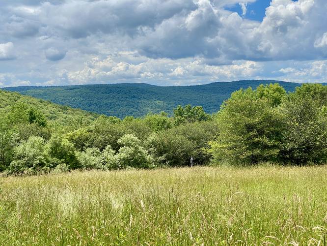
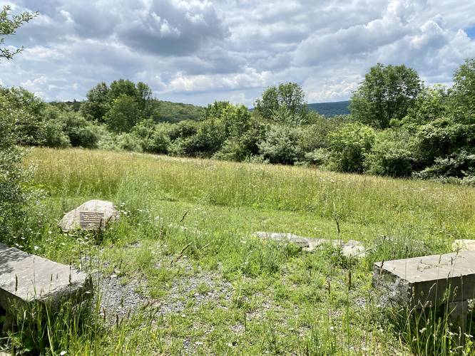
Meadow View - Mile 2.95
Around mile 2.95, hikers will reach a large open meadow with more meadow and mountain views. This is the last of the views along the Twain Trail, so soak them up while you can. Note that you can enjoy these views from stone benches setup along the trail around mile 3.
Keep-Right to Parking - Mile 3
At mile 3, hikers will keep-right to head north and back to parking to wrap up the hike at approximately 3.3 miles.
Parking
Hikers will find a large parking lot at the Tanglewood Nature Center (coordinates provided). The lot is large enough to fit a couple dozen vehicles.
Pets
Dogs are not allowed at the Gleason Meadows property at Tanglewood Nature Center.
Water Source
When the Tanglewood Nature Center is open, hikers can refill their water bottles inside.
Warning
Steep terrain: This hike follows some steep terrain and due to the elevation profile and other trails in the area, this is by far one of the most difficult hikes around Elmira, New York. While there are more difficult hikes elsewhere, this one should be considered "Hard" for the average hiker.
Timber Rattlesnakes: This area is known to be home to the Timber Rattlesnake. They can be found roaming the forest or sunning themselves on-trail or in rocky outcroppings between the months of April and October each year. Be on the lookout for any rattlesnakes and give any you find plenty of space.
Hike Description
This hike begins at the main parking lot for Tanglewood Nature Center's Gleason Meadows and heads in via the main trailhead. This GPS track heads in a counter-clockwise direction, so if following this route exactly, hikers will start by heading down into the meadow behind the main trailhead and will follow red blazes along the way. The trail starts off scenic with meadow and rolling mountain views - during warmer months, hikers can enjoy wildflowers and singing birds along their way downhill. The views don't last for long as the trail shortly heads into the woods.
Keep-Right - Mile 0.25
Shortly after getting into the woods from the first meadow, hikers will want to keep right at the fork around mile 0.25.
Downhill Hike - Mile 0 to 0.8
Once in the woods, there's not much to see along the way outside of signage for either fossils or Mark Twain quotes; however, the hike is all downhill from the start to mile 0.8 with some shale rock sections that can be a bit annoying to walk on.
Uphill Hiking (Fossil Hunting) - Mile 0.8 to 1.5
From miles 0.8 to 1.5, the hike changes to an uphill climb with at least one short bench (flat spot) in the trail where you can rest. Note that the trail is littered with small rocks and a lot of them are filled with ancient sea creature fossils like Trilobites, Gastropots, Brachiopods, and Corals - so be on the lookout for odd-shaped rocks or weird patterns in the rocks as you slowly ascend the mountain.
Chemung River View - Mile 1.5
At mile 1.5, hikers will reach the first view of the Chemung River on the steep slopes of the mountainside. The shale rock has made for an opening where trees don't grow - giving hikers a nice view of the Chemung River, the valley, and surrounding mountains. The views aren't over here though, so keep hiking up following the red blazes. Watch out for rattlesnakes here.
Chemung River Vista - Mile 1.95
Around mile 1.95, hikers will reach the southern-most vista of the Chemung River. Here, hikers can take a break at a nearby bench to relax and take in the views of neighboring mountains and hillsides. There are a couple of different vantage points at this vista - mostly of the surrounding mountains with peeks of the Chemung River. Again, watch out for rattlesnakes here.
After visiting the 2nd and last vista of the Chemung River, hikers will follow the red blazes of the Twain Trail as it meanders north along the eastern side of the trail. There isn't much to see along the way until hikers reach an open and scenic meadow around mile 2.9.
Meadow View - Mile 2.95
Around mile 2.95, hikers will reach a large open meadow with more meadow and mountain views. This is the last of the views along the Twain Trail, so soak them up while you can. Note that you can enjoy these views from stone benches setup along the trail around mile 3.
Keep-Right to Parking - Mile 3
At mile 3, hikers will keep-right to head north and back to parking to wrap up the hike at approximately 3.3 miles.
Parking
Hikers will find a large parking lot at the Tanglewood Nature Center (coordinates provided). The lot is large enough to fit a couple dozen vehicles.
Pets
Dogs are not allowed at the Gleason Meadows property at Tanglewood Nature Center.
Water Source
When the Tanglewood Nature Center is open, hikers can refill their water bottles inside.
Warning
Steep terrain: This hike follows some steep terrain and due to the elevation profile and other trails in the area, this is by far one of the most difficult hikes around Elmira, New York. While there are more difficult hikes elsewhere, this one should be considered "Hard" for the average hiker.
Timber Rattlesnakes: This area is known to be home to the Timber Rattlesnake. They can be found roaming the forest or sunning themselves on-trail or in rocky outcroppings between the months of April and October each year. Be on the lookout for any rattlesnakes and give any you find plenty of space.