Loading...

Turpentine Trail-Duffy Lake-Pine Ridge Loop

Distance:
20.6 Miles / 33.2 km
Type:
Loop
Difficulty:
Strenuous
Time to Hike:
10 hours, ~18 minutes
Features:
Surface Type:
Dirt
Park:
Willamette National Forest
Town:
Sisters, Oregon
Directions:
44.553965, -121.933951
Added:
September 26, 2017
Updated:
November 27, 2017
Loading...
Loading...
1,090 '

Total Change
2,849 '

Ascent
2,886 '

Descent

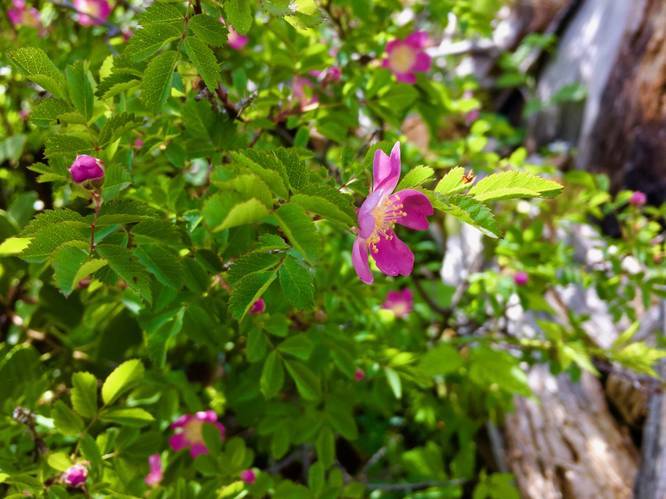
Hike a spectacular mega-loop full of views, wildflowers, past burns, and.... an overgrown trail! Cumulative elevation gain is 3,000 feet. 

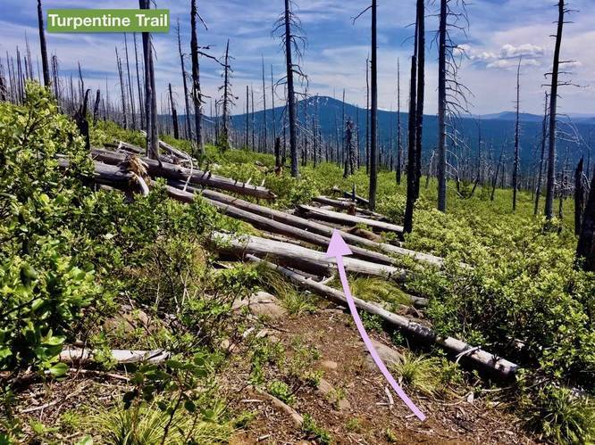
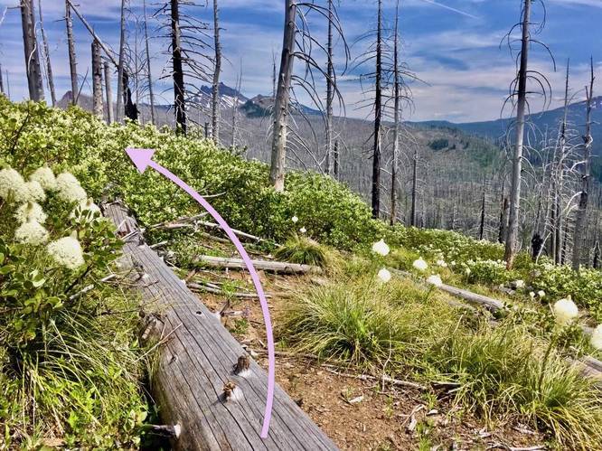
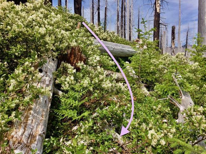
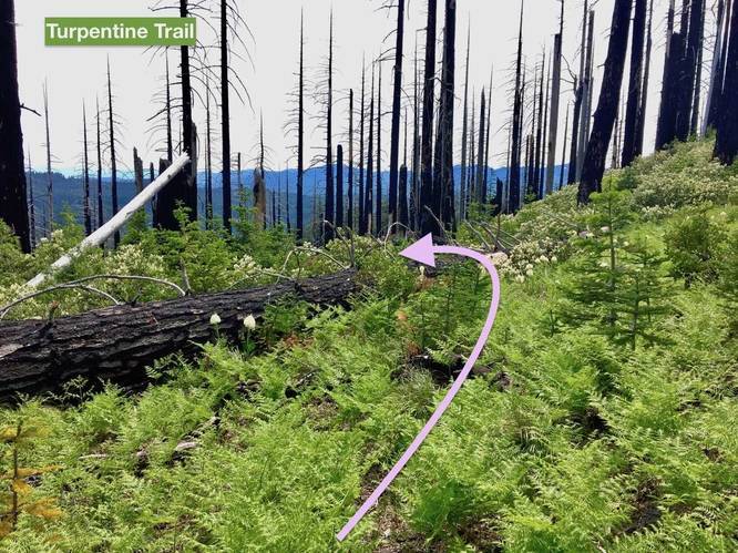
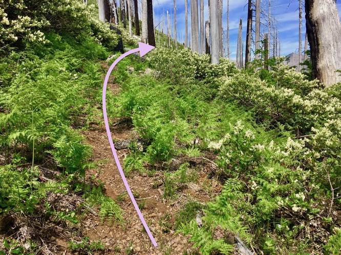
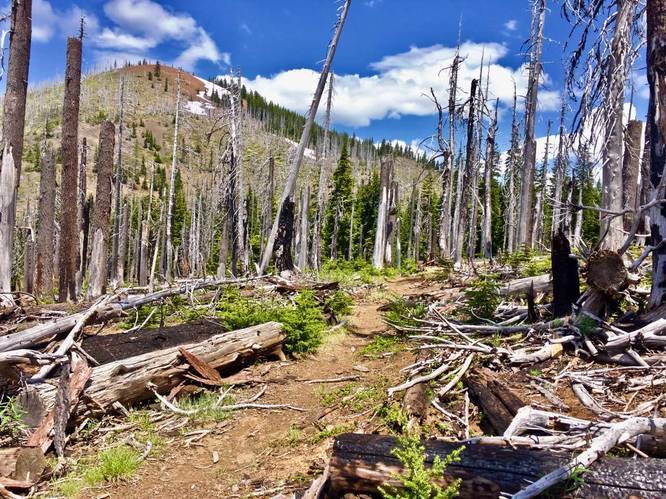
A major warning for this hike: Do NOT attempt this hike without GPS and route-finding skills. Be prepared to get scuffed, crawl on your belly under logs, step over hundreds of logs, and hike through termite-infested snags. But if you carry along a GPS, you will have a memorable adventure worth telling about, be glad you did it, (and never wish to re-do!) The views are constant throughout this hike. By providing a GPS track, you will hopefully have less issues finding the trail than I did.

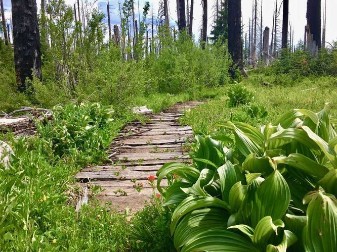
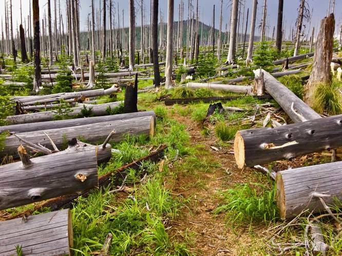
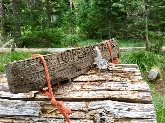
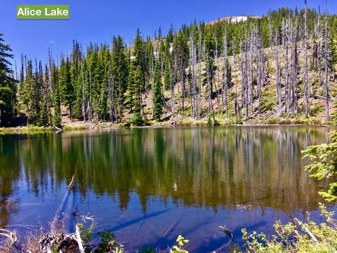
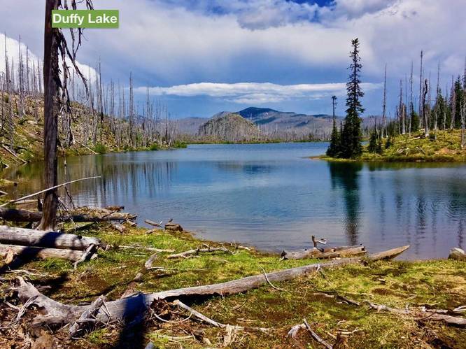
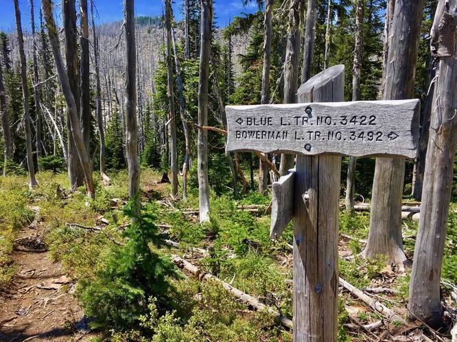
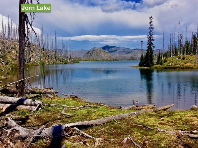
Start out on the Pine Ridge TH, turn right onto the Turpentine Trail, pass under thick green forest before reaching the burn. Cross and pass under hundreds of fallen logs, descend a series of extremely overgrown switchbacks, then reach the Duffy Lake Trail as you exit the burn. Turn left at the junction, pass by Duffy Lake, re-enter the burn, pass by Mowich Lake, little Alice Lake, and cross over a pass before descending down a forested trail to Jorn Lake. Jorn Lake is the centerpiece of the popular Eight Lakes Basin. Turn left onto the Blue Lake Trail. 

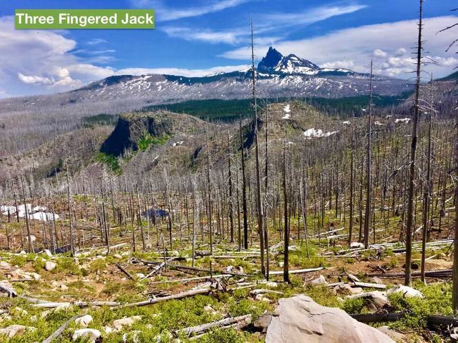
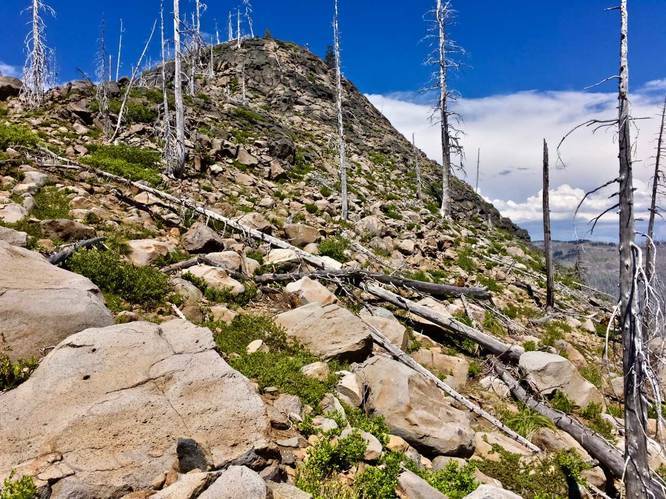
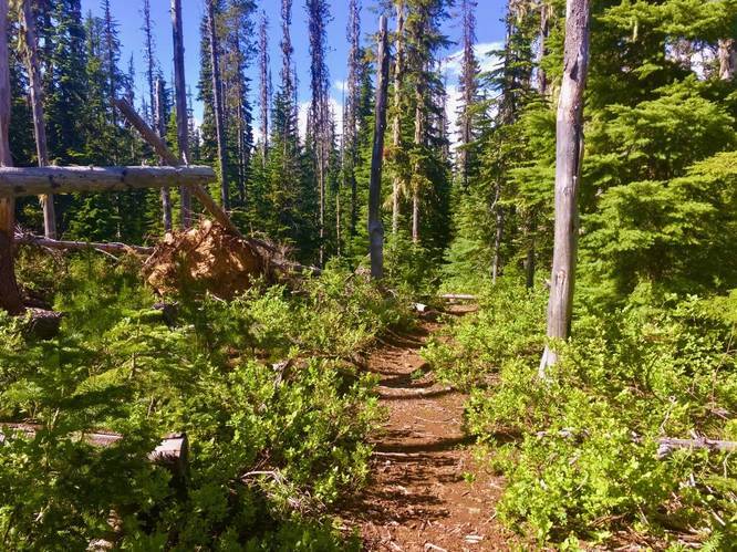
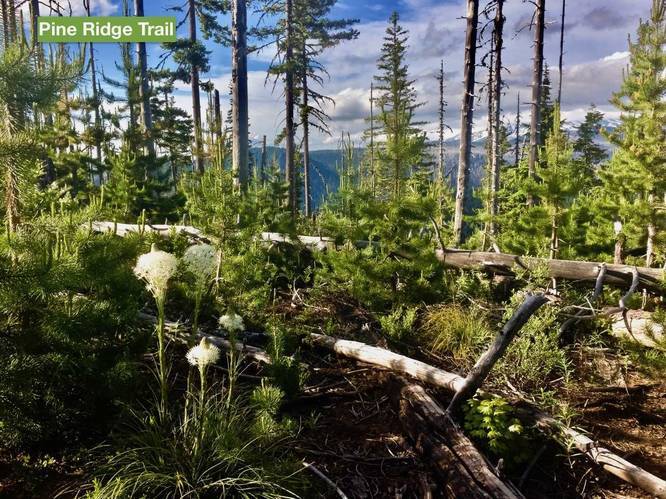
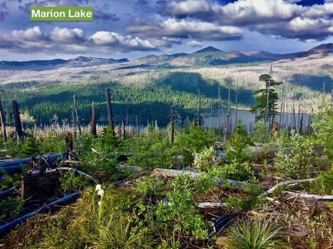
Once on the Blue Lake Trail, pass Blue Lake and ascend over a burned, exposed saddle between Saddle Mountain and a lava plug, then descend down in a series of switchbacks before re-entering the forest. Turn left onto the well-graded Pine Ridge Trail and take this forested trail back to your car. To add the optional half-mile hike to Marion Mountain (extremely recommended!), once on the Pine Ridge Trail, take the Marion Mountain Trail detour. See the hiking guide on MyHikes for Marion Mountain via Pine Ridge.

Explore 4 trails near Sisters, OR
  1. Parking

    44.553965, -121.933951
  2. Main Trailhead

    44.554065, -121.933649
  3. Trail continues straight

    44.521514, -121.934708
    Trail continues straight
  4. Trail turns to the left

    44.515264, -121.931297
    Trail turns to the left
  5. Trail comes down through brush

    44.514294, -121.926758
    Trail comes down through brush
  6. Trail curves left through brush

    44.514239, -121.931022
    Trail curves left through brush
  7. Trail turns right through the brush

    44.514642, -121.930328
    Trail turns right through the brush
  8. Short section of boardwalk

    44.513139, -121.926894
    Short section of boardwalk
  9. Wildflowers

    44.514503, -121.926492
    Wildflowers
  10. Trail cuts through fallen dead trees

    44.503747, -121.922661
    Trail cuts through fallen dead trees
  11. Turpentine Trail sign

    44.497178, -121.921394
    Turpentine Trail sign
  12. Trail cuts through more dead standing

    44.502839, -121.870636
    Trail cuts through more dead standing
  13. View of Alice Lake

    44.505719, -121.867967
    View of Alice Lake
  14. View of Duffy Lake

    44.514786, -121.870286
    View of Duffy Lake
  15. Blue Lake Trail junction

    44.514469, -121.867936
    Blue Lake Trail junction
  16. Vista of Three Fingered Jack

    44.527753, -121.870042
    Vista of Three Fingered Jack
  17. Vista heading up a hill

    44.527753, -121.870042
    Vista heading up a hill
  18. Trail continues straight through the forest

    44.538175, -121.871794
    Trail continues straight through the forest
  19. Pine Ridge Trail

    44.551589, -121.875983
    Pine Ridge Trail
  20. Vista of Marion Lake

    44.552758, -121.877647
    Vista of Marion Lake
  21. Vista of Jorn Lake

    44.514786, -121.870286
    Vista of Jorn Lake
No community routes found. To add your own hike as a Community Route for this Trail guide, leave a Trip Report with an attached GPX file.

Seasons

Summer, Fall

Photo Albums

2 Trip Reports

No Star-Ratings
20.6 miles / 33.2 km
Trail added
September 26, 2017
Hiked on
June 26, 2017
Updated on
November 27, 2017
18.8 miles / 30.3 km
June 22, 2020
This is a cool loop. I'm grateful to the first write-up as it was the only link up of these trails that I could find across all of the interwebs. This trail has a little bit of everything: great vistas, forests, burn areas, lakes, ridgelines, a few streams, etc. I found the trail relatively easier to follow then the original write-up suggests as I think the forest service has had the chance to clear some of the trees blocking the trail. There was still several blocking, but easy to navigate around or over. We went clockwise, camped near the top of marion mountain (w a great view of mt jeff) after 4+ miles the first night, then split the next part of the loop into 7ish mile days over two days. We camped around Duffy lake the second night. Only trouble was there was not a water source between Turpentine Creek and Jack Creek. Luckily Jack Creek was there for us to refill before we went over the ridge in direct sunlight. Once you descend into the lake regions you are obviously good for water. We went in late June and there were heavy mosquitoes on almost the entire trip, but that is just par for the course this time of year. Also I think the mileage is 20 only if you include up and down Marion Mountain.
Hiking

Weather Forecast

In Sisters, OR

Explore Hiking Trails

New Hikes

Raven Rocks via Appalachian Trail
5.1 Miles
8.2 km
Strenuous
Out-and-Back
Tibwin Plantation Trail
1.9 Miles
3.1 km
Easy
Out-and-Back
Sandford Lake Trail
1.3 Miles
2.1 km
Easy
Out-and-Back
Angel Falls Loop
2.8 Miles
4.5 km
Moderate
Loop

Before you leave...

MyHikes is an indie web platform aimed to make exploring public trails easier for everyone. The site has no investors and is owned and operated by one person, Dave Miller (Founder & Admin). As the Founder, main contributor, and doer-of-all-things for MyHikes, I share my trips with over-detailed write-ups for fun on a volunteer basis and I believe that public trail information should be available to everyone.

It takes a lot of time 🕦, money 💰, and effort (including espresso shots ☕) to run MyHikes, including hiking , mapping , writing , and publishing new trails with high-quality content... along with building new features, moderating, site maintainance, and app development for iOS and Android . I simply ask that if you find MyHikes' trail guides helpful to please consider becoming a Supporter to help keep the site, iOS, and Android apps available to everyone.

Supporters unlock website and in-app perks with a one-time payment of $25 (you renew) 😎👍. Or you can simply make a Donation of your choice without a MyHikes user account. Otherwise, telling your friends about MyHikes is the next-best thing - both quick and free 🎉

Thanks for visiting MyHikes and have a great hike!️

Admin user profile picture

Dave Miller
MyHikes Founder & Admin