Tumbling Run Falls at State Game Lands 268 near Morris, Pennsylvania is a difficult 1.2-mile loop (or out-and-back) off-trail bushwhack hike that leads up Tumbling Run creek to the 100-foot long and 50-foot tall waterfall (with a 12-foot tall free-fall cascade) named Tumbling Run Falls.
Hike Description
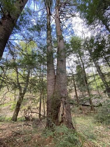
This hike begins along Lower Stony Fork Road within State Game Lands 268 (SGL 268) just before the road crosses a bridge to run along the western side of Stony Fork creek. Here, hikers will head into the forest - following alongside Stony Fork - while passing a small grove of old White Pines with at least a couple of old growths still standing.
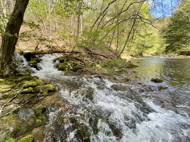
Next, hikers will walk approximately 0.15-miles downstream to find a small two-tiered waterfall, about 3 or 4-feet tall, that spills from Tumbling Run into Stony Fork. Here, hikers will want to stay on the left-hand side of Tumbling Run while making their way up the creek. This section of the hike requires several creek crossings in order to avoid steep or impassible terrain.
12-foot two-tiered Cascade
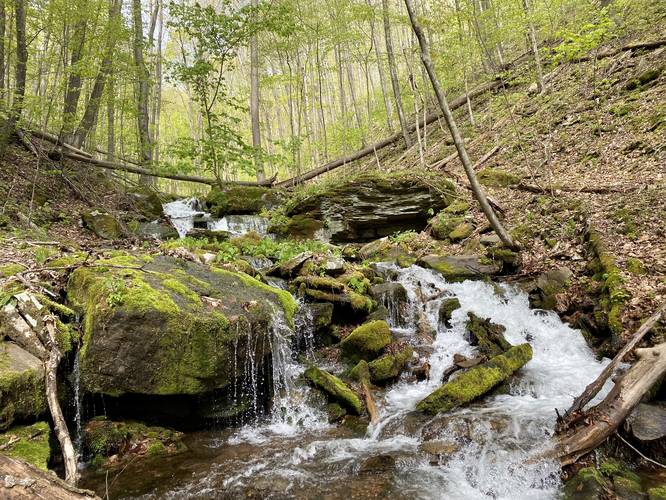
Around mile 0.45, hikers will reach a nice two-tiered waterfall that spills down Tumbling Run creek at about 12-feet tall in total. Here, the trail continues up and around this waterfall along the left-hand side. Most hikers, unless they know about the larger waterfall upstream, may confuse this waterfall with the main attraction - Tumbling Run Falls, as I almost did.
Reaching Tumbling Run Falls
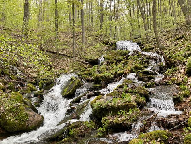
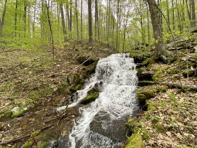
Hikers will eventually climb up to the base of Tumbling Run Falls around mile 0.66. The height of the waterfall is different based on where you observe it. From the very-bottom of the waterfall, including all cascades from the top, Tumbling Run Falls is about 50-feet tall and 100-feet long. The main free-fall section of the waterfall (at the very top) is only about 12-feet tall; however, the remaining cascades that seem to endlessly continue down Tumbling Run makes this entire waterfall significantly taller. The pictures here do not do any justice - especially during the Spring - as the sheer number of cascades, in addition to the large seasonal tributary waterfall, jam pack a ton of scenery into one small space that's difficult to photograph well. Hikers will want to explore the entire waterfall before heading out - including hiking up to the 12-foot free-fall top section of Tumbling Run Falls, to get a better photo.
Hiking out with a Loop
On this trek I decided to avoid the creek on the way out as much as possible. So the data here creates a loop, which is significantly easier to follow than just hiking up and down Tumbling Run. The trail data on the return hike follows the creek from Tumbling Run Falls downstream then it follows the western banks of the creek on the top of the hillside. Hikers will easily catch up with the beginning section of the hike by following the terrain as it slowly slopes back downhill to where you first find Tumbling Run creek spilling into Stony Fork.
Once you reach Stony Fork again, hike through the White Pine grove to get back to parking.
Warnings
Hunting: This hike sits within the State Game Lands which allows hunting. Wear orange, make your presence known, and check hunting schedules before committing to this hike.
Wet Feet: Plan to get your feet wet, bring waders, waterproof boots, or all of the above as this hike is an off-trail bushwhack that follows a creek.
Rattlesnakes: Between May and early October, the Timber Rattlesnake may be found in the rocky terrain hunting or cooling down. Watch your steps and give any rattlers you find enough space.
Parking
Hikers will find a small parking turnout at the coordinates provided. It's large enough to fit a couple of vehicles.
Pets
Dogs are allowed if leashed; however, because of the terrain I would leave my dog at home (as I did on this hike) to avoid annoyances or complications while trying to safely cross the creek.
Difficulty
Due to the rocky uneven terrain, slippery rocks, creek crossings, and steep slopes, this hike should be considered difficult or 'hard'. Trekking poles will help on this hike.
Winter Maintenance
This road is not maintained during the winter, so this hike is seasonal between April and the end of November.
Hike Description
This hike begins along Lower Stony Fork Road within State Game Lands 268 (SGL 268) just before the road crosses a bridge to run along the western side of Stony Fork creek. Here, hikers will head into the forest - following alongside Stony Fork - while passing a small grove of old White Pines with at least a couple of old growths still standing.
Next, hikers will walk approximately 0.15-miles downstream to find a small two-tiered waterfall, about 3 or 4-feet tall, that spills from Tumbling Run into Stony Fork. Here, hikers will want to stay on the left-hand side of Tumbling Run while making their way up the creek. This section of the hike requires several creek crossings in order to avoid steep or impassible terrain.
12-foot two-tiered Cascade
Around mile 0.45, hikers will reach a nice two-tiered waterfall that spills down Tumbling Run creek at about 12-feet tall in total. Here, the trail continues up and around this waterfall along the left-hand side. Most hikers, unless they know about the larger waterfall upstream, may confuse this waterfall with the main attraction - Tumbling Run Falls, as I almost did.
Reaching Tumbling Run Falls
Hikers will eventually climb up to the base of Tumbling Run Falls around mile 0.66. The height of the waterfall is different based on where you observe it. From the very-bottom of the waterfall, including all cascades from the top, Tumbling Run Falls is about 50-feet tall and 100-feet long. The main free-fall section of the waterfall (at the very top) is only about 12-feet tall; however, the remaining cascades that seem to endlessly continue down Tumbling Run makes this entire waterfall significantly taller. The pictures here do not do any justice - especially during the Spring - as the sheer number of cascades, in addition to the large seasonal tributary waterfall, jam pack a ton of scenery into one small space that's difficult to photograph well. Hikers will want to explore the entire waterfall before heading out - including hiking up to the 12-foot free-fall top section of Tumbling Run Falls, to get a better photo.
Hiking out with a Loop
On this trek I decided to avoid the creek on the way out as much as possible. So the data here creates a loop, which is significantly easier to follow than just hiking up and down Tumbling Run. The trail data on the return hike follows the creek from Tumbling Run Falls downstream then it follows the western banks of the creek on the top of the hillside. Hikers will easily catch up with the beginning section of the hike by following the terrain as it slowly slopes back downhill to where you first find Tumbling Run creek spilling into Stony Fork.
Once you reach Stony Fork again, hike through the White Pine grove to get back to parking.
Warnings
Hunting: This hike sits within the State Game Lands which allows hunting. Wear orange, make your presence known, and check hunting schedules before committing to this hike.
Wet Feet: Plan to get your feet wet, bring waders, waterproof boots, or all of the above as this hike is an off-trail bushwhack that follows a creek.
Rattlesnakes: Between May and early October, the Timber Rattlesnake may be found in the rocky terrain hunting or cooling down. Watch your steps and give any rattlers you find enough space.
Parking
Hikers will find a small parking turnout at the coordinates provided. It's large enough to fit a couple of vehicles.
Pets
Dogs are allowed if leashed; however, because of the terrain I would leave my dog at home (as I did on this hike) to avoid annoyances or complications while trying to safely cross the creek.
Difficulty
Due to the rocky uneven terrain, slippery rocks, creek crossings, and steep slopes, this hike should be considered difficult or 'hard'. Trekking poles will help on this hike.
Winter Maintenance
This road is not maintained during the winter, so this hike is seasonal between April and the end of November.