The Trestle-Jessup-Otterkill Loop at Schunnemunk State Park in Cornwall, New York is a difficult 4.1-mile loop hike that features a summit of Schunnemunk Mountain, eight different vistas and overlooks of the Hudson Valley including Sharon's Bench overlook, and two seasonal waterfalls named Baby Brook Falls and Lower Baby Brook Falls.
Trail
This hike follows three named trails in order: Trestle Trail (white blazes), Barton Swamp Trail (white blaze with red dots), and the Jessup Trail (yellow blazes), and the Otterkill Trail (red blazes).
Hike Description
This recording begins at the Moodna Viaduct parking area along Otterkill Rd and heads east. We originally hiked along the Moodna Viaduct Trail before heading into the woods along the Trestle Trail; however, hikers can walk down the road instead - either way, this adds about 0.2 to 0.3-miles to the hike which is not included in the total mileage.
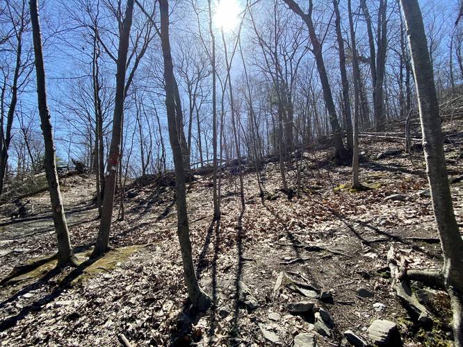
The trail (Trestle Trail) heads into the woods near the viaduct and follows white blazes up to a junction with the Otterkill Trail (red blazes). Here, hikers will want to keep right to continue hiking up the mountain spine along the Trestle Trail. The hike up the mountain spine is difficult, so pace yourself on the way up. Around mile 0.4, hikers may want to stop at a small obstructed and seasonal vista to catch you breath before continuing onward to the Sharon's Bench overlook / vista.
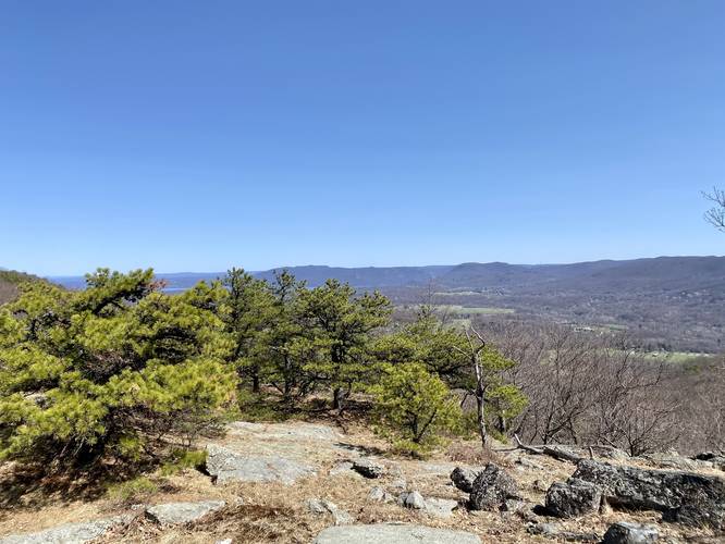
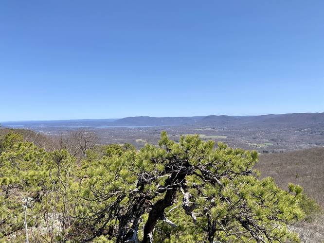
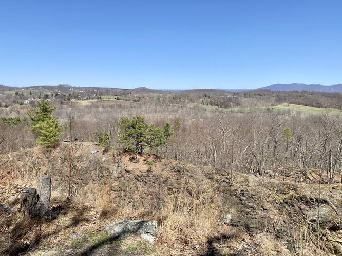
Sharon's Bench Overlook / Vista
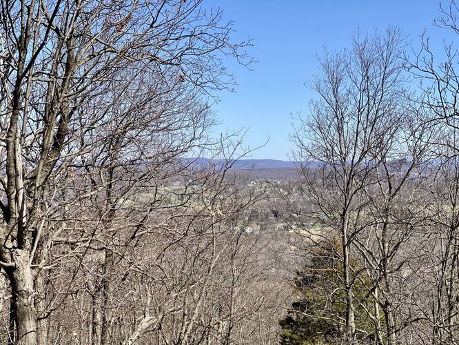
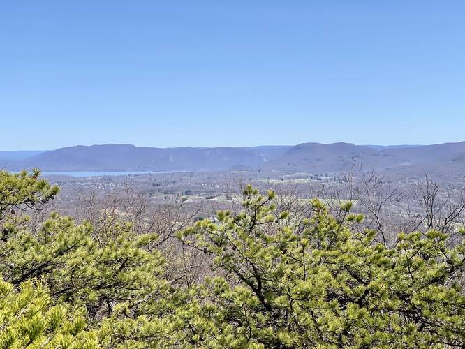
Around mile 0.6, from the trailhead, hikers will reach a beautiful overlook that faces north with views of the Hudson Valley, the Catskill Mountain range, and the Moodna Viaduct. This is a great place to take another break before continuing onward; however, hikers should note that by reaching this point in the trail, the worst of the climbing is over.
More Vistas!
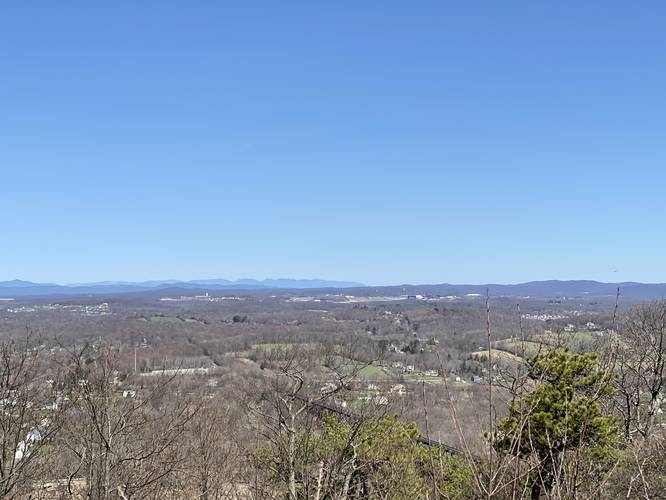
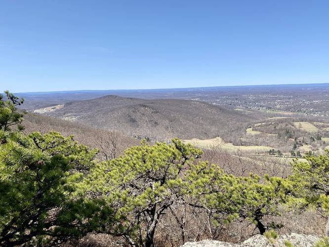
After visiting Sharon's Bench overlook, hikers will find at least two small paths that lead out to rock outcroppings atop this mountain between miles 1.2 and 1.6. Most of them have excellent vistas and overlooks either facing west or east. Some vistas have views of the Hudson Valley and the Catskill Mountains while others face east to give hikers a view of the Hudson River, Storm King Mountain, and the Storm King Art Center.
After visiting these rocky granite outcroppings, hikers will want to continue along the Trestle Trail for a short distance to reach the Barton Swamp Trail.
Barton Swamp Trail Junction
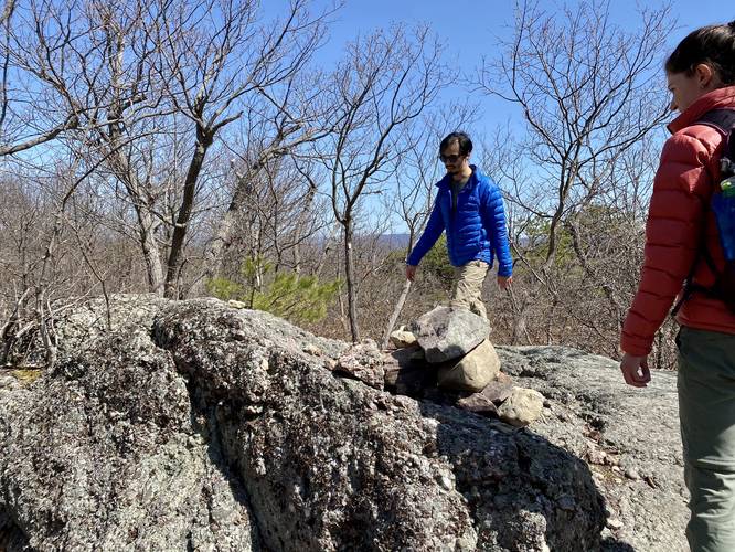
Around mile 1.65, hikers will approach the Barton Swamp Trail (white and red dot blazes) junction on their left-hand side, but this trail is extremely easy to miss. The trail begins on top of a large boulder and the blazes are marked behind the hiker as they hike south, so keep an eye out for a large boulder - no more than 2 feet tall, by 10 feet long - along the Trestle Trail to locate the Barton Swamp Trail.
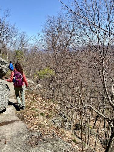
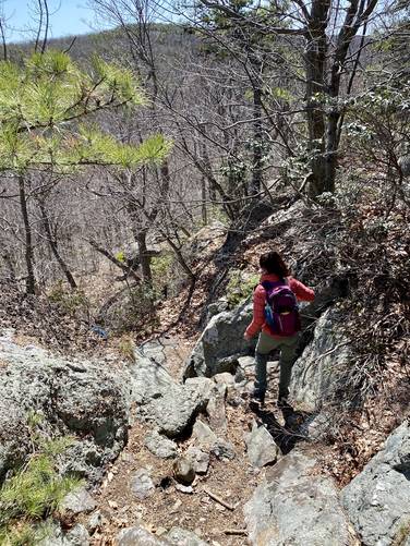
Hiking the Barton Swamp Trail also has a nice rocky outcropping vista point - this one faces east with views of Storm King Mountain and the Storm King Art Center. Just beyond the vista is a large cliff side that hikers must walk atop to follow the trail. It can be dangerous if slippery so hike at your own risk and bring proper footwear. After passing the cliff side, the Barton Trail heads down these boulders which is fairly steep and rocky.
Jessup Trail Junction
After hiking down the boulder field along the Barton Swamp Trail, hikers will cross Baby Brook creek to reach the Jessup Trail (yellow blazes). Here, hikers will want to take a left-hand turn to follow the Jessup Trail downhill and along Baby Brook.
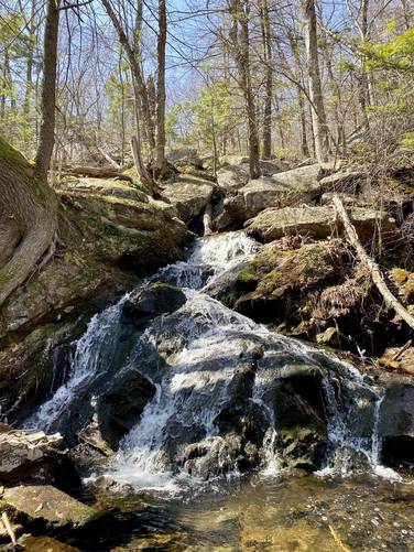
Baby Brook Falls
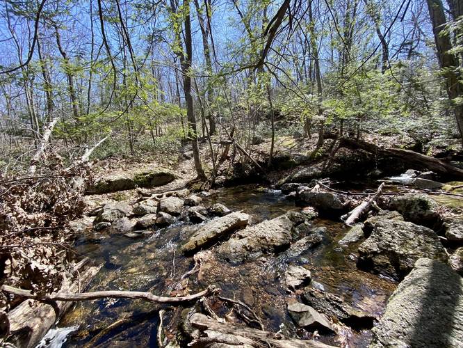
Around mile 2.1, hikers will reach the seasonal waterfall, Baby Brook Falls. This waterfall consists of several cascades, but the main waterfall is a two-tiered ~15-foot cascade. The Jessup Trail heads right up to this waterfall, so you cannot miss it - unless Baby Brook has dried up by mid-Summer.
After visiting Baby Brook Falls, hikers will continue following the Jessup Trail downhill. We ended up following a section of the Jessup Trail that is no longer maintained, as it was re-routed recently - but both routes lead to the same place -- the Otterkill Trail (red blazes).
Otterkill Trail Junction
Around mile 2.95, hikers will reach the Otterkill Trail (red blazes) and will want to take a left-hand turn here to make their way out and back to parking.
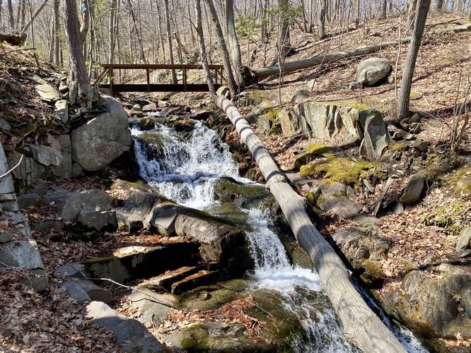
Lower Baby Brook Falls
Around mile 3, hikers will reach Lower Baby Brook Falls which again is a seasonal waterfall. This waterfall consists of many cascades with the biggest being no more than 5-feet tall, but in total the waterfall is about 10-feet tall at best. Lower Baby Brook Falls cascades down into a large pool of water that looks great for fishing brook trout.
Otterkill Overlook
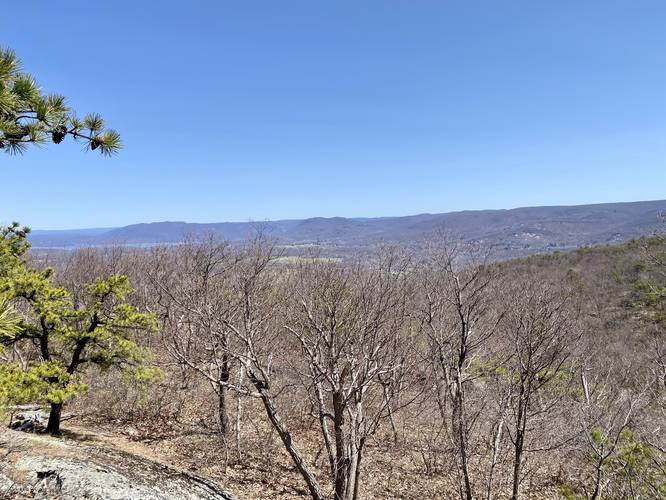
After passing Lower Baby Brook Falls, the last point-of-interest along this hike is the Otterkill Overlook located around mile 3.8. Hikers will want to stop here for one last vista of the Hudson Valley and Storm King Mountain before they head out.
Hiking out from the Otterkill Overlook is as simple as following the red blazes north to reach the white blazes of the Trestle Trail, the downhill and back to Otterkill Road to end the hike.
Vistas and Overlooks
Hikers should note that except for the Jessup Trail, every trail has at least one vista or overlook located along this hike. The Jessup Trail does include a vista, but just not on this exact track.
Baby Brook Falls
Baby Brook Falls is located right along the Jessup Trail around mile 2.1 in this GPS track and is the larger of the two waterfalls located along this hike. It cascades down Baby Brook in a series of waterfalls with the main waterfall being a two-tiered ~15-foot cascade. Hikers will also find Lower Baby Brook Falls is located along the Otterkill Trail, near the junction with the Jessup Trail, around mile 3 in this GPS track. Both waterfalls are seasonal and likely dry-up by the Summer.
Blaze Colors
This hike follows several blazes listed in order: Trestle Trail - white blazes, Barton Swamp Trail - white blaze with red dot, Jessup Trail - yellow blazes, and the Otterkill Trail - red blazes.
Warnings
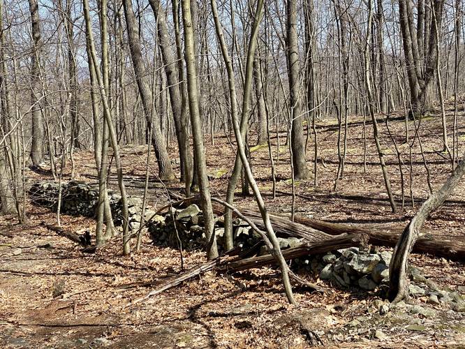
Rattlesnakes: This trail may contain Timber Rattlesnakes between the months of late April through late September. They tend to sunbathe on the rocky outcroppings, which can be found near the mountain summit along the Trestle Trail and the Barton Swamp Trail. While they're usually rare, they sometimes don't rattle until they're approached, so watch your step and give any rattlesnakes you find extra space.
Cliffs: This section of Barton Swamp Trail follows a very steep cliff side. There's enough footing to make this a safe hike along the top of the cliff, but hikers should come prepared with the proper footwear to avoid slipping.
Trail
This hike follows three named trails in order: Trestle Trail (white blazes), Barton Swamp Trail (white blaze with red dots), and the Jessup Trail (yellow blazes), and the Otterkill Trail (red blazes).
Hike Description
This recording begins at the Moodna Viaduct parking area along Otterkill Rd and heads east. We originally hiked along the Moodna Viaduct Trail before heading into the woods along the Trestle Trail; however, hikers can walk down the road instead - either way, this adds about 0.2 to 0.3-miles to the hike which is not included in the total mileage.
The trail (Trestle Trail) heads into the woods near the viaduct and follows white blazes up to a junction with the Otterkill Trail (red blazes). Here, hikers will want to keep right to continue hiking up the mountain spine along the Trestle Trail. The hike up the mountain spine is difficult, so pace yourself on the way up. Around mile 0.4, hikers may want to stop at a small obstructed and seasonal vista to catch you breath before continuing onward to the Sharon's Bench overlook / vista.
Sharon's Bench Overlook / Vista
Around mile 0.6, from the trailhead, hikers will reach a beautiful overlook that faces north with views of the Hudson Valley, the Catskill Mountain range, and the Moodna Viaduct. This is a great place to take another break before continuing onward; however, hikers should note that by reaching this point in the trail, the worst of the climbing is over.
More Vistas!
After visiting Sharon's Bench overlook, hikers will find at least two small paths that lead out to rock outcroppings atop this mountain between miles 1.2 and 1.6. Most of them have excellent vistas and overlooks either facing west or east. Some vistas have views of the Hudson Valley and the Catskill Mountains while others face east to give hikers a view of the Hudson River, Storm King Mountain, and the Storm King Art Center.
After visiting these rocky granite outcroppings, hikers will want to continue along the Trestle Trail for a short distance to reach the Barton Swamp Trail.
Barton Swamp Trail Junction
Around mile 1.65, hikers will approach the Barton Swamp Trail (white and red dot blazes) junction on their left-hand side, but this trail is extremely easy to miss. The trail begins on top of a large boulder and the blazes are marked behind the hiker as they hike south, so keep an eye out for a large boulder - no more than 2 feet tall, by 10 feet long - along the Trestle Trail to locate the Barton Swamp Trail.
Hiking the Barton Swamp Trail also has a nice rocky outcropping vista point - this one faces east with views of Storm King Mountain and the Storm King Art Center. Just beyond the vista is a large cliff side that hikers must walk atop to follow the trail. It can be dangerous if slippery so hike at your own risk and bring proper footwear. After passing the cliff side, the Barton Trail heads down these boulders which is fairly steep and rocky.
Jessup Trail Junction
After hiking down the boulder field along the Barton Swamp Trail, hikers will cross Baby Brook creek to reach the Jessup Trail (yellow blazes). Here, hikers will want to take a left-hand turn to follow the Jessup Trail downhill and along Baby Brook.
Baby Brook Falls
Around mile 2.1, hikers will reach the seasonal waterfall, Baby Brook Falls. This waterfall consists of several cascades, but the main waterfall is a two-tiered ~15-foot cascade. The Jessup Trail heads right up to this waterfall, so you cannot miss it - unless Baby Brook has dried up by mid-Summer.
After visiting Baby Brook Falls, hikers will continue following the Jessup Trail downhill. We ended up following a section of the Jessup Trail that is no longer maintained, as it was re-routed recently - but both routes lead to the same place -- the Otterkill Trail (red blazes).
Otterkill Trail Junction
Around mile 2.95, hikers will reach the Otterkill Trail (red blazes) and will want to take a left-hand turn here to make their way out and back to parking.
Lower Baby Brook Falls
Around mile 3, hikers will reach Lower Baby Brook Falls which again is a seasonal waterfall. This waterfall consists of many cascades with the biggest being no more than 5-feet tall, but in total the waterfall is about 10-feet tall at best. Lower Baby Brook Falls cascades down into a large pool of water that looks great for fishing brook trout.
Otterkill Overlook
After passing Lower Baby Brook Falls, the last point-of-interest along this hike is the Otterkill Overlook located around mile 3.8. Hikers will want to stop here for one last vista of the Hudson Valley and Storm King Mountain before they head out.
Hiking out from the Otterkill Overlook is as simple as following the red blazes north to reach the white blazes of the Trestle Trail, the downhill and back to Otterkill Road to end the hike.
Vistas and Overlooks
Hikers should note that except for the Jessup Trail, every trail has at least one vista or overlook located along this hike. The Jessup Trail does include a vista, but just not on this exact track.
Baby Brook Falls
Baby Brook Falls is located right along the Jessup Trail around mile 2.1 in this GPS track and is the larger of the two waterfalls located along this hike. It cascades down Baby Brook in a series of waterfalls with the main waterfall being a two-tiered ~15-foot cascade. Hikers will also find Lower Baby Brook Falls is located along the Otterkill Trail, near the junction with the Jessup Trail, around mile 3 in this GPS track. Both waterfalls are seasonal and likely dry-up by the Summer.
Blaze Colors
This hike follows several blazes listed in order: Trestle Trail - white blazes, Barton Swamp Trail - white blaze with red dot, Jessup Trail - yellow blazes, and the Otterkill Trail - red blazes.
Warnings
Rattlesnakes: This trail may contain Timber Rattlesnakes between the months of late April through late September. They tend to sunbathe on the rocky outcroppings, which can be found near the mountain summit along the Trestle Trail and the Barton Swamp Trail. While they're usually rare, they sometimes don't rattle until they're approached, so watch your step and give any rattlesnakes you find extra space.
Cliffs: This section of Barton Swamp Trail follows a very steep cliff side. There's enough footing to make this a safe hike along the top of the cliff, but hikers should come prepared with the proper footwear to avoid slipping.