The Trail of the Cedars at North Cascades National Park in Newhalem, Washington is an easy 0.7-mile loop hike that features views of the Skagit River, old-growth trees, and a seasonal, small waterfall spillway.
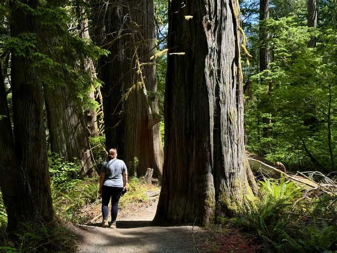
Old-growth Grove - Mile 0.43 Just past the spur path to the spillway sits one last grove of old-growth Western Redcedar trees. Grouped in about three (or more), you can hike through this scenic grove of ancient trees as they tower overhead. This is another great photo-op spot along the trail.
Hike the Trail of the Cedars
This short hike begins in the town center of Newhalem where hikers will find parking on the north side of the North Cascades Highway. Cross the highway and pass the Skagit General Store (grab a bite to eat or espresso if needed) and continue across Silk Stocking Road to find a red suspension bridge with "Trail of the Cedars" printed at the top. The trailhead for the Trail of the Cedars essentially begins on the south side of the road.Skagit River Views - Mile 0
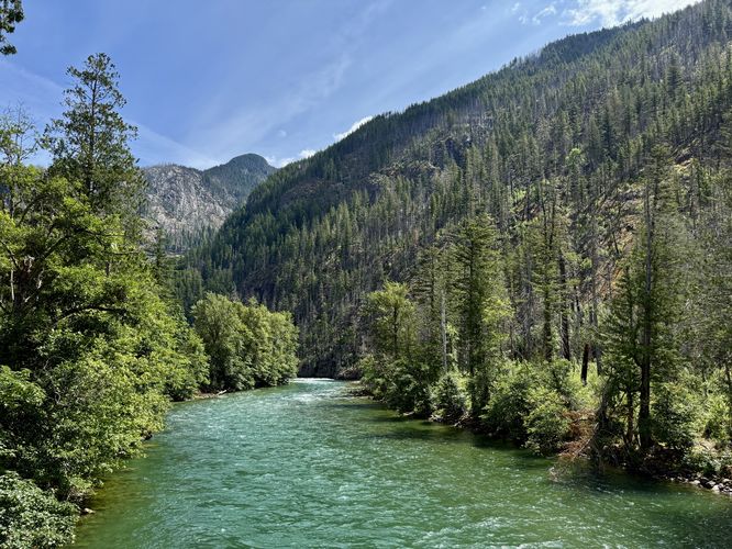
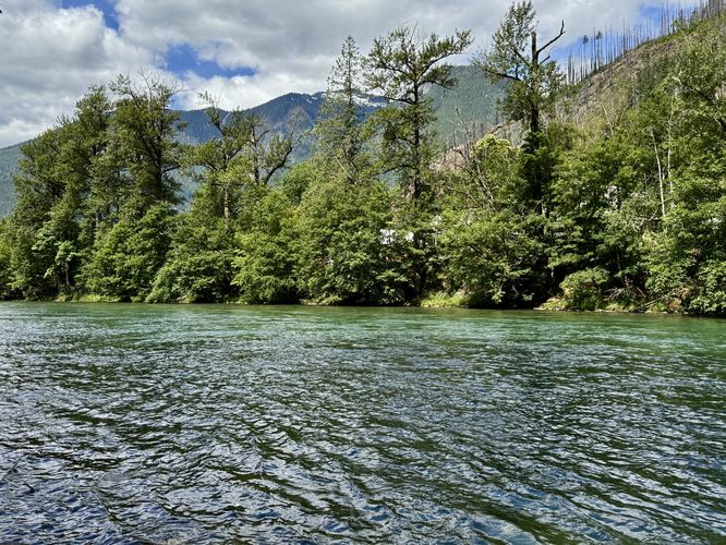
Just beyond the trailhead, located on the suspension bridge, sit beautiful views of the Skagit River and its turquoise-tinted waters. You don't need to walk very far from the trailhead at all to reach these views. If you don't care much about old-growth trees, the history of the area, or lessons in wildfires, then the views of the Skagit River are at least worth checking out.Wildfire Remnants & Western Redcedars - Mile 0.07 to 0.3
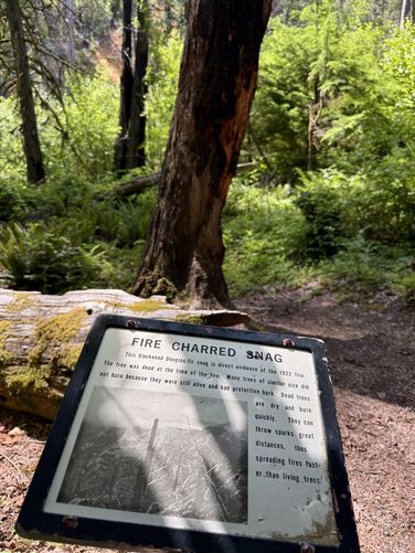
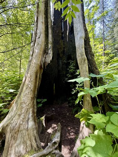
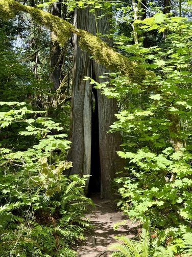
After crossing the suspension bridge, this route leads clockwise along the loop where you'll first pass remnants of a wildfire from 1922. Along the way are information kiosks where you can learn more about the fire, its destruction, and why some trees are still standing today thanks to their fire-resistant bark. You'll even find a massive trunk of a long-dead fire-scarred Western Redcedar tree that even adults can step into for a bit of fun near mile 0.17. Around mile 0.2, you'll find the "see-thru tree", another Western Redcedar tree whose center has rotted away, leaving a window that hikers can peer directly through to the other side. You can learn more about why the tree can live with a rotted core, which is a natural phenomenon for Western Redcedars.Newhalem Powerhouse - Mile 0.3
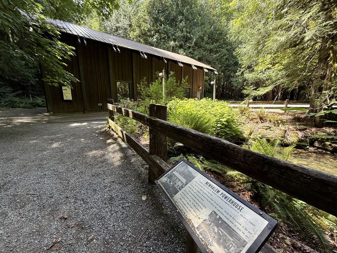
At mile 0.3, the trail leads out of the forest, somewhat, to reach the Newhalem Powerhouse. This building, originally constructed in 1921, was used to generate electricity for a sawmill and the construction camp for the Gorge Dam. After being destroyed in a fire in 1966, during which a main water line broke and sprayed the surrounding forest and ultimately saved the forest and the old-growth Western Redcedars that you're exploring along the route. The powerhouse was rebuilt in 1970 and still stands today.Ancient Western Redcedar - Mile 0.36
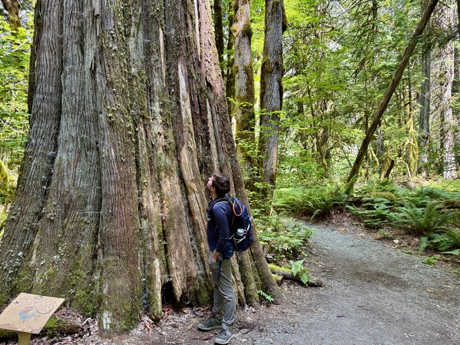
Just past the powerhouse sits a massive old-growth Western Redcedar that sits on-trail. This is a great spot to take a photo. If you can, get a shot next to the tree for scale.Waterfall Spillway - Mile 0.4
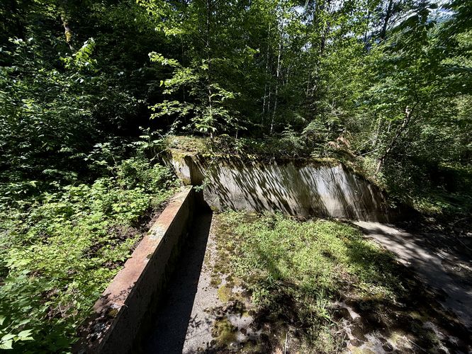
Around mile 0.4, at the end of a short spur path, sits a concrete waterfall spillway that once flowed from the powerhouse. It's unclear if this spillway ever flows, but the vegetation growing in the creekbed appears that maybe this flow is seasonal during periods of snow melt. No water was flowing when we visited, and hence, no short cascade either.Old-growth Grove - Mile 0.43 Just past the spur path to the spillway sits one last grove of old-growth Western Redcedar trees. Grouped in about three (or more), you can hike through this scenic grove of ancient trees as they tower overhead. This is another great photo-op spot along the trail.