The Tiadaghton Trail to Old Wagon Road Loop at Tiadaghton State Forest in Waterville, Pennsylvania is a difficult 4.5-mile loop hike that features views of the PA Grand Canyon from Huntley Mountain.
Hike Description
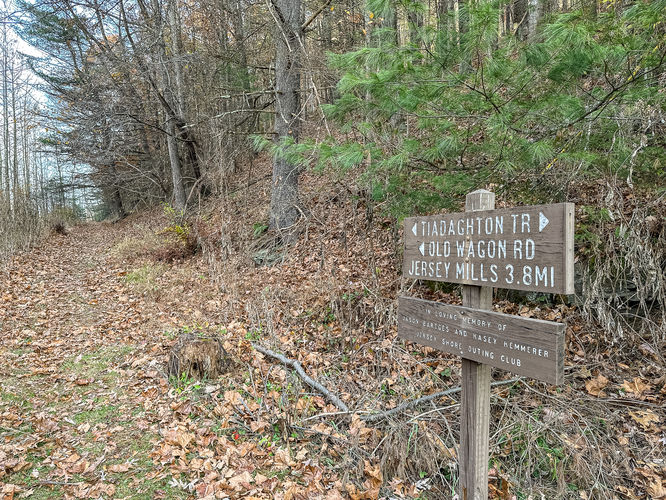
This hike starts by following the rail trail from the back of the Waterville Recreational Access parking lot and you will almost immediately see a grassy path leading off the rail trail to the right which leads to the trailhead sign for Tiadaghton Trail and Old Wagon Road. A short distance beyond, the Tiadaghton Trail will cut off of the Old Wagon Road to the right and ascend via several switchbacks. Tiadaghton Trail is blazed yellow and looks as if it was previously blazed blue.
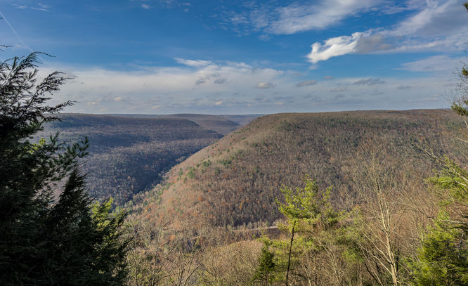
At approximately .4 of a mile there are some slightly off trail views that may vary depending on the season. These views look across Pine Creek towards the forest district office. As the trail switchbacked towards the ledge, I ventured off the trail some to see what views I could find.
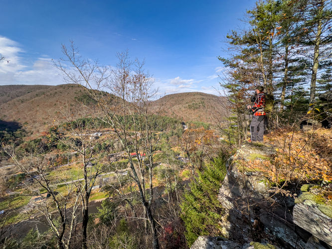
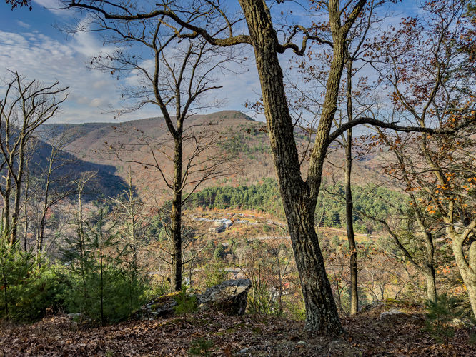
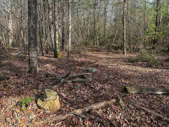
As you continue to climb on Tiadaghton Trail at about .8 of mile (41.31739, -77.37607) you will connect with an old grade and continue to ascend. Just after reaching the top, there is a campsite and stone fire ring. Less than a tenth of a mile beyond the campsite, Tiadaghton Trail will leave the wider path of the grade and cuts to the left through the forest and towards the rim and to a lookout.
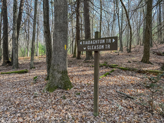
The trail continues through the forest and eventually connects with Gleason Trail at about 2.3 miles into the hike (41.33323, -77.38084). In order to complete the loop, at this point you would leave Tiadaghton Trail and follow the red blazes of Gleason Trail and is descends back down the mountain. Near the top there are a series of short, steep switchbacks. I did this hike in early November and the trail was covered in leaves making it easy to slide some due to the steepness of the trail. The steepness of this route is likely due to the trail skirting around a section of private land. The trail does become easier once you get to the run that was mostly dry during my hike, but I imagine at other times might have some flow to it.
Gleason trail will eventually connect back with Old Wagon Road at about 2.9 miles (41.33282, -77.39068). At this point you could drop down a little further to the rail trail and back to the parking lot or stay on the Old Wagon Road and back to where you started. I opted for the Old Wagon Road, which is more of a trail and labeled that way on some maps. This route stays elevated some from the rail trail and I found it as an enjoyable finish to the hike as a nice stroll through the woods with some views of Pine Creek and wondering what history there might be to this route.
Hike Description
This hike starts by following the rail trail from the back of the Waterville Recreational Access parking lot and you will almost immediately see a grassy path leading off the rail trail to the right which leads to the trailhead sign for Tiadaghton Trail and Old Wagon Road. A short distance beyond, the Tiadaghton Trail will cut off of the Old Wagon Road to the right and ascend via several switchbacks. Tiadaghton Trail is blazed yellow and looks as if it was previously blazed blue.
At approximately .4 of a mile there are some slightly off trail views that may vary depending on the season. These views look across Pine Creek towards the forest district office. As the trail switchbacked towards the ledge, I ventured off the trail some to see what views I could find.
As you continue to climb on Tiadaghton Trail at about .8 of mile (41.31739, -77.37607) you will connect with an old grade and continue to ascend. Just after reaching the top, there is a campsite and stone fire ring. Less than a tenth of a mile beyond the campsite, Tiadaghton Trail will leave the wider path of the grade and cuts to the left through the forest and towards the rim and to a lookout.
The trail continues through the forest and eventually connects with Gleason Trail at about 2.3 miles into the hike (41.33323, -77.38084). In order to complete the loop, at this point you would leave Tiadaghton Trail and follow the red blazes of Gleason Trail and is descends back down the mountain. Near the top there are a series of short, steep switchbacks. I did this hike in early November and the trail was covered in leaves making it easy to slide some due to the steepness of the trail. The steepness of this route is likely due to the trail skirting around a section of private land. The trail does become easier once you get to the run that was mostly dry during my hike, but I imagine at other times might have some flow to it.
Gleason trail will eventually connect back with Old Wagon Road at about 2.9 miles (41.33282, -77.39068). At this point you could drop down a little further to the rail trail and back to the parking lot or stay on the Old Wagon Road and back to where you started. I opted for the Old Wagon Road, which is more of a trail and labeled that way on some maps. This route stays elevated some from the rail trail and I found it as an enjoyable finish to the hike as a nice stroll through the woods with some views of Pine Creek and wondering what history there might be to this route.