The Bubbles Loop hike at
Acadia National Park near Mount Desert, Maine is a difficult 3.5-mile hike that traverses the two mountains on the north side of
Jordan Pond, South Bubble and North Bubble.
Hiking The Bubbles
The Bubbles are some of
Acadia's most iconic mountains. Most visitors to the park will visit
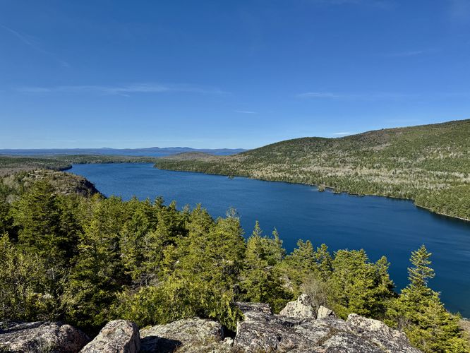
Jordan Pond and, at the very least, will enjoy the scenery of the pond's water with The Bubbles towering over the northern shores. This hike, however, leads visitors up along The Bubbles Trail to traverse these majestic mountains in order to take in scenery of
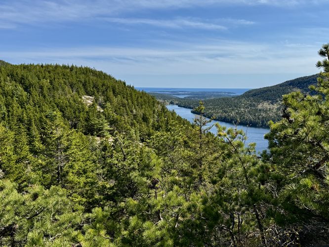
Jordan Pond,
Cadillac Mountain, Eagle Lake, and the Atlantic Ocean.
This hike begins along the Bubbles Divide Trail, located on the west side of Park Loop Road at the coordinates provided. Most hikers follow the #1 trail guide for The Bubbles via corporate trail apps, thus hiking through the most-popular sections of trails. This route leads hikers along a more secluded route which includes rock scrambling and far less people.
Parking to South Bubble - Mile 0 to 0.5
From the parking lot, hike along the Bubbles Divide Trail until you reach a junction with the Jordan Pond Carry. Here, take a left-hand turn to follow the Jordan Pond Carry as it leads downhill through the forest to reach the
Jordan Pond Path around mile 0.5. Once at
Jordan Pond, you'll find nice views of the water and Penobscot Mountain to the west. To continue the hike, take an immediate (sharp) right-hand turn to follow the Bubbles Trail.
Scrambling up South Bubble - Mile 0.5 to 0.75
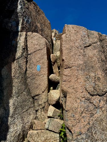
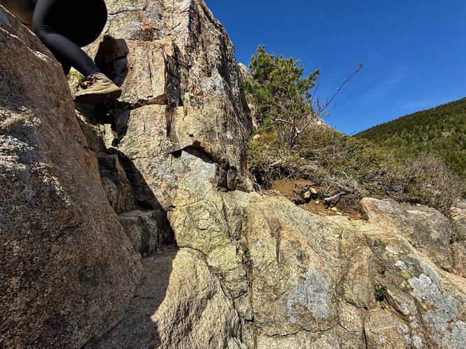
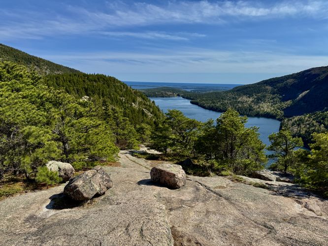
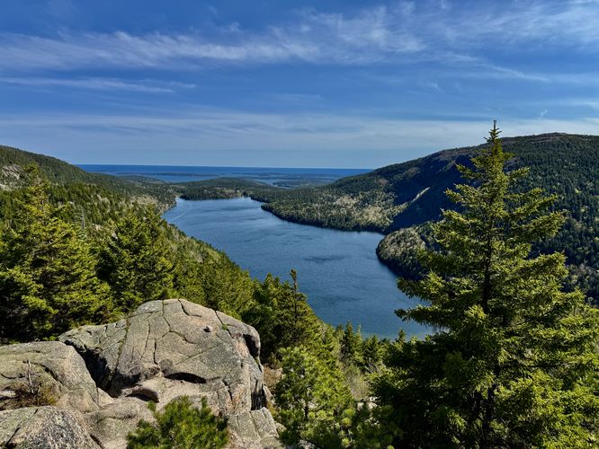
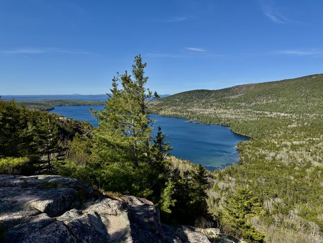
Once on the Bubbles Trail, the hike up South Bubble is not easy (hence the "Hard" difficulty rating). Along the way are large rocks and boulders that you'll have to traverse up this steep mountainside. Closer to the top, near mile 0.66 and 0.68, are at least two rock scrambles that are about 8-feet tall. These rock scrambles are not very difficult, but they might slow you down a bit. At least one rock scramble has metal rungs to help you up the cliffs. At each scramble (pitch), you'll find ledges and cliffs so be mindful. You'll also find stunning views of
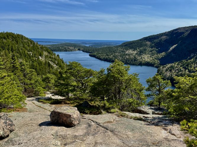
Jordan Pond and the Atlantic Ocean as you traverse the southern cliff-filled slopes of South Bubble. Around mile 0.75, the scrambling will be over and you'll essentially be at the top of South Bubble with stunning views.
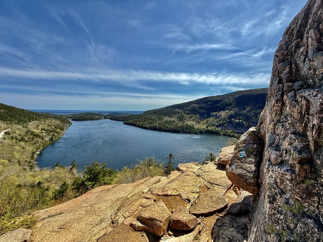
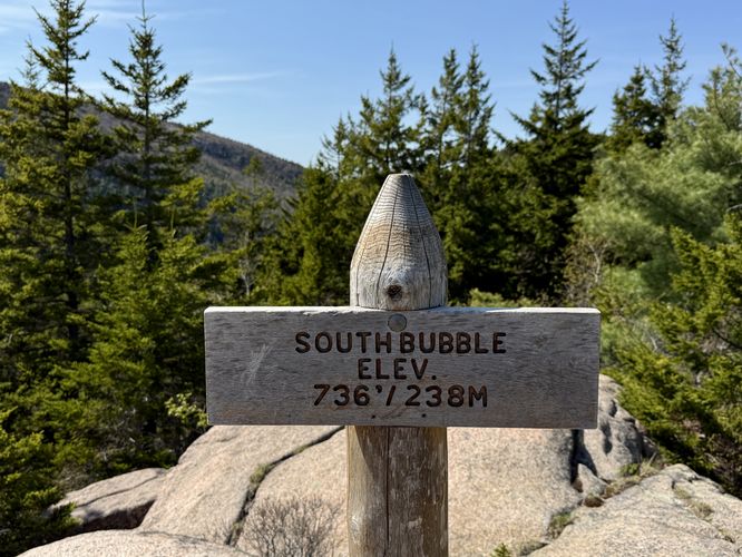
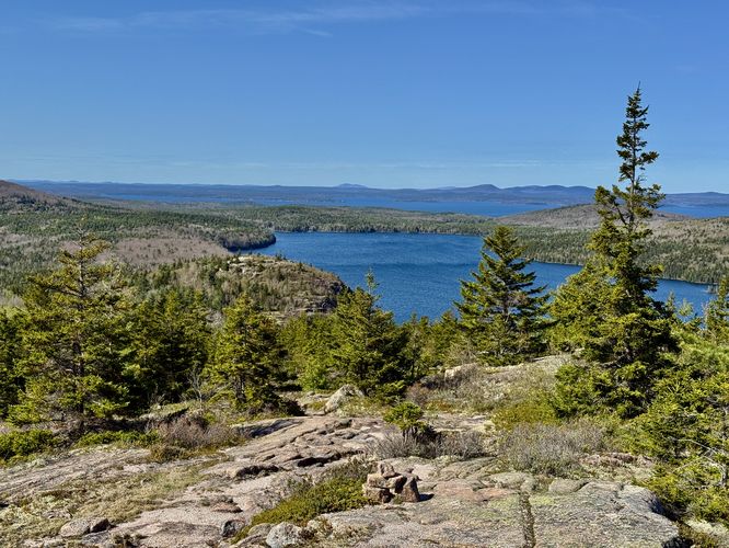
South Bubble Summit & The Bubble - Mile 0.8 to 0.86
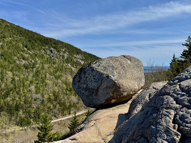
After soaking up the breathtaking views from South Bubble, the hike continues on to reach the summit of South Bubble, around mile 0.8. There's a neighboring sign, labeled "The Bubble" which leads hikers out to another rocky cliff face where you'll find a massive boulder teetering on the edge of South Bubble. This large boulder is named "The Bubble". You'll also find nice views of Eagle Lake and
Cadillac Mountain from this cliff.
Hiking to North Bubble's Summit - Mile 0.86 to 1.45
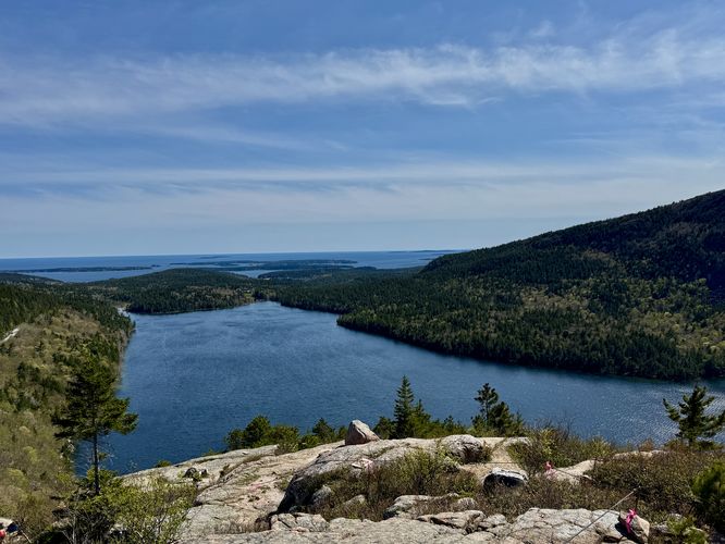
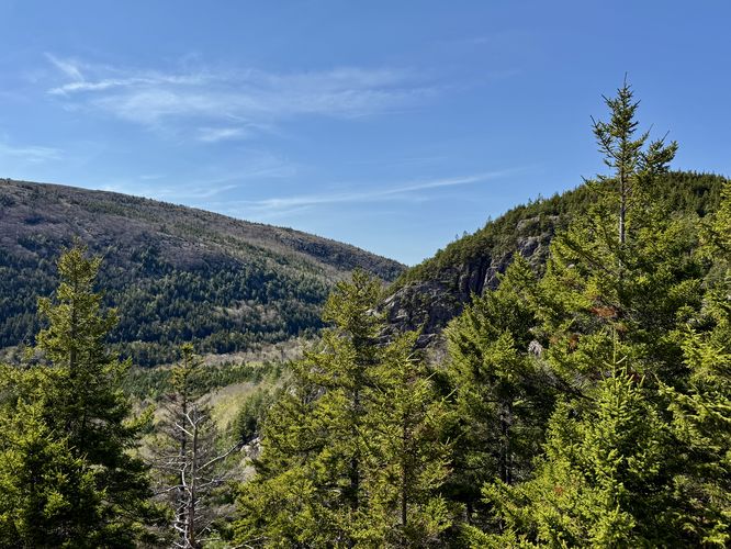
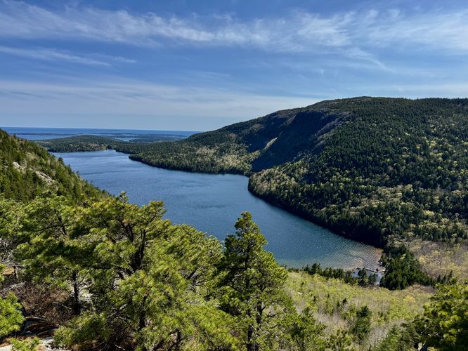
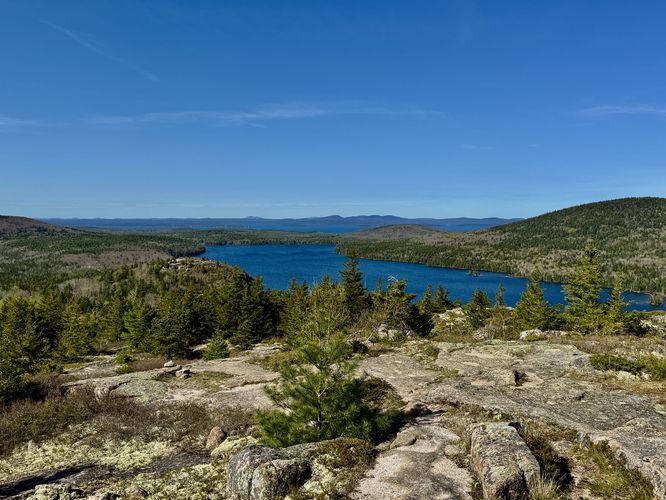
From South Bubble's summit, the hike to North Bubble is fairly straight forward. Simply follow the Bubbles Trail as it traverses the northern slopes of South Bubble, follow the Bubbles Divide Trail, and take a left-hand turn on the Bubbles Trail as it leads up North Bubble. Along the way are a bunch of views you can check out. At mile 1 is a nice view of North Bubbles southern slopes as the last view along South Bubble. On North Bubble there are several vista points too like at mile 1.3 and 1.35. Both vistas include views of South Bubble,
Jordan Pond,
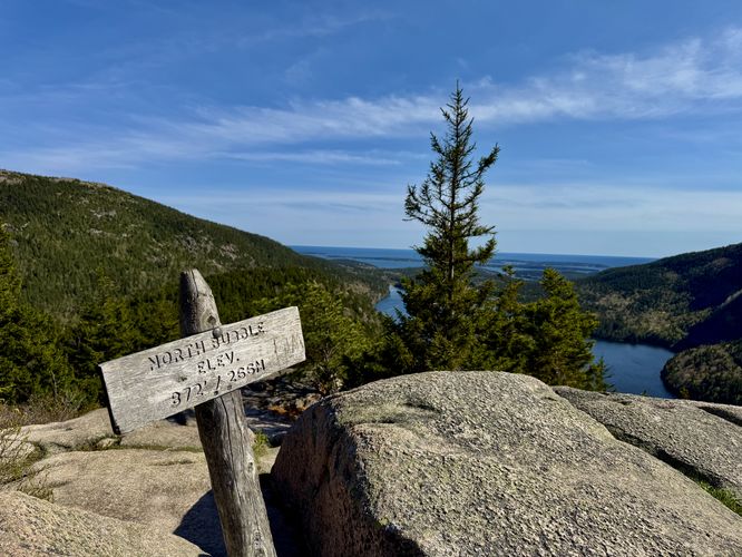
Cadillac Mountain, and Penobscot Mountain -- along with the Atlantic Ocean. Hikers will reach the summit of North Bubble around mile 1.45 where you'll find another summit sign and more views. The views from North Bubble's summit is hard to beat as you get to look back at the traverse you just made across South Bubble. Take a seat and enjoy the sweeping views from North Bubble's summit before pushing onward.
Hiking North Bubble & Views - Mile 1.45 to 2.3
Once you pass North Bubble's summit, the hike back to parking continues with breathtaking scenery. Fun fact, most people don't follow the Bubbles Trail north along North Bubble and thus this part of the hike is ultra-secluded. Beyond North Bubble, the trail leads along an exposed bedrock path that leads out to cliffs along the mountain's eastern slopes. From these cliffs, you'll find stunning views of
Cadillac Mountain, Eagle Lake, Frenchman Bay, and the distant mountains to the northeast. Cliff views can be found around mile 1.75 while the exposed and open trail views can be found between miles 1.8 and 2.1. This part of the trail can be a bit tricky to follow, but simply look for the stone cairns that define the trail along with the blue blazes that are seldomly painted along the bedrock.
Hiking North Bubble to Parking - Mile 2.3 to 3.5
The last leg of this hike is from miles 2.3 to 3.5 and are arguably not very interesting but are necessary to complete the loop. The views along the northern slopes of North Bubble end around mile 2.1 or 2.2 where the trail dips back into the forest. Eventually, around mile 2.3, you'll reach the Eagle Lake Carriage Road which is a popular biking trail and likely service road for the park. Take a right-hand turn here to follow the road as it leads downhill. Be on the lookout for a discrete right-hand turn around mile 2.95 / 3. Take this right-hand turn which leads hikers down the Jordan Pond Carry (trail). The hike along the Jordan Pond Carry is again pretty boring but it passes through the forest and leads back to the original trail junction near the start of the hike. Once at the original trail junction, near mile 3.45 take a left-hand turn to hike back to parking. Complete the loop at mile 3.5 at parking.
Parking
Hikers will find a medium-sized parking lot at the coordinates provided, located along Park Loop Road. The parking lot is large enough to fit about 20 vehicles (max) and it fills up quickly. If the parking lot is full, plan on a backup hike like the
Jordan Pond Loop or you can consider starting/ending at the south end of
Jordan Pond instead where you'll find a lot more parking spaces.
Pets
Dogs are allowed only if leashed and cleaned up after.
Warning
Cliffs and scrambling: This hike leads through areas of steep cliffs, steep terrain, and rock scrambles. Be mindful and reconsider taking the scrambling route if it's been raining or if it's very wet outside to reduce risk.