The Swallow Falls Canyon Trail at Swallow Falls State Park in Oakland, Maryland is an easy 1.6 mile loop trail that leads to four amazing waterfalls at the park - Tolliver Falls, Swallow Falls (Upper and Lower), and Muddy Creek Falls. This loop trail is by far one of the most scenic trails in Maryland as it winds through old growth (300+ year old) virgin Hemlock and White Pine trees and into the canyon next to Swallow Falls. As you hike along this trail, you'll feel more like you're in the Pacific Northwest than on the east coast.
This route starts off at the trailhead at the main parking lot and runs south to Tolliver Falls first, then heads north to Swallow Falls, and eventually Muddy Creek Falls in the northern section. Please note that there's a $5 out-of-state and a $3 in-state fee to park.
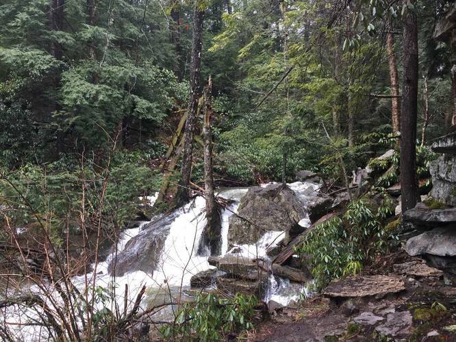
Tolliver Falls: Tolliver Falls can be found on the southeastern portion of the loop and is only about 5 feet tall, but has a cascade of about 20 feet wide. Tolliver Falls also feeds into a large pool below where the trail skirts along the shores of the creek, but from afar it looks as though the trail disappears.
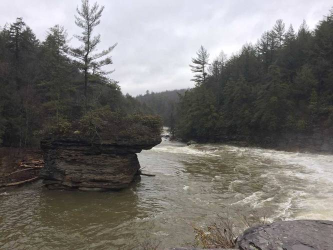
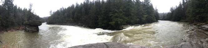
Upper Swallow Falls: Upper Swallow Falls can be found in the middle section on the east side of the loop along the Youghiogheny River, just north of Tolliver Falls. The trail juts out into the river onto a large rock outcropping that sits flush with the top of the falls. Looking downriver is a large stone standing in the middle of the river where the water has cut away the sides, leaving it standing with a lone tree. Be careful on the rocks here, especially when they're wet.
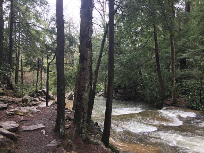
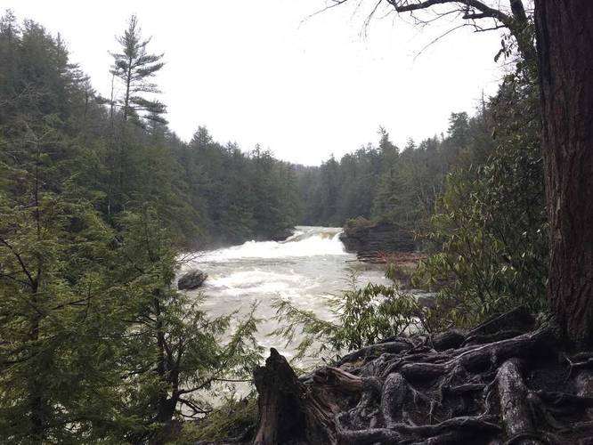
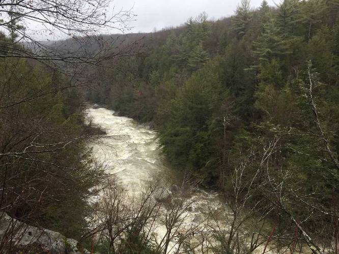
Following the trail north of Upper Swallow Falls, you'll hike along the side of the Youghiogheny River's canyon. Massive boulders teeter on piles of smaller rocks below and during the Spring, there may be trickling waterfalls coming down the rocks as you hike by.
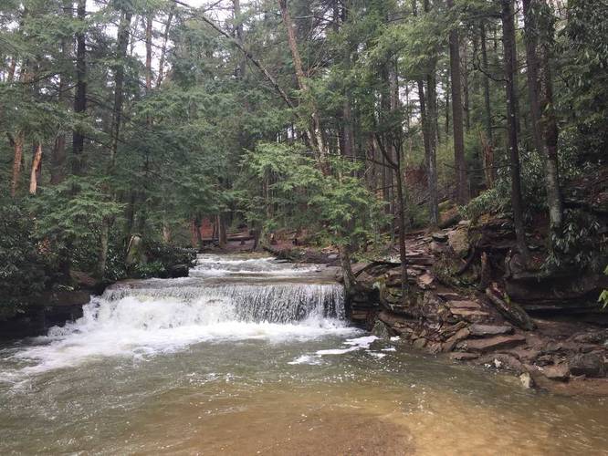
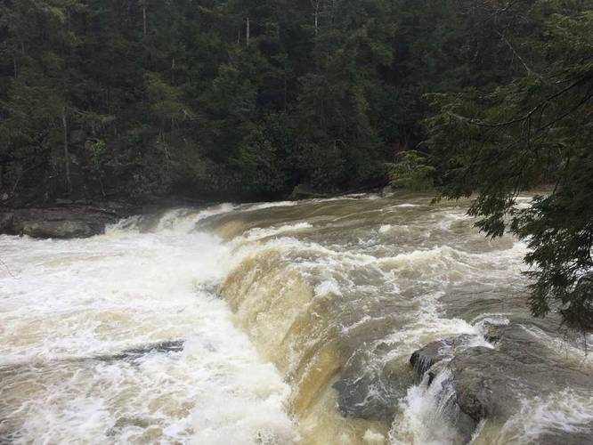
Lower Swallow Falls: The Lower section of Swallow Falls can be found just north of the Upper falls section on the loop. The waterfall is the widest falls you'll see and is likely closer to 40 feet wide, but the drop itself is only about 6 or 8 feet. There's a wooden fence and platform with signage for Lower Swallow Falls, so you can't miss it.
After visiting Lower Swallow Falls, the trail continues north to Muddy Creek Falls, which lies at the very northern point in the loop.
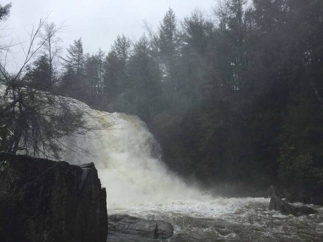
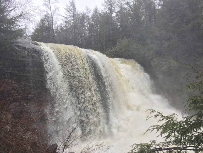
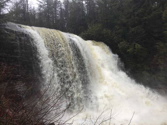
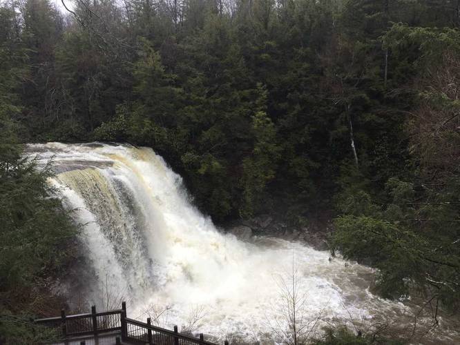
Muddy Creek Falls is the tallest waterfall along the hike and during the early Spring, the cascade is often overflowing and roars downstream. Follow the trail up the wooden staircase to reach the top of Muddy Creek Falls for a view down the creek. After checking out the top of the falls, head south and then take your immediate left-hand turn to head towards the last two lookout points in the park - one of Muddy Creek Falls and the other of the Youghiogheny River.
After visiting both lookouts and taking one last peek of Muddy Creek Falls, the hike out is short and flat back to parking.
This route starts off at the trailhead at the main parking lot and runs south to Tolliver Falls first, then heads north to Swallow Falls, and eventually Muddy Creek Falls in the northern section. Please note that there's a $5 out-of-state and a $3 in-state fee to park.
Tolliver Falls: Tolliver Falls can be found on the southeastern portion of the loop and is only about 5 feet tall, but has a cascade of about 20 feet wide. Tolliver Falls also feeds into a large pool below where the trail skirts along the shores of the creek, but from afar it looks as though the trail disappears.
Upper Swallow Falls: Upper Swallow Falls can be found in the middle section on the east side of the loop along the Youghiogheny River, just north of Tolliver Falls. The trail juts out into the river onto a large rock outcropping that sits flush with the top of the falls. Looking downriver is a large stone standing in the middle of the river where the water has cut away the sides, leaving it standing with a lone tree. Be careful on the rocks here, especially when they're wet.
Following the trail north of Upper Swallow Falls, you'll hike along the side of the Youghiogheny River's canyon. Massive boulders teeter on piles of smaller rocks below and during the Spring, there may be trickling waterfalls coming down the rocks as you hike by.
Lower Swallow Falls: The Lower section of Swallow Falls can be found just north of the Upper falls section on the loop. The waterfall is the widest falls you'll see and is likely closer to 40 feet wide, but the drop itself is only about 6 or 8 feet. There's a wooden fence and platform with signage for Lower Swallow Falls, so you can't miss it.
After visiting Lower Swallow Falls, the trail continues north to Muddy Creek Falls, which lies at the very northern point in the loop.
Muddy Creek Falls is the tallest waterfall along the hike and during the early Spring, the cascade is often overflowing and roars downstream. Follow the trail up the wooden staircase to reach the top of Muddy Creek Falls for a view down the creek. After checking out the top of the falls, head south and then take your immediate left-hand turn to head towards the last two lookout points in the park - one of Muddy Creek Falls and the other of the Youghiogheny River.
After visiting both lookouts and taking one last peek of Muddy Creek Falls, the hike out is short and flat back to parking.