The Sunderland Caves Hike at the UMass Mt Toby Forest in Sunderland, Massachusetts is a moderate 3-mile out-and-back hike featuring the stunning Sunderland Caves.
This hike starts off at the parking lot and follows the Robert Frost Trail. The trail starts off with a good incline along with loose rocks for a short period of time, but eventually opens up.
After roughly 0.6-miles you'll hit a trail junction - follow the Caves sign to the right (west). Some maps call this the Sugar Farms Trail, others have it unmarked. This trail continues on for another 0.3-miles before you reach another right (west) turn onto the "Trails to Caves" trail. The caves are located roughly 0.3-miles after this turns.
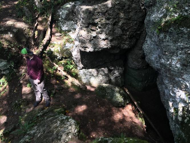
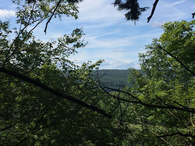
Upon reaching the caves, trail opens up near what appears to be some larger rock formations and a large slope - this is the top of the caves. There is a split in the trees and what looks to be about a 5-foot space between two large rock faces. Upon closer look you can gaze down into a deep chasm. From here you can follow the trail around the chasm to a small overlook area with views of the Connecticut River and the Pocumtuck Ridge, or descend the trail to the entrance of the cave.
This recording follows the continuation of the blue-blazed trail below the cliffs and back up to the top of the caves. Once back on top of the caves, follow the trail back to the parking lot.
Overall the trail should be considered easy-to-moderate. However the trail down to the caves is very steep, but manageable. The trail along the cliffs is narrow but an easy traverse and only has one short scramble back up to the top.
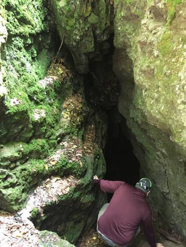
Sunderland Caves: The cave has a large entrance and goes in at least 30 feet. While this recording does not include exploration of the cave, it is possible to go through the cave and out the other side; however, flashlights are required as there are several drops and it's very dark. There's also a sharp temperature drop both in front of the cave as well as inside.
Pets: Dogs are allowed if on leash and their waste must be carried out.
This hike starts off at the parking lot and follows the Robert Frost Trail. The trail starts off with a good incline along with loose rocks for a short period of time, but eventually opens up.
After roughly 0.6-miles you'll hit a trail junction - follow the Caves sign to the right (west). Some maps call this the Sugar Farms Trail, others have it unmarked. This trail continues on for another 0.3-miles before you reach another right (west) turn onto the "Trails to Caves" trail. The caves are located roughly 0.3-miles after this turns.
Upon reaching the caves, trail opens up near what appears to be some larger rock formations and a large slope - this is the top of the caves. There is a split in the trees and what looks to be about a 5-foot space between two large rock faces. Upon closer look you can gaze down into a deep chasm. From here you can follow the trail around the chasm to a small overlook area with views of the Connecticut River and the Pocumtuck Ridge, or descend the trail to the entrance of the cave.
This recording follows the continuation of the blue-blazed trail below the cliffs and back up to the top of the caves. Once back on top of the caves, follow the trail back to the parking lot.
Overall the trail should be considered easy-to-moderate. However the trail down to the caves is very steep, but manageable. The trail along the cliffs is narrow but an easy traverse and only has one short scramble back up to the top.
Sunderland Caves: The cave has a large entrance and goes in at least 30 feet. While this recording does not include exploration of the cave, it is possible to go through the cave and out the other side; however, flashlights are required as there are several drops and it's very dark. There's also a sharp temperature drop both in front of the cave as well as inside.
Pets: Dogs are allowed if on leash and their waste must be carried out.