Stony Book Gristmill and Falls in Brewster, Massachusetts is an easy 0.3-mile loop walk that features the historic gristmill, a Herring run site, and several 2 to 3-foot tall waterfalls.
Walk Description
This trail begins along Stony Brook Road across from the historic Stony Brook Gristmill and follows the path heading north, down hill, and along the brook. Near the top of the brook are concrete "ladders" / human-made waterfalls that allow Herring to navigate upstream. These tiny human-made waterfalls are scenic, but it gets better as you walk further.
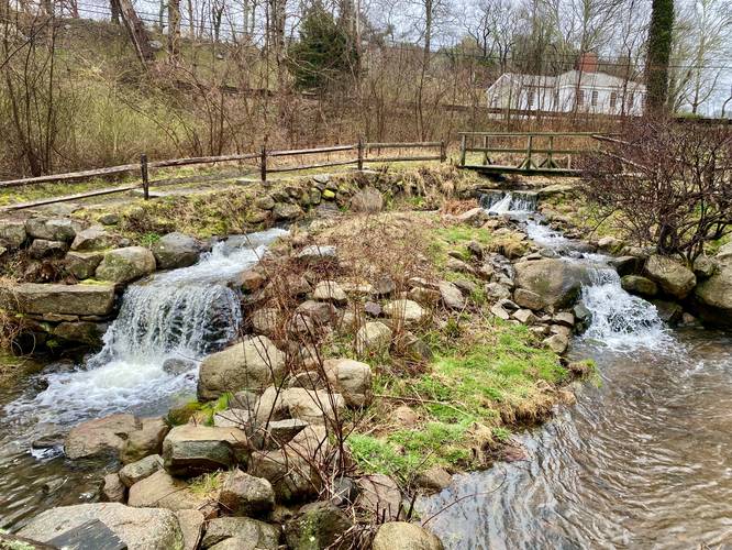
Stony Brook Waterfalls
Just a bit further downstream are two 2 to 3-foot tall waterfalls that spill down Stony Brook. Not entirely sure if all of the waterfalls were human-made or not, but this section of the walk, in my opinion, was the most-scenic even in early April with minimal color out. The two waterfalls cascade down and under a wooden bridge and sits adjacent to an ivy-covered well. All while a large tree hanging over the trail is covered in its own ivy, leaving the walker feel like they're in a totally different place.
The trail heads down the banks of Stony Brook before hitting a dead-end and turning back. Walkers can skip that if they wish. The trail will then head back up to Stony Brook Road along the eastern side of the waterfalls and brook. The trail crosses the brook and then crosses the road to lead to the gristmill.
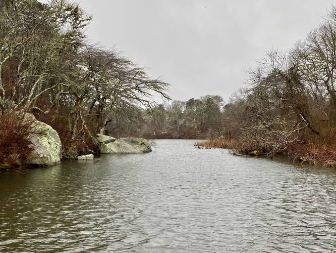
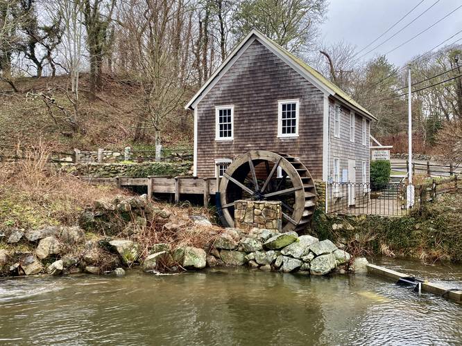
Walkers can follow the path as it passes the Stony Brook Gristmill to make their way to the southern end of the loop where you get views of Lower Mill pond. The pond sits about 2-feet above your feet, held back by a retention wall, which gives you a feeling like you're standing in the pond. Downstream from the pond, the trail continues and provides a view of the gristmill with its waterwheel and small 3-foot human-made waterfall cascading behind. After passing the mill one last time, the walk ends back at parking.
Herring Run
These waterfall ladders provide Herring with a navigable path to reach fresh water ponds to spawn as they make their journey from Cape Cod Bay. The herring run begins in mid-March and ends near the end of May. During my trip here in early April I unfortunately did not see any migrating herring.
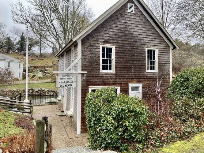
Stony Brook Gristmill
The Stony Brook Gristmill is the only remaining structure from Brewster's Factory Village, a bustling 19th century industrial area. For more information about the gristmill or its museum, check the Brewster MA website.
Parking
Walkers will find a small parking lot at the coordinates provided. The lot can fit about 10 vehicles.
Pets
Dogs are not allowed on this trail.
Walk Description
This trail begins along Stony Brook Road across from the historic Stony Brook Gristmill and follows the path heading north, down hill, and along the brook. Near the top of the brook are concrete "ladders" / human-made waterfalls that allow Herring to navigate upstream. These tiny human-made waterfalls are scenic, but it gets better as you walk further.
Stony Brook Waterfalls
Just a bit further downstream are two 2 to 3-foot tall waterfalls that spill down Stony Brook. Not entirely sure if all of the waterfalls were human-made or not, but this section of the walk, in my opinion, was the most-scenic even in early April with minimal color out. The two waterfalls cascade down and under a wooden bridge and sits adjacent to an ivy-covered well. All while a large tree hanging over the trail is covered in its own ivy, leaving the walker feel like they're in a totally different place.
The trail heads down the banks of Stony Brook before hitting a dead-end and turning back. Walkers can skip that if they wish. The trail will then head back up to Stony Brook Road along the eastern side of the waterfalls and brook. The trail crosses the brook and then crosses the road to lead to the gristmill.
Walkers can follow the path as it passes the Stony Brook Gristmill to make their way to the southern end of the loop where you get views of Lower Mill pond. The pond sits about 2-feet above your feet, held back by a retention wall, which gives you a feeling like you're standing in the pond. Downstream from the pond, the trail continues and provides a view of the gristmill with its waterwheel and small 3-foot human-made waterfall cascading behind. After passing the mill one last time, the walk ends back at parking.
Herring Run
These waterfall ladders provide Herring with a navigable path to reach fresh water ponds to spawn as they make their journey from Cape Cod Bay. The herring run begins in mid-March and ends near the end of May. During my trip here in early April I unfortunately did not see any migrating herring.
Stony Brook Gristmill
The Stony Brook Gristmill is the only remaining structure from Brewster's Factory Village, a bustling 19th century industrial area. For more information about the gristmill or its museum, check the Brewster MA website.
Parking
Walkers will find a small parking lot at the coordinates provided. The lot can fit about 10 vehicles.
Pets
Dogs are not allowed on this trail.