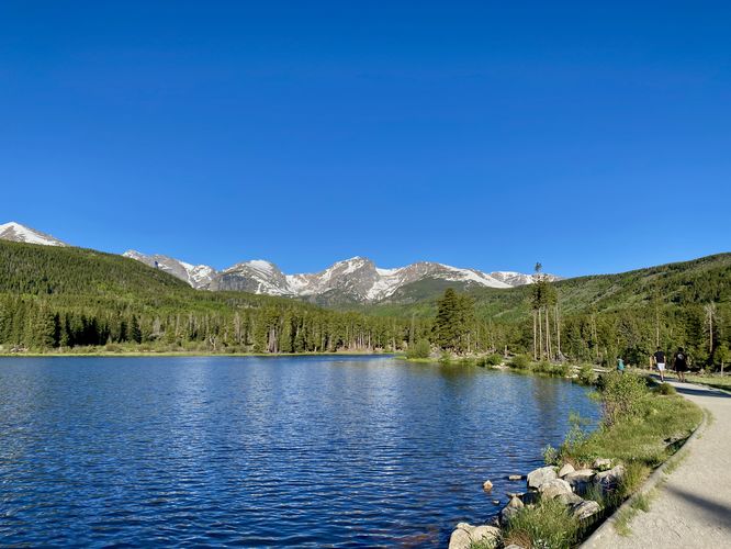
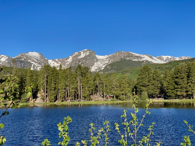
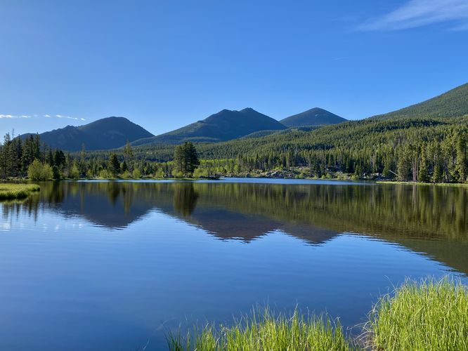
The Sprague Lake Trail at Rocky Mountain National Park near Estes Park, Colorado is an easy 0.8-mile loop hike that features stunning views of the surrounding mountains and provides opportunities for viewing wildlife.
Hike
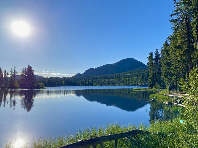
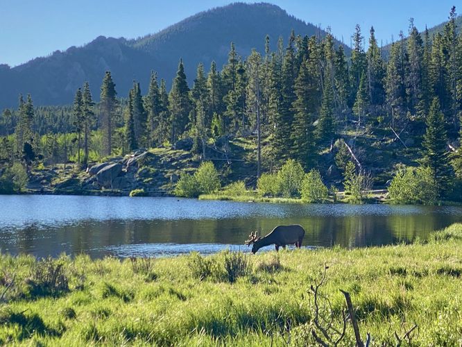
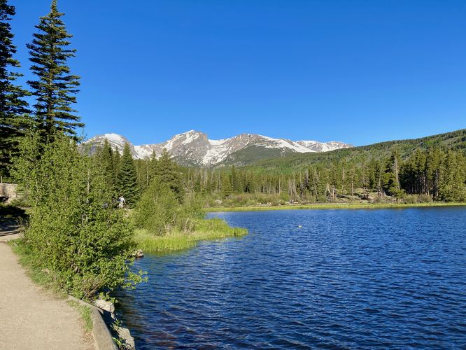
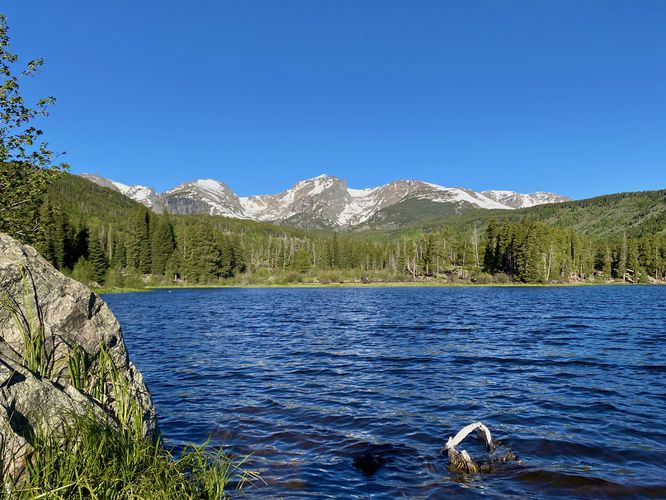
This short and flat hike begins at the main trailhead for the Sprague Lake Trail, located on the eastern side of the main parking lot. The trail heads in toward the lake along a short spur pathway before it splits along the loop. This track leads hikers southeast as the trail encompasses Sprague Lake. During our hike here in the early morning in June 2024, we were lucky to find an elk looking for breakfast in the lake. The elk was a nice addition to the breathtaking scenery along Sprague Lake, but they usually show up in the early morning or early evening for meals. From the western side of the lake, hikers will get views of the Estes Cone mountain. As you make your way around to the east side of the lake, you'll find the accessible campsite path (not included in this track) and views of Half Mountain, Otis Peak, Hallett Peak, and the Tyndall Glacier to name a few mountains and POI to the west. The eastern side of the trail has a couple of information kiosks where you can read about the history of the lake and its private ownership as a resort back in the early 1900's. Finally, the trail circles back to the trailhead for an easy 0.8-mile loop hike.
Universal Access
This trail is universally accessible throughout the entire trail. It follows a flat, dirt pathway with minimal elevation grade changes. On the south side of the trail is a small incline.
Accessible Camping
This trail includes a universally-accessible campsite that can only be used with a valid permit. Please visit the Rocky Mountain National Park's main website for more information and how to register the site.
Wildlife Viewing
This trail is great for viewing wildlife, especially deer, elk, and moose due to the open spaces for grazing and finding food in addition to the lake's water source for drinking. If you wish to spot wildlife, your best chances are in the early morning or in the early evening. Always keep a safe distance while viewing - approx. 75-feet for elk and longhorn sheep; 120-feet for bear and moose.
Pets
Dogs are not allowed on this trail.
Parking
Hikers will find a massive parking lot at the coordinates provided, located within the Hidden Valley section of the park right off of Trail Ridge Road. The lot is large enough to fit many dozens of vehicles.
Timed-Entry Reservations
Between the months of late May through early October you must purchase a timed-entry pass to visit Rocky Mountain National Park. If you wish to visitor and hike anything off of the Bear Lake Road, you must purchase a dedicated Bear Lake timed-entry pass. You can find more information about timed entry on the park's website.
Restrooms
As of June 2024, there are restroom facilities at the parking lot.
Warnings
Elevation sickness: This trail brings hikers through terrain that ascends up to 8,700-feet above sea level. Around the 7,000-foot mark above sea level, hikers may start to experience symptoms of elevation sickness including headache, muscle aches, shortness of breath, among other warning signs. In order to avoid elevation sickness it's recommended to ascend to higher elevations and take short walks to acclimate over the course of several days before taking a long or physically-demanding hike. At any time you feel elevation sickness kicking in, that's the time to turn back and head for lower altitude or the parking lot.
Wild animals: While rare, hikers may encounter bears or mountain lion along the trail. Again, this is rare due to the insane amount of people who hike these trails each day; however, it's smart to know that these wild animals could be on-trail. Please read-up on how to properly handle a bear or mountain lion encounter before hitting the trails.
Hike
This short and flat hike begins at the main trailhead for the Sprague Lake Trail, located on the eastern side of the main parking lot. The trail heads in toward the lake along a short spur pathway before it splits along the loop. This track leads hikers southeast as the trail encompasses Sprague Lake. During our hike here in the early morning in June 2024, we were lucky to find an elk looking for breakfast in the lake. The elk was a nice addition to the breathtaking scenery along Sprague Lake, but they usually show up in the early morning or early evening for meals. From the western side of the lake, hikers will get views of the Estes Cone mountain. As you make your way around to the east side of the lake, you'll find the accessible campsite path (not included in this track) and views of Half Mountain, Otis Peak, Hallett Peak, and the Tyndall Glacier to name a few mountains and POI to the west. The eastern side of the trail has a couple of information kiosks where you can read about the history of the lake and its private ownership as a resort back in the early 1900's. Finally, the trail circles back to the trailhead for an easy 0.8-mile loop hike.
Universal Access
This trail is universally accessible throughout the entire trail. It follows a flat, dirt pathway with minimal elevation grade changes. On the south side of the trail is a small incline.
Accessible Camping
This trail includes a universally-accessible campsite that can only be used with a valid permit. Please visit the Rocky Mountain National Park's main website for more information and how to register the site.
Wildlife Viewing
This trail is great for viewing wildlife, especially deer, elk, and moose due to the open spaces for grazing and finding food in addition to the lake's water source for drinking. If you wish to spot wildlife, your best chances are in the early morning or in the early evening. Always keep a safe distance while viewing - approx. 75-feet for elk and longhorn sheep; 120-feet for bear and moose.
Pets
Dogs are not allowed on this trail.
Parking
Hikers will find a massive parking lot at the coordinates provided, located within the Hidden Valley section of the park right off of Trail Ridge Road. The lot is large enough to fit many dozens of vehicles.
Timed-Entry Reservations
Between the months of late May through early October you must purchase a timed-entry pass to visit Rocky Mountain National Park. If you wish to visitor and hike anything off of the Bear Lake Road, you must purchase a dedicated Bear Lake timed-entry pass. You can find more information about timed entry on the park's website.
Restrooms
As of June 2024, there are restroom facilities at the parking lot.
Warnings
Elevation sickness: This trail brings hikers through terrain that ascends up to 8,700-feet above sea level. Around the 7,000-foot mark above sea level, hikers may start to experience symptoms of elevation sickness including headache, muscle aches, shortness of breath, among other warning signs. In order to avoid elevation sickness it's recommended to ascend to higher elevations and take short walks to acclimate over the course of several days before taking a long or physically-demanding hike. At any time you feel elevation sickness kicking in, that's the time to turn back and head for lower altitude or the parking lot.
Wild animals: While rare, hikers may encounter bears or mountain lion along the trail. Again, this is rare due to the insane amount of people who hike these trails each day; however, it's smart to know that these wild animals could be on-trail. Please read-up on how to properly handle a bear or mountain lion encounter before hitting the trails.