The Soapstone Hill Loop (Gate 37) at Quabbin Reservoir in Petersham, Massachusetts is a difficult 4.3-mile hike that features stunning views from Soapstone Hill, a primitive camping area, old quarry sites, swamp views, old-growth white pine trees, and a view of Quabbin from the shore.
Hike Description
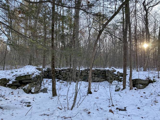
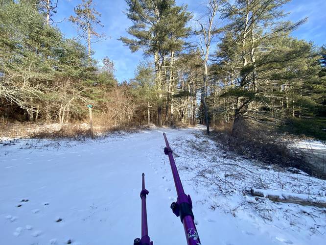
This hike begins at the parking coordinates provided for Gate 37. Please note that during the winter, this road is not maintained and thus anyone driving in must do so at their own risk. Hikers will begin at the yellow gate, Gate 37, which sits next to an old barn foundation located just behind the parking area - this is one of the first signs of old towns that hikers will pass. Once on the trail, it's a mostly-flat slow walk to reach the first junction.
Stay Straight - Mile 0.55
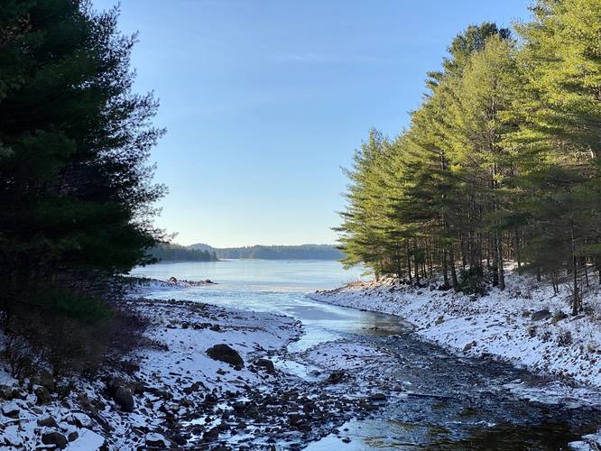
Around mile 0.55, hikers will reach the first trail junction - simply go straight to walk across the bridge that spans West Branch Fever Brook. After crossing the brook, hikers will notice a nice view of Quabbin facing south as the water feeds into the reservoir.
Right-Hand Turn - Mile 0.6
Just beyond the bridge, hikers will take a right-hand turn to head toward Soapstone Hill at mile 0.6. Note the trees on this corner are old apple trees - another sign that people used to live here. The hike becomes a bit more scenic from here as the trail heads north passing beaver dams in the brook located just off-trail.
Left-Hand Turn - Mile 0.75
At mile 0.75, hikers will reach a left-hand turn in the trail. Take this left-hand turn to hike up Soapstone Hill via the Soapstone Mountain Trail.
Old Quarry - Mile 0.83
Around mile 0.83, just after hopping on the Soapstone Mountain Trail, hikers will find a short spur trail that leads to an old quarry site. This quarry pit is deep - maybe several feet deep and is now filled with water that drains out at ground level. On the side of the large pit are large rocks piled up, indicating this was once quarried out - one can only guess they cut out soapstone to resell.
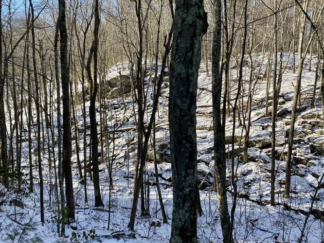
Climbing Soapstone Hill - Mile 0.85 to 1.14
From miles 0.85 to 1.14, hikers will be hiking up the steepest slopes of Soapstone Hill. This does not last very long, but is not an easy hike up either, hence the "Hard" difficulty. Hikers will notice large rocky outcroppings on the trail, which indicates you're almost at the top. During the winter, these large rocks are covered in a thick layer of ice, which means you must bring ice spikes in order to traverse these sections of the mountain - albeit they are not taller than 3-feet.
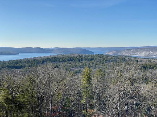
Soapstone Hill Vista - Mile 1.14
Finally, hikers will reach the top of the mountain around mile 1.14 where they'll also find a stunning 180-degree south-facing view of Quabbin Reservoir. The view from Soapstone Hill is a bit remote for the area, but is well-worth the hike in. The mountain's bedrock is exposed here, making it easy for hikers to walk around to get different views. Sit and enjoy the view before continuing onward.
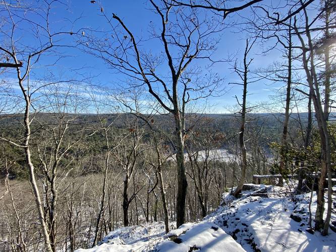
Obstructed Gorge View - Mile 1.16
Just beyond the Soapstone Hill Vista lies a seasonal obstructed "view" of the Soapstone Gorge to the east. During cold months, hikers can get a glimpse of the beaver-made swamp that sits in West Branch Fever Brook and the surrounding mountains. After passing this (or bypassing) hikers will be walking on a flat grade surface at the top of the mountain before it begins its slow descent toward the Federated Women's Club State Forest.
Right-Hand Turn - Mile 1.83
Around mile 1.83, hikers will reach a trail on the right-hand side. Take this turn as it will lead directly to the Federated Women's Club State Forest. If you miss this turn (which is easy to do), hikers can take the next right-hand turn which will lead to the same place.
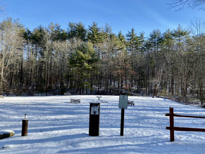
Primitive Campsites & State Forest - Mile 2.05
At mile 2.05, hikers will enter the Federated Women's Club State Forest which is technically outside of Quabbin Reservoir's boundaries. The Federated Women's Club State Forest is a tract of land that is surrounded by Quabbin, but also provides one of the only primitive campsites found anywhere near Quabbin's boarders - which, in my opinion, is pretty special. This camp area has picnic tables, grills, and campsites for pitching a tent.
Gorge Trail Blue Blazes - Mile 2.13
From here, to continue on the loop, head to the southeast corner of the state forest land to find a small wooden bridge that crosses West Branch Fever Brook to reach the Gorge Trail as it heads south back toward parking, around mile 2.13.
Gorge Trail "Overlook" - Mile 2.23
Around mile 2.23, hikers will find a right-hand spur trail that leads to a small rocky outcropping above the gorge. While the photo doesn't do any justice, this "overlook" is actually pretty interesting as it gives hikers a chance to view Soapstone Hill's rocky foundation that juts out into the gorge.
Creek Crossing - Mile 2.72
Around mile 2.72 is a creek crossing (no need to get your feet wet) which can be used to filter water if need be.
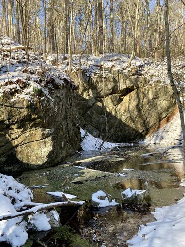
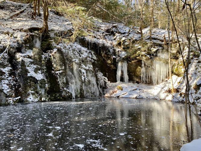
Old Quarry Site - Mile 2.8
At mile 2.8, hikers can head off-trail toward the mountain to find another old quarry site. During the winter, this site is really stunning as the mountain seeps water over the large rocks and into the deep pool below - making for spectacular ice formations. The quarry's pool is deep too, so do not walk on the ice. During warm months, this pool is likely still filled with water. On the side of the large pit are large rocks piled up, indicating this was once quarried out - one can only guess they cut out soapstone to resell
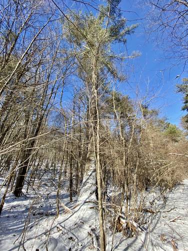
Old-Growth White Pine - Mile 2.9
At mile 2.9 is an old-growth white pine tree.
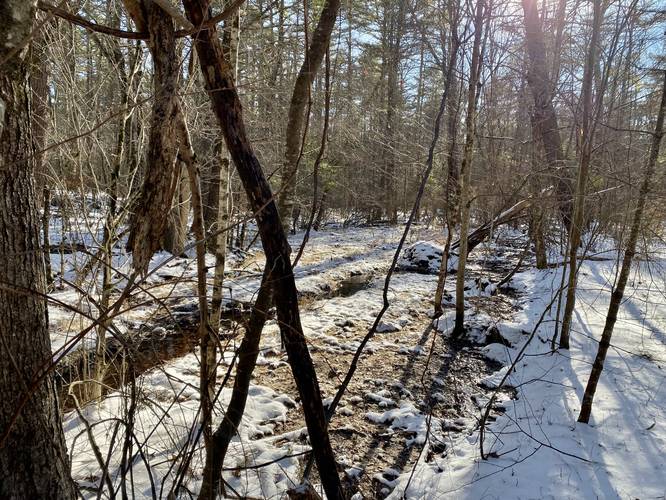
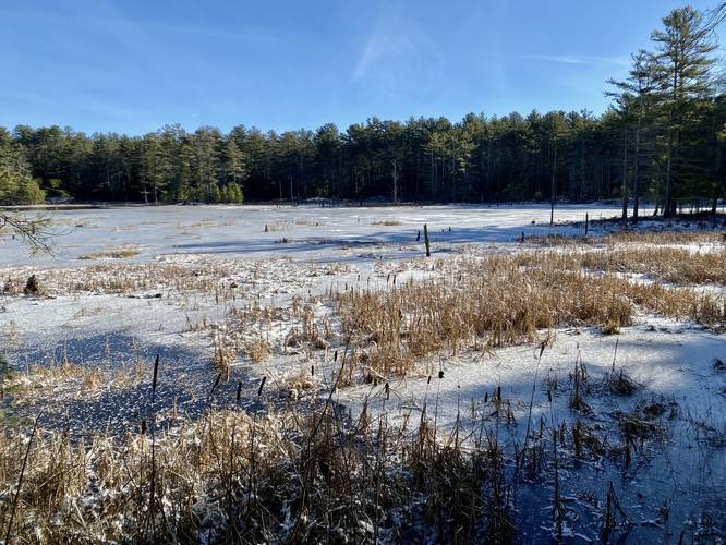
Swamp Overlook - Mile 3.2
Around mile 3.2 is a quick off-trail view above the West Branch Fever Brook that provides hikers will a scenic overlook of the water.
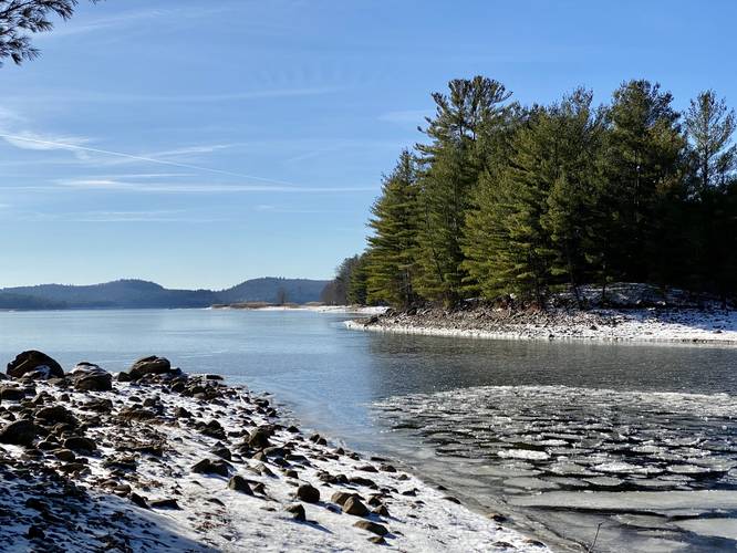
Quabbin Shore View - Mile 3.5 to 3.6
At mile 3.5 is an optional hike out to the shores of Quabbin, which in my opinion, rounds out the hike and is well-worth the extra mileage. At mile 3.5, just after crossing the West Branch Fever Brook, hikers will find a small trail that leads to the brook's shores. Follow the brook to the banks of Quabbin Reservoir for additional views. During the winter, hikers will find frozen waves on the shore. Once ready to leave, look for the trail that cuts back into the woods from the shoreline.
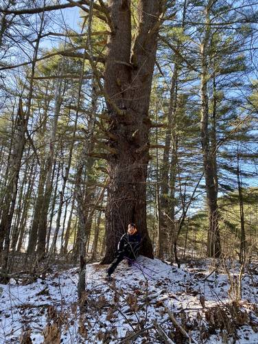
Old-Growth White Pine - Mile 3.65
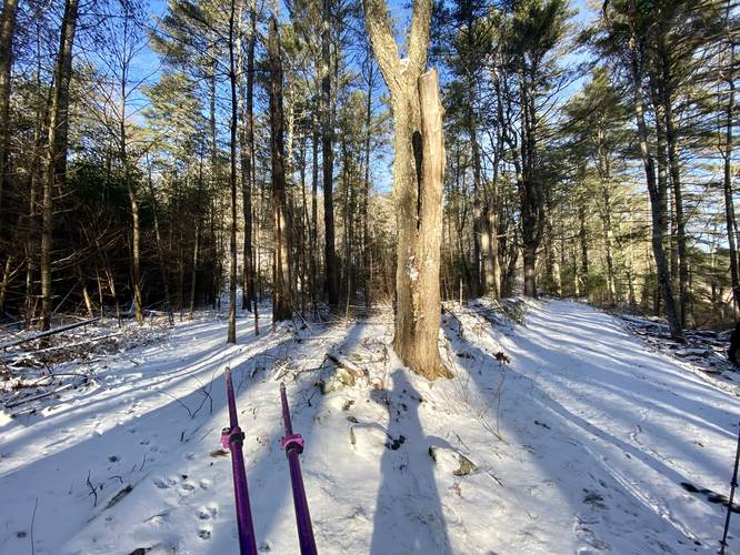
At mile 3.65, hikers will find another old-growth white pine tree which appears to be older and larger than the one found at mile 2.9.
Right-Hand Turn - Mile 3.7
At mile 3.7, take a right-hand turn to follow the trail (old town road) back to Gate 37 and the parking area for a 4.3-mile hike.
Parking
Hikers will find small parking turnouts at the coordinates provided for Gate 37. The parking spaces are large enough to fit a half-dozen vehicles. Please do not block the gate. Do not block the road. Park at your own risk during the winter as this gate's service road is not maintained, salted, or plowed.
Pets
Dogs are not allowed at any trails within Quabbin's boundaries.
Biking
Mountain biking appears to be permitted along this route.
Difficulty
This hike may be considered moderate to some experienced hikers, but to the average hiker or general public, this hike should be considered "Hard" or difficult. Note that the hardest section of the hike is ascending Soapstone Hill and the rest should be considered easy walking.
Camping and Backpacking
Please note that camping is only permitted within the Federated Women's Club State Forest. There are no overnight opportunities within Quabbin itself; however, the state forest abuts Quabbin's boundaries and thus, backpacking is permitted along this loop as long as you only camp at the state forest sites.
Warning
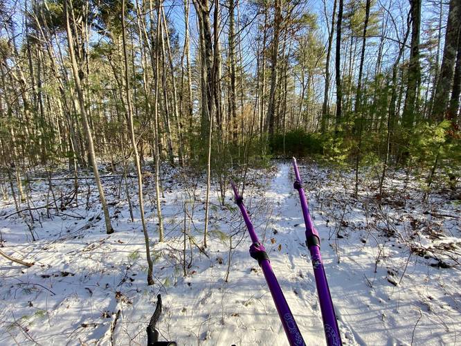
Overgrowth & Ticks: Please note that as of late December, 2022, the Soapstone Mountain Trail and Soapstone Gorge Trail (Gorge Trail) are both a bit overgrown. This was fine during the winter, but during warm months, both trails are likely difficult to hike in many sections as the bushes are starting to take over. The Gorge Trail especially has a lot of overgrowth that may be difficult to see beyond during Summer months. In combination with ticks, this hike may not be for everyone.
Winter Ice Spikes: Hikers must use ice spikes on this hike in the winter, especially when ascending or descending the southern slope of Soapstone Hill where the bedrock will likely be covered in a thick layer of ice.
Hike Description
This hike begins at the parking coordinates provided for Gate 37. Please note that during the winter, this road is not maintained and thus anyone driving in must do so at their own risk. Hikers will begin at the yellow gate, Gate 37, which sits next to an old barn foundation located just behind the parking area - this is one of the first signs of old towns that hikers will pass. Once on the trail, it's a mostly-flat slow walk to reach the first junction.
Stay Straight - Mile 0.55
Around mile 0.55, hikers will reach the first trail junction - simply go straight to walk across the bridge that spans West Branch Fever Brook. After crossing the brook, hikers will notice a nice view of Quabbin facing south as the water feeds into the reservoir.
Right-Hand Turn - Mile 0.6
Just beyond the bridge, hikers will take a right-hand turn to head toward Soapstone Hill at mile 0.6. Note the trees on this corner are old apple trees - another sign that people used to live here. The hike becomes a bit more scenic from here as the trail heads north passing beaver dams in the brook located just off-trail.
Left-Hand Turn - Mile 0.75
At mile 0.75, hikers will reach a left-hand turn in the trail. Take this left-hand turn to hike up Soapstone Hill via the Soapstone Mountain Trail.
Old Quarry - Mile 0.83
Around mile 0.83, just after hopping on the Soapstone Mountain Trail, hikers will find a short spur trail that leads to an old quarry site. This quarry pit is deep - maybe several feet deep and is now filled with water that drains out at ground level. On the side of the large pit are large rocks piled up, indicating this was once quarried out - one can only guess they cut out soapstone to resell.
Climbing Soapstone Hill - Mile 0.85 to 1.14
From miles 0.85 to 1.14, hikers will be hiking up the steepest slopes of Soapstone Hill. This does not last very long, but is not an easy hike up either, hence the "Hard" difficulty. Hikers will notice large rocky outcroppings on the trail, which indicates you're almost at the top. During the winter, these large rocks are covered in a thick layer of ice, which means you must bring ice spikes in order to traverse these sections of the mountain - albeit they are not taller than 3-feet.
Soapstone Hill Vista - Mile 1.14
Finally, hikers will reach the top of the mountain around mile 1.14 where they'll also find a stunning 180-degree south-facing view of Quabbin Reservoir. The view from Soapstone Hill is a bit remote for the area, but is well-worth the hike in. The mountain's bedrock is exposed here, making it easy for hikers to walk around to get different views. Sit and enjoy the view before continuing onward.
Obstructed Gorge View - Mile 1.16
Just beyond the Soapstone Hill Vista lies a seasonal obstructed "view" of the Soapstone Gorge to the east. During cold months, hikers can get a glimpse of the beaver-made swamp that sits in West Branch Fever Brook and the surrounding mountains. After passing this (or bypassing) hikers will be walking on a flat grade surface at the top of the mountain before it begins its slow descent toward the Federated Women's Club State Forest.
Right-Hand Turn - Mile 1.83
Around mile 1.83, hikers will reach a trail on the right-hand side. Take this turn as it will lead directly to the Federated Women's Club State Forest. If you miss this turn (which is easy to do), hikers can take the next right-hand turn which will lead to the same place.
Primitive Campsites & State Forest - Mile 2.05
At mile 2.05, hikers will enter the Federated Women's Club State Forest which is technically outside of Quabbin Reservoir's boundaries. The Federated Women's Club State Forest is a tract of land that is surrounded by Quabbin, but also provides one of the only primitive campsites found anywhere near Quabbin's boarders - which, in my opinion, is pretty special. This camp area has picnic tables, grills, and campsites for pitching a tent.
Gorge Trail Blue Blazes - Mile 2.13
From here, to continue on the loop, head to the southeast corner of the state forest land to find a small wooden bridge that crosses West Branch Fever Brook to reach the Gorge Trail as it heads south back toward parking, around mile 2.13.
Gorge Trail "Overlook" - Mile 2.23
Around mile 2.23, hikers will find a right-hand spur trail that leads to a small rocky outcropping above the gorge. While the photo doesn't do any justice, this "overlook" is actually pretty interesting as it gives hikers a chance to view Soapstone Hill's rocky foundation that juts out into the gorge.
Creek Crossing - Mile 2.72
Around mile 2.72 is a creek crossing (no need to get your feet wet) which can be used to filter water if need be.
Old Quarry Site - Mile 2.8
At mile 2.8, hikers can head off-trail toward the mountain to find another old quarry site. During the winter, this site is really stunning as the mountain seeps water over the large rocks and into the deep pool below - making for spectacular ice formations. The quarry's pool is deep too, so do not walk on the ice. During warm months, this pool is likely still filled with water. On the side of the large pit are large rocks piled up, indicating this was once quarried out - one can only guess they cut out soapstone to resell
Old-Growth White Pine - Mile 2.9
At mile 2.9 is an old-growth white pine tree.
Swamp Overlook - Mile 3.2
Around mile 3.2 is a quick off-trail view above the West Branch Fever Brook that provides hikers will a scenic overlook of the water.
Quabbin Shore View - Mile 3.5 to 3.6
At mile 3.5 is an optional hike out to the shores of Quabbin, which in my opinion, rounds out the hike and is well-worth the extra mileage. At mile 3.5, just after crossing the West Branch Fever Brook, hikers will find a small trail that leads to the brook's shores. Follow the brook to the banks of Quabbin Reservoir for additional views. During the winter, hikers will find frozen waves on the shore. Once ready to leave, look for the trail that cuts back into the woods from the shoreline.
Old-Growth White Pine - Mile 3.65
At mile 3.65, hikers will find another old-growth white pine tree which appears to be older and larger than the one found at mile 2.9.
Right-Hand Turn - Mile 3.7
At mile 3.7, take a right-hand turn to follow the trail (old town road) back to Gate 37 and the parking area for a 4.3-mile hike.
Parking
Hikers will find small parking turnouts at the coordinates provided for Gate 37. The parking spaces are large enough to fit a half-dozen vehicles. Please do not block the gate. Do not block the road. Park at your own risk during the winter as this gate's service road is not maintained, salted, or plowed.
Pets
Dogs are not allowed at any trails within Quabbin's boundaries.
Biking
Mountain biking appears to be permitted along this route.
Difficulty
This hike may be considered moderate to some experienced hikers, but to the average hiker or general public, this hike should be considered "Hard" or difficult. Note that the hardest section of the hike is ascending Soapstone Hill and the rest should be considered easy walking.
Camping and Backpacking
Please note that camping is only permitted within the Federated Women's Club State Forest. There are no overnight opportunities within Quabbin itself; however, the state forest abuts Quabbin's boundaries and thus, backpacking is permitted along this loop as long as you only camp at the state forest sites.
Warning
Overgrowth & Ticks: Please note that as of late December, 2022, the Soapstone Mountain Trail and Soapstone Gorge Trail (Gorge Trail) are both a bit overgrown. This was fine during the winter, but during warm months, both trails are likely difficult to hike in many sections as the bushes are starting to take over. The Gorge Trail especially has a lot of overgrowth that may be difficult to see beyond during Summer months. In combination with ticks, this hike may not be for everyone.
Winter Ice Spikes: Hikers must use ice spikes on this hike in the winter, especially when ascending or descending the southern slope of Soapstone Hill where the bedrock will likely be covered in a thick layer of ice.