Loading...

WINTER SALE! 50% OFF Supporter Accounts — now through January 31st. Learn More.

Spruce Flats Falls Trail

The Spruce Flats Falls Trail at the Great Smoky Mountains National Park is an amazing 1.7 mile out-and-back hike in the Tremont section of the park near Townsend TN.

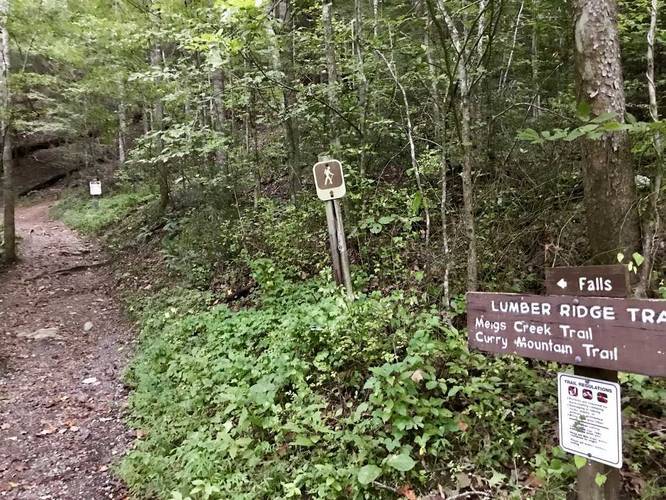
The trail can start in a few different places, but the parking lot is located off of Tremond Rd at the Tremont Institute. Park at the visitor center and take the trail at the sign that says "Lumber Ridge Trail". Follow the trail about 60 feet to a building and stay to the left side of that building - the trailhead to Spruce Flats Falls is right there.

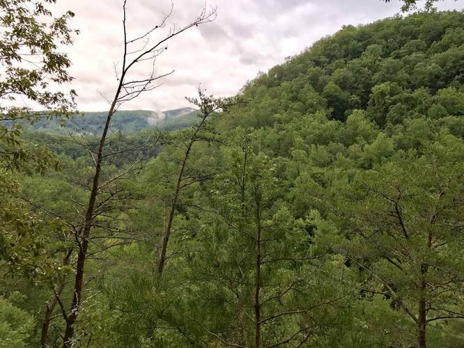
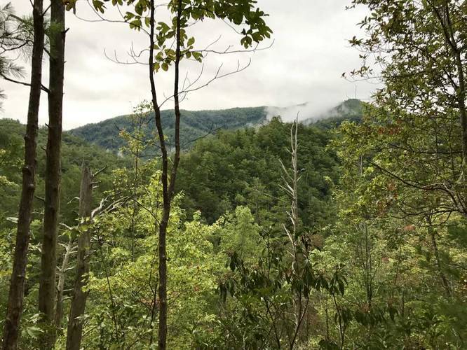
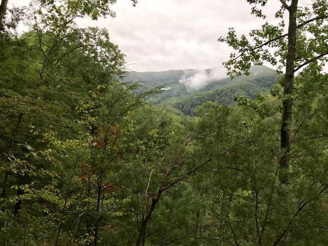
Head up the trail and you'll hit switchbacks early on, but they don't last for very long. After the switchbacks, you'll get a couple of view points of the mountains in the Tremont region of the Great Smoky's. You'll pass two large boulder fields along the trail before the descent to Spruce Flats Falls.

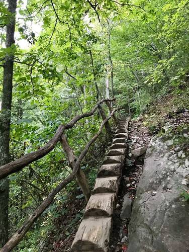
On the descent to the falls is a wooden notch ladder with wooden hand-rails, use this for balance.

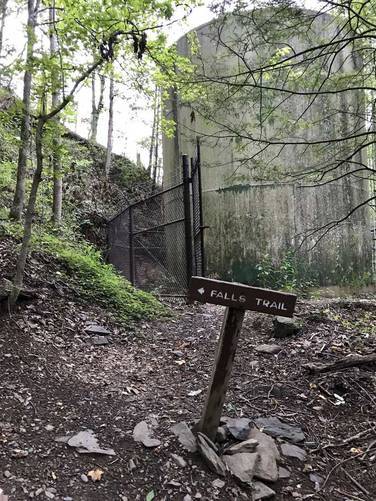
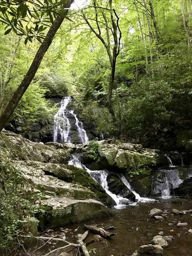
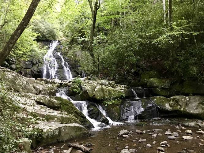
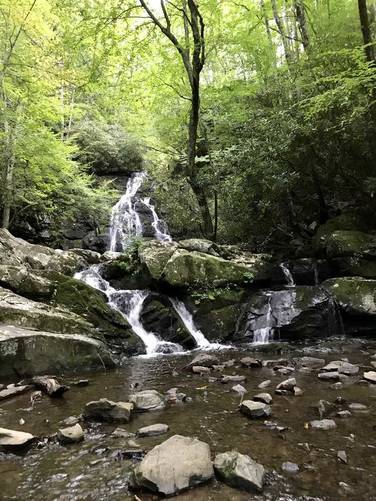
You'll reach Spruce Flats Falls after 1 mile and you cannot miss it.

Backpacking is technically allowed on this trail; however, there aren't any places that you can actually camp due to the elevation grade.
Explore 17 trails near Townsend, TN

Know Before You Go

  • Spruce Flats Falls Trail is a 1.7-mile roundtrip hike in the Tremont area of Great Smoky Mountains National Park, near Townsend, TN.
  • The trailhead is accessed from the Tremont Institute parking lot, following signs for "Lumber Ridge Trail" initially and then staying left of the building to find the Spruce Flats Falls Trail.
  • The trail features switchbacks, mountain viewpoints, boulder fields, a wooden ladder for descent, and Spruce Flats Falls at the turnaround point, with backpacking technically permitted but camping not feasible due to the terrain.
Interactive topographic map for Spruce Flats Falls Trail located in Townsend, TN. Click the "View Map" button to load GPS coordinates and trail markers.
Get directions
Distance
1.7 mi
Difficulty
Moderate
Type
Out-and-Back
Est. Time
51 min
Elev. Gain
580'
Rating
5.0
Added
September 06, 2017
Updated
February 19, 2019

Weather Forecast

Loading...
Total Change
293'
Ascent
580'
Descent
580'
Loading...

Download the GPX Data for Offline Use

Supporters get exclusive access to download trail routes to the MyHikes app for offline use. Stay prepared on your adventure, even without an internet connection! Become a Supporter today to unlock this feature and hike with confidence.

Download Spruce Flats Falls Trail GPX Data to the MyHikes Mobile App

Features

Vista / Lookout Point
Waterfalls
Camping
Water Source

Points of interest

  1. Parking

    35.641478, -83.689928
  2. Main Trailhead

    35.64104, -83.688608
  3. Follow signs for Falls

    35.641033, -83.688575
    Follow signs for Falls
  4. Follow signs for the Falls Trail

    35.639417, -83.687881
    Follow signs for the Falls Trail

Safety information

For your own safety: plan ahead, let someone know where you'll be, and hike at your own risk.

Availability

Summer

Surface type

Dirt

Trip Reports (Reviews)

Rated 5.0 out of 5 based on 1 rating.

Ready to help fellow hikers? Add a trip report to share your experience and provide valuable insights for other hikers!

2.0 miles / 3.2 km
September 02, 2017
Hiking
No community routes found. To add your own hike as a Community Route for this Trail guide, leave a Trip Report with an attached GPX file.

Popular categories

Scenic mountain view representing vista trails
Vista trails
Scenic gorge of cascades representing waterfall trails
Waterfall hikes
Rugged mountain terrain representing summit trails
Summit trails
Scenic mountain view representing dog-friendly trails
Dog-friendly
Scenic campsite with a view representing camping trails
Camping trails
Appalachian Trail logo representing A.T. hikes
A.T. hikes

You May Also Like

Colorado's Million Dollar Highway - Plan a day's drive adventure along the iconic Million Dollar Highway in Colorado. Explore the best short trails, roadside stops, waterfalls, vistas, ghost towns, and hot springs within a ~6 hour road trip.
Explore

Colorado's Million Dollar Highway

Plan a day's drive adventure along the iconic Million Dollar Highway in Colorado. Explore the best short trails, roadside stops, waterfalls, vistas, ghost towns, and hot springs within a ~6 hour road trip.

Read
Glacier's Going-to-the-Sun Road - Discover the breathtaking beauty of Glacier National Park along the iconic Going-to-the-Sun Road. From stunning roadside stops to picturesque waterfalls and vistas, this engineering marvel offers endless opportunities for exploration.
Explore

Glacier's Going-to-the-Sun Road

Discover the breathtaking beauty of Glacier National Park along the iconic Going-to-the-Sun Road. From stunning roadside stops to picturesque waterfalls and vistas, this engineering marvel offers endless opportunities for exploration.

Read
🍪 We use cookies to learn about site usage and to serve map tiles. You may block cookies manually in the browser. By continuing you agree. Learn more