The Slide Mountain Trail at Catskill Park within the Slide Mountain Wilderness near Phoenicia, New York is a difficult 5.7-mile out-and-back hike that features views and the summit of the Catkills' tallest mountain, Slide Mountain.
Trails
This hike follows two trails: Phoenicia East Branch Trail (yellow blazes), Wittenberg - Cornell - Slide Trail (red blazes).
Hike Description
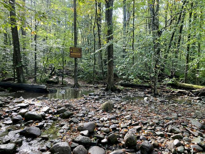
This hike begins at the main parking lot for Slide Mountain, located at the coordinates provided, and heads in along the main trailhead for the Phoenicia East Branch Trail (yellow blazes). The trail initially crosses two creeks within the first few-hundred feet - during the Spring, these creeks may be difficult to cross depending on the level of snowmelt, but during the Summer they're a breeze to cross if you step on the right rocks.
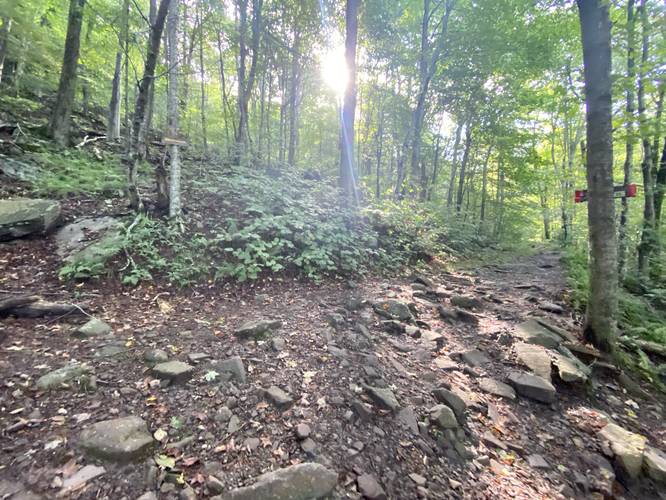
Bouldery / Rocky Trail with Steep Grade - Mile 0 to 0.45
Hikers will follow the unforgiving rocky and steep terrain of the yellow-blazed Phoenicia East Branch Trail until they reach a right-hand turn around mile 0.45. Here, the trail's grade becomes a lot more manageable as it follows a more gradual elevation profile until you reach the Slide Mountain Trail (red blazed, officially Wiitenberg - Cornell - Slide Trail) at mile 0.75.
Slide Mountain Trail / Left-hand Turn - Mile 0.75
Around mile 0.75, hikers will reach a left-hand turn at the red-blazed Wittenberg - Cornell - Slide Trail (aka Slide Mountain Trail). Here, the elevation grade becomes steeper again as the trail begins to climb the remaining slopes of Slide Mountain. Along the way, however, are some interesting sights to make stops at.
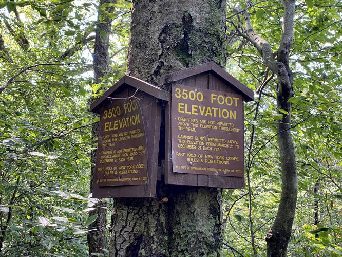
3,500-foot Marker - Mile 1.45
Around mile 1.45, hikers will reach a trail marker for the 3,500-foot elevation range. This marker exists to remind hikers and backpackers that no open fires are allowed year-round. In addition, camping is not permitted between March 21 to December 21 each year.
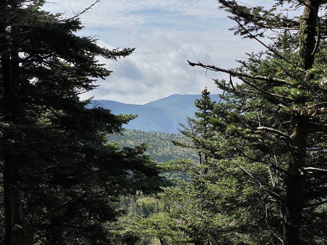
View of Table Mountain - Mile 2.25
Around mile 2.25 is an off-trail path to the south that leads to a view of Table Mountain. The view isn't the greatest, and albeit a bit obstructed, but it's worth checking-out considering how few views Slide Mountain has to offer, especially if hiking on a cloudy day. The view itself is located, in the GPS data provided, at mile 2.27.
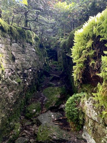
Moss-Covered Ledges - Mile 2.6
Around mile 2.6, hikers will find moss-covered ledges located off-trail to the south. These ledges can be interesting to poke around and photograph on your way up the mountain.
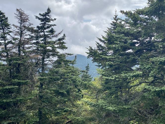
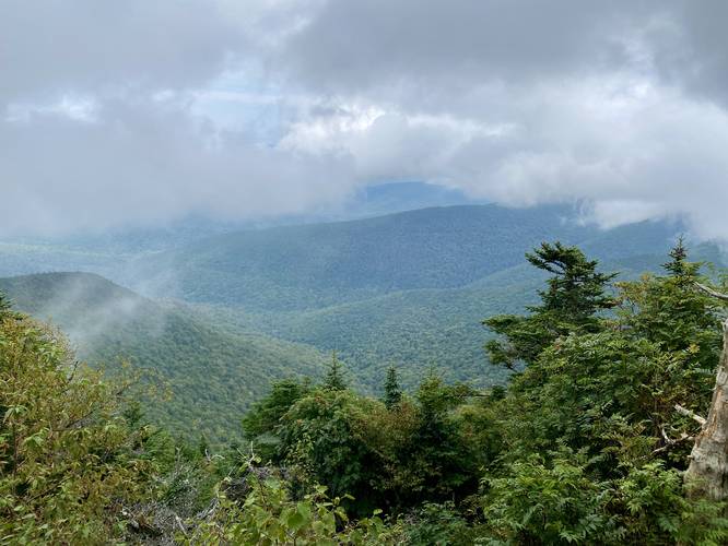
Slide Mountain Vista - Mile 2.7
At mile 2.7 is the Slide Mountain Vista, which provides views of this own mountain's northern slopes in addition to Wittenberg Mountain's northwest slopes. This is the best vista along this hike, so take in the views while you can. Even on a cloudy day, like on my hike, the clouds can part to give you a glimpse of what Slide Mountain has to offer for views.
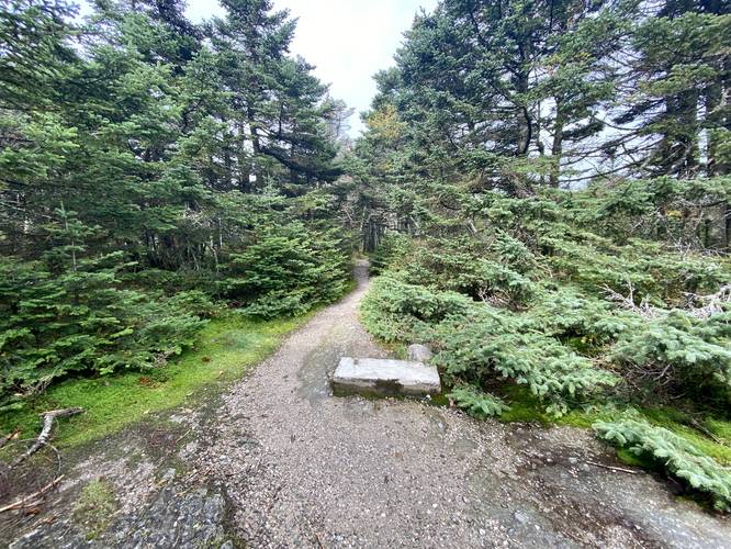
Slide Mountain Summit - Mile 2.75
At mile 2.9 is the summit of Slide Mountain. Hikers will find a concrete footing of what used to be an old lookout / firetower that once stood on the mountain. According to the USGS survey marker notes, the summit marker lies off-trail just north of this concrete block.
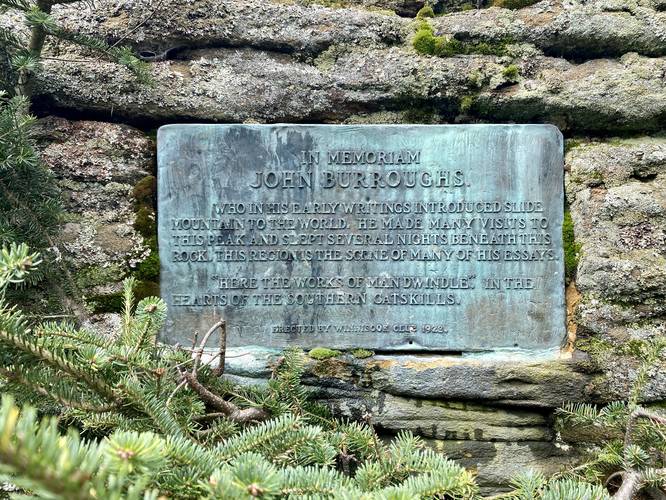
View of Dink Mountain / Ledge / John Burroughs Plaque - Mile 2.8
Hiking just a bit further from the summit, hikers will find a rock ledge that provides an obstructed view of Dink Mountain just beyond the mountain col below your feet. On this same ledge, if you hike down, is an old plaque from 1922 dedicated to John Burroughs who was once a writer that showed the world what Slide Mountain had to offer.
Hiking Out - Mile 2.8 to 5.6
The hike out obviously follows the same path down the mountain, but it's worth stopping at the Slide Mountain Vista on your way out to get the most "bang for your buck" before descending. Watch your step on the way down, especially along the Phoenicia East Branch Trail as those rocks and boulders can be nasty on the ankle. Be mindful of each turn so you stay on-track.
Parking
Hikers will find a large parking lot at the coordinates provided. The lot is large enough to fit a couple dozen vehicles.
Pets
Dogs are allowed if leash and must be cleaned up after.
Camping and Backpacking
Backpacking and camping is allowed per state park rules and regulations. Camping is not allowed above 3,500-feet between March 21 and December 21 ever year. Open fires are not permitted year-round.
Warning
Rocky terrain: As stated previously, this trail has some unforgiving rocky terrain, which can easily roll your ankle or worse. Watch your steps and take your time when traversing the rocks.
Trails
This hike follows two trails: Phoenicia East Branch Trail (yellow blazes), Wittenberg - Cornell - Slide Trail (red blazes).
Hike Description
This hike begins at the main parking lot for Slide Mountain, located at the coordinates provided, and heads in along the main trailhead for the Phoenicia East Branch Trail (yellow blazes). The trail initially crosses two creeks within the first few-hundred feet - during the Spring, these creeks may be difficult to cross depending on the level of snowmelt, but during the Summer they're a breeze to cross if you step on the right rocks.
Bouldery / Rocky Trail with Steep Grade - Mile 0 to 0.45
Hikers will follow the unforgiving rocky and steep terrain of the yellow-blazed Phoenicia East Branch Trail until they reach a right-hand turn around mile 0.45. Here, the trail's grade becomes a lot more manageable as it follows a more gradual elevation profile until you reach the Slide Mountain Trail (red blazed, officially Wiitenberg - Cornell - Slide Trail) at mile 0.75.
Slide Mountain Trail / Left-hand Turn - Mile 0.75
Around mile 0.75, hikers will reach a left-hand turn at the red-blazed Wittenberg - Cornell - Slide Trail (aka Slide Mountain Trail). Here, the elevation grade becomes steeper again as the trail begins to climb the remaining slopes of Slide Mountain. Along the way, however, are some interesting sights to make stops at.
3,500-foot Marker - Mile 1.45
Around mile 1.45, hikers will reach a trail marker for the 3,500-foot elevation range. This marker exists to remind hikers and backpackers that no open fires are allowed year-round. In addition, camping is not permitted between March 21 to December 21 each year.
View of Table Mountain - Mile 2.25
Around mile 2.25 is an off-trail path to the south that leads to a view of Table Mountain. The view isn't the greatest, and albeit a bit obstructed, but it's worth checking-out considering how few views Slide Mountain has to offer, especially if hiking on a cloudy day. The view itself is located, in the GPS data provided, at mile 2.27.
Moss-Covered Ledges - Mile 2.6
Around mile 2.6, hikers will find moss-covered ledges located off-trail to the south. These ledges can be interesting to poke around and photograph on your way up the mountain.
Slide Mountain Vista - Mile 2.7
At mile 2.7 is the Slide Mountain Vista, which provides views of this own mountain's northern slopes in addition to Wittenberg Mountain's northwest slopes. This is the best vista along this hike, so take in the views while you can. Even on a cloudy day, like on my hike, the clouds can part to give you a glimpse of what Slide Mountain has to offer for views.
Slide Mountain Summit - Mile 2.75
At mile 2.9 is the summit of Slide Mountain. Hikers will find a concrete footing of what used to be an old lookout / firetower that once stood on the mountain. According to the USGS survey marker notes, the summit marker lies off-trail just north of this concrete block.
View of Dink Mountain / Ledge / John Burroughs Plaque - Mile 2.8
Hiking just a bit further from the summit, hikers will find a rock ledge that provides an obstructed view of Dink Mountain just beyond the mountain col below your feet. On this same ledge, if you hike down, is an old plaque from 1922 dedicated to John Burroughs who was once a writer that showed the world what Slide Mountain had to offer.
Hiking Out - Mile 2.8 to 5.6
The hike out obviously follows the same path down the mountain, but it's worth stopping at the Slide Mountain Vista on your way out to get the most "bang for your buck" before descending. Watch your step on the way down, especially along the Phoenicia East Branch Trail as those rocks and boulders can be nasty on the ankle. Be mindful of each turn so you stay on-track.
Parking
Hikers will find a large parking lot at the coordinates provided. The lot is large enough to fit a couple dozen vehicles.
Pets
Dogs are allowed if leash and must be cleaned up after.
Camping and Backpacking
Backpacking and camping is allowed per state park rules and regulations. Camping is not allowed above 3,500-feet between March 21 and December 21 ever year. Open fires are not permitted year-round.
Warning
Rocky terrain: As stated previously, this trail has some unforgiving rocky terrain, which can easily roll your ankle or worse. Watch your steps and take your time when traversing the rocks.