The Shang Hollow Trail to Rattlesnake Point at Hammersley Wild Area within Susquehannock State Forest near Wharton, Pennsylvania is a moderate 4.2-mile out-and-back / lollipop hike that leads out to what appears to be a possible rattlesnake habitat clear-cutting on the side of a mountain top.
Trails
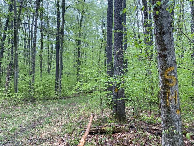
This hike follows one named trail: Shang Hollow Trail (yellow blazes). Note that the hike also follows a pipeline, heads into the woods for a short bushwhack, and then follows an old unmarked (on the state forest / wild area maps) orange-blazed trail that leads directly to "Rattlesnake Point".
Hike Description
This hike begins along McConnell Road near Wharton, PA and heads in along the Shang Hollow Trail (yellow blazes) which is also a service road for the first 0.45-miles. Despite the first 0.45-miles being a service road, the Shang Hollow Trail is a beautiful and peaceful walk, especially in the Spring time when the wild violets are in bloom alongside small ferns.
Carving Tree - Mile 1.15
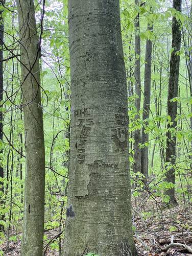
After taking the right-hand turn around mile 0.45, hikers will follow the yellow blazes of the undulating Shang Hollow Trail with not much to see except the occasional Black Cherry grove. Around mile 1.15, hikers may notice an old tree with carvings in it from (likely hunters or backpackers) from ~1975. While noted, it's best to leave the tree alone and enjoy the existing carvings.
Shang Hollow Junction - Mile 1.4
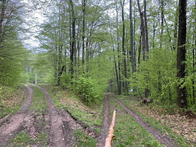
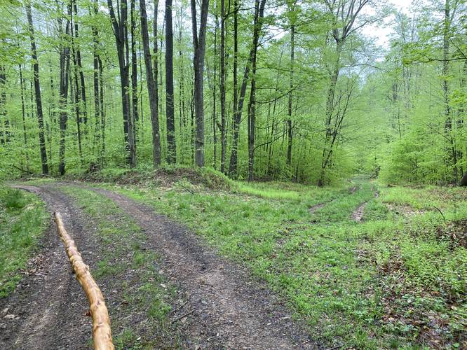
If skipping this hike altogether to just follow the Shang Hollow Trail, hikers will want to be on the lookout for a trail junction around mile 1.4. If you hit the pipeline (by continuing to hike straight), you've gone too far. Turn back and look for faded yellow blazes behind overgrowth just a couple-hundred feet behind you.
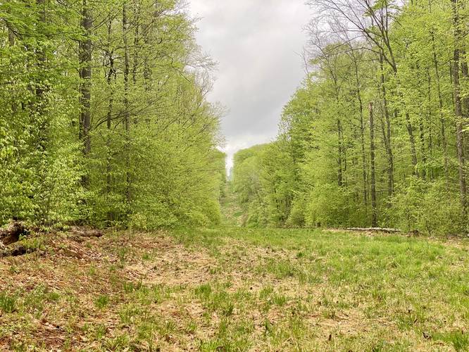
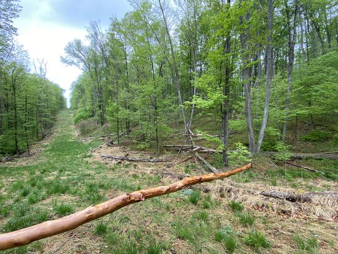
At the Pipeline - Orange-blazes Ahead / Bushwhack North
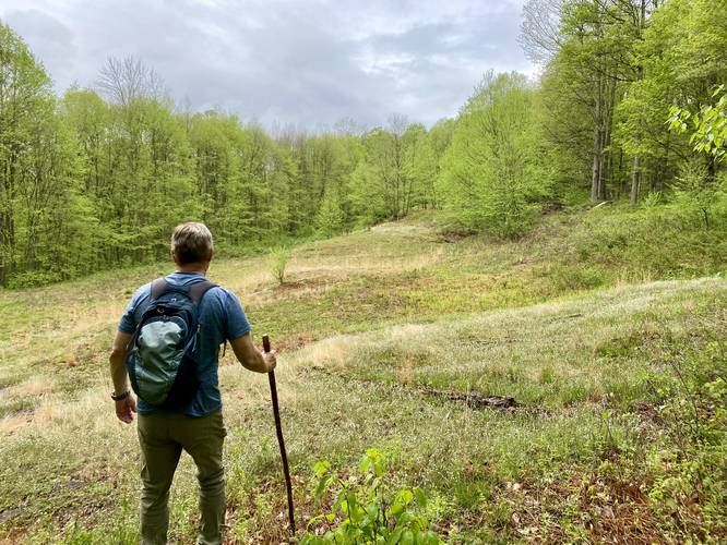
If attempting to reach "Rattlesnake Point", hikers will want to reach the pipeline and easily hike straight along the orange-blazed unmarked trail. However, if you want to recreate this hike and follow the bushwhack, hikers can head northeast along the pipeline and thus head into the woods, heading east, after 300-feet.
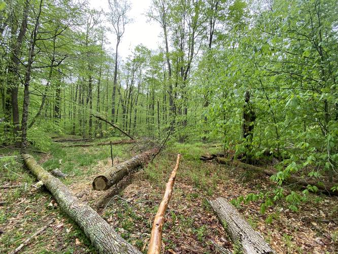
Rattlesnake Point - Mile 1.85
Around mile 1.85 (whether you bushwhack or follow the unmarked orange-blazed trail), hikers will reach the mountaintop clearing unofficially known as "Rattlesnake Point". Here, we were hoping for a nice unobstructed vista into the rest of Hammersley Wild Area, but instead we found large piles of shale rock buried with dirt - indicating that either the state dumped shale here on purpose to help build rattlesnake habitats or sometime in the past, this area may have been dug out for mining or quarry purposes. Either way, no real view exists here, but was a fun spot to hike out to. After checking out "Rattlesnake Point" we decided to hike to the "end" of the old unmarked trail (marked on Caltopo's map tiles, likely from the 1960's) which sits at the very top of the mountain. Upon reaching almost the top (mile 1.95 in the GPS data), we found a hunter covered in camoflauge looking for turkeys. Not wanting to disturb his hunt, we headed back through Rattlesnake Point and out.
Orange-Blazed Unmarked Trail to Pipeline
Hikers can take the unmarked orange-blazed trail back to the pipeline by heading due-west from "Rattlesnake Point". The trail is fairly obvious to follow.
Finding Shang Hollow Trail from Pipeline
Upon returning to the pipeline, we wanted to know where the Shang Hollow Trail finally met up with the pipeline where it was supposed to, so we hiked south on the pipeline to reach a hard-to-see yellow blaze on the right-hand side. This was the Shang Hollow Trail. We hiked north following scarcely-placed yellow blazes (some super faded) until we reached the original path we came in on.
Hiking Out
Whether you hike directly from the pipeline back or head south to hook north along the proper Shang Hollow Trail route, hiking back is as simple as heading the opposite way you came in. The trail continues to undulate and is a bit more work than hiking in.
Parking
Hikers will find parking at the coordinates provided. The lot is large enough to hold about 6 vehicles.
Pets
Dogs are allowed if leashed and their waste should be carried out by the hiker.
Warnings
Rattlesnakes: This area is known for its Timber Rattlesnake population and "Rattlesnake Point" may be home to some of these snakes. Watch your step, take your time, and give any rattlers you find space.
Hunters: Hammersley Wild Area is a known destination for hunting. Upon mapping this trail, we found 2 hunter's trucks at the trailhead, but did not think we'd see anyone, but we were wrong. I almost walked directly into a hunter on-top of "Rattlesnake Point", which took me by surprise. Wear blaze orange to make yourself stand out.
No water: There were no creek crossings along this hike and thus no water sources to filter from. Pack in as much water as you think you'll need for 4.2-miles.
Trails
This hike follows one named trail: Shang Hollow Trail (yellow blazes). Note that the hike also follows a pipeline, heads into the woods for a short bushwhack, and then follows an old unmarked (on the state forest / wild area maps) orange-blazed trail that leads directly to "Rattlesnake Point".
Hike Description
This hike begins along McConnell Road near Wharton, PA and heads in along the Shang Hollow Trail (yellow blazes) which is also a service road for the first 0.45-miles. Despite the first 0.45-miles being a service road, the Shang Hollow Trail is a beautiful and peaceful walk, especially in the Spring time when the wild violets are in bloom alongside small ferns.
Carving Tree - Mile 1.15
After taking the right-hand turn around mile 0.45, hikers will follow the yellow blazes of the undulating Shang Hollow Trail with not much to see except the occasional Black Cherry grove. Around mile 1.15, hikers may notice an old tree with carvings in it from (likely hunters or backpackers) from ~1975. While noted, it's best to leave the tree alone and enjoy the existing carvings.
Shang Hollow Junction - Mile 1.4
If skipping this hike altogether to just follow the Shang Hollow Trail, hikers will want to be on the lookout for a trail junction around mile 1.4. If you hit the pipeline (by continuing to hike straight), you've gone too far. Turn back and look for faded yellow blazes behind overgrowth just a couple-hundred feet behind you.
At the Pipeline - Orange-blazes Ahead / Bushwhack North
If attempting to reach "Rattlesnake Point", hikers will want to reach the pipeline and easily hike straight along the orange-blazed unmarked trail. However, if you want to recreate this hike and follow the bushwhack, hikers can head northeast along the pipeline and thus head into the woods, heading east, after 300-feet.
Rattlesnake Point - Mile 1.85
Around mile 1.85 (whether you bushwhack or follow the unmarked orange-blazed trail), hikers will reach the mountaintop clearing unofficially known as "Rattlesnake Point". Here, we were hoping for a nice unobstructed vista into the rest of Hammersley Wild Area, but instead we found large piles of shale rock buried with dirt - indicating that either the state dumped shale here on purpose to help build rattlesnake habitats or sometime in the past, this area may have been dug out for mining or quarry purposes. Either way, no real view exists here, but was a fun spot to hike out to. After checking out "Rattlesnake Point" we decided to hike to the "end" of the old unmarked trail (marked on Caltopo's map tiles, likely from the 1960's) which sits at the very top of the mountain. Upon reaching almost the top (mile 1.95 in the GPS data), we found a hunter covered in camoflauge looking for turkeys. Not wanting to disturb his hunt, we headed back through Rattlesnake Point and out.
Orange-Blazed Unmarked Trail to Pipeline
Hikers can take the unmarked orange-blazed trail back to the pipeline by heading due-west from "Rattlesnake Point". The trail is fairly obvious to follow.
Finding Shang Hollow Trail from Pipeline
Upon returning to the pipeline, we wanted to know where the Shang Hollow Trail finally met up with the pipeline where it was supposed to, so we hiked south on the pipeline to reach a hard-to-see yellow blaze on the right-hand side. This was the Shang Hollow Trail. We hiked north following scarcely-placed yellow blazes (some super faded) until we reached the original path we came in on.
Hiking Out
Whether you hike directly from the pipeline back or head south to hook north along the proper Shang Hollow Trail route, hiking back is as simple as heading the opposite way you came in. The trail continues to undulate and is a bit more work than hiking in.
Parking
Hikers will find parking at the coordinates provided. The lot is large enough to hold about 6 vehicles.
Pets
Dogs are allowed if leashed and their waste should be carried out by the hiker.
Warnings
Rattlesnakes: This area is known for its Timber Rattlesnake population and "Rattlesnake Point" may be home to some of these snakes. Watch your step, take your time, and give any rattlers you find space.
Hunters: Hammersley Wild Area is a known destination for hunting. Upon mapping this trail, we found 2 hunter's trucks at the trailhead, but did not think we'd see anyone, but we were wrong. I almost walked directly into a hunter on-top of "Rattlesnake Point", which took me by surprise. Wear blaze orange to make yourself stand out.
No water: There were no creek crossings along this hike and thus no water sources to filter from. Pack in as much water as you think you'll need for 4.2-miles.