The Sewe Shell Ring Trail at Francis Marion National Forest near Awendaw, South Carolina is an easy 1.1-mile loop hike that features two Native American shell mounds.
Hike (Clockwise)
This hike begins at the main trailhead for the Sewee Shell Ring Trail and heads-in to the loop. At the fork for the loop, this recording heads to the clam mound first by keeping left at the fork and following the "Clam Mound" signs -- heading this way first will bring the hiker clockwise along the loop.
Clam Mound (Midden) - Mile 0.33 to 0.36
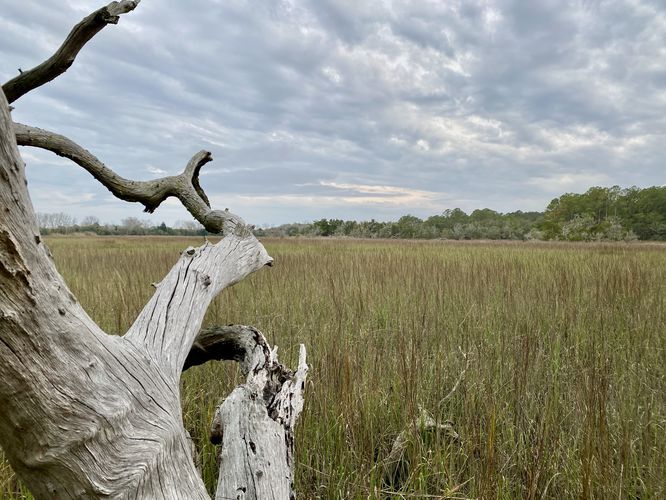
Around mile 0.33, hikers will follow the trail out toward the edge of the salt marsh where you'll find signage for the ancient Native American clam mound. This clam mound is a "midden", which is simply a term for a pile of refuse (trash, discarded shells, or other materials) leftover by humans. The clam mound is very very large and most people won't know they're walking on it until they follow the loop that encompasses the clam mound from mile 0.33 to mile 0.36. Once you get the full scale of the clam mound, you'll realize that ancient Native American peoples used this area for centuries, slowly piling up their clam refuse into the same pile. Please respect the land and ancient history and do not touch or disturb the mound.
Connecting to the Shell Ring - Mile 0.4 to 0.53
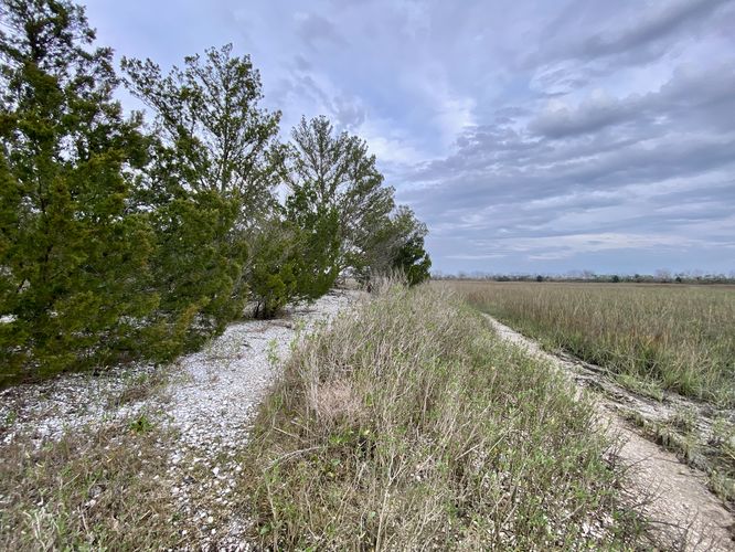
Hikers will head westward from the Clam Mound to reach the Shell Ring via one of two pathways that connect the loop. This recording follows the southern-most path as it runs along the edge of the marsh to reach the raised boardwalk section of the trail that encompasses the Shell Ring. Along this path, hikers will find tall palmetto, marsh views, and a beautiful forest.
Sewee Shell Ring - Mile 0.53 to 0.66
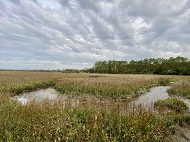
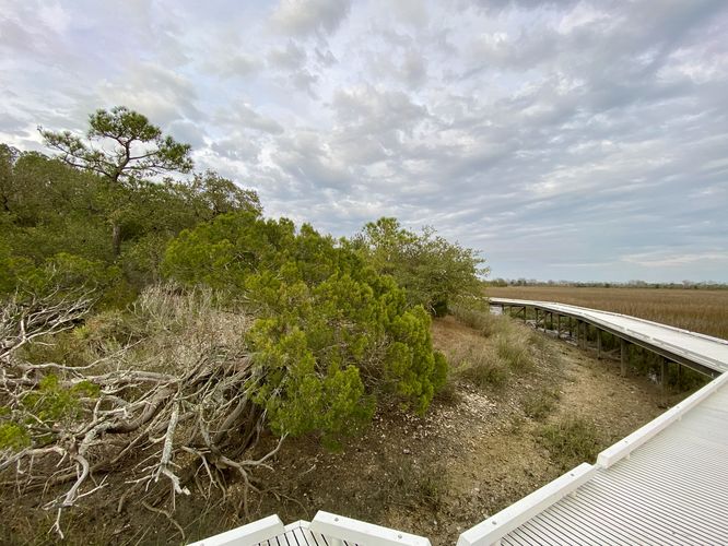
Around mile 0.53, hikers will reach the raised boardwalk section of the trail that leads out into the marsh and circles the Sewee Shell Ring. Here, you'll find more views of the salt marsh, including a creek that flows through the marsh and out to the Atlantic Ocean. Here, you'll find an abundance of clams living in and around the creek (facing southward). To the north is the insanely-massive Sewee Shell Ring. It's difficult to tell just how large the shell ring is, but from our perspective, the shell ring must have been over 100-feet wide in diameter with varying terrain that raised it ~10-feet from the base of the salt marsh. This meant that ancient Native Americans preferred this location for hauling clams out of the marsh/ocean and dumped their refuse into this midden over millennia. The sheer size of the shell ring is impressive, but so are the views from the boardwalk. This section of the trail is by far the most scenic along the loop so take in the views while you can. Hikers will also find several benches that line the boardwalk so you can sit and enjoy the views.
After exploring the Sewee Shell Ring, this track leads out and back to parking via the western side of the loop. The trail doesn't have much else to see along the hike on your way out except for some random palmetto growing in the forest. Hikers will reach the parking lot for a 1.1-mile loop hike to complete the journey.
Parking
Hikers will find a medium-sized parking lot at the coordinates provided. The lot is large enough to fit a dozen vehicles or so and provides parking for one or two tour buses.
Pets
Dogs are allowed only if leashed and must be cleaned up after.
Hike (Clockwise)
This hike begins at the main trailhead for the Sewee Shell Ring Trail and heads-in to the loop. At the fork for the loop, this recording heads to the clam mound first by keeping left at the fork and following the "Clam Mound" signs -- heading this way first will bring the hiker clockwise along the loop.
Clam Mound (Midden) - Mile 0.33 to 0.36
Around mile 0.33, hikers will follow the trail out toward the edge of the salt marsh where you'll find signage for the ancient Native American clam mound. This clam mound is a "midden", which is simply a term for a pile of refuse (trash, discarded shells, or other materials) leftover by humans. The clam mound is very very large and most people won't know they're walking on it until they follow the loop that encompasses the clam mound from mile 0.33 to mile 0.36. Once you get the full scale of the clam mound, you'll realize that ancient Native American peoples used this area for centuries, slowly piling up their clam refuse into the same pile. Please respect the land and ancient history and do not touch or disturb the mound.
Connecting to the Shell Ring - Mile 0.4 to 0.53
Hikers will head westward from the Clam Mound to reach the Shell Ring via one of two pathways that connect the loop. This recording follows the southern-most path as it runs along the edge of the marsh to reach the raised boardwalk section of the trail that encompasses the Shell Ring. Along this path, hikers will find tall palmetto, marsh views, and a beautiful forest.
Sewee Shell Ring - Mile 0.53 to 0.66
Around mile 0.53, hikers will reach the raised boardwalk section of the trail that leads out into the marsh and circles the Sewee Shell Ring. Here, you'll find more views of the salt marsh, including a creek that flows through the marsh and out to the Atlantic Ocean. Here, you'll find an abundance of clams living in and around the creek (facing southward). To the north is the insanely-massive Sewee Shell Ring. It's difficult to tell just how large the shell ring is, but from our perspective, the shell ring must have been over 100-feet wide in diameter with varying terrain that raised it ~10-feet from the base of the salt marsh. This meant that ancient Native Americans preferred this location for hauling clams out of the marsh/ocean and dumped their refuse into this midden over millennia. The sheer size of the shell ring is impressive, but so are the views from the boardwalk. This section of the trail is by far the most scenic along the loop so take in the views while you can. Hikers will also find several benches that line the boardwalk so you can sit and enjoy the views.
After exploring the Sewee Shell Ring, this track leads out and back to parking via the western side of the loop. The trail doesn't have much else to see along the hike on your way out except for some random palmetto growing in the forest. Hikers will reach the parking lot for a 1.1-mile loop hike to complete the journey.
Parking
Hikers will find a medium-sized parking lot at the coordinates provided. The lot is large enough to fit a dozen vehicles or so and provides parking for one or two tour buses.
Pets
Dogs are allowed only if leashed and must be cleaned up after.