The Sandy Point Beach Park Hike at Sandy Point Beach Park in Stockton Springs, Maine is an easy 1.7-mile loop hike that features views of the Penobscot River and the Eastern Channel and leads through an Atlantic White Cedar swamp.
Penobscot River Loop - Mile 0 to 0.15
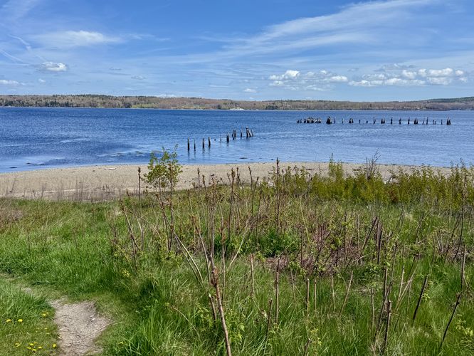
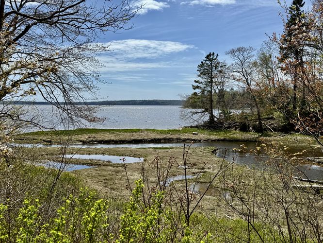
The first leg of this hike leads from the parking lot to the water's edge along the Penobscot River. Here, you'll find views of the water, remnants of an old dock, and the Penobscot Narrows Bridge located to the north.
Bugs: During mid-spring the bugs were non-existant along this hike even in the swamp. That may not be the case for mid-summer or other times of the year. This trail is likely a bit buggy.
Trails
This hike follows several named trails at the park including: Wheelchair Accessible Trail, North Amazon Loop, South Amazon Loop, and the Shore Loop.Hiking Sandy Point Beach Park
The trails at Sandy Point Beach Park provide hikers with several options for getting out and exploring the waterways and woodlands around the Stockton Springs area of coastal Maine. While the park has several officially-named trails, this hike leads you through the majority of those trails to see virtually everything that the park has to offer. In following this route, you'll find waterway views, traverse a scenic swamp nicknamed "the Amazon", and complete three loops along the way.Penobscot River Loop - Mile 0 to 0.15
The first leg of this hike leads from the parking lot to the water's edge along the Penobscot River. Here, you'll find views of the water, remnants of an old dock, and the Penobscot Narrows Bridge located to the north. Overlook & Wheelchair Accessible Trail - Mile 0.15 to 0.28
After exploring the water's edge, the hike leads to the southern area of the parking lot were the trail system can be found. Here, you'll start off by following the Wheelchair Accessible Trail. Note that in the route provided, there's a bisecting trail that we included which is not wheelchair accessible! If you wish to follow the accessible path, take a right-hand turn at the trail kiosk sign to follow that route instead. If you follow this route, it leads uphill to reach the overlook area where you'll find a bench that sits with a view of the Penobscot River. After checking out the view, which is similar to the view along the water's edge, you'll follow the accessible trail as it leads west toward Hersey Retreat Road.Amazon Loop - Mile 0.35
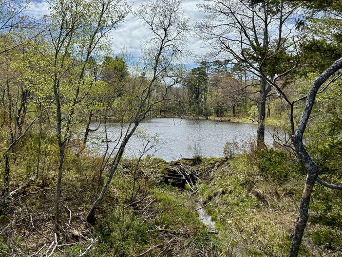
At mile 0.35, hikers will find a footbridge that spans a small creek with an adjacent sign labeled "Amazon and Shore Trails". Here, take the left-hand turn to follow the blue blazes of the Amazon Loop. The trail will cross Hersey Retreat Road before continuing onward into the Atlantic White Cedar swamp. You'll eventually reach a fork in the trail around mile 0.48 where this trail guide follows the North Amazon Loop trail first. The Amazon Loop is full of mud, moss, ferns, red-tinted tannin-laden water and the beautiful Atlantic White Cedar trees. As you traverse through the swamp, you'll mostly be walking across raised wooden planks that keep you out of the mud, however, there are some spots where you'll likely get your feet a bit muddy.Shore Loop & Views - Mile 0.95 to 1
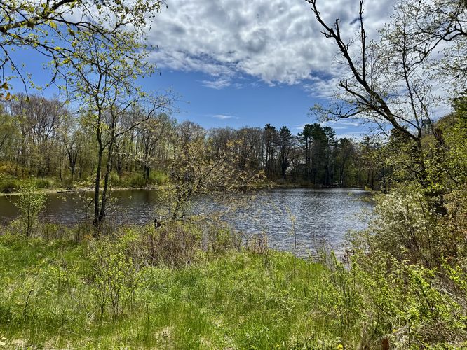
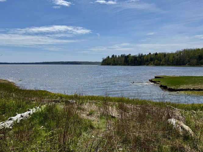
Around mile 0.95, hikers will reach the junction with the Shore Loop (white blazes) where you have the option to hike the trail in full or simply hike out to the shore's edge for more views. This route opts for the latter. We hiked out to the edge of the water to take-in views of the bay and marshlands then we backtracked to the South Amazon Loop to hike out. The Shore Loop is certainly a nice break from the raised wooden planks and mud.Amazon Loop to Parking - Mile 1 to 1.7
The last leg of this hike leads from the shore to parking via the South Amazon Loop. Similar to the North Amazon Loop, you'll be faced with mud and wooden planks to hike across. With that said, there are less raised wooden planks along the South Amazon Loop than the North. You'll find more moss, ferns, fiddleheads in the spring, and Atlantic White Cedar trees that fill in the landscape. Oh yeah, and you'll find more mud! The trail crosses the road once more, then the route follows the Wheelchair Accessible Trail back to the parking lot to wrap up this fun and secluded 1.7-mile loop hike.Parking
Hikers will find a large parking lot at the coordinates provided, located at the end of Steamboat Wharf Road. The lot is large enough to fit several dozen vehicles as of May 2025.Pets
Dogs are allowed only if leashed and must be cleaned up after.Warnings
Mud: This hike leads through an Atlantic White Cedar swamp where you'll find plenty of mud.Bugs: During mid-spring the bugs were non-existant along this hike even in the swamp. That may not be the case for mid-summer or other times of the year. This trail is likely a bit buggy.