The Sanford Lake Trail at Birdseye Hollow State Forest near Savona, New York is an easy 1.3-mile out-and-back hike that features scenic views of Sanford Lake.
Trails
This hike follows one named trail: Sanford Lake Trail. Note that the trail follows two different blaze colors including blue blaze markers from the trailhead to mile 0.4. At mile 0.4, hikers will follow the yellow blazes out to the boat launch.
Hike
This hike begins at the north side of Sanford Lake along Kettle Road. The trailhead and parking doesn't look very inviting (especially during the Winter) but this trail is actually well-worth the hike to take-in views. Hikers, if they wish, do not need to hike the entire trail to get a scenic payout as views of Sanford Lake are not far from the trailhead.
Trailhead to Campsite & Views - mile 0 to 0.1
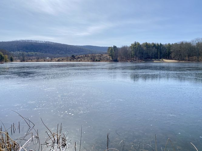
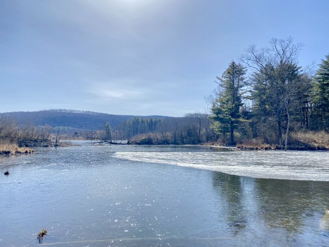
Regardless, the trail starts off by following a dirt path that leads to the official blue blazed trail. It ascends a small hill before reaching a campsite at mile 0.1. The campsite has a privy and provides access to views of Sanford Lake. If you hike downhill along the mossy path, you'll find views from the northwestern banks of Sanford Lake, just downhill from the campsite.
Hiking the Loop to the Boat Launch - Mile 0.1 to 0.7
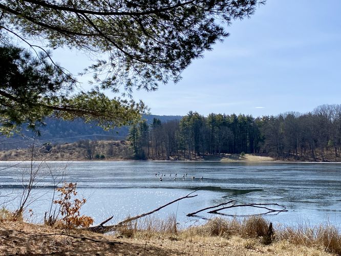
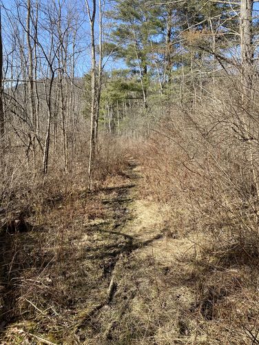
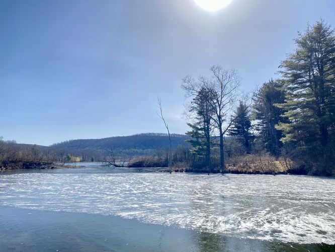
After visiting the campsite and lake views near mile 0.1, hikers may want explore the rest of the Sanford Lake Trail by following the blue blazes westward from the campsite. Note that this portion of the trail can be muddy and overgrown during warmer months. The trail heads through a relatively-overgrown thorny part of the forest as it passes by two beaver dams. The beaver dams provide more views of Sanford Lake and the creek that drains from it. Soon, around mile 0.35, hikers will reach a trail junction -- take a left-hand turn here to hike across the wooden bridge that spans the creek flowing from Sanford Lake. Immediately after the wooden bridge, take a left-hand turn to follow yellow blaze markers. Once on the yellow marker section of the Sanford Lake Trail, hikers will follow this path until it reaches a forest road. Along the way is one 20-foot downhill and uphill dip in the terrain but that poses as the only obstacle. Once at the forest road, hike down to reach the end of the boat launch. From the boat launch, hikers will have more views of Sanford Lake, including a view of the northwestern shore where you first hiked-in.
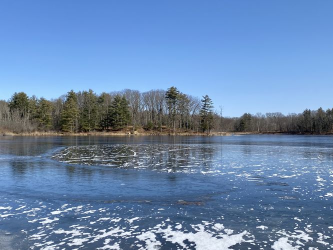
After visiting the boat launch, the hike essentially ends here. You can explore a bit further if you wish (see the official park map for more details), but the views of Sanford Lake are pretty much over, with the exception of one last parking area that we did not hike to that includes similar views. The hike back to parking is easy -- just make sure you take the proper right-hand turns along the way. And feel free to enjoy the scenic views of Sanford Lake on your way out.
Parking
Hikers will find a very small parking turnout at the coordinates provided, located along Kettle Road on the north side of Sanford Lake. The turnout is large enough to fit at most 2 vehicles. There are other parking areas for this trail -- please see the official park map for more details.
Pets
Dogs are allowed if leashed and must be cleaned up after.
Camping & Backpacking
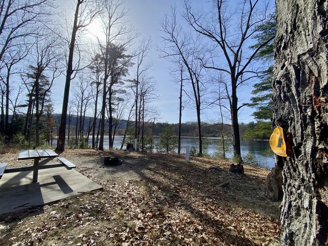
Camping is permitted at the designated campsite, located near mile 0.1 along the trail. There's a picnic table and a metal fire ring you can use to start a fire. Behind the campsite is a privy, albeit it's very old and starting to fall apart as of February 2024. Please follow all state forest rules and regulations if camping.
Trails
This hike follows one named trail: Sanford Lake Trail. Note that the trail follows two different blaze colors including blue blaze markers from the trailhead to mile 0.4. At mile 0.4, hikers will follow the yellow blazes out to the boat launch.
Hike
This hike begins at the north side of Sanford Lake along Kettle Road. The trailhead and parking doesn't look very inviting (especially during the Winter) but this trail is actually well-worth the hike to take-in views. Hikers, if they wish, do not need to hike the entire trail to get a scenic payout as views of Sanford Lake are not far from the trailhead.
Trailhead to Campsite & Views - mile 0 to 0.1
Regardless, the trail starts off by following a dirt path that leads to the official blue blazed trail. It ascends a small hill before reaching a campsite at mile 0.1. The campsite has a privy and provides access to views of Sanford Lake. If you hike downhill along the mossy path, you'll find views from the northwestern banks of Sanford Lake, just downhill from the campsite.
Hiking the Loop to the Boat Launch - Mile 0.1 to 0.7
After visiting the campsite and lake views near mile 0.1, hikers may want explore the rest of the Sanford Lake Trail by following the blue blazes westward from the campsite. Note that this portion of the trail can be muddy and overgrown during warmer months. The trail heads through a relatively-overgrown thorny part of the forest as it passes by two beaver dams. The beaver dams provide more views of Sanford Lake and the creek that drains from it. Soon, around mile 0.35, hikers will reach a trail junction -- take a left-hand turn here to hike across the wooden bridge that spans the creek flowing from Sanford Lake. Immediately after the wooden bridge, take a left-hand turn to follow yellow blaze markers. Once on the yellow marker section of the Sanford Lake Trail, hikers will follow this path until it reaches a forest road. Along the way is one 20-foot downhill and uphill dip in the terrain but that poses as the only obstacle. Once at the forest road, hike down to reach the end of the boat launch. From the boat launch, hikers will have more views of Sanford Lake, including a view of the northwestern shore where you first hiked-in.
After visiting the boat launch, the hike essentially ends here. You can explore a bit further if you wish (see the official park map for more details), but the views of Sanford Lake are pretty much over, with the exception of one last parking area that we did not hike to that includes similar views. The hike back to parking is easy -- just make sure you take the proper right-hand turns along the way. And feel free to enjoy the scenic views of Sanford Lake on your way out.
Parking
Hikers will find a very small parking turnout at the coordinates provided, located along Kettle Road on the north side of Sanford Lake. The turnout is large enough to fit at most 2 vehicles. There are other parking areas for this trail -- please see the official park map for more details.
Pets
Dogs are allowed if leashed and must be cleaned up after.
Camping & Backpacking
Camping is permitted at the designated campsite, located near mile 0.1 along the trail. There's a picnic table and a metal fire ring you can use to start a fire. Behind the campsite is a privy, albeit it's very old and starting to fall apart as of February 2024. Please follow all state forest rules and regulations if camping.