The Ross Dam Trail at North Cascades National Park near Diablo, Washington is a moderate 2.2-mile out-and-back hike that leads to stunning views of Ross Lake, Skagit River, alpine mountains, and waterfalls from the Ross Lake Dam.
No swimming: Despite the beautiful turquoise waters of Ross Lake, no swimming or diving is allowed near the Ross Lake Dam. There are spillgates that open without warning and thus the waters that surround the dam are extremely dangerous. Find another place to take a swim.
Hike to Ross Lake Dam
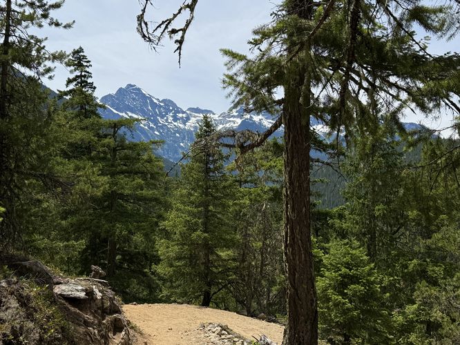
This section of the Ross Dam Trail begins at the main parking lot for the Ross Dam Trail, located on the north side of the North Cascades Highway. The trail immediately starts off by heading downhill through the forest, following turns and switchbacks to descend toward the Skagit River and Ross Lake. Along the way, hikers will find window views between the trees of the neighboring alpine mountains and the turquoise waters of Ross Lake below.Happy Creek Falls - Mile 0.27
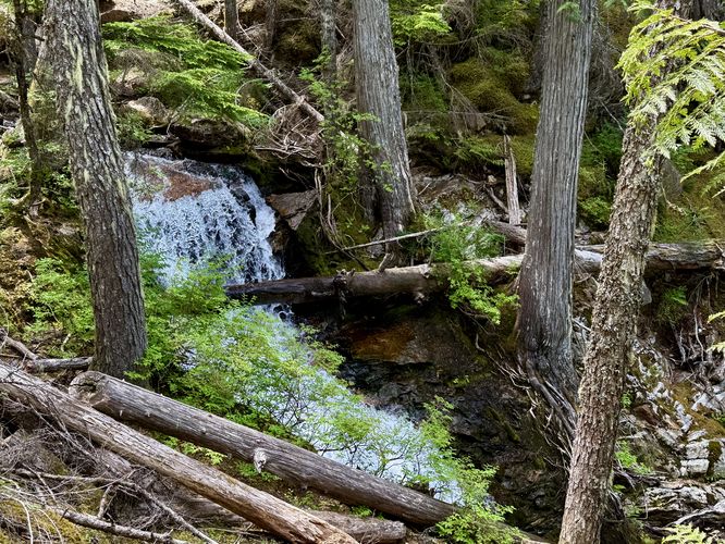
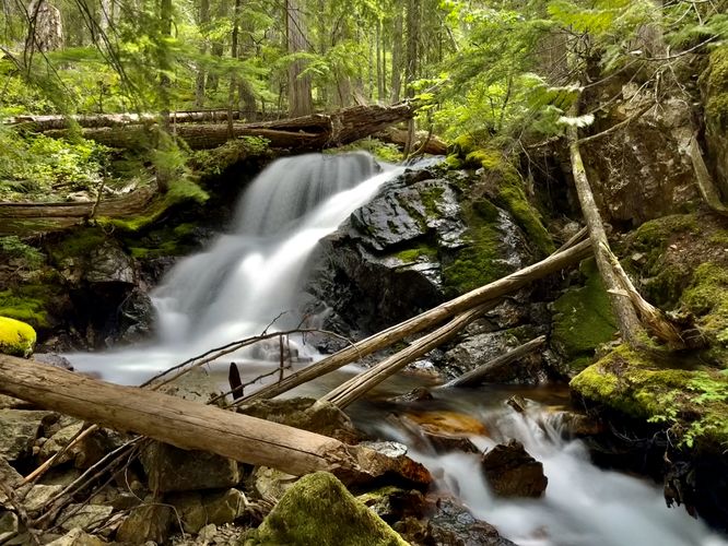
On the way down around mile 0.27, you'll find tumbling cascades of Happy Creek Falls as the water makes its way from higher elevations down to the Skagit River / Ross Lake. Here, you'll find a scenic view of a 15-foot waterfall (Upper Happy Creek Falls) to the south from the footbridge that crosses the creek. The best view of Upper Happy Creek Falls is located just off-trail and is not difficult to reach for most hikers. It's also a great spot to sit down and enjoy the waterfall, especially to take a break on the hike back to parking. Just beyond the bridge on-trail, you'll find more waterfalls of Happy Creek as they tumble downhill, but watch your step as the creek's banks become super steep and dangerous. Stay on-trail for your own safety if you plan to view the northern waterfalls in Happy Creek.Snapping Turtle Rock - Mile 0.37
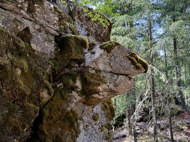
Just downhill from the waterfalls in Happy Creek sits a massive boulder (glacial erratic) that sits along the trail. If you look close-enough, you might notice that the rock resembles a snapping turtle's head with a large moss-covered body, hence, Snapping Turtle Rock.Ross Lake & Alpine Views - Mile 0.66
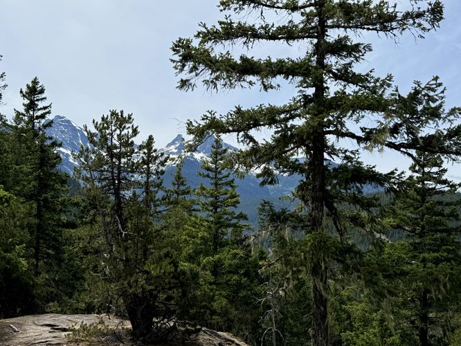
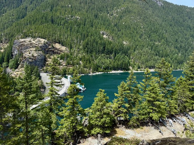
After hiking down more switchbacks, you'll reach a viewpoint around mile 0.66. Here, you'll find the turquoise waters of Ross Lake with the Ross Lake Dam holding the water back. If you look to the west from this lookout, you'll find the alpine mountains that surround the Colonial Glacier towering overhead.Service Road to Ross Lake Dam - Mile 0.72 to 1
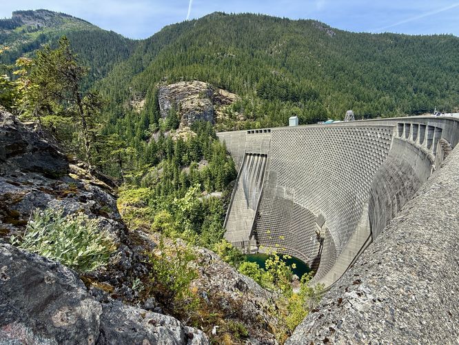
At mile 0.72, the Ross Dam Trail takes a left-hand turn along a dirt service road. Here, you'll walk through the forest as you make your way along the service road to reach the top of the Ross Lake Dam. Keep-right after hopping on the service road to reach the dam. Around mile 1, after passing through a large rock cut for the road, you'll reach the southern end of the Ross Lake Dam. The view of the dam, from this lookout point, is pretty interesting as it provides visitors with a view of the massive, pocketed concrete wall that holds the Skagit River's waters back, forming Ross Lake.Ross Lake Dam Views - Mile 1 to 1.1
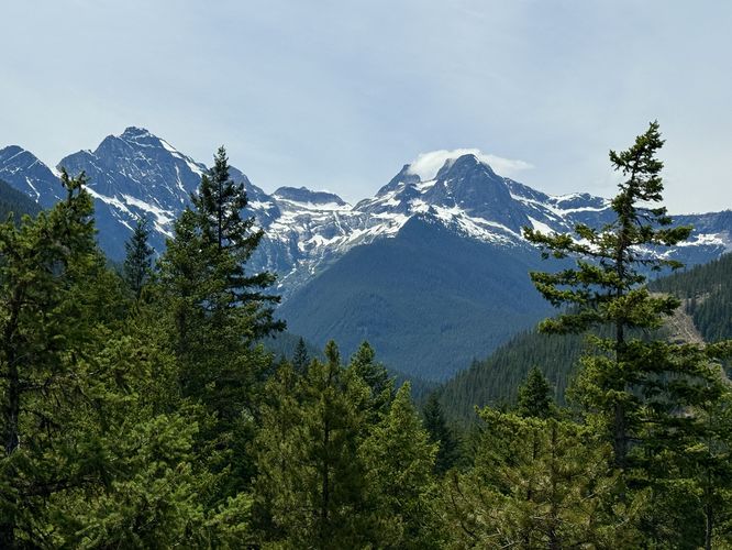
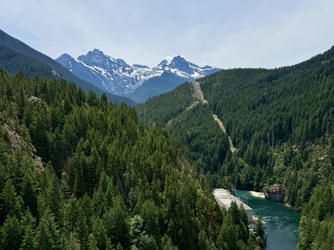
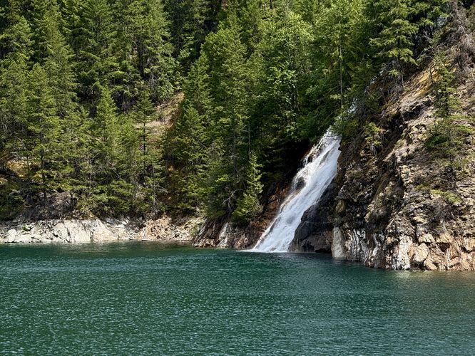
Once you're on the Ross Lake Dam, the views start opening up a lot more. Immediately after stepping onto the dam, you'll find turquoise waters of Ross Lake and the Skagit River as it heads west to reach Diablo Lake. To the east sits the massive Lower Happy Creek Falls, which spills into Ross Lake and appears to be over 100-feet tall. The waterfall sits ~600-feet from the edge of the dam and can be viewed around mile 1.1, near the half-way point on the dam. To the west are views of the turquoise Skagit River and the alpine mountains that surround the Diablo Lake area like Colonial Peak, Pyramid Peak, and the Colonial Glacier overhead.Hiking Out - Mile 1.1 to 2.2
Again, this guide for the Ross Dam Trail turns-around in the middle of the dam, but the trail continues on to reach the Ross Lake Resort and ultimately connects to other trails at North Cascades National Park. If you're simply looking for a fun day hike, you will have taken in most of the views that the area has to offer. The hike back up to parking is straight forward, simply follow the service road back to the dirt trail and follow its switchbacks up to the parking lot. Remember that a break at Upper Happy Creek Falls is a great place to sit and relax, especially on a hot day, as the forest provides shade and water to cool down. Return to the parking lot at mile 2.2 for a moderate, but fun day hike at North Cascades National Park.Restrooms
There are pit toilets located behind the trailhead sign, just beyond the parking area.Parking & Fees
Hikers will find a medium-sized parking lot at the coordinates provided, located on the north side of the North Cascades Highway. The lot is large enough to fit a few dozen vehicles as of June 2025. As of June 2025, there are no fees to enter North Cascades National Park, making it one of the few national parks that does not require an entrance fee.Pets
Dogs are allowed only if leashed and must be cleaned up after.Warning
Steep drop-offs: This hike leads to sections of trail that have steep drop-offs and slopes. It also leads out to the Ross Lake Dam, which plummets hundreds of feet down to the Skagit River. Stay on-trail and away from the top of the dam's ledges for your own safety.No swimming: Despite the beautiful turquoise waters of Ross Lake, no swimming or diving is allowed near the Ross Lake Dam. There are spillgates that open without warning and thus the waters that surround the dam are extremely dangerous. Find another place to take a swim.