Rocky Point via Lake McDonald Trail at Glacier National Park near West Glacier, Montana is a moderate 2.2-mile out-and-back hike that leads to Rocky Point and features views of Lake McDonald and its surrounding mountains.
Blowdowns: As of September 2024, this hike passes through a forest that was previously burned by wildfire, approximately 10-years prior (or less). Due to this, there are dead standing trees located to the east of Rocky Point and these countless dead trees line the trail. The trail is also littered with blowdown trees that cross the trail and force hikers to traverse over or under them. When the wind is whipping hard, it's not the smartest idea to hike through all of these dead standing especially in sections that slow the hiker down, like through all of the blowdowns that cross the trail. Not only does hit make the hike annoying beyond Rocky Point, but it can also be dangerous with all of these dead trees. Hike at your own risk.
Trails
This hike follows two named trails: Lake McDonald Trail, Rocky Point Nature Trail (loop).Hiking to Rocky Point
This hike begins north of the Fish Creek campground along the trailhead for the Lake McDonald Trail. The park includes a sign for "Rocky Point Trail" here as well, which is a bit confusing but the main trail follows the Lake McDonald Trail first as it leads eastward through the forest. As you hike toward Rocky Point, the Lake McDonald Trail leads downhill as it passes through a lush fern-filled forest. You'll reach a trail junction that leads south toward the Fish Creek campground around mile 0.48 with the Rocky Point Nature Trail located just beyond this junction.Rocky Point Nature Trail - Mile 0.52
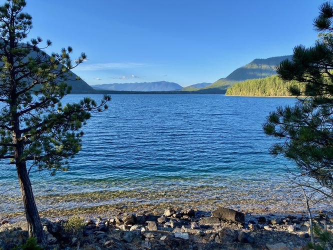
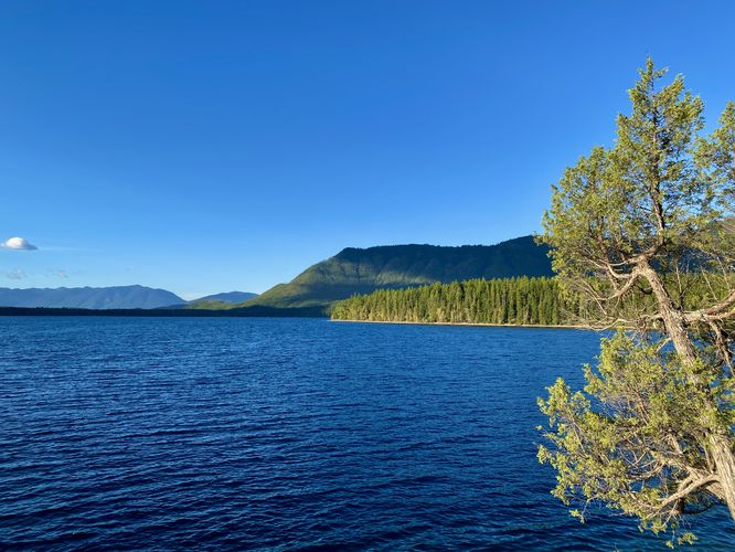
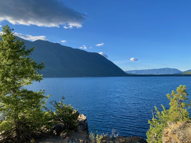
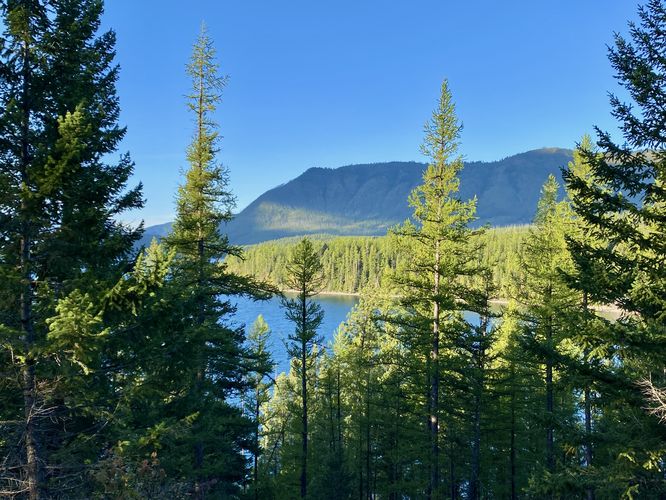
Hikers will reach a second trail junction, located around mile 0.52, where you'll find signs for the Rocky Point Nature Trail. Take this right-hand turn to hike the loop and to reach the views along Rocky Point. Around mile 0.7, you'll reach views of the Lake McDonald shore and the mountain ridges south of here that surround the Apgar Village region of the park. The views don't stop as you make your way around Rocky Point from mile 0.7 to 0.8. Most of the views are of Lake McDonald, Apgar ridge, Belton Hills, and the alpine mountains that tower over the lake to the northeast. The Rocky Point Nature Trail leads back uphill to reach another view of the water and the mountains that comprise the Apgar ridge, located around mile 0.88. The trail then leads back to the Lake McDonald Trail.Lake McDonald Trail and Blowdowns - Mile 1 to 1.25
This route only includes a very small portion of the Lake McDonald Trail beyond the Rocky Point Nature Trail and turns around just 0.3-miles from the junction. The reason for this was based on what I felt like were dangerous conditions -- to start, the forest was burnt within the last decade and left the forest with countless dead standing trees. Second, the wind was whipping strong that day and kept the dead standing trees swaying in the wind. And last, the trail was littered with blowdowns. After just 0.3-miles one-way, I had traversed over a dozen blowdowns that crossed the trail. My original goal was to hike most, if not all, of the Lake McDonald Trail that day, but after 0.3-miles I felt like it wasn't worth the effort or the risk. Due to this, I decided to turn back and cut my losses. As of September 2024, the Lake McDonald Trail could really use some on-going maintenance to ensure blowdowns are taken care of, but due to the countless dead standing, the park might have cut their own losses and don't often maintain the trail.Hiking Out - Mile 1.25 to 2.2
After exploring the blowdown-laden Lake McDonald Trail, I hiked back to parking by following the trail straight back, which also completed the "loop" of the Rocky Point Nature Trail. The hike back undulates its way and leads back uphill to parking for a short and somewhat-moderate 2.2-mile out-and-back hike.Vehicle Reservations
Depending on what time of year you visit, you may need to reserve a vehicle entrance pass to get into the park, in addition to a park entry fee (or annual National Parks pass). Before planning this hike, ensure you've checked the NPS website for when and where Glacier NP vehicle reservations are required.Parking
Visitors will find a medium-sized dirt parking lot on the west side of Inside North Fork Road at the coordinates provided. The lot can fit over a dozen vehicles as of September 2024.Pets
Dogs are not allowed on any trails at Glacier National Park.Warning
Grizzly bears: This trail is frequented often by grizzly bears, especially in late Summer and early Fall as they scrounge for 20 hours/day bulking for the winter. Always give wild animals plenty of space, including several hundred feet for grizzlies. It's best to bring bear spray on this hike as a last defense just in case a grizzly were to charge at you. Always make plenty of noise while hiking to alert animals to your presence long before you see them. It's also smart to hike with another person.Blowdowns: As of September 2024, this hike passes through a forest that was previously burned by wildfire, approximately 10-years prior (or less). Due to this, there are dead standing trees located to the east of Rocky Point and these countless dead trees line the trail. The trail is also littered with blowdown trees that cross the trail and force hikers to traverse over or under them. When the wind is whipping hard, it's not the smartest idea to hike through all of these dead standing especially in sections that slow the hiker down, like through all of the blowdowns that cross the trail. Not only does hit make the hike annoying beyond Rocky Point, but it can also be dangerous with all of these dead trees. Hike at your own risk.