Ralph's Majestic Vista Loop via the Allegheny Front Trail at
Moshannon State Forest near Port Matilda, Pennsylvania is a moderate 5.7-mile hike that features views of Pennsylvania's mountains from the Allegheny Front and includes campsites for backpacking.
Hiking Ralph's Majestic Vista Loop
This hike begins at the main parking lot for Ralph's Majestic Vista, located at the coordinates provided, along Underwood Road just south of the junction with North Run Road. Most day hikers, if short on time, will hike out to Ralph's Majestic Vista and Ralph's Pretty Good View as an out-and-back; however, there are several other vistas along the Allegheny Front that are worth exploring. Since we knew half of the hike might be less exciting, we decided to skip the views first to save them for later. This loop and the guide follow that same mindset, but you can hike it in the opposite order if you wish!
Hiking the High Plateau - Mile 0 to 2.85
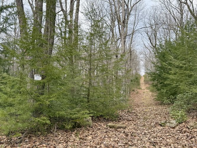
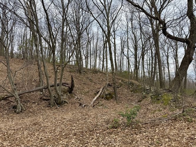
If you wish to save the views for last, then you'll want to start off by hiking north along Underwood Road. Take a left-hand turn onto North Run Road and follow that downhill until ~mile 0.4. Just beyond the private cabin is an unmarked trail that leads into the forest from North Run Road. Take this trail and follow it as it leads uphill into a high plateau. This plateau doesn't have much to offer but hikers will notice the mountain laurel, blueberry, and teaberry bushes that line the path. It has a similar vibe of high plateau West Virginia hikes, if you've ever been. Eventually the trail levels out before it drops down to reach Smays Trail. Keep right as it leads around the hill to reach the Stage Coach Trail, located at the junction with Underwood Road. From here, you'll pass an old quarry (it looks like a gutted hillside), around mile 2.1. After this, the Allegheny Front Trail passes through a young forest (recently logged) and continues out toward the Whetstone Run Overlook for your first vista along the hike.
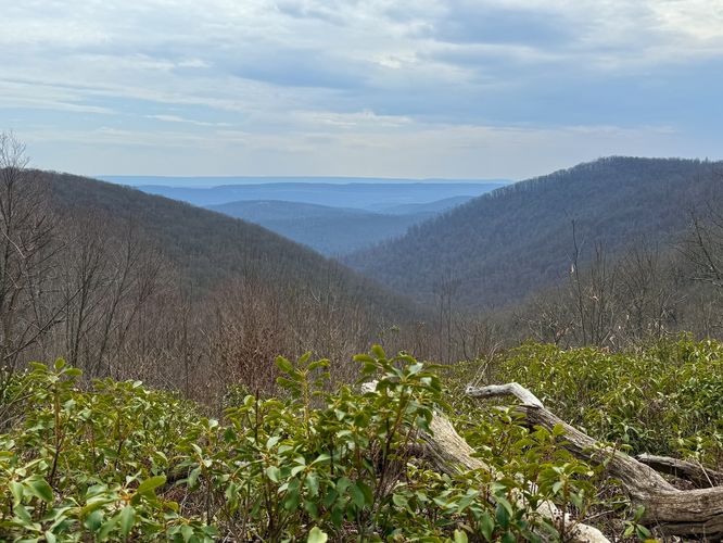
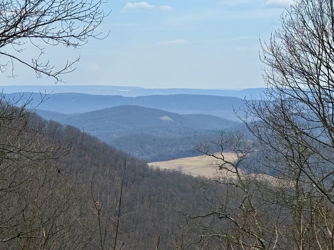
Whetstone Run Overlook - Mile 2.85
Before the trail drops down to the slopes of the Allegheny Front, hikers will be treated with a stunning view of central-Pennsylvania's rolling mountains, around mile 2.85, at the Whetstone Run Overlook. Being the first of several views along this hike, the Whetstone Run Overlook provides some of the best views (in my opinion), so take them in while you can.
Hiking the Allegheny Front - Mile 2.85 to 5.2
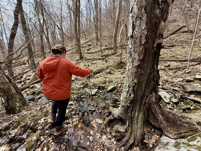
After passing the Whetstone Run Overlook, the Allegheny Front Trail leads down into Whetstone Run Hollow where you'll be delighted to find uneven rocks, fallen trees, and a creek that makes the uneven rocks slippery when wet. Arguably, this section of the trail is the most annoying. The AFT will eventually lead back uphill, but the trail substrate is essentially littered fist-sized rocks or larger rocks that are stuck in the ground. Truth be told, the AFT, as it traverses the front itself can be a pain to walk on. There is hope, however, as you'll pass several views along the way including Ralph's Pretty Good View and Ralph's Majestic Vista -- just keep hiking!
Whetstone Hollow Overlook - Mile 3.65
Once the AFT climbs out from the front's south-facing slopes, hikers will reach what I called the Whetstone Hollow Overlook around mile 3.65. This view can be easily missed if you're staring at your feet, but it's a nice place to take a break from the uphill climb while you take in views of more of Pennsylvania's rolling mountains.
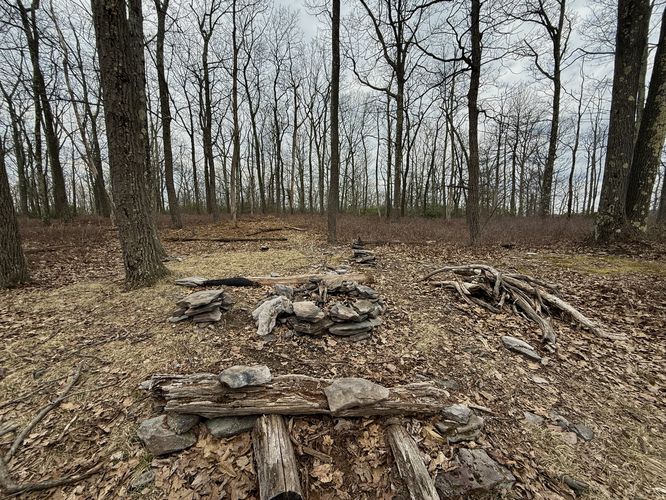
Campsite with a View - Mile 4.15
Further down the trail, around mile 4.15, sits a campsite with a view from the Allegheny Front. The view include farmlands in the valley below with, of course, more of Pennsylvania's rolling mountains in the distance. This campsite is a great spot to take a short break or setup camp if you plan on backpacking this loop.
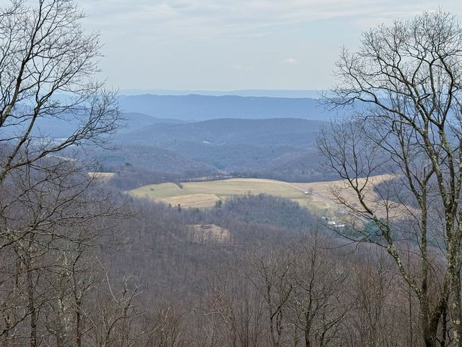
Ralph's Pretty Good View - Mile 4.9
The AFT continues heading south as it follows an annoying rocky path to reach Ralph's Pretty Good View, located at mile 4.9. Don't let the name fool you, as this view is by far the best of Ralph's named views along the front. From Ralph's Pretty Good View, you'll find sweeping views of the valley below and several mountain ranges that line the horizon. By far the best view along the loop, it's a great place to take a short break before you push onward to Ralph's Majestic Vista.
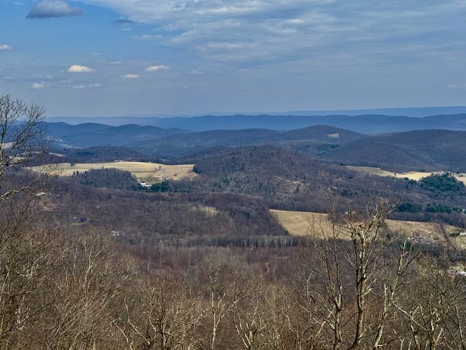
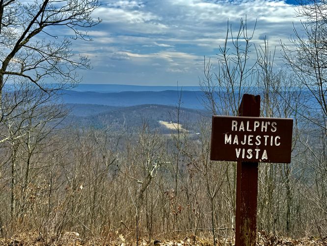
Ralph's Majestic Vista - Mile 5.15
The last view along this loop (or the first if you hike the opposite way) is Ralph's Majestic Vista. This view, in my opinion, was not as nice as the previous views along the hike. The name was likely intended to throw-off the general public so that Ralph could enjoy his "Pretty Good View" in peace and quiet. Regardless of the naming conventions, Ralph's Majestic View provides a head-on south-facing view of the mountain range located across the valley with at least one range poking up behind. Some valley views are included, but for the best views head over to Ralph's Pretty Good View instead.
Hiking to Parking - Mile 5.15 to 5.7
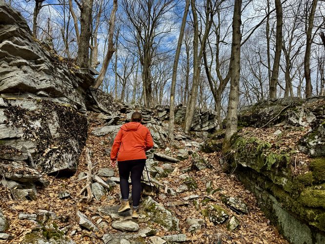
The last stretch of the hike is from Ralph's Majestic Vista to parking. This easy uphill with an easier downhill is met with an interesting rock outcropping where the Allegheny Front Trail leads through its center. Lots of moss-covered rocks here. Eventually the trail passes through mountain laurel and ends at the main parking lot for a 5.7-mile loop hike.
Parking
Hikers will find a small parking turnout at the coordinates provided along Underwood Road. The turnout is large enough to fit about 5 vehicles as of March 2025. Note that additional street parking is available, but do not block the forest road.
Camping & Backpacking
Please follow all state forest rules and regulations if you plan to backpack / disperse / primitive camp.
Warning
Timber Rattlesnakes: While rare to find, this area is home to the Timber Rattlesnake which could be out sunning itself or roaming the forest between the months of April through October. Be on the lookout and give any rattler you find plenty of space.


 PA Wilds