The Pilgrim Spring Trail at Cape Cod National Seashore in Truro, Massachusetts is a moderate 0.7-mile loop hike that leads to the first freshwater spring found by pilgrims and features views of the salt marshes and dunes.
Hike Description
This hike begins at the massive parking lot located at the end of Pilgrim Heights Road. Hikers can first stop at the gazebo that sits near the trailhead for a nice vista of the nearby marshes before hiking down the Pilgrim Spring Trail. Note that this trail has a lot of poison ivy off to the side during warm months, so stay on-trail.
Marsh and Dune Vista - Mile 0.24
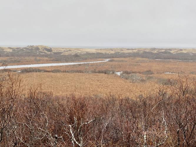
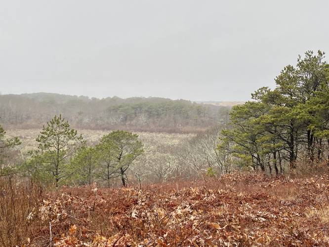
As you hike the Pilgrim Spring Trail it'll pass through a forested area before heading downhill, providing views of the saltwater marshes and dunes, located around mile 0.24.
Pilgrim Spring - Mile 0.38
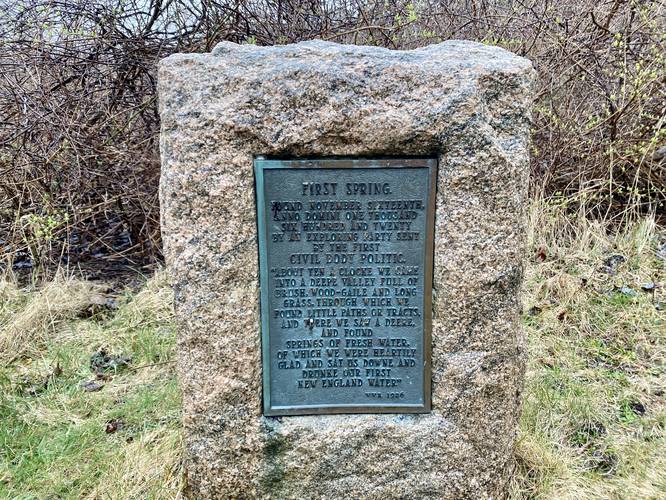
Just beyond the vista, after you hike downhill a bit further along a windy path, sits the Pilgrim Spring commemorative stone and plaque that marks the location of the first freshwater spring located by pilgrims in 1620. The plaque reads: "First Spring. Found November sixteenth anno domini one thousand sixhundred and twenty by an exploring party sent by the first Civil Body Politic. 'About ten a clocke we came into a deep valley full of brush, wood-gaile, and long grass, through which we found little paths or tracts, and there we saw a deere, and found springs of fresh water, of which we were heartily glad and sat us downe and drunke our first New England water. vvr 1926"
Hiking to Parking
After visiting the Pilgrim Spring, hikers can choose to explore the trail system here a bit further but if you're looking to head back to parking right away, you can take a right-hand turn at the Spring to head back uphill. This hill path leads directly to restrooms and the parking lot. Once at the parking lot, hike through the trail that bisects the lot to reach your vehicle.
Parking
Hikers will find a massive parking lot at the coordinates provided at the end of Pilgrim Heights Road. The lot is large enough to fit many dozen vehicles.
Pets
Dogs are not allowed on this trail.
Warnings
Poison Ivy: During warm months poison ivy is pretty bad off of this trail, according to official signage, so stay on-trail.
Hike Description
This hike begins at the massive parking lot located at the end of Pilgrim Heights Road. Hikers can first stop at the gazebo that sits near the trailhead for a nice vista of the nearby marshes before hiking down the Pilgrim Spring Trail. Note that this trail has a lot of poison ivy off to the side during warm months, so stay on-trail.
Marsh and Dune Vista - Mile 0.24
As you hike the Pilgrim Spring Trail it'll pass through a forested area before heading downhill, providing views of the saltwater marshes and dunes, located around mile 0.24.
Pilgrim Spring - Mile 0.38
Just beyond the vista, after you hike downhill a bit further along a windy path, sits the Pilgrim Spring commemorative stone and plaque that marks the location of the first freshwater spring located by pilgrims in 1620. The plaque reads: "First Spring. Found November sixteenth anno domini one thousand sixhundred and twenty by an exploring party sent by the first Civil Body Politic. 'About ten a clocke we came into a deep valley full of brush, wood-gaile, and long grass, through which we found little paths or tracts, and there we saw a deere, and found springs of fresh water, of which we were heartily glad and sat us downe and drunke our first New England water. vvr 1926"
Hiking to Parking
After visiting the Pilgrim Spring, hikers can choose to explore the trail system here a bit further but if you're looking to head back to parking right away, you can take a right-hand turn at the Spring to head back uphill. This hill path leads directly to restrooms and the parking lot. Once at the parking lot, hike through the trail that bisects the lot to reach your vehicle.
Parking
Hikers will find a massive parking lot at the coordinates provided at the end of Pilgrim Heights Road. The lot is large enough to fit many dozen vehicles.
Pets
Dogs are not allowed on this trail.
Warnings
Poison Ivy: During warm months poison ivy is pretty bad off of this trail, according to official signage, so stay on-trail.