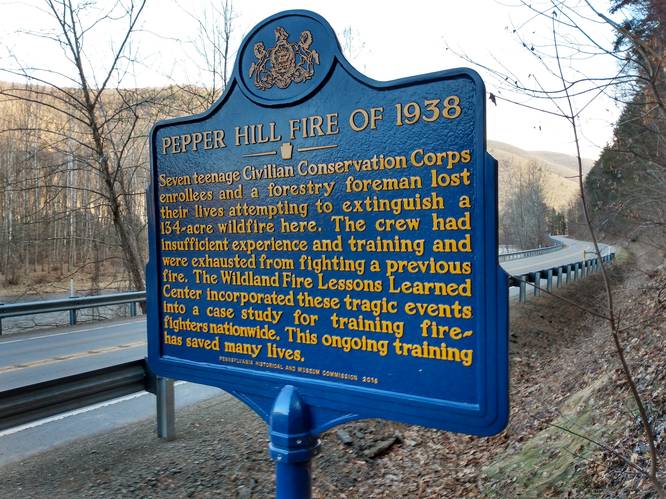
The Pepper Hill Trail at Elk State Forest near Sinnemahoning, Pennsylvania is a hard 6.4-mile hike that includes a historical point of interest. The Pepper Hill Fire transpired here in 1938. Tragically, seven Civilian Conservation Corps (CCC) teenaged youth and a Forest Service Leader lost their lives. A Survivor Rock where three CCC members took refuge lays high on the mountain, above the steep narrow hollow where the eight other CCC members perished.
Trails
This Pepper Hill Trail is an one-way 6.4 mile hike that starts along Ridge Road on the southeast side of the Squaretimber Wild Area, and follows the ridgeline for about 4 miles to the southeast to a switchback trail that descends a steep hillside to Pepperhill Run. Pepper Hill Trail then follows Peppermill Run that flows to the First Fork Sinnemahoning Creek running along State Route 872. There is a short (one-quarter mile) spur trail at the top of the switchbacks that leads to the Survivor Rock.
Hike Description
This hike did not follow the entire trail. Instead, this out-and-back trek begins along State Route 872 - just south of where Pepperhhill Run flows into the First Fork Sinnemahoning Creek and climbs to the Pepper Hill Fire Survivor Rock, or to about the to half-way point of the entire trail and then returns back to the starting point.
For this hike, the hikers will need to walk northeast along the creek side of State Route 872 for about 0.3-miles to reach the Pepper Hill Trail trailhead. Hikers will note the Pennsylvania State Historical Marker for the Pepper Hill Fire of 1938 at the trailhead near the mouth of Peppermill Run. Before being able to access the trail, the hiker must cross of the highway, and climb over the guardrail on the west-side of the highway. At this point, the hiker must then scramble climb a steep embankment for about 30 feet, to get to the level ground on top of the embankment, which was once the old highway grade, and now is called Pepper Hill Road (a private and gated road). From here, the Pepper Hill trail starts up and over and through the small private land corridor that is blazed-yellow in the northwest direction. Within less than one-quarter of a mile, the trail continues on a firm and wide, easy-walking treadway to the northwest on state forest land.
Lower Pepper Hill Trail
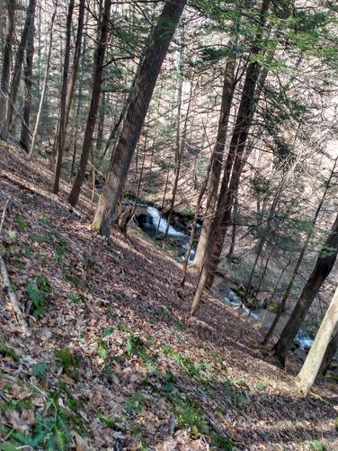
The trail continues on an easy-walking treadway to the northwest through state forest land for about 1.0 mile. This portion of the hike is a up-valley slope journey through an impressive stand of old-growth oak along Pepperhill Run. The hiker follows the yellow blazes. At least two creek crossings are need along this section of trail.
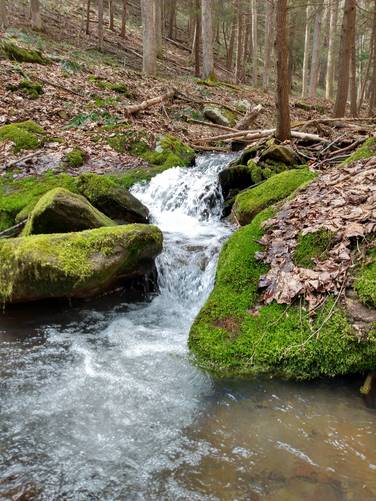
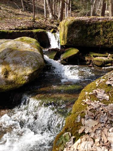
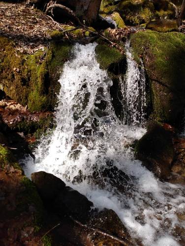
Interesting sights observed included several cascading small water falls (spring time), a huge Wild Grape Vine, and Elk Scat (looks like extra-large black jelly beans). These small cascades add scenery to this hike. At about 1 mile, on this section, the hiker will note that the trail crosses the creek and turns to the northeast, to start the switchback climb (just before the pipeline).
On this hike, the hiker continued northwest out onto the pipeline to observe the vistas looking north and south, and into the large boulder field off-trail and just beyond the pipeline. (Just a small distance).
Rule of thumb: if you've hit the pipeline before reaching the switchback portion of the Pepper Hill Trail, you need to hike back to find the junction.
Switchbacks on the Pepper Hill Trail
The true character of the Pepper Hill Trail and the need to exercise caution on the trails, especially if they still had any snow or ice left on them, comes to bear on this section of the trail. Here the relative steepness of the terrain, the narrow trail tread and numerous switchbacks, and the need to exercise caution comes into focus. On the upper section of the switchbacks, which had the most steepness terrain and narrowness of trail tread, this hiker had a profound sense of the height to the point of being a little phobia on the top switchback that seemed to hang on the edge of a face cliff.
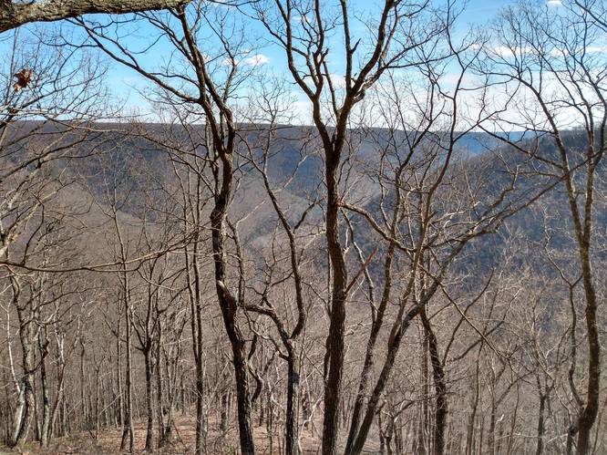
Obstructed seasonal vistas: around mile 2.75 is an area where the trail switches back around a mountainside, giving hikers a seasonal vista of the surrounding mountains. Doing the hike, during early spring or late fall, gave this view.
Dangerously steep terrain: There was no snow or ice on the trail for this hike, but a thick carpet of leaves and some loose stones lay on the pathway, which can make for slippery footing on the steep terrain never the less.
Evidence of More Recent Wildfires: Along the way to the Survivor Rock Trail, the hiker found several trees and stumps that had burn marks on them. One such notable stump is located along the trail at the mile 3.0 mark.
The hiker also noticed that during the dry season of late spring and fall, when there exists a thick layer of dried leaves on the forest floor and on a windy day, the conditions are set for the potential of a major wildfire to occur. The only missing component on days like these, is a fire ignition source. Be that done, by careless actor with a campfire spark or by discarding a lite cigar or cigarette butt, a wildfire can and sadly does occur. The steep terrain in the narrow hollows on the mountain sides combined with the forceful updraft wind then act as a chimney to accelerate the speed of the wildfire spread creating very hazardous conditions for anyone having to battle the wildland blaze.
The important message to hikers and campers: Don't let this happen. Don't be careless with fire. Follow the fire safety rules at all times.
Survivor Rock Spur Trail
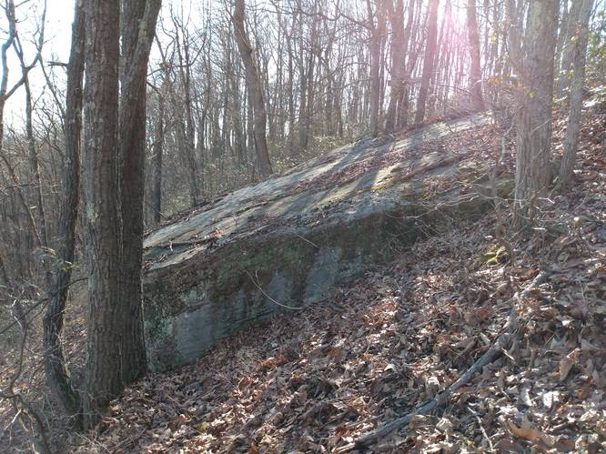
Around mile 3.2, hikers will note the Survivor Rock Tr. sign for spur trail (blazed yellow) at the top of the switchback that leads the Survivor Rock. This track cuts through the woods for one-quarter-of-a-mile from the Pepper Hill Trail to the Survivor Rock.
No words can describe the emotion that one feels when on this portion of hike. Remember that this area is where people tragically lost their lives back in 1938.
Parking
Hikers will find a large parking turnout along the highway by the coordinates provided. The turnout is large enough for about 2 or 3 vehicles at most without blocking the private driveway to the seasonal camps that are on the west bank of the First Fork Sinnemahoning Creek . Do not block the driveway.
Pets
These trails are not dog-friendly. Mainly, because dogs can be a distraction on the hike and the hike is hard, and the need for much carefulness applied, especially on the switchback portion and along the state highway.
Biking and Horses
Neither Biking or horseback riding is allowed on Hiking Only trails.
Camping and Backpacking
Although camping is allowed along trails in the Elk State Forest, PA where state forest rules permit backcountry / dispersed / primitive camping. This marked trail is not suitable for Camping and Backpacking. The Bucktail Path Trail is by far the best place to camp in this area; and it would be best for the camper to park at another designation parking area for any extended hikes or overnight camping trips
Private Land
This trail crosses some private land to connect to the state forest. Please respect the land owners and stay on the trail at all times.
History and Historical Points of Interest
The DCNR map for Pepper Hill Trail shows a parking area on SR 872 at the trailhead on where Pepperhhill Run flows into the First Fork Sinnemahoning Creek. The hiker was not able to find this. So, the hiker went to the Sinnemahoning Wildlife Center to ask for instructions to get to the trail.
Turns out that that parking area, had been removed by highway department. A very knowledgeable Forest Program Specialist provided information to understand where to park and where the Pepper Hill trail started, and how to hike through the small private corridor. The Forest Program Specialist also provide additional details about character of the Pepper Hill Trail and recommended exercising caution on the trails given the relative steepness of the terrain, the narrow trail tread and numerous switchbacks. After the hike, the hiker had post-hike correspondence with the Forest Program Specialist, and mentioned that my hike had successfully reached the Survivor Rock on the Pepper Hill Trail on that day. The Forest Program Specialist, replied a thoughtful message back:
"I’m also glad that you were able to safely hike up to see Survivor’s Rock where some wildland firefighters climbed onto the rock to escape sure fatality from the wildfire that was at their heels. It is not hard to imagine given the terrain, why others could not outrun the fire and where in the same area there was a tragic loss of life for several CCC “boys” and a member of our Dept. staff, while battling a wildfire on the sidehill and in a slot canyon there in 1938.
It was truly a tragedy, but as with most wildfire fatalities there were errors made and lessons learned from those errors that still serve as a case study today. The lessons from this site and other tragic wildfires at other sites throughout the country are incorporated into some of the standard watch out situations and fire orders that are still taught to keep wildland fire fighters safe to this day."
The Wayside Memorial Picnic Area honors the CCC youth and Forest Service Leader who lost their lives in the Pepper Hill Fire of 1938. A memorial plaque and waterfall stone structure is viewable from the roadside parking along State Route 120 about 3 miles south of the town of Emporium in Cameron County, Pennsylvania.