The Pass Lake Trail at White River National Forest
near Keystone, Colorado is an easy 0.1-mile out-and-back trail that runs along the shoreline of the high altitude lake known as Pass Lake and features sweeping mountain views, located within Loveland Pass.
Hike
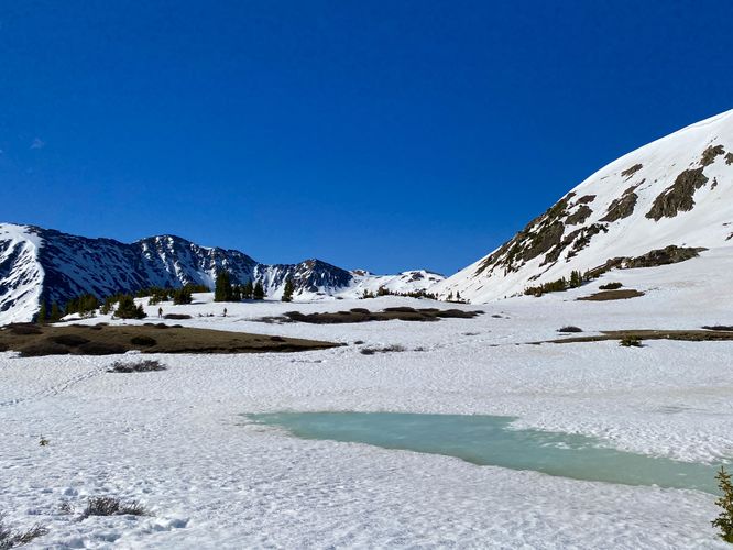
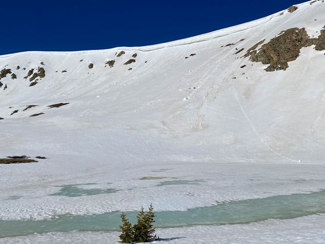
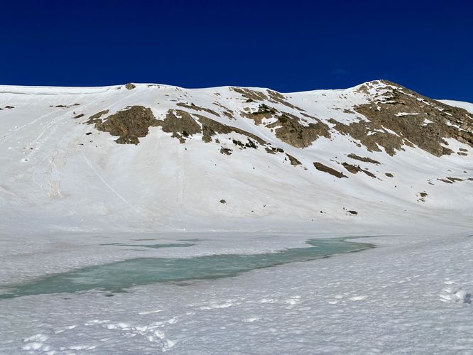
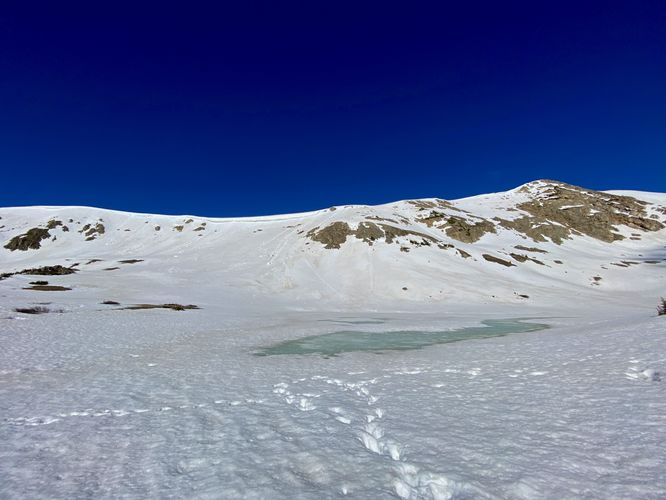
This very short hike begins at the main parking lot for Pass Lake and follows the trail as it runs along the eastern side of Pass Lake. During our hike here in early June 2024, there was still ~3-feet of snowpack on the ground which made traversing the trail fairly difficult. Lots of postholing even for this very short 0.1-mile out-and-back hike. I decided I wanted to reach the southern shore of Pass Lake despite the snow, but was met with 3-foot deep postholing into a very-wet outflow creek located in the middle of Pass Lake's eastern edge. Despite having one hiker cruise through this terrain before me, I decided I didn't need to get my feet freezing wet to see the same view and to tack on ~0.1 more miles to this route, so I turned around. For hikers visiting during the Summer, Pass Lake provides stunning views without so much snowpack. This hike was interesting though, we got to see late Spring snowpack along with slumping snow cliffs that clung onto the mountain's ridges around Loveland Pass. Quite the sight to see for out-of-state visitors.
Parking
Hikers will find a small parking lot at the coordinates provided, located along the west side of US-6. The lot is large enough to fit less than a dozen vehicles as of June 2024.
Pets
Dogs are allowed if leashed and should be cleaned up after.
Warning
Elevation sickness: This trail sits at about 11,900 feet above sea level. Around the 7,000-foot mark above sea level, hikers may start to experience symptoms of elevation sickness including headache, muscle aches, shortness of breath, among other warning signs. In order to avoid elevation sickness it's recommended to ascend to higher elevations and take short walks to acclimate over the course of several days before taking a long or physically-demanding hike. At any time you feel elevation sickness kicking in, that's the time to turn back and head for lower altitude.
Hike
This very short hike begins at the main parking lot for Pass Lake and follows the trail as it runs along the eastern side of Pass Lake. During our hike here in early June 2024, there was still ~3-feet of snowpack on the ground which made traversing the trail fairly difficult. Lots of postholing even for this very short 0.1-mile out-and-back hike. I decided I wanted to reach the southern shore of Pass Lake despite the snow, but was met with 3-foot deep postholing into a very-wet outflow creek located in the middle of Pass Lake's eastern edge. Despite having one hiker cruise through this terrain before me, I decided I didn't need to get my feet freezing wet to see the same view and to tack on ~0.1 more miles to this route, so I turned around. For hikers visiting during the Summer, Pass Lake provides stunning views without so much snowpack. This hike was interesting though, we got to see late Spring snowpack along with slumping snow cliffs that clung onto the mountain's ridges around Loveland Pass. Quite the sight to see for out-of-state visitors.
Parking
Hikers will find a small parking lot at the coordinates provided, located along the west side of US-6. The lot is large enough to fit less than a dozen vehicles as of June 2024.
Pets
Dogs are allowed if leashed and should be cleaned up after.
Warning
Elevation sickness: This trail sits at about 11,900 feet above sea level. Around the 7,000-foot mark above sea level, hikers may start to experience symptoms of elevation sickness including headache, muscle aches, shortness of breath, among other warning signs. In order to avoid elevation sickness it's recommended to ascend to higher elevations and take short walks to acclimate over the course of several days before taking a long or physically-demanding hike. At any time you feel elevation sickness kicking in, that's the time to turn back and head for lower altitude.