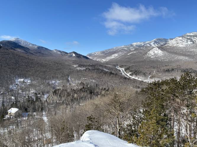
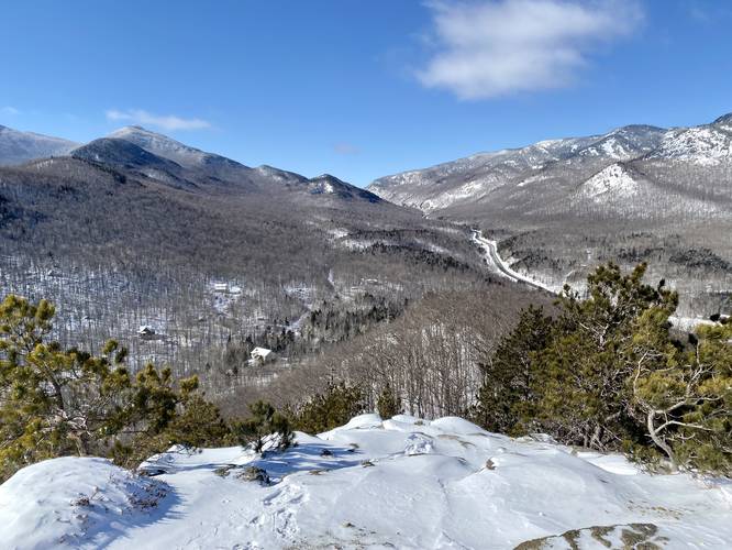
The Owls Head Trail at Adirondack Park in Keene, New York is a difficult weekday-only 1.2-mile out-and-back trail that leads to the summit of a small mountain named Owls Head. The hike features panoramic views that peer into the High Peaks Wilderness including stunning views of Cascade Mountain, Porter Mountain, and Pitchoff Mountain, but also requires rock scrambles to reach the top - some of which are moderately-dangerous.
Hours (Must Read)
This trail is only open Monday - Friday from 7AM - 4PM and the trail exists on private property for ~90% of the trail. This trail is closed on weekends. Parking can be found near but not at the trailhead. Please park on the road as the trailhead sits on a private driveway.
Parking
Hikers can park along Owls Head Lane without blocking traffic near the trailhead, but do not park in the private driveway or block the driveway. If somehow parking is full, please find another hike to reduce issues here so that hikers can continue enjoying Owls Head for years to come. Again, this trail is closed on weekends.
Difficulty and Rock Scrambles
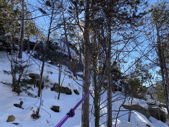
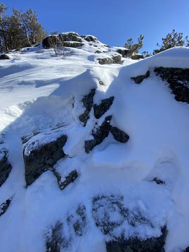
This trail should be considered moderate to difficult (hard) because of the rock scrambles along the way. The most dangerous of the rock scrambles exists at the last ~30-feet of the trail, where it follows several 4-foot tall steep rock faces before wrapping around a very steep slope to reach the top. These 4-foot tall rock scrambles are not difficult, but the dangerous part is the steep slope that shoots down the mountain below these scrambles - especially where the trail begins to turn around this rock face where it follows a very steep grade. During the winter, this precarious surface does not make it easy or smart to summit Owls Head - hence, this GPS recording ends just below the summit because I turned around there during a winter ascent.
Hike Description
This trail begins along a private driveway located just off of Owls Head Lane in Keene, NY. There's plenty of signage for the trail - including information about this tract of private land. Please respect the land owners and use this trail for foot traffic only. The trail immediately heads uphill and this does not stop until you reach the first rock scramble, located approximately halfway up the mountain.
First Rock Scramble - Mile 0.27
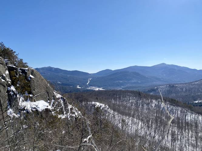
Around mile 0.27, hikers will reach the first rock scramble. This steep scramble is about 10 to 15-feet high with several very steep sections of terrain. Hikers will make their way up some large boulders before using trees to aid in climbing up and over the rock ledge. During the winter, this is where most people turn back (from what it looked like), as it's very difficult to find proper footing here. The steep slopes build-up a lot of snow, causing your snowshoes to slide and sink - making for dangerous conditions if the snow breaks away. Regardless, once the hiker makes it above this first scramble, they're presented with an awesome view of Cascade Mountain, Pitchoff Mountain, and NY-73 cutting between the two.
Second Rock Scramble - Mile 0.44
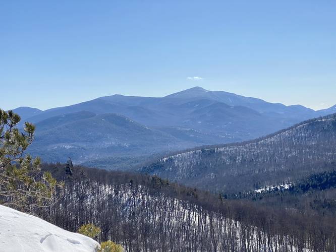
After passing the first 15-foot rock scramble, hikers will follow a small "bench" in the mountain where the elevation grade is fairly gradual before approaching the second rocky climb. The second rock scramble is not very difficult as you can walk up along the left-hand side before using some 2.5-foot tall boulders to climb up the rest of the way. During the winter, this section can be a bit tricky since you can't see your footing, so bring waterproof gloves to aid in clearing away the snow. After climbing this second rock outcropping, hikers are presented with yet another stunning view of the surrounding mountains - this time, it's approximately 180-degrees of views!
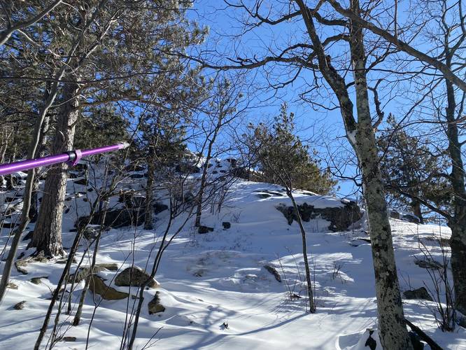
Summit Rock Scramble - Mile 0.6
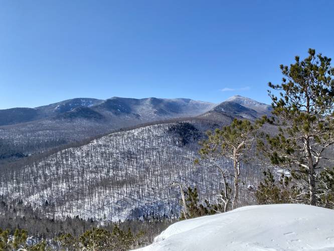
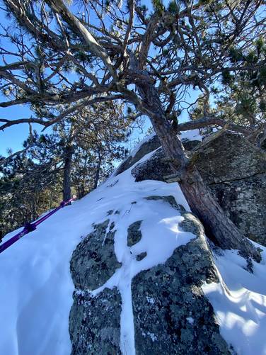
After the second rocky outcrop climb, hikers then make their way uphill before following another bench in the mountain. At the end of the flatter grade is a very large rock - approximately 30-feet tall that must be climbed to reach the actual summit, around mile 0.6. Here, the only way up is by heading to the left-hand side of this massive rock to find a precarious rocky slope. This rocky slope is comprised of (3) 4-foot tall ledges with their own steep slopes. Once the hiker hops on the first ledge, they'll notice the vista facing north toward Sentinel Mountain, but will also note the very steep drop-off that slopes further down the mountain. Each ledge, note there are 3 of them, have their own flat surface; however, a tumble from high up could result in a person falling very far down this rocky mountain ledge - possibly to their death. Here, I decided to climb to the first ledge, then the 2nd ledge. I then used the large tree to climb onto the 3rd ledge. From here, I was able to see the very very steep slope of the trail as it wrapped around this rock ledge to reach the summit - approximately 20-30 feet of hiking at best - and then I gave up. There's yet another rocky slope that can be climbed to reach the summit located to the right-hand side of where the trail follows - bypassing the trail's wrap-around, but a fall off of this bypass rock could easily send the hiker falling to their death faster than following the rock wrap-around. During the winter, it's much easier to slip on these rocks even with using crampons or snowshoes, so I decided to turn back here on this winter ascent!
Hiking Out
On the way out, do not forget to take more photos as this hike has plenty of vista opportunities without actually summitting Owls Head. Take your time on each of the rock scrambles to ensure proper footing.
Pets
Dogs are allowed if leashed and their waste must be carried out by the hiker. Please note the rock scrambles though - it's probably best that you do not plan to bring your dog beyond the mid-way rock scramble as this may be dangerous for dogs climbing up or down.
Hours (Must Read)
This trail is only open Monday - Friday from 7AM - 4PM and the trail exists on private property for ~90% of the trail. This trail is closed on weekends. Parking can be found near but not at the trailhead. Please park on the road as the trailhead sits on a private driveway.
Parking
Hikers can park along Owls Head Lane without blocking traffic near the trailhead, but do not park in the private driveway or block the driveway. If somehow parking is full, please find another hike to reduce issues here so that hikers can continue enjoying Owls Head for years to come. Again, this trail is closed on weekends.
Difficulty and Rock Scrambles
This trail should be considered moderate to difficult (hard) because of the rock scrambles along the way. The most dangerous of the rock scrambles exists at the last ~30-feet of the trail, where it follows several 4-foot tall steep rock faces before wrapping around a very steep slope to reach the top. These 4-foot tall rock scrambles are not difficult, but the dangerous part is the steep slope that shoots down the mountain below these scrambles - especially where the trail begins to turn around this rock face where it follows a very steep grade. During the winter, this precarious surface does not make it easy or smart to summit Owls Head - hence, this GPS recording ends just below the summit because I turned around there during a winter ascent.
Hike Description
This trail begins along a private driveway located just off of Owls Head Lane in Keene, NY. There's plenty of signage for the trail - including information about this tract of private land. Please respect the land owners and use this trail for foot traffic only. The trail immediately heads uphill and this does not stop until you reach the first rock scramble, located approximately halfway up the mountain.
First Rock Scramble - Mile 0.27
Around mile 0.27, hikers will reach the first rock scramble. This steep scramble is about 10 to 15-feet high with several very steep sections of terrain. Hikers will make their way up some large boulders before using trees to aid in climbing up and over the rock ledge. During the winter, this is where most people turn back (from what it looked like), as it's very difficult to find proper footing here. The steep slopes build-up a lot of snow, causing your snowshoes to slide and sink - making for dangerous conditions if the snow breaks away. Regardless, once the hiker makes it above this first scramble, they're presented with an awesome view of Cascade Mountain, Pitchoff Mountain, and NY-73 cutting between the two.
Second Rock Scramble - Mile 0.44
After passing the first 15-foot rock scramble, hikers will follow a small "bench" in the mountain where the elevation grade is fairly gradual before approaching the second rocky climb. The second rock scramble is not very difficult as you can walk up along the left-hand side before using some 2.5-foot tall boulders to climb up the rest of the way. During the winter, this section can be a bit tricky since you can't see your footing, so bring waterproof gloves to aid in clearing away the snow. After climbing this second rock outcropping, hikers are presented with yet another stunning view of the surrounding mountains - this time, it's approximately 180-degrees of views!
Summit Rock Scramble - Mile 0.6
After the second rocky outcrop climb, hikers then make their way uphill before following another bench in the mountain. At the end of the flatter grade is a very large rock - approximately 30-feet tall that must be climbed to reach the actual summit, around mile 0.6. Here, the only way up is by heading to the left-hand side of this massive rock to find a precarious rocky slope. This rocky slope is comprised of (3) 4-foot tall ledges with their own steep slopes. Once the hiker hops on the first ledge, they'll notice the vista facing north toward Sentinel Mountain, but will also note the very steep drop-off that slopes further down the mountain. Each ledge, note there are 3 of them, have their own flat surface; however, a tumble from high up could result in a person falling very far down this rocky mountain ledge - possibly to their death. Here, I decided to climb to the first ledge, then the 2nd ledge. I then used the large tree to climb onto the 3rd ledge. From here, I was able to see the very very steep slope of the trail as it wrapped around this rock ledge to reach the summit - approximately 20-30 feet of hiking at best - and then I gave up. There's yet another rocky slope that can be climbed to reach the summit located to the right-hand side of where the trail follows - bypassing the trail's wrap-around, but a fall off of this bypass rock could easily send the hiker falling to their death faster than following the rock wrap-around. During the winter, it's much easier to slip on these rocks even with using crampons or snowshoes, so I decided to turn back here on this winter ascent!
Hiking Out
On the way out, do not forget to take more photos as this hike has plenty of vista opportunities without actually summitting Owls Head. Take your time on each of the rock scrambles to ensure proper footing.
Pets
Dogs are allowed if leashed and their waste must be carried out by the hiker. Please note the rock scrambles though - it's probably best that you do not plan to bring your dog beyond the mid-way rock scramble as this may be dangerous for dogs climbing up or down.