The Old Cove Landing Trail at Wilder Ranch State Park near Santa Cruz, California is an easy 2.5-mile loop trail that features stunning views of California's rock ledge coastline and includes an abundance of wildflowers during late Spring.
Trails
This hike follows one named trail - Old Cove Landing Trail.
Hike Description
This trail begins at the main parking lot for Wilder Ranch State Park and, this recording, heads in a clockwise direction. Along the way, hikers will get beautiful views of the hills to the north, yellow wildflowers in the Spring, and eventually the ocean will come into view.
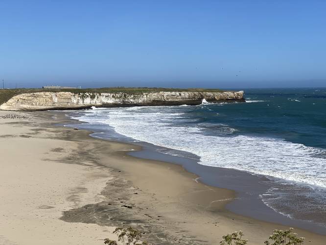
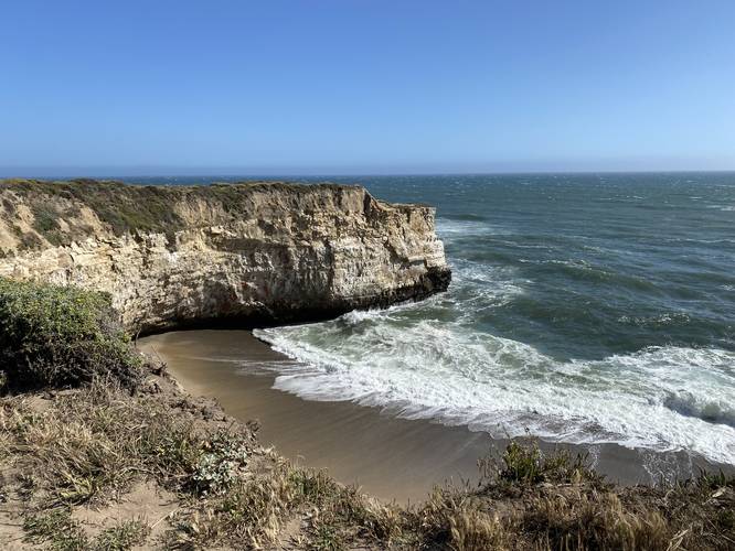
Wilder Beach Vista - Mile 0.7
Around mile 0.7, hikers will reach a view of the Wilder Beach Natural Preserve, which is closed-off to public access. The vantage point from the trail givers hikers a view that peers directly onto the beach, including the rocky cliff ledges where waves constantly crash over.
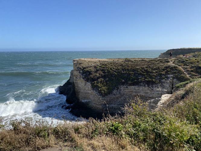
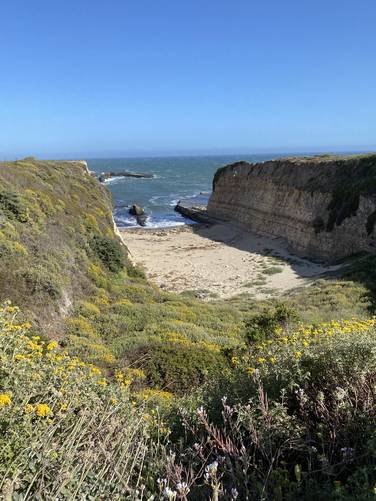
Sea Cliff Peninsula - Mile 0.8
Just after passing the Wilder Beach Vista, hikers will get an even better view of Wilder Beach if they follow the skinny trail as it heads out onto a cliff peninsula. This is probably the best view along the entire hike, but the views don't end here.
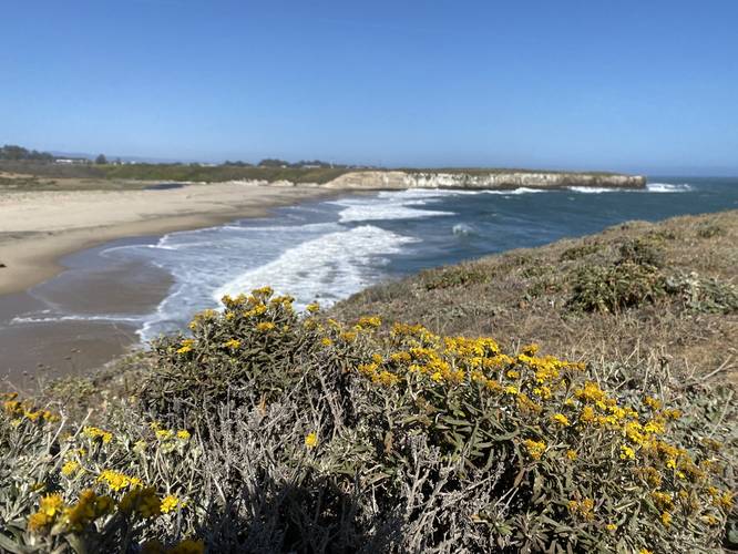
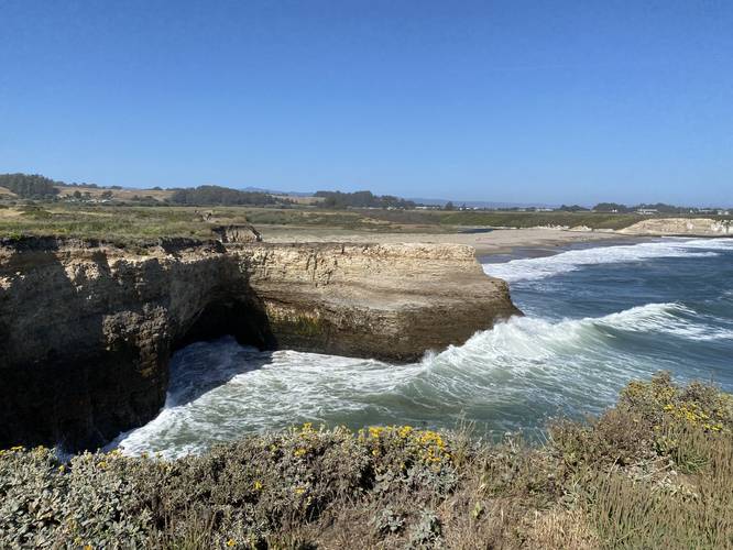
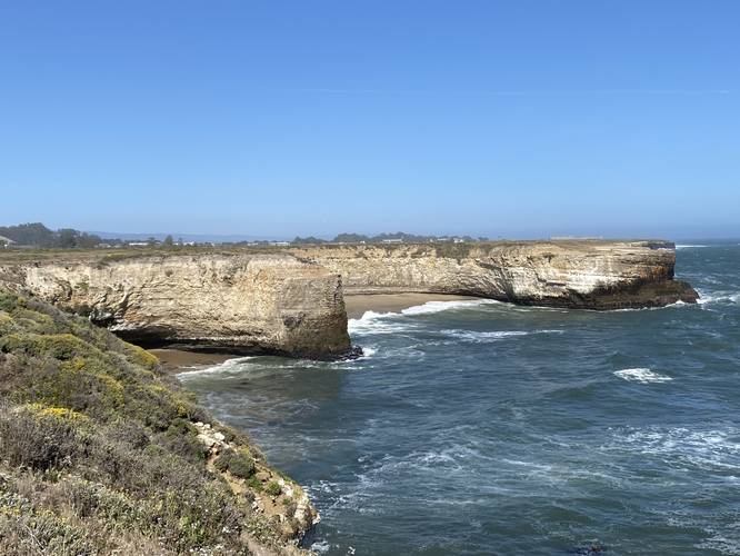
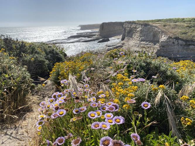
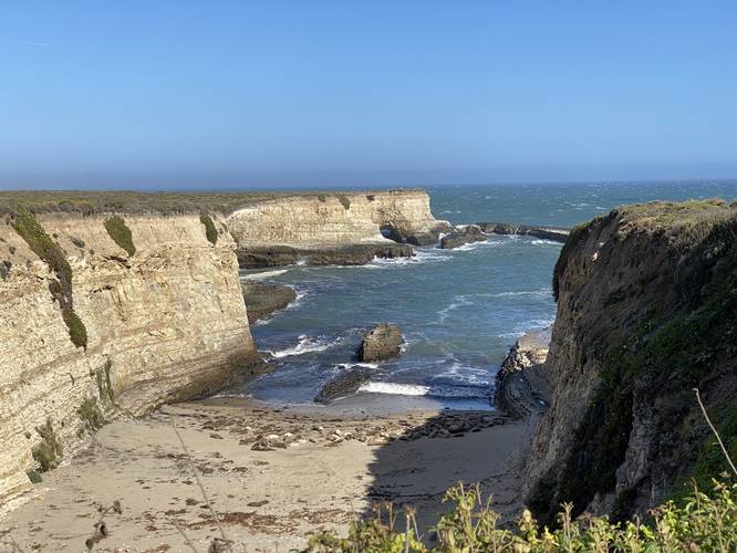
More Sea Cliff Views - Mile 0.9 to 1.9
Between miles 1 to 1.9, hikers will find an abundance of both sea cliff and ocean views and wildflowers along the trail. During late Spring, it felt like most of the wildflowers just didn't stop; however, the wind also felt similarly. The last of the views (which I forgot to photograph) was Sand Plant Beach around mile 1.9 - here, the wind was one of the worst spots.
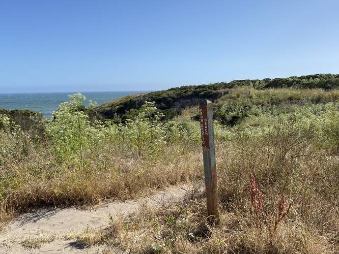
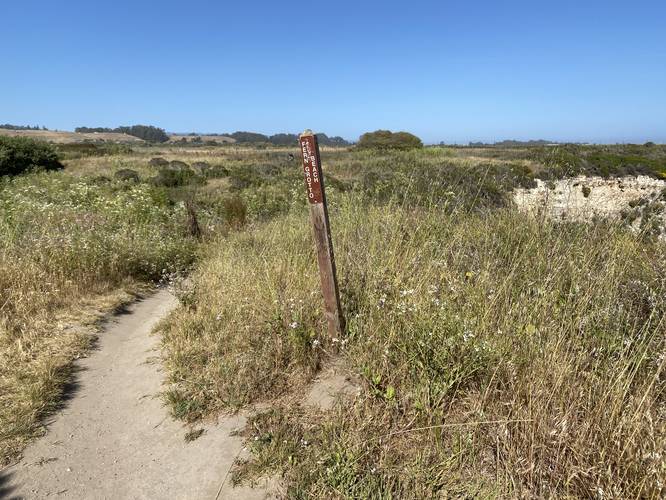
Fern Grotto Beach Access - Mile 1.5 & Mile 1.6
At mile 1.5 and mile 1.6 are two trailheads to access Fern Grotto Beach which is just below this trail.
Road Hike, Railroad Crossing, back to Parking - Mile 1.9 to 2.3
Between miles 1.9 to 2.3, hikers will no longer be hiking along the wind coastline and will instead follow a fairly boring (minus the wildflowers) trail as it makes its way up a road, passing an old railroad crossing, before taking a right-hand turn. At that right-hand turn, the trail heads straight back to the parking lot.
Parking & Fees
Hikers will find a large parking lot at the coordinates provided. As of May 2022, there's a $10 fee to enter the park with a vehicle. Alternatively, it seems folks will park along CA-1 and walk into the park instead, bypassing the park's $10 fee.
Warnings
Excessive wind: This trail follows a coastline that receives a lot of constant strong wind. During this hike, the wind was at least 20mph along the sea cliffs, if not a more during some strong gusts.
Rattlesnakes: This area may have rattlesnakes, though are a bit more rare closer to the ocean than uphill on the opposite side of CA-1.
Mountain Lion: This area is known to have mountain lion - it's best to not hike alone and bring a friend when hiking in areas with known mountain lion populations.
Trails
This hike follows one named trail - Old Cove Landing Trail.
Hike Description
This trail begins at the main parking lot for Wilder Ranch State Park and, this recording, heads in a clockwise direction. Along the way, hikers will get beautiful views of the hills to the north, yellow wildflowers in the Spring, and eventually the ocean will come into view.
Wilder Beach Vista - Mile 0.7
Around mile 0.7, hikers will reach a view of the Wilder Beach Natural Preserve, which is closed-off to public access. The vantage point from the trail givers hikers a view that peers directly onto the beach, including the rocky cliff ledges where waves constantly crash over.
Sea Cliff Peninsula - Mile 0.8
Just after passing the Wilder Beach Vista, hikers will get an even better view of Wilder Beach if they follow the skinny trail as it heads out onto a cliff peninsula. This is probably the best view along the entire hike, but the views don't end here.
More Sea Cliff Views - Mile 0.9 to 1.9
Between miles 1 to 1.9, hikers will find an abundance of both sea cliff and ocean views and wildflowers along the trail. During late Spring, it felt like most of the wildflowers just didn't stop; however, the wind also felt similarly. The last of the views (which I forgot to photograph) was Sand Plant Beach around mile 1.9 - here, the wind was one of the worst spots.
Fern Grotto Beach Access - Mile 1.5 & Mile 1.6
At mile 1.5 and mile 1.6 are two trailheads to access Fern Grotto Beach which is just below this trail.
Road Hike, Railroad Crossing, back to Parking - Mile 1.9 to 2.3
Between miles 1.9 to 2.3, hikers will no longer be hiking along the wind coastline and will instead follow a fairly boring (minus the wildflowers) trail as it makes its way up a road, passing an old railroad crossing, before taking a right-hand turn. At that right-hand turn, the trail heads straight back to the parking lot.
Parking & Fees
Hikers will find a large parking lot at the coordinates provided. As of May 2022, there's a $10 fee to enter the park with a vehicle. Alternatively, it seems folks will park along CA-1 and walk into the park instead, bypassing the park's $10 fee.
Warnings
Excessive wind: This trail follows a coastline that receives a lot of constant strong wind. During this hike, the wind was at least 20mph along the sea cliffs, if not a more during some strong gusts.
Rattlesnakes: This area may have rattlesnakes, though are a bit more rare closer to the ocean than uphill on the opposite side of CA-1.
Mountain Lion: This area is known to have mountain lion - it's best to not hike alone and bring a friend when hiking in areas with known mountain lion populations.