Trail name(s): Oak Ridge Interpretive Trail, Turtleback Mountain Trail
Location: Ossipee Park Road, Moultonborough NH
Permitted uses: Hiking, Nature Study, low impact activities such as snowshoeing and cross country skiing
Prohibited uses: No Bikes, No Camping or overnight use, No fires. No motorized vehicles
Hours: Open during daylight hours.
Fees and Parking: There is no fee to park or to use the trails. There is an enormous amount of parking at the Castle in the Clouds Conservation area
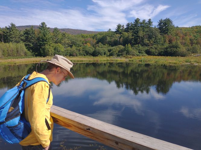
Pets: Dogs are allowed on the trails and owners are expected to clean up after them and to keep them leashed. Dog waste bags are provided as well as a trash receptacle for dog waste near the Shannon Pond road entrance.
Accessibility: This hike is not wheelchair accessible.
Hiker amenities: There is an information kiosk for Shannon Pond and the Oak Ridge Interpretive Trails information is posted on the right hand side of the Kiosk. There is a trash bin near Shannon Pond at the entrance to Shannon Pond road that leads hikers to the information kiosk. However, hikers are asked to carry out all trash. There are no restrooms. There are picnic tables near the trailhead parking area.
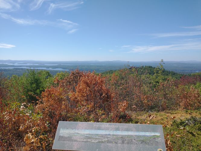
Length and Trail information: The trail is approximately 2.3 miles long, hiked as a loop and is considered easy. Our goal for this hike was to stop at each of the 18 “stations” that have been installed along this interpretive trail, get some exercise, have some fun and learn about the history, biology and ecology of this area. We also planned to stop at station #13, The Lookout, and take in the views of Moultonborough Bay, Lake Winnipesaukee and have a picnic lunch.
There's no need for a guide, the information plaques are well maintained and easy to find and read, but one is available for purchase at the Castle in the Clouds gift shop or online by going to the Lakes Region Conservation Trust website (www.lrct.org).
The trail begins at the Information kiosk for Shannon Pond with the first station being posted directly on the kiosk. Hikers will need to hike along the Turtleback Mountain trail, which is blazed in yellow. At the junction of Oak Ridge Trail, hikers will veer to the left and begin a gentle ascent as they follow the Oak Ridge Trail that is blazed in Blue. In addition to the blue blaze, hikers will see a small square green marker with a picture of an acorn on it that identifies the interpretive trail. The trail is very well marked, and very well maintained. It is also very well traveled, so there is little chance of getting lost or going off trail. The substrate for the most part is similar to walking on a class 6 road. The ascent is steady but not too steep and has switchback to make the ascent even easier. There are several stations to stop at as you ascend, and that also makes the climb feel a lot easier.
The elevation gain from this hike is not that dramatic, so we were very surprised at how nice the views were when we reached the Lookout. The foliage was just beginning to show fall color and the smoke that was present earlier in the year from the Canada wildfires were no longer there or obscuring the view. At the lookout there is a panoramic plaque installed that identifies the bodies of water and the mountains that can be seen in the distance.
After enjoying our lunch, we packed up and began the second half of our journey. The trail is more narrow and has a slow, steady descent. If hikers visit this trail during the wet spring season, there may be trail closure after station #14 due to muddy conditions caused by snowmelt. We were visiting during the end of summer and also during a drought, so we ventured past the posted warning sign alongside the trail. Although we did not see muddy conditions, we did notice a marked difference in the ecosystem. As the trail descended through the mostly Hemlock Forest, there was more shade from the dense tree canopy and the temperature was decidedly cooler. We noticed large patches of ferns that had been absent during our ascent and the substrate was rockier, and loose perhaps due to spring waters flowing in the wetter seasons. Although the footing was harder to descend than the ascent, it was by no means difficult. We just had to pay attention more to our footing and be careful on the looser sections.
We made our way down the rocky trail to the last of the 18 stations located beside Shannon Brook which was now barely a trickle. We then followed the trail back to Shannon Pond and ended our day of hiking.
Although this is a relatively short hike, it’s full of fun, education and beautiful views. We would highly recommend this hike if you happen to be in the Moultonborough NH area.