The Mt. Morris Dam Overlook at Letchworth State Park is an easy 3.3-mile out-and-back hike that features views of the Genesee River, Mt. Morris Dam, and the Letchworth Gorge.
Trails
This hike follows one named trail: Highbanks Trail (green blazes).
Hike
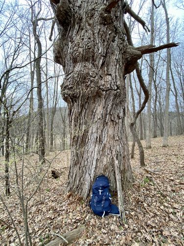
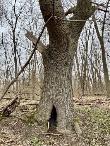
This hike begins in the town of Mt. Morris, New York on the north side of the Genesee River. Hikers will find the trailhead located on the north side of the parking lot. The hike starts here at the Highbanks Trail. The green blazes of the Highbanks Trail leads hikers up the slopes of Letchworth Gorge. As you make your way up the gorge, the elevation gain is generally "harder" in the beginning before the gorge generally levels out, albeit the trail does provide some undulation throughout. Most of the hike includes a quiet forest setting with some old growth trees along the way and, during cold months, obstructed views into the Letchworth Gorge.
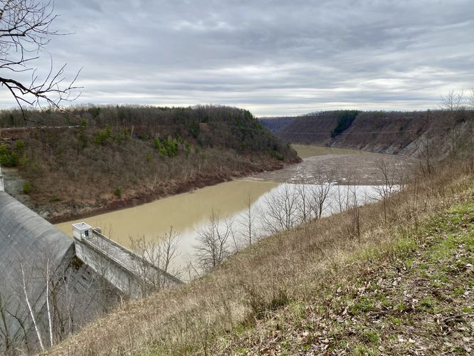
Mt. Morris Dam Viewpoint - Mile 0.7
At mile 0.7, hikers will reach a view of the Mt. Morris Dam as seen from down river. This was my favorite view of the dam as it sits straight ahead tucked between the steep canyon walls of the Letchworth Gorge. This viewing area is a bit obstructed by the neighboring tres, but there's enough of an opening to see the dam in full, especially during colder months with no leaves on the trees.
Loop Option - Mile 0.75
Just beyond the first view of the Mt. Morris Dam, hikers will find a split in the trail. The main pathway heads northward before bending west again - this track brings hikers in that direction and saves the short-cut southern portion for the hike out. By taking this right-hand turn, you'll hike a bit more uphill than if you take the southern route along the gorge's edge.
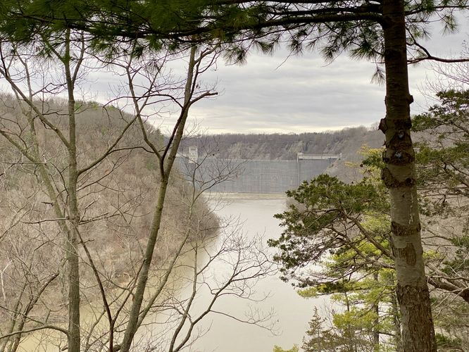
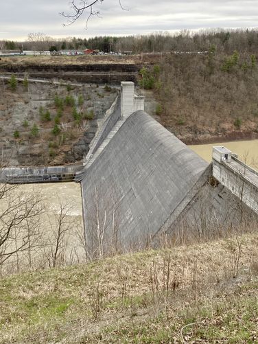
Mt. Morris Dam Overlook - Mile 1.55
Finally, around mile 1.55, hikers will reach the Mt. Morris Dam Overlook which provides more sweeping views into the Letchworth Gorge. Here, you'll be standing inline with the Dam that sits in the gorge below your feet. To the west is a scenic view of the gorge with its steep canyon walls. Below is the Mt. Morris Dam with its churning waters, and to the east is an obstructed view back toward Mt. Morris, NY.
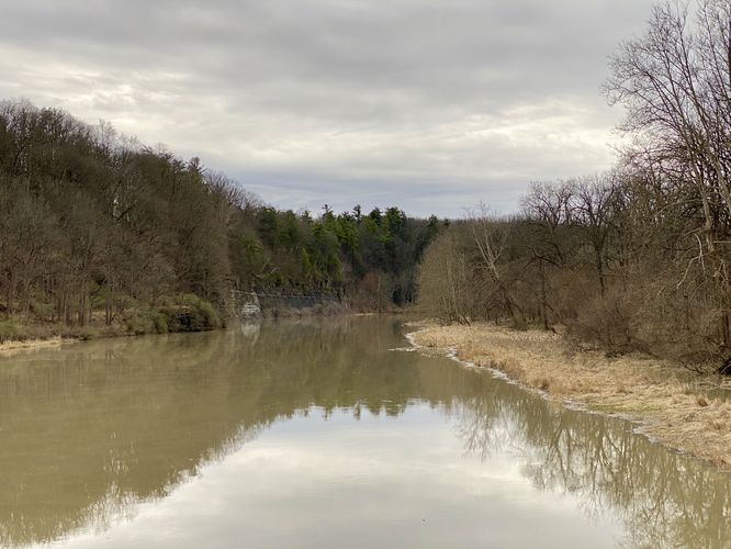
Hiking Out / Genesee River Bridge - Mile 1.6 to 3.15
The hike out back to parking is very easy as most of the walk is downhill. If you want to explore the southern loop portion along the Highbanks Trail, be on the lookout for a right-hand turn with no signage. This short-cut will save a bit of time. Last, if you wish to get a different perspective of the Genesee River, you can follow the path out to mile 3.15 where you'll follow a bridge to the middle of the river. From here, you can get a nice view upstream. During our hike here, we came for the totality of the April 8 2024 eclipse and watched it unfold from the bridge.
Restrooms
There are seasonal restrooms located at the Mt. Morris Dam Overlook.
Pets
Dogs are allowed only if leashed and must be cleaned up after.
Parking
Hikers will find a medium-sized parking lot at the coordinates provided, located on the west side of NY-36, north of the Genesee River. The lot is large enough to fit a dozen vehicles or slightly less as of April 2024.
April 8 2024 Eclipse Hike
We hiked this trail during the 2024 eclipse to be in the path of totality. Despite the 100% cloud cover, the eclipse was still an experience to behold, especially in the path of totality. We hiked the gorge before totality set in, then hit the Genesee River bridge to wait for totality. Totality started getting closer and the gorge and river became a lot more dim, then very quickly - within a matter of ~10 seconds - it was as if someone shut off the lights with a dimmer switch and the world went dark. Peepers came out in-full, automatic lights were turned on, and the small number of people on the bridge with us - located ~100-feet away - became invisible to the eye for just a few minutes. Then slowly, the light came back and it was all over ~4 minutes later.
Trails
This hike follows one named trail: Highbanks Trail (green blazes).
Hike
This hike begins in the town of Mt. Morris, New York on the north side of the Genesee River. Hikers will find the trailhead located on the north side of the parking lot. The hike starts here at the Highbanks Trail. The green blazes of the Highbanks Trail leads hikers up the slopes of Letchworth Gorge. As you make your way up the gorge, the elevation gain is generally "harder" in the beginning before the gorge generally levels out, albeit the trail does provide some undulation throughout. Most of the hike includes a quiet forest setting with some old growth trees along the way and, during cold months, obstructed views into the Letchworth Gorge.
Mt. Morris Dam Viewpoint - Mile 0.7
At mile 0.7, hikers will reach a view of the Mt. Morris Dam as seen from down river. This was my favorite view of the dam as it sits straight ahead tucked between the steep canyon walls of the Letchworth Gorge. This viewing area is a bit obstructed by the neighboring tres, but there's enough of an opening to see the dam in full, especially during colder months with no leaves on the trees.
Loop Option - Mile 0.75
Just beyond the first view of the Mt. Morris Dam, hikers will find a split in the trail. The main pathway heads northward before bending west again - this track brings hikers in that direction and saves the short-cut southern portion for the hike out. By taking this right-hand turn, you'll hike a bit more uphill than if you take the southern route along the gorge's edge.
Mt. Morris Dam Overlook - Mile 1.55
Finally, around mile 1.55, hikers will reach the Mt. Morris Dam Overlook which provides more sweeping views into the Letchworth Gorge. Here, you'll be standing inline with the Dam that sits in the gorge below your feet. To the west is a scenic view of the gorge with its steep canyon walls. Below is the Mt. Morris Dam with its churning waters, and to the east is an obstructed view back toward Mt. Morris, NY.
Hiking Out / Genesee River Bridge - Mile 1.6 to 3.15
The hike out back to parking is very easy as most of the walk is downhill. If you want to explore the southern loop portion along the Highbanks Trail, be on the lookout for a right-hand turn with no signage. This short-cut will save a bit of time. Last, if you wish to get a different perspective of the Genesee River, you can follow the path out to mile 3.15 where you'll follow a bridge to the middle of the river. From here, you can get a nice view upstream. During our hike here, we came for the totality of the April 8 2024 eclipse and watched it unfold from the bridge.
Restrooms
There are seasonal restrooms located at the Mt. Morris Dam Overlook.
Pets
Dogs are allowed only if leashed and must be cleaned up after.
Parking
Hikers will find a medium-sized parking lot at the coordinates provided, located on the west side of NY-36, north of the Genesee River. The lot is large enough to fit a dozen vehicles or slightly less as of April 2024.
April 8 2024 Eclipse Hike
We hiked this trail during the 2024 eclipse to be in the path of totality. Despite the 100% cloud cover, the eclipse was still an experience to behold, especially in the path of totality. We hiked the gorge before totality set in, then hit the Genesee River bridge to wait for totality. Totality started getting closer and the gorge and river became a lot more dim, then very quickly - within a matter of ~10 seconds - it was as if someone shut off the lights with a dimmer switch and the world went dark. Peepers came out in-full, automatic lights were turned on, and the small number of people on the bridge with us - located ~100-feet away - became invisible to the eye for just a few minutes. Then slowly, the light came back and it was all over ~4 minutes later.