Loading...

WINTER SALE! 50% OFF Supporter Accounts — now through January 31st. Learn More.

Mount Major

The Mount Major Trail at Mount Major State Park in Alton, New Hampshire is a difficult and popular 4-mile loop hike to the summit of Mount Major and views of Lake Winnipesaukee.

This recording heads up along the Boulder Trail (orange blazes), down the Brook Trail (yellow blazes), and finally down the Main Trail (blue blazes) before reaching the parking lot.

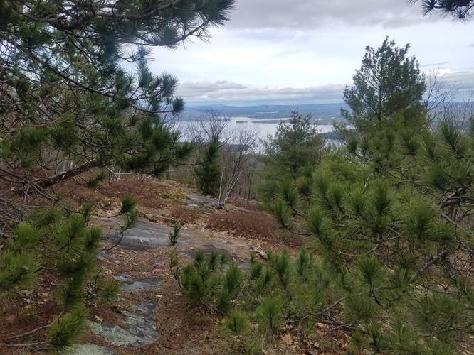
I went on May 4th and the Boulder Trail (orange) was mostly dry, but the Brook Trail (yellow) was very wet and muddy. The water was still fairly easy to avoid, so waterproof shoes are not needed. The Boulder Trail (orange) was fairly steep going up, with some rocky sections that were easy to scramble through. The Brook Trail (yellow) is much less steep and much easier on the knees than the other trails when making your descent.

This is a very popular trail as I saw quite a few people, dogs and families on the trail. The parking lot was completely full, with overflow parking along the side of Route 11.

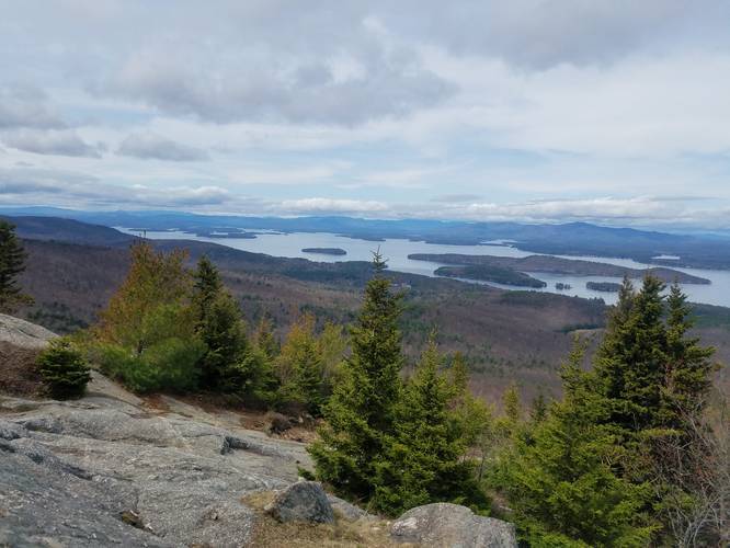
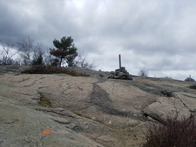
Lookout Point / Summit: Overall it was a great hike with beautiful views of Lake Winnipesaukee from the summit of Mount Major. The summit can be found roughly 1.6-miles from the parking lot after heading up the Boulder Trail (orange).
Explore 15 trails near Alton, NH

Know Before You Go

  • Mount Major offers a 4-mile loop hike with scenic views of Lake Winnipesaukee, accessible via multiple trails with varying difficulty.
  • The Boulder Trail (orange blazes) is a steep, rocky ascent, while the Brook Trail (yellow blazes) provides a less steep, but potentially wet and muddy descent.
  • Mount Major is a popular hiking destination; expect crowded trails and a full parking lot, especially during peak season.
Interactive topographic map for Mount Major located in Alton, NH. Click the "View Map" button to load GPS coordinates and trail markers.
Get directions
Distance
4.0 mi
Difficulty
Hard
Type
Loop
Est. Time
2 hrs
Elev. Gain
1,311'
Rating
0.0
Added
May 05, 2019
Updated
May 23, 2019

Weather Forecast

Loading...
Total Change
1,136'
Ascent
1,311'
Descent
1,236'
Loading...

Download the GPX Data for Offline Use

Supporters get exclusive access to download trail routes to the MyHikes app for offline use. Stay prepared on your adventure, even without an internet connection! Become a Supporter today to unlock this feature and hike with confidence.

Download Mount Major GPX Data to the MyHikes Mobile App

Features

Vista / Lookout Point
Dogs
Mountain Summit
Water Source

Points of interest

  1. Parking

    43.519321, -71.273757
  2. Main Trailhead

    43.519309, -71.273557
  3. Lake Winnipesaukee from the summit of Mount Major

    43.51374, -71.287131
    Lake Winnipesaukee from the summit of Mount Major
  4. Just below the summit of Mount Major

    43.513241, -71.287046
    Just below the summit of Mount Major

Safety information

For your own safety: plan ahead, let someone know where you'll be, and hike at your own risk.

Availability

All seasons

Surface type

Dirt

Trip Reports (Reviews)

Your opinion matters! Be the first to rate this trail.

Ready to help fellow hikers? Add a trip report to share your experience and provide valuable insights for other hikers!

No community routes found. To add your own hike as a Community Route for this Trail guide, leave a Trip Report with an attached GPX file.

Popular categories

Scenic mountain view representing vista trails
Vista trails
Scenic gorge of cascades representing waterfall trails
Waterfall hikes
Rugged mountain terrain representing summit trails
Summit trails
Scenic mountain view representing dog-friendly trails
Dog-friendly
Scenic campsite with a view representing camping trails
Camping trails
Appalachian Trail logo representing A.T. hikes
A.T. hikes

You May Also Like

Colorado's Million Dollar Highway - Plan a day's drive adventure along the iconic Million Dollar Highway in Colorado. Explore the best short trails, roadside stops, waterfalls, vistas, ghost towns, and hot springs within a ~6 hour road trip.
Explore

Colorado's Million Dollar Highway

Plan a day's drive adventure along the iconic Million Dollar Highway in Colorado. Explore the best short trails, roadside stops, waterfalls, vistas, ghost towns, and hot springs within a ~6 hour road trip.

Read
Glacier's Going-to-the-Sun Road - Discover the breathtaking beauty of Glacier National Park along the iconic Going-to-the-Sun Road. From stunning roadside stops to picturesque waterfalls and vistas, this engineering marvel offers endless opportunities for exploration.
Explore

Glacier's Going-to-the-Sun Road

Discover the breathtaking beauty of Glacier National Park along the iconic Going-to-the-Sun Road. From stunning roadside stops to picturesque waterfalls and vistas, this engineering marvel offers endless opportunities for exploration.

Read
🍪 We use cookies to learn about site usage and to serve map tiles. You may block cookies manually in the browser. By continuing you agree. Learn more