The Hike along Miners Run in McIntyre Wild Area near Ralston, Pennsylvania is a moderate 0.8 mile loop hike that leads along a boulder-strewn run with several cascades and waterfalls.
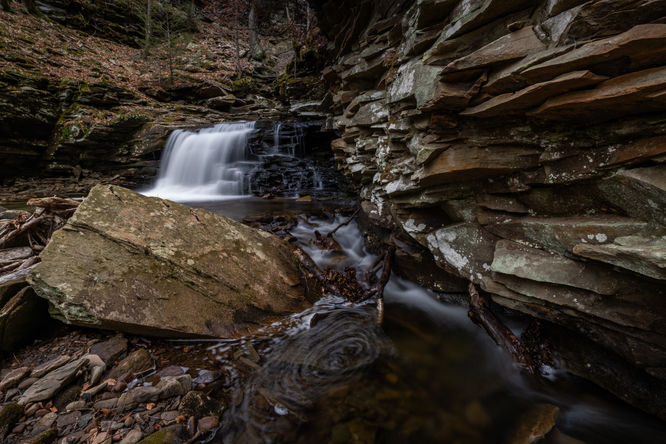
At this point, continuing the hike upstream looks daunting with no good way to proceed, however, if you look up and to the left of the run, you will see a small cave like opening and if you work your way up to this mini-cave, the path around the second waterfall becomes evident. It's a narrow path with a steep drop off, so proceed with caution.
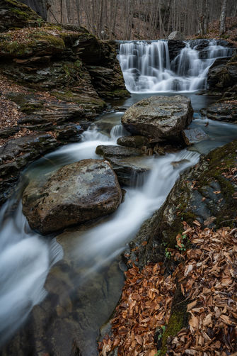
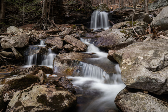
The third waterfall is just upstream and just beyond an interesting section with several boulders and depending on the water level, small cascades working its way around the boulders in various places. It can be a little tricky working your way around and through the boulders and running water, I zigged zagged my way to the left in front of the boulders and then back right in-between the boulders and to the right side of the run with a great view of the third waterfall.
I continued on the right side of the run up past the waterfall and to a precariously balanced boulder on top of a much smaller rock. Continue heading upstream and you will again be encountered with large boulders directly in the stream with Miners Run working it's way through and around wherever possible.
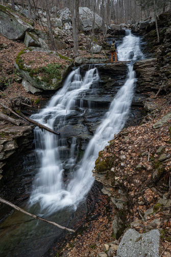
As you find your way around these boulders, the fourth waterfall will come into view and is likely the largest waterfall on the run. On previous hikers I have scrambled up the left side of the run, but on this most recent hike I found a scramble to the right which then gave me a great view of both the fourth and fifth falls.
The final waterfall, the sixth, depending on what you count as waterfalls is a little past the fifth. There are a series of small cascades leading up to the small final waterfall. The path back to Rock Run road and the parking can be found on the right side of the stream and is easy to follow, but does have a short section that go through thickening mountain laurel.
Falling rocks: There are some rock ledges that line the run, mostly comprised of shale which is known to flake and fall randomly. Be mindful of this when traversing the run near any rock ledges.
Parking
There is a small parking lot next to the bridge along Miners Run. The lot is large enough for about four vehicles. (I was the fourth vehicle, but did not see any others hiking the run, it is also used for people fishing Rock Run.)Hiking MIners Run
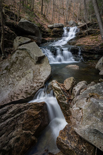
The first waterfall is visible from the bridge and can be photographed from both sides of the run using the bridge to gain access either side. The hike otherwise starts following the run going up the left side of the run and works its way up the side of the lower falls and around a large boulder. As you move past the boulder, you will work your way up the run and into a rocky gorge and to the second falls.At this point, continuing the hike upstream looks daunting with no good way to proceed, however, if you look up and to the left of the run, you will see a small cave like opening and if you work your way up to this mini-cave, the path around the second waterfall becomes evident. It's a narrow path with a steep drop off, so proceed with caution.
The third waterfall is just upstream and just beyond an interesting section with several boulders and depending on the water level, small cascades working its way around the boulders in various places. It can be a little tricky working your way around and through the boulders and running water, I zigged zagged my way to the left in front of the boulders and then back right in-between the boulders and to the right side of the run with a great view of the third waterfall.
I continued on the right side of the run up past the waterfall and to a precariously balanced boulder on top of a much smaller rock. Continue heading upstream and you will again be encountered with large boulders directly in the stream with Miners Run working it's way through and around wherever possible.
As you find your way around these boulders, the fourth waterfall will come into view and is likely the largest waterfall on the run. On previous hikers I have scrambled up the left side of the run, but on this most recent hike I found a scramble to the right which then gave me a great view of both the fourth and fifth falls.
The final waterfall, the sixth, depending on what you count as waterfalls is a little past the fifth. There are a series of small cascades leading up to the small final waterfall. The path back to Rock Run road and the parking can be found on the right side of the stream and is easy to follow, but does have a short section that go through thickening mountain laurel.
Pets
Dogs are technically allowed and should be leashed, but it may be difficult to explore and traverse with a dog on this off-trail hike.Warning
Timber rattlesnakes: This area is home to the Timber Rattlesnake which can be found roaming the forest floor between the months of April and October each year. Be on the lookout and give any rattlers you find plenty of space.Falling rocks: There are some rock ledges that line the run, mostly comprised of shale which is known to flake and fall randomly. Be mindful of this when traversing the run near any rock ledges.