The Miller Mountain Pipeline Loop at Pinchot State Forest in Tunkhannock, Pennsylvania is a strenuous 2.7-mile loop hike that leads straight up the mountain and leads down the pipeline, featuring sweeping views down its western slope. Pipeline & Sweeping Views - Mile 0.9 to 1.75
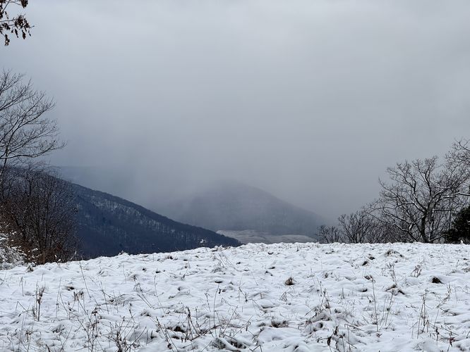
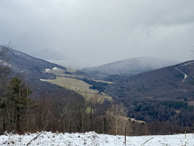
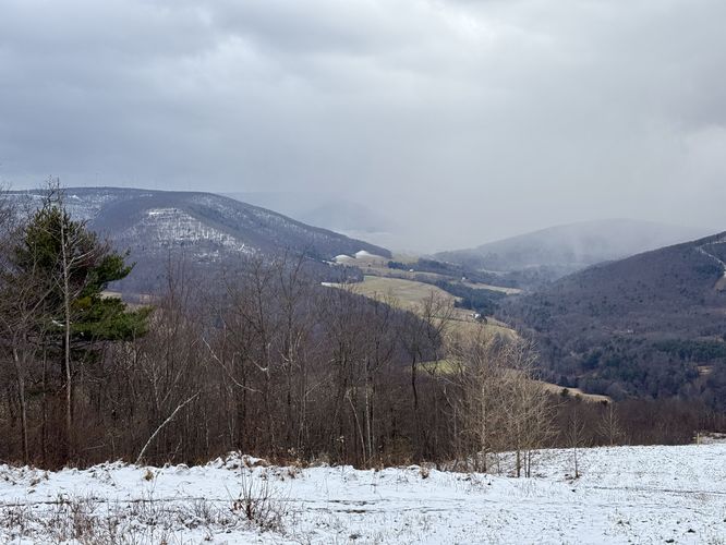
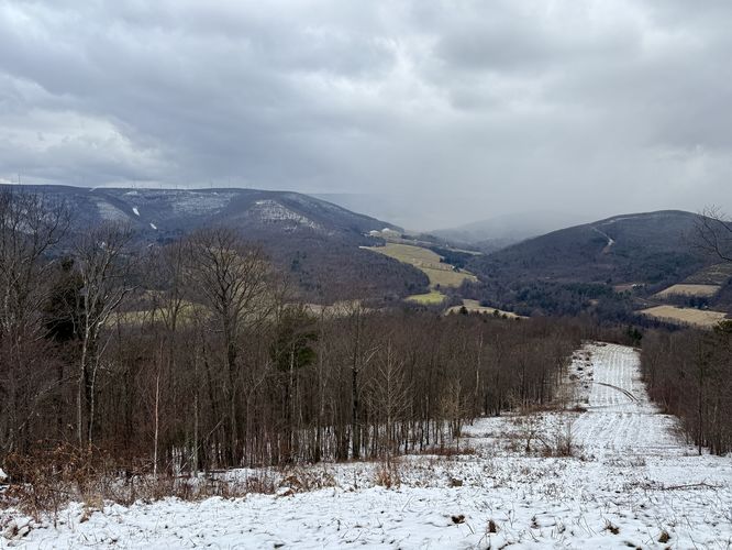
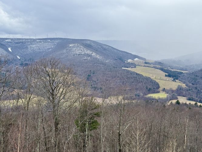
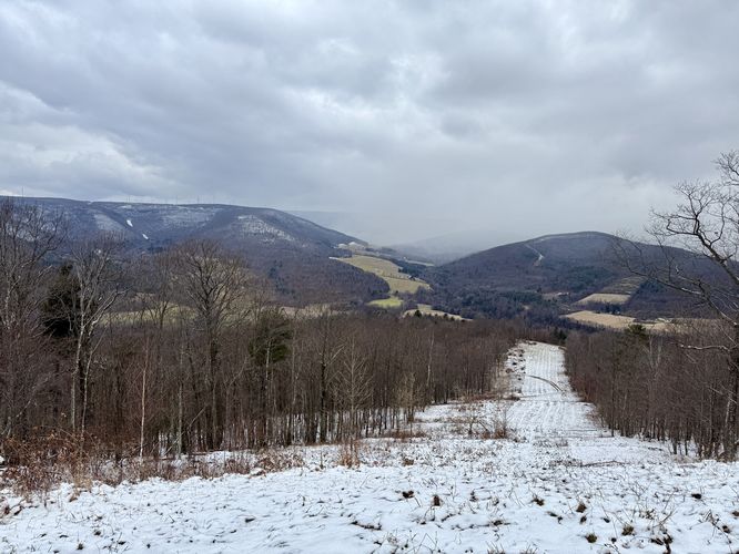
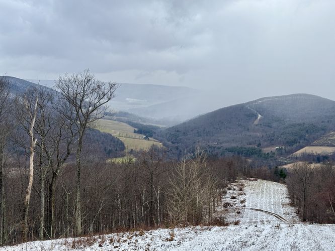
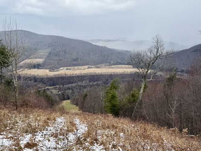
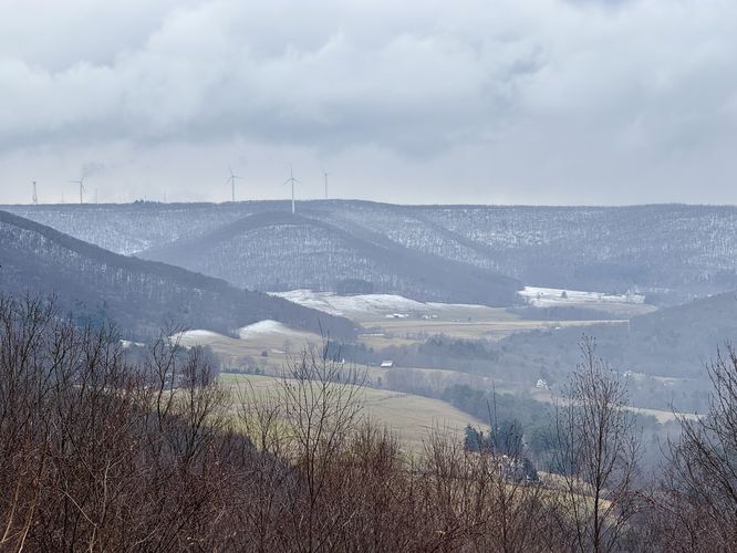
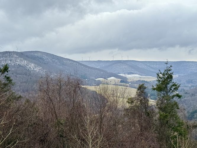
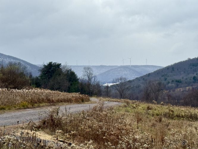
At mile 0.9, hikers will reach the top of Miller Mountain -- not the summit, but the cut of pipeline that sits just ~200-feet below the actual summit of the mountain. For what it's worth, this is essentially the "top" of the mountain. At the pipeline, this route leads due-west down the pipeline. During our hike, we saw a dark rain cloud coming in from the west, so instead of hiking to the summit of the mountain (heading east), we decided to change course and hike west down the pipeline. The pipeline appeared more gradual with a longer descent compared to the steep trail that this route follows up the mountain, but it includes several very steep sections of elevation grade. Around mile 1.15, hikers will reach the crest of the mountain where the pipeline drops down into the valley below. Here, the best views of Forkston Mountain and its numerous wind turbines comes into view. During our hike here, a curtain of snow rolled-in over Forkston Mountain and the valley below as we began our descent. The initial descent from the crest is super steep, so take your time. You'll find a large rock outcropping near the trail too, which adds interesting scenery, but obviously the best views are that of Forkston Mountain and the valley below. These views don't change much for the hike along the pipeline, despite the large number of view POI provided on the map. Note that the pipeline is generally mowed, but may be mowed just a couple of times per year so hiking the pipeline during the winter is by-far the easiest time of year to follow this trail due to the lack of overgrowth. Eventually, the trail will reach a junction with an easy-grade path that leads north and back to parking, located near mile 1.75. The elevation grade that drops down to this trail is the last super-steep section of pipeline, so watch your step. Western Trail to Parking - Mile 1.75 to 2.7
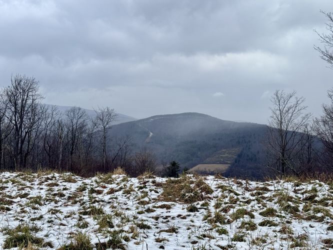
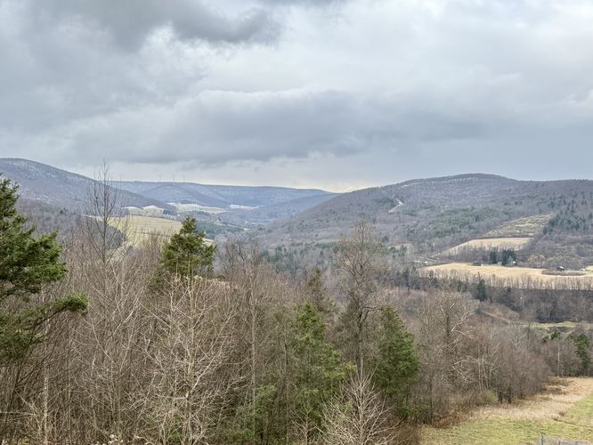
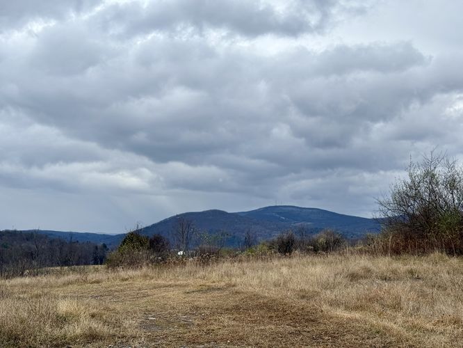
Once on the western trail that bisects the pipeline, hikers will walk north as the trail leads back toward Jurista Drive South. This trail is easy to follow with no roots or large rocks, but rather a simple gravel path. It's a much-needed trail to follow after the somewhat brutal elevation grade downhill along the pipeline. Take this trail as it meanders north to reach a secondary parking lot. The trail follows an entry road out to the DCNR-owned farm located along Jurista Drive South. Along the walk toward the farm, you'll find views of Avery Mountain, Osterhout Mountain, and Miller Mountain. If you turn around, you'll find views to the west of Forkston Mountain. Once on Jurista Drive South, hike east to reach the parking area and to complete this strenuous 2.7-mile loop hike.
Pipeline hiking: This route leads hikers down a natural gas pipeline trail that may be overgrown during warm months. The pipeline is mowed seasonally, but at least one section of the trail was still overgrown even in very-late November 2024. Your mileage may vary on this pipeline depending on what time of year you hike it.
Timber Rattlesnakes: Northern Pennsylvania is home to the Timber Rattlesnake which loves open, sunny, and rocky mountain tops. Be on the lookout for rattlesnakes if you plan to hike this between the end of April and early October since these snakes are generally found outside of their dens during these months.
Hiking Miller Mountain's Pipeline
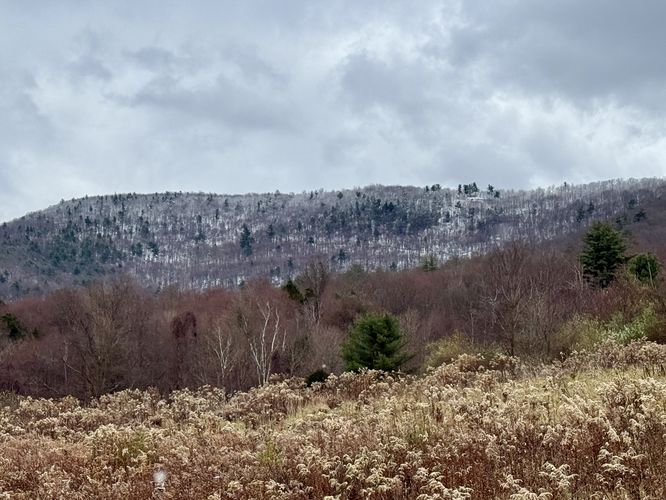
This hike begins along the northern-most trailhead for Miller Mountain, located directly across the street from Jurista Hill Road. The trail begins to climb the mountain at a moderate grade, hitting one main switchback where you'll find an old stone wall which used to act as a property marker long-ago. From the rock wall, the hike up the mountain has very few points-of-interest or noteworthy sights. We hiked this the day after Thanksgiving 2024 when a snowfall came in the day prior -- the snow on the ground and in the distant mountains provided obstructed views through the trees when we took breaks on our hike up. These views were obviously not worth taking pictures of, but were nice to take-in amongst numerous breaks hiking this steep trail.Steep Route / Right-Hand Turn - Mile 0.45
Around mile 0.45, hikers will reach a junction in the trail. This route keeps right at the fork and leads straight up the mountain, which is by far the steepest way to hike up Miller Mountain. Due to foot-traffic patterns, the left-hand turn here appears more popular and leads to a different spot atop the mountain. If you wish to follow this route, you'll want to take a right-hand turn here. The trail picks up in elevation grade as it ascends the hardest part of Miller Mountain. Take as many breaks as you need on the way up -- for us, it took approximately 55-minutes to make it from the trailhead to the pipeline.Pipeline & Sweeping Views - Mile 0.9 to 1.75
At mile 0.9, hikers will reach the top of Miller Mountain -- not the summit, but the cut of pipeline that sits just ~200-feet below the actual summit of the mountain. For what it's worth, this is essentially the "top" of the mountain. At the pipeline, this route leads due-west down the pipeline. During our hike, we saw a dark rain cloud coming in from the west, so instead of hiking to the summit of the mountain (heading east), we decided to change course and hike west down the pipeline. The pipeline appeared more gradual with a longer descent compared to the steep trail that this route follows up the mountain, but it includes several very steep sections of elevation grade. Around mile 1.15, hikers will reach the crest of the mountain where the pipeline drops down into the valley below. Here, the best views of Forkston Mountain and its numerous wind turbines comes into view. During our hike here, a curtain of snow rolled-in over Forkston Mountain and the valley below as we began our descent. The initial descent from the crest is super steep, so take your time. You'll find a large rock outcropping near the trail too, which adds interesting scenery, but obviously the best views are that of Forkston Mountain and the valley below. These views don't change much for the hike along the pipeline, despite the large number of view POI provided on the map. Note that the pipeline is generally mowed, but may be mowed just a couple of times per year so hiking the pipeline during the winter is by-far the easiest time of year to follow this trail due to the lack of overgrowth. Eventually, the trail will reach a junction with an easy-grade path that leads north and back to parking, located near mile 1.75. The elevation grade that drops down to this trail is the last super-steep section of pipeline, so watch your step. Western Trail to Parking - Mile 1.75 to 2.7
Once on the western trail that bisects the pipeline, hikers will walk north as the trail leads back toward Jurista Drive South. This trail is easy to follow with no roots or large rocks, but rather a simple gravel path. It's a much-needed trail to follow after the somewhat brutal elevation grade downhill along the pipeline. Take this trail as it meanders north to reach a secondary parking lot. The trail follows an entry road out to the DCNR-owned farm located along Jurista Drive South. Along the walk toward the farm, you'll find views of Avery Mountain, Osterhout Mountain, and Miller Mountain. If you turn around, you'll find views to the west of Forkston Mountain. Once on Jurista Drive South, hike east to reach the parking area and to complete this strenuous 2.7-mile loop hike. Parking
Hikers will find a grass-area parking lot located at the coordinates provided on the north side of Jurista Drive South. The parking area is directly across the street from a once-private property with a trailer-sized home that's now owned by the DCNR. The lot is large enough to fit over a dozen vehicles.Pets
Dogs are allowed if leashed and should be cleaned up after.Warnings
Steep elevation: This hike follows some of the steepest elevation on Miller Mountain and may not be the best route for the average hiker.Pipeline hiking: This route leads hikers down a natural gas pipeline trail that may be overgrown during warm months. The pipeline is mowed seasonally, but at least one section of the trail was still overgrown even in very-late November 2024. Your mileage may vary on this pipeline depending on what time of year you hike it.
Timber Rattlesnakes: Northern Pennsylvania is home to the Timber Rattlesnake which loves open, sunny, and rocky mountain tops. Be on the lookout for rattlesnakes if you plan to hike this between the end of April and early October since these snakes are generally found outside of their dens during these months.