Trail names: Massanutten Ridge Trail
Location: Del Webb Drive, Massanutten VA
Permitted uses: Hiking, Nature Study, Geocaching
Prohibited uses: Fires and littering are not permitted.
Hours: There are no posted hours.
Fees and Parking: There is no fee to park or to use the trails. There is parking available in the lot for about 14 cars.
Pets: There are no posted prohibitions on pets but due to the rocky terrain I would not recommend bringing a dog along this trail.
Accessibility: This trail is not wheelchair accessible.
Hiker amenities: There is an information kiosk at the trailhead parking lot with a posted map. There are bins for trash and recycling. There are no restrooms or water.
Length and Trail information: This hike is done as an out and back hike and is approximately 5.7 miles. The trail is marked with blue trail blazes and is considered difficult. What makes this hike difficult, is not so much great changes in elevation, rather because the trail is very very rocky and difficult to navigate.
Hikers can access the trail from the parking lot at the end of Del Webb Drive or they can pay for a ride on the ski lift up to the Peak and then hike it from the Peak to the Parking lot and back. Since we were staying at the Condos here, we ended up hiking from the Del Webb parking lot where we left a car, along the Massanutten Ridge Trail to the Massanutten Peak and then down the service road to the Condo where we were staying. We then took another car back to the Del Webb parking lot and retrieved the car parked there. The trail we have show is edited to give future hikers an out and back trail to follow, since they may not have the luxury of staying at one of the Condos.
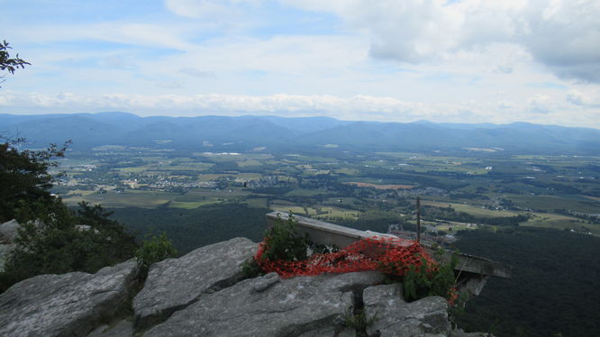
From the Del Webb trailhead parking lot, the hike will begin by climbing a set of sturdy wooden stairs. Before heading up the stairs, take a minute to check out the Massanutten Overlook information board. Although it has a lot of graffiti on it, we could still read the history about the area and use the key to identify some features seen in the valley below.
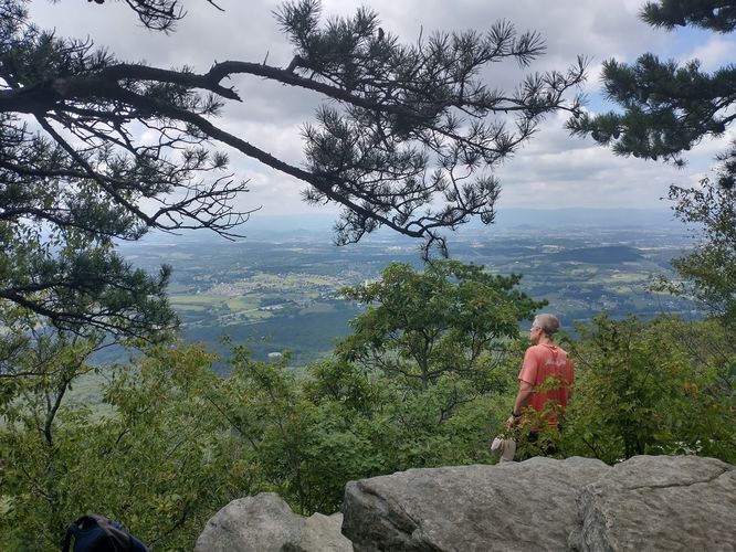
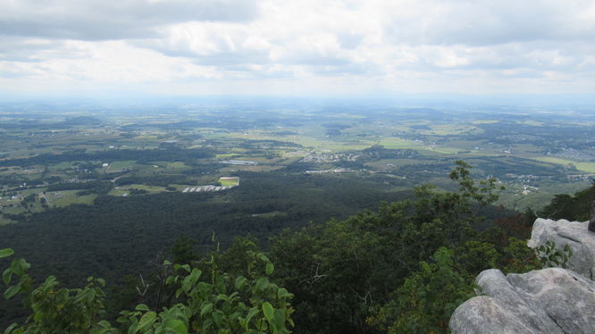
At the top of the stairs the trail immediately becomes rocky and a bit of a challenge to navigate. Needless to say, the rocky terrain slowed our progress. Keep in mind that this is prime habitat for snakes, so be careful where you place your hands and feet as you travel along this beautiful ridge trail. There were lots of opportunities for what we started calling “pocket views” of the valley. The best views can be found at the Massanutten Peak. We took advantage of every “Pocket View” along the trail to take a rest, enjoy the views and hydrate before moving on. Even though this is considered a challenging hike, we saw lots of other hikers on the trail, so be ready for some company.
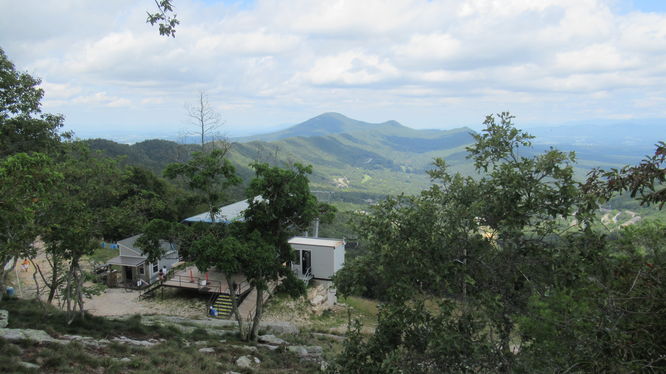
The trail eventually led us to the service road that ascended to a cell tower to the right, and the ski lift to the left. We hiked up to the cell tower area and found an information board posted that showed us we were at the Massanutten Peak. The board identified the towns below, the trees surrounding the area and the Allegheny Mountains in the distance. It also gave a very brief history of its use by Native Americans and Confederate sentries during the Civil War. After a brief break and a snack we headed over to the area above the ski lift to get a view of the valley from the rocky outcropping, then we began our long trek back down the service road. Hiking down the service road was steep and gravely. The views weren’t great, but it was a nice change from scrambling over rocks.