Mary's Lake Trail in Estes Park, Colorado is an easy 0.6-mile out-and-back trail that features views of Mary's Lake, Lily Mountain, and Twin Sisters Peaks.
Hike
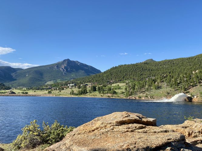
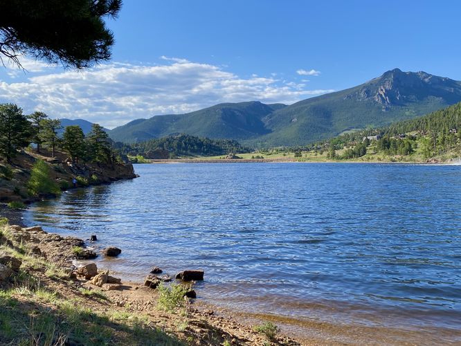
This short hike begins at the main parking lot for Mary's Lake, located at the coordinates provided off of Mary's Lake Road in Estes Park. The trail has two entrances - this path leads in just beyond the rules and regulations sign to head to the waters. This initial pathway is mostly a fisherman's path as it ends by the water. Hikers can skip this portion if the wish, but we hiked back up the hill - passing an old concrete footing - located near the "summit" of the park, before connecting to the main trail that runs along the north shore of Mary's Lake. Once on the main pathway, it follows a dirt trail that undulates along the northern shore of the lake, providing views along the way -- mostly that of Twin Sisters Mountain, Lily Mountain, and the hydroelectric dam spout that shoots water into Mary's Lake.
The trail ends at the northwestern parking lot where hikers will find picnic tables with shade umbrellas -- or you might find a nice fishing spot along the way. The walk back to parking is simple, but mostly uphill as the trail undulates back to the parking lot for a 0.6-mile out-and-back hike.
Fishing
Mary's Lake is a very-popular fishing spot for locals and tourists alike.
Parking
Hikers will find a large parking lot at the coordinates provided, located on the south side of Mary's Lake Road in the northeastern section of the lake. The parking lot is large enough to fit a couple dozen vehicles.
Pets
Dogs are allowed only if leashed or under total control through voice command (per rules and regulations as of June 2024).
Hike
This short hike begins at the main parking lot for Mary's Lake, located at the coordinates provided off of Mary's Lake Road in Estes Park. The trail has two entrances - this path leads in just beyond the rules and regulations sign to head to the waters. This initial pathway is mostly a fisherman's path as it ends by the water. Hikers can skip this portion if the wish, but we hiked back up the hill - passing an old concrete footing - located near the "summit" of the park, before connecting to the main trail that runs along the north shore of Mary's Lake. Once on the main pathway, it follows a dirt trail that undulates along the northern shore of the lake, providing views along the way -- mostly that of Twin Sisters Mountain, Lily Mountain, and the hydroelectric dam spout that shoots water into Mary's Lake.
The trail ends at the northwestern parking lot where hikers will find picnic tables with shade umbrellas -- or you might find a nice fishing spot along the way. The walk back to parking is simple, but mostly uphill as the trail undulates back to the parking lot for a 0.6-mile out-and-back hike.
Fishing
Mary's Lake is a very-popular fishing spot for locals and tourists alike.
Parking
Hikers will find a large parking lot at the coordinates provided, located on the south side of Mary's Lake Road in the northeastern section of the lake. The parking lot is large enough to fit a couple dozen vehicles.
Pets
Dogs are allowed only if leashed or under total control through voice command (per rules and regulations as of June 2024).