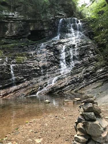
The Margarette Falls Trail at Cherokee National Forest near Whitesand Tennessee, is a moderate 2.7 mile out-and-back hike up to the 60 foot waterfall, Margarette Falls.
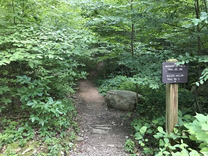
The trail itself starts out easy, uphill on a low elevation grade until you reach the junction with about 3 other trails. From the parking lot to the intersection is about 0.3 miles and is private land on both sides - stay on the trail here.
Upon reaching the intersection, take the right-hand turn and then the immediate left-hand turn to stay on the Margarette Falls Trail. There will be sign posts for the falls as well, just follow those and the blue blazes.
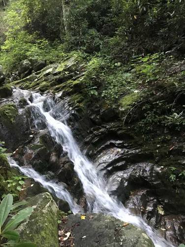
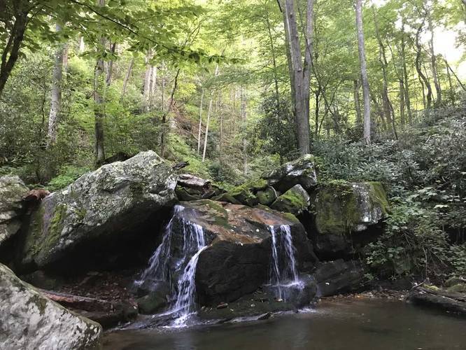
Along the way you'll find plenty of waterfalls about 8 to 12 feet in height, but you'll know you reached Margarette Falls once you see it. The trail has plenty of rocky patches that last 0.1 to 0.2 miles in length and are difficult to walk on, so watch your footing.
Backpacking is technically allowed on this trail and throughout Cherokee National Forest, but there aren't any good places to camp along this trail. However, there are better places more suited for camping on other trails by the first trail junction.
The trail itself starts out easy, uphill on a low elevation grade until you reach the junction with about 3 other trails. From the parking lot to the intersection is about 0.3 miles and is private land on both sides - stay on the trail here.
Upon reaching the intersection, take the right-hand turn and then the immediate left-hand turn to stay on the Margarette Falls Trail. There will be sign posts for the falls as well, just follow those and the blue blazes.
Along the way you'll find plenty of waterfalls about 8 to 12 feet in height, but you'll know you reached Margarette Falls once you see it. The trail has plenty of rocky patches that last 0.1 to 0.2 miles in length and are difficult to walk on, so watch your footing.
Backpacking is technically allowed on this trail and throughout Cherokee National Forest, but there aren't any good places to camp along this trail. However, there are better places more suited for camping on other trails by the first trail junction.