The Maple Run Trail at Spencer Crest Nature Center in Corning, New York is a moderate 0.6-mile one-way trail that features a gazebo and a beautiful view of Amelia Pond.
This recording begins at the parking lot and heads downhill, adjacent to the nature center building. The trail then hits a fork with a green-blazed trail - stay right at the fork to continue along the yellow blazes.
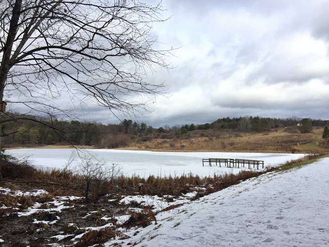
Shortly after the first fork, the trail will reach a gazebo with two picnic tables that sits next to Amelia Pond. Next to this gazebo is a plaque dedicated to Amelia Gerhardt Creath (1931 - 1975) who was a Corning Community College Biologist.
After taking in the views at Amelia Pond, the trail continues onward and heads uphill slightly before leveling out. Here, hikers will also find interpretive signs for the Fibonacci Walk. After about 0.4-miles, the trail will reach a junction with the High Meadow Trail and this is where the Maple Run Trail becomes more moderate.
The junction with the High Meadow Trail is a note-worthy point along the trail since after here, heading east, the trail will take two moderate climbs downhill. During wet months, and when the trail is littered with leaves, the trail becomes very slick as its grade turns much more steep. While this trail is not very long, this short section of trail should be taken slow and considered moderate despite the short climb up/downhill.
After reaching the bottom of both steep hill sections along the Maple Run Trail, the trail terminates at a triple yellow blaze marking. Here, hikers will find the trail links up with a couple of other trails at the park, including the Hemlock Pass Trail.
Blaze Colors
This trail follows a single yellow blaze; however, sometimes the yellow blazes also pass or follow another trail simultaneously, so keep an eye out for single yellow blazes as you hike.
Pets
Dogs are allowed if leashed and their waste must be carried out by the hiker.
Parking
Hikers can find parking at the main parking lot at Spencer Crest Nature Center - at the coordinates provided. The parking lot is large enough to fit a few dozen vehicles.
This recording begins at the parking lot and heads downhill, adjacent to the nature center building. The trail then hits a fork with a green-blazed trail - stay right at the fork to continue along the yellow blazes.
Shortly after the first fork, the trail will reach a gazebo with two picnic tables that sits next to Amelia Pond. Next to this gazebo is a plaque dedicated to Amelia Gerhardt Creath (1931 - 1975) who was a Corning Community College Biologist.
After taking in the views at Amelia Pond, the trail continues onward and heads uphill slightly before leveling out. Here, hikers will also find interpretive signs for the Fibonacci Walk. After about 0.4-miles, the trail will reach a junction with the High Meadow Trail and this is where the Maple Run Trail becomes more moderate.
The junction with the High Meadow Trail is a note-worthy point along the trail since after here, heading east, the trail will take two moderate climbs downhill. During wet months, and when the trail is littered with leaves, the trail becomes very slick as its grade turns much more steep. While this trail is not very long, this short section of trail should be taken slow and considered moderate despite the short climb up/downhill.
After reaching the bottom of both steep hill sections along the Maple Run Trail, the trail terminates at a triple yellow blaze marking. Here, hikers will find the trail links up with a couple of other trails at the park, including the Hemlock Pass Trail.
Blaze Colors
This trail follows a single yellow blaze; however, sometimes the yellow blazes also pass or follow another trail simultaneously, so keep an eye out for single yellow blazes as you hike.
Pets
Dogs are allowed if leashed and their waste must be carried out by the hiker.
Parking
Hikers can find parking at the main parking lot at Spencer Crest Nature Center - at the coordinates provided. The parking lot is large enough to fit a few dozen vehicles.