Many Parks Curve Trail at Rocky Mountain National Park
near Estes Park, Colorado is an easy 0.4-mile out-and-back
universally-accessible pathway that features panoramic views of Longs Peak, Deer Mountain, and the many "parks" that comprise Rocky Mountain National Park.
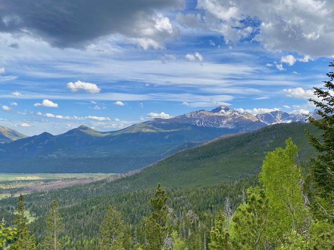
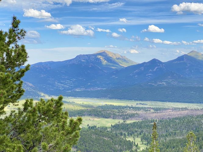
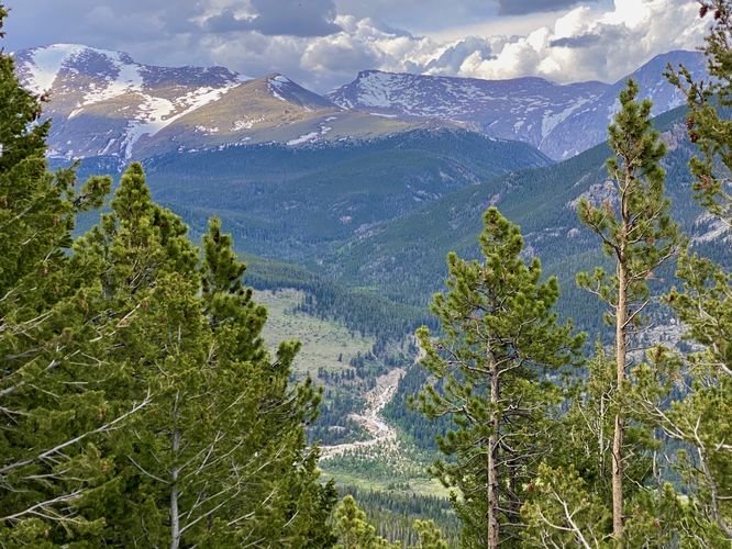
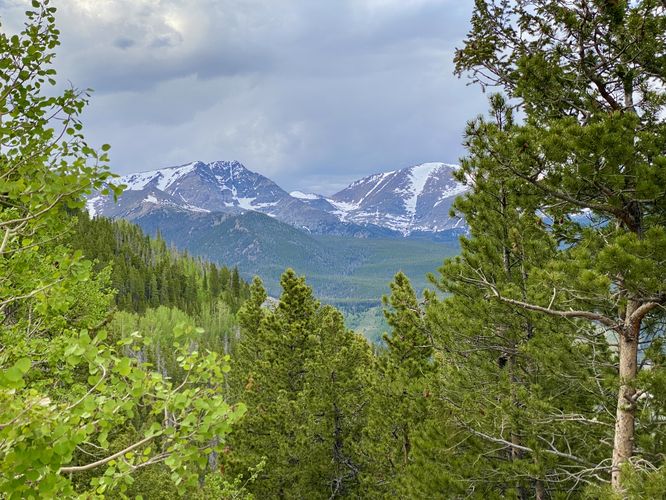
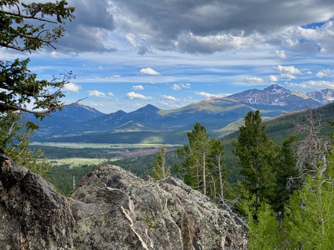
This is not a hike but rather a walk along a universally-accessible sidewalk to take-in the panoramic views of Rocky Mountain National Park. This trail begins in two different parking lots, but this guide brings hikers from the western-most lot (up the mountain road) down to the eastern-most parking lot. The trail begins on the south side of the western lot, crossing the road, to reach a sidewalk with a railing that leads down the mountain, featuring breathtaking views of the park to the east and north. The trail includes views of the park's tallest mountain, Longs Peak in addition to shorter, but popular mountains that hikers are drawn to, like Deer Mountain. The trail also includes signage that explains the park's many "parks" that are comprised of named sections of meadows that exist within Rocky Mountain National Park.
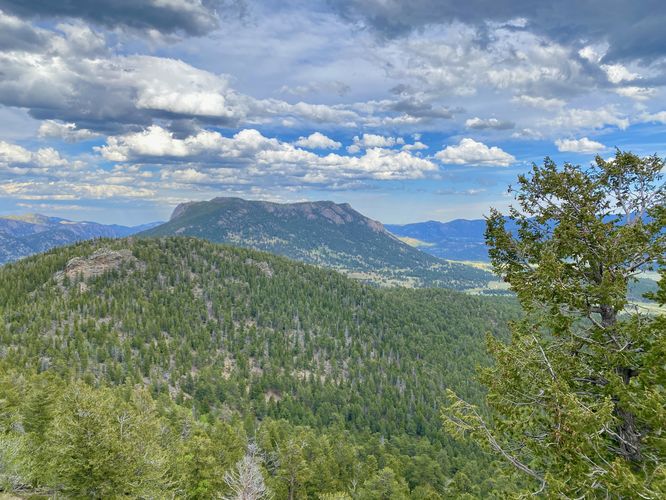
At the eastern parking lot is a fun rock scramble that you can go off-trail to explore different views; however that scramble is obviously not universally accessible. On the far side of the eastern parking lot (northern side) is a different view of mountains that can really only be seen between a couple of trees -- appearing to be Bighorn Mountain and Fairchild Mountain.
Due to this pathway's altitude, at 9,600-feet above sea level, it's a great place for visitors to take-in the natural beauty while also taking short walks to acclimatize.
Paved Path & Universal Access
This short parking lot viewpoint is universally accessible via pavement, a sidewalk, and a short boardwalk.
Pets
Dogs are not allowed on this trail.
Parking
Hikers will find a medium-sized parking lot at the coordinates provided along Fall River Road. The lot is large enough to fit just over a dozen vehicles as of June 2024.
Timed-Entry Reservations
Between the months of late May through early October you must purchase a timed-entry pass to visit Rocky Mountain National Park. If you wish to visitor and hike anything off of the Bear Lake Road, you must purchase a dedicated Bear Lake timed-entry pass. You can find more information about timed entry on the park's website.
Warnings
Elevation sickness: This trail brings hikers through terrain at 9,600-feet above sea level. Around the 7,000-foot mark above sea level, hikers may start to experience symptoms of elevation sickness including headache, muscle aches, shortness of breath, among other warning signs. In order to avoid elevation sickness it's recommended to ascend to higher elevations and take short walks to acclimate over the course of several days before taking a long or physically-demanding hike. At any time you feel elevation sickness kicking in, that's the time to turn back and head for lower altitude or the parking lot.
This is not a hike but rather a walk along a universally-accessible sidewalk to take-in the panoramic views of Rocky Mountain National Park. This trail begins in two different parking lots, but this guide brings hikers from the western-most lot (up the mountain road) down to the eastern-most parking lot. The trail begins on the south side of the western lot, crossing the road, to reach a sidewalk with a railing that leads down the mountain, featuring breathtaking views of the park to the east and north. The trail includes views of the park's tallest mountain, Longs Peak in addition to shorter, but popular mountains that hikers are drawn to, like Deer Mountain. The trail also includes signage that explains the park's many "parks" that are comprised of named sections of meadows that exist within Rocky Mountain National Park.
At the eastern parking lot is a fun rock scramble that you can go off-trail to explore different views; however that scramble is obviously not universally accessible. On the far side of the eastern parking lot (northern side) is a different view of mountains that can really only be seen between a couple of trees -- appearing to be Bighorn Mountain and Fairchild Mountain.
Due to this pathway's altitude, at 9,600-feet above sea level, it's a great place for visitors to take-in the natural beauty while also taking short walks to acclimatize.
Paved Path & Universal Access
This short parking lot viewpoint is universally accessible via pavement, a sidewalk, and a short boardwalk.
Pets
Dogs are not allowed on this trail.
Parking
Hikers will find a medium-sized parking lot at the coordinates provided along Fall River Road. The lot is large enough to fit just over a dozen vehicles as of June 2024.
Timed-Entry Reservations
Between the months of late May through early October you must purchase a timed-entry pass to visit Rocky Mountain National Park. If you wish to visitor and hike anything off of the Bear Lake Road, you must purchase a dedicated Bear Lake timed-entry pass. You can find more information about timed entry on the park's website.
Warnings
Elevation sickness: This trail brings hikers through terrain at 9,600-feet above sea level. Around the 7,000-foot mark above sea level, hikers may start to experience symptoms of elevation sickness including headache, muscle aches, shortness of breath, among other warning signs. In order to avoid elevation sickness it's recommended to ascend to higher elevations and take short walks to acclimate over the course of several days before taking a long or physically-demanding hike. At any time you feel elevation sickness kicking in, that's the time to turn back and head for lower altitude or the parking lot.