The Lumberman's Loop at Susquehannock State Forest near Sweden Township, Pennsylvania is a moderate 6.5-mile loop hike that features a beautiful forest walk that encompasses the Pennsylvania Lumber Museum and follows several named trails.
Trails
This loop includes several named trails in a counter-clockwise order: Lumbermans Trail (red blazes), Crowell Hollow Trail (red blazes), and the Commissioner Trail (red and blue blazes).
Private Property
Please note that this hike follows defined trails through some sections of private property for quite a while. Please respect the land owners and stay on-trail at all times within private property areas. Please check the state forest map (by changing the map tiles to Susquehannock State Forest) to see where the private properties sit.
Hike Description
This hike begins at the lower parking lot at the PA Lumber Museum and first follows the Lumbermans Trail heading east, which follows PA Route-6 on the northern side of the road. On the opposite end of the Lumber Museum property lies a sign with red blazes for the Lumbermans Trail, take a left-hand turn here and then an immediate right-hand turn to stay on the Lumbermans Trail.
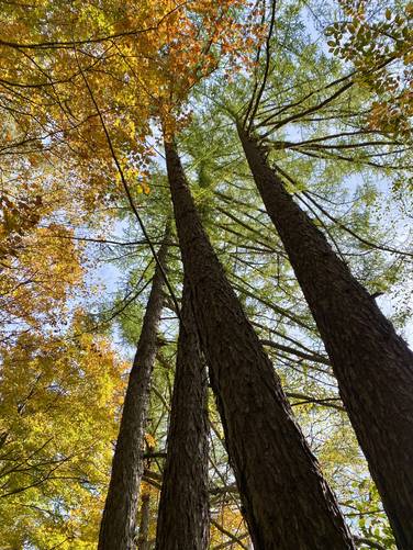
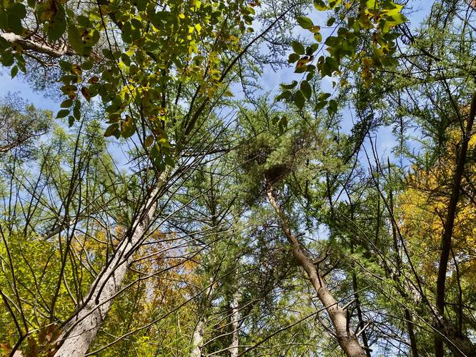
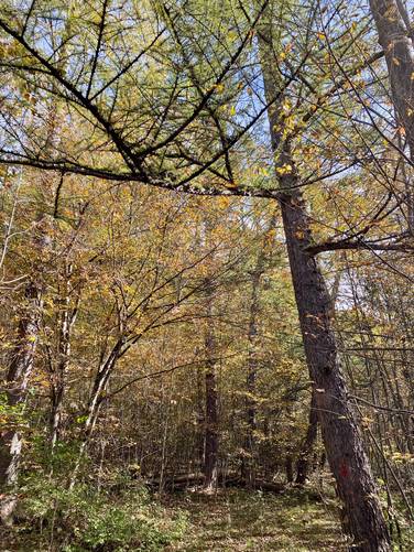
Larch Stand - Mile 0.38, 0.5, & 0.75
One of the highlights of this hike are the stands of Larch trees that sit along the Lumbermans Trail which can be found at mile 0.5 and 0.75. Larch are the only species of evergreen trees that purposefully drop their needles in the winter, thus are the only species of evergreen that has Autumn foliage. Stands of Larch typically turn a vibrant yellow, which helps them stand out amongst the rest of the Fall foliage. Upon this hike in early October, the Larch had not yet turned yellow.
Private Property Walk - Mile 0.8
At mile 0.8, the Lumbermans Trail comes out at a private driveway. This is confusing, but hikers must stay between the south side of the driveway (as it heads east) and the stand of pine trees just to the right of the private drive. Hikers will cross the driveway as it heads north, before turning east, to follow the trail as it passes through an open field just south of the private home. At the other side of the field, just before the next private property, are red blazes for the continuation of the Lumbermans Trail on the left-hand side. Please respect the land owners and stay on the trail at all times.
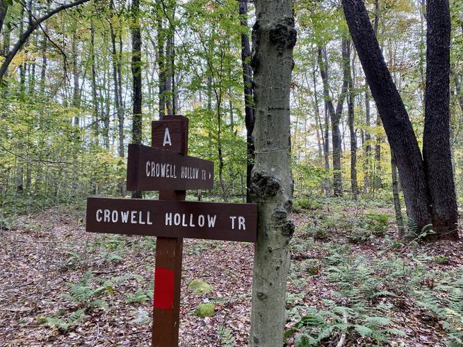
Crowell Hollow Trail - Mile 1
At mile 1, where the trail bends north after coming in from the private field, hikers will enter the Crowell Hollow Trail; however, there are no signs for this trailhead.
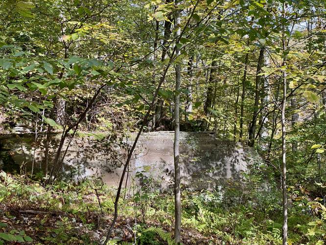
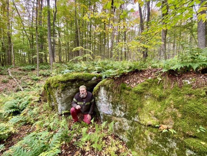
Old Quarry Site - Mile 1.07
Around mile 1.07, hikers will pass a rocky outcropping on the side of the mountain - this is actually an old quarry site. Notice the flat-cut bedrock - this was likely dug out and then cut out over 100-years ago, circa late 1800s or early 1900s.
Keep Right - Mile 1.2
Around mile 1.2, the trail will reach a crest in the hill where the Crowell Hollow Trail meets a junction with a left-hand turn that heads up the mountain toward a rocky outcropping. Here, stay right to head downhill into Crowell Hollow to stay on the Crowell Hollow Trail.
Crowell Hollow Trail Sights
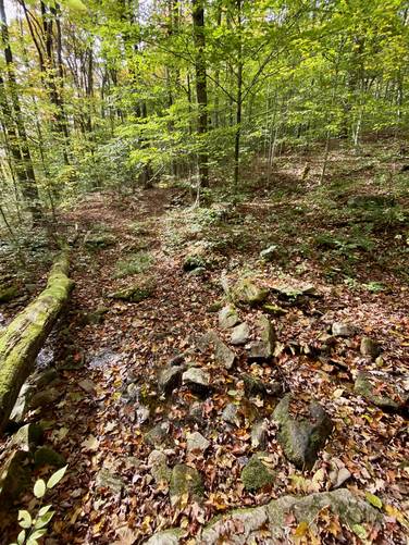
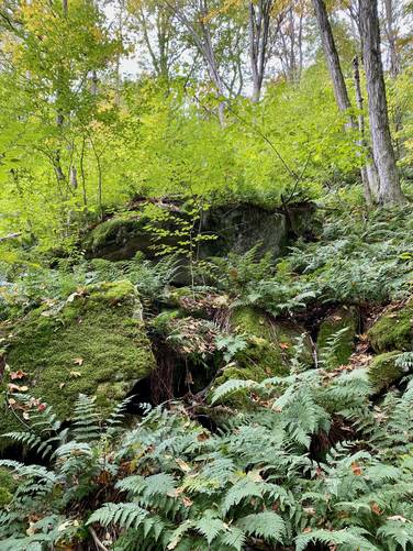
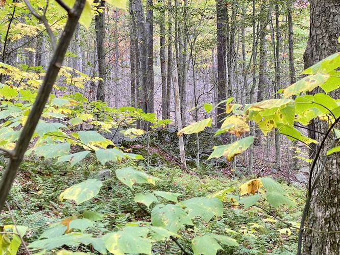
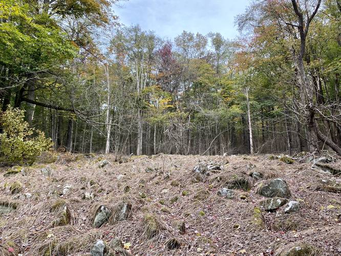
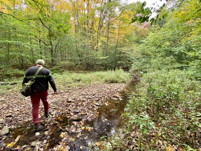
At mile 1.8 is a creek crossing where hikers, if need be, can filter water. Between miles 2.4 and 2.65 are large moss-covered boulders and rocks that sit along the trail, which provide an different look and feel. Note that through this section of the hike, the trail also has some rocky sections which can be annoying to navigate when the leaves cover the ground. Last, there's an open field full of grass-covered boulders at mile 2.68 - watch your step as one wrong move could break an ankle here. The boulders have small crevasses and holes that are hidden by the thick and tall grass that grows up from below. This area appears to be a boulder swamp or headwaters of sorts for Crowell Run creek; however, that's speculation.
Commissioner Trail - Mile 3.5
At mile 3.5, hikers will reach a junction with the Commissioner Trail. Take a left-hand turn here to follow the red blazes of that trail as it heads back down the mountain to reach Commissioner Run.
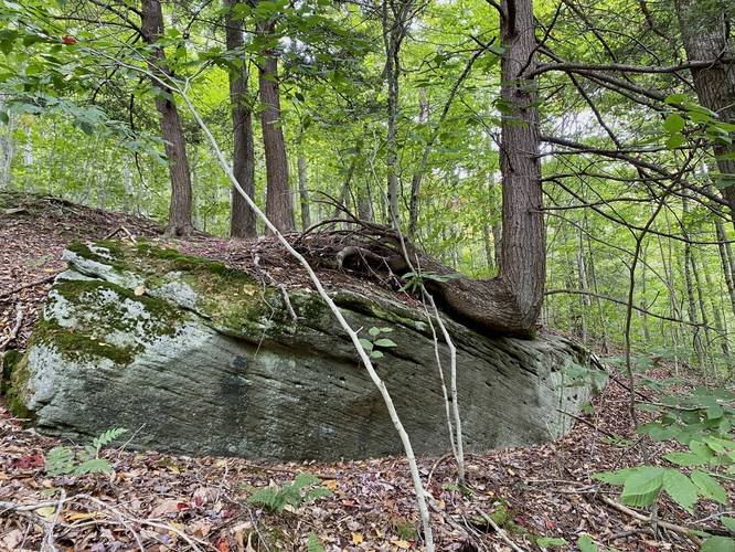
Large Boulder - Mile 3.92
At mile 3.92, hikers will reach a table-like boulder that has a large tree growing on its top. I labeled this as a possible bouldering boulder, however, it might be too low to the ground to count.
Commissioner Run Blue Blazes - Mile 5.1
At mile 5.1, hikers will cross Commissioner Run - a spot where, if need be, you can filter water. This is also where the Commissioner Trail follows blue blazes, which indicates a skiing trail for the winter.
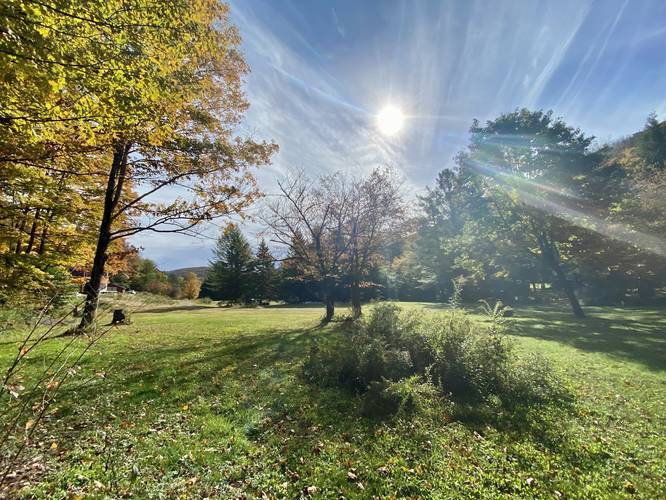
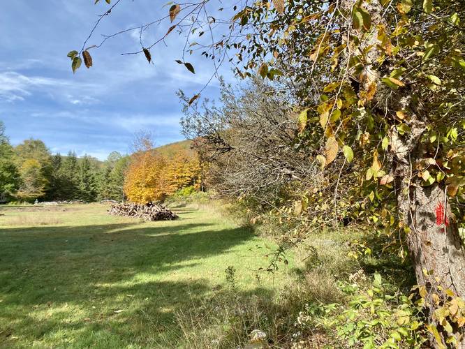
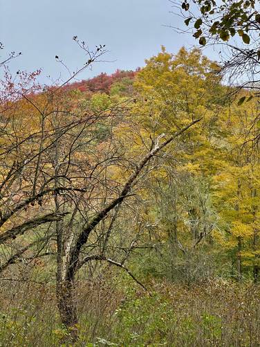
Apple Orchard & "View" - Mile 5.7
At mile 5.7, hikers will reach an old apple orchard, which indicates a homestead once stood nearby. Here, when the leaves are off of the apple trees, it provides hikers with an obstructed view of the mountain you just climbed and descended. During Autumn, the mountainside often be found popping with color through this obstructed view.
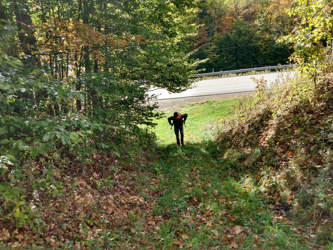
Parking Lot - Mile 6.2
At mile 6.2, hikers will end the hike by reaching the parking lot.
Parking
Hikers will find parking at the coordinates provided, which is located just a stones-throw from PA Route-6 at the Lumber Museum. The lot is large enough to hold a half-dozen vehicles or so.
Pets
Dogs are allowed if leashed and their waste should be carried out by the hiker.
Camping & Backpacking
While we didn't find any campsites along this trail, dispersed / primitive / backcountry camping is permitted in Susquehannock State Forest. If camping, please follow all state forest rules and regulations.
Warning
Timber Rattlesnakes: While there may not be an active rattlesnake den nearby, between the months of April and October, they may be out roaming the woods or drinking and hunting by the creeks. This trail does pass by some rocky outcroppings on the mountain, though, none of them are sun-lit, which means chances of seeing a rattlesnake on this hike are slim.
Trails
This loop includes several named trails in a counter-clockwise order: Lumbermans Trail (red blazes), Crowell Hollow Trail (red blazes), and the Commissioner Trail (red and blue blazes).
Private Property
Please note that this hike follows defined trails through some sections of private property for quite a while. Please respect the land owners and stay on-trail at all times within private property areas. Please check the state forest map (by changing the map tiles to Susquehannock State Forest) to see where the private properties sit.
Hike Description
This hike begins at the lower parking lot at the PA Lumber Museum and first follows the Lumbermans Trail heading east, which follows PA Route-6 on the northern side of the road. On the opposite end of the Lumber Museum property lies a sign with red blazes for the Lumbermans Trail, take a left-hand turn here and then an immediate right-hand turn to stay on the Lumbermans Trail.
Larch Stand - Mile 0.38, 0.5, & 0.75
One of the highlights of this hike are the stands of Larch trees that sit along the Lumbermans Trail which can be found at mile 0.5 and 0.75. Larch are the only species of evergreen trees that purposefully drop their needles in the winter, thus are the only species of evergreen that has Autumn foliage. Stands of Larch typically turn a vibrant yellow, which helps them stand out amongst the rest of the Fall foliage. Upon this hike in early October, the Larch had not yet turned yellow.
Private Property Walk - Mile 0.8
At mile 0.8, the Lumbermans Trail comes out at a private driveway. This is confusing, but hikers must stay between the south side of the driveway (as it heads east) and the stand of pine trees just to the right of the private drive. Hikers will cross the driveway as it heads north, before turning east, to follow the trail as it passes through an open field just south of the private home. At the other side of the field, just before the next private property, are red blazes for the continuation of the Lumbermans Trail on the left-hand side. Please respect the land owners and stay on the trail at all times.
Crowell Hollow Trail - Mile 1
At mile 1, where the trail bends north after coming in from the private field, hikers will enter the Crowell Hollow Trail; however, there are no signs for this trailhead.
Old Quarry Site - Mile 1.07
Around mile 1.07, hikers will pass a rocky outcropping on the side of the mountain - this is actually an old quarry site. Notice the flat-cut bedrock - this was likely dug out and then cut out over 100-years ago, circa late 1800s or early 1900s.
Keep Right - Mile 1.2
Around mile 1.2, the trail will reach a crest in the hill where the Crowell Hollow Trail meets a junction with a left-hand turn that heads up the mountain toward a rocky outcropping. Here, stay right to head downhill into Crowell Hollow to stay on the Crowell Hollow Trail.
Crowell Hollow Trail Sights
At mile 1.8 is a creek crossing where hikers, if need be, can filter water. Between miles 2.4 and 2.65 are large moss-covered boulders and rocks that sit along the trail, which provide an different look and feel. Note that through this section of the hike, the trail also has some rocky sections which can be annoying to navigate when the leaves cover the ground. Last, there's an open field full of grass-covered boulders at mile 2.68 - watch your step as one wrong move could break an ankle here. The boulders have small crevasses and holes that are hidden by the thick and tall grass that grows up from below. This area appears to be a boulder swamp or headwaters of sorts for Crowell Run creek; however, that's speculation.
Commissioner Trail - Mile 3.5
At mile 3.5, hikers will reach a junction with the Commissioner Trail. Take a left-hand turn here to follow the red blazes of that trail as it heads back down the mountain to reach Commissioner Run.
Large Boulder - Mile 3.92
At mile 3.92, hikers will reach a table-like boulder that has a large tree growing on its top. I labeled this as a possible bouldering boulder, however, it might be too low to the ground to count.
Commissioner Run Blue Blazes - Mile 5.1
At mile 5.1, hikers will cross Commissioner Run - a spot where, if need be, you can filter water. This is also where the Commissioner Trail follows blue blazes, which indicates a skiing trail for the winter.
Apple Orchard & "View" - Mile 5.7
At mile 5.7, hikers will reach an old apple orchard, which indicates a homestead once stood nearby. Here, when the leaves are off of the apple trees, it provides hikers with an obstructed view of the mountain you just climbed and descended. During Autumn, the mountainside often be found popping with color through this obstructed view.
Parking Lot - Mile 6.2
At mile 6.2, hikers will end the hike by reaching the parking lot.
Parking
Hikers will find parking at the coordinates provided, which is located just a stones-throw from PA Route-6 at the Lumber Museum. The lot is large enough to hold a half-dozen vehicles or so.
Pets
Dogs are allowed if leashed and their waste should be carried out by the hiker.
Camping & Backpacking
While we didn't find any campsites along this trail, dispersed / primitive / backcountry camping is permitted in Susquehannock State Forest. If camping, please follow all state forest rules and regulations.
Warning
Timber Rattlesnakes: While there may not be an active rattlesnake den nearby, between the months of April and October, they may be out roaming the woods or drinking and hunting by the creeks. This trail does pass by some rocky outcroppings on the mountain, though, none of them are sun-lit, which means chances of seeing a rattlesnake on this hike are slim.