The Lincoln Loop and Teaberry Loop hike at the Quehanna Wild Area near Benezette, Pennsylvania is a moderate 4.7-mile loop hike that features three overlooks.
Trails
Lincoln Loop Trail (southern half), Teaberry Loop Trail (northern half). Note: this specific hike does not include the bisecting trail that connects both the Lincoln Loop to the Teaberry Loop; however, we do include a point-of-interest on the map indicating where the bisecting trail junctions are.
Popularity
This is one of the most popular day hikes in the Quehanna Wild Area and while this hike is very nice, there are plenty of other awesome hikes nearby that see less foot traffic.
Trail Description
This hike begins at the Beaver Run parking area and heads east along Beaver Run Road (technically a trail) before reaching the Quehanna Highway. The trail crosses the Quehanna Highway and follows yellow blazes, past a left-hand turn, before reaching the first vista point.
1st Overlook / Vista
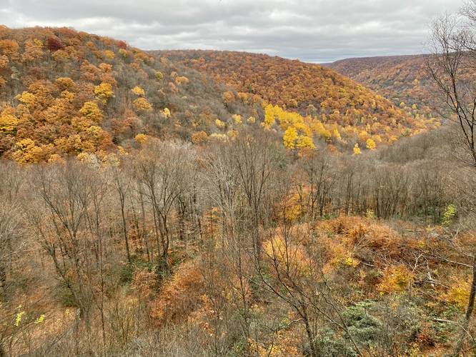
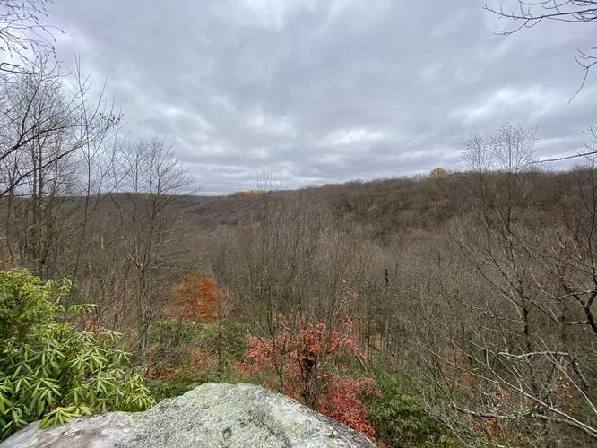
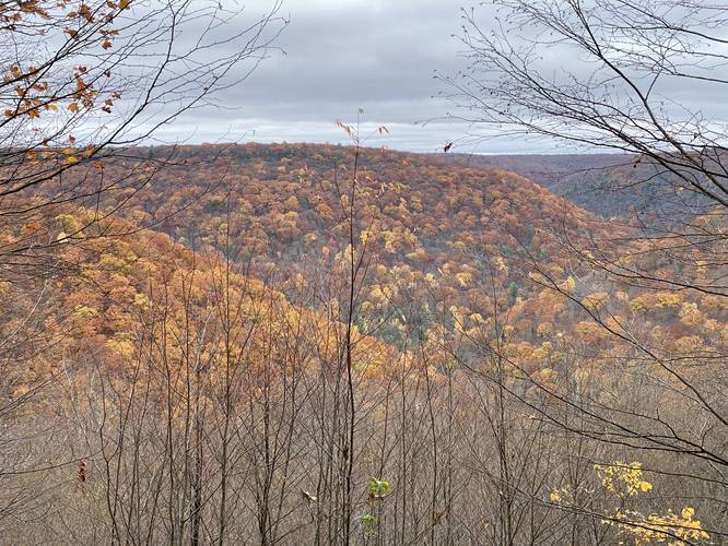
Hikers will reach the first vista around mile 0.6. This is the best view you'll get throughout the entire hike, so if you're stopping by for a short vista hike and do not want to see the entire trail, this is the easiest way to see a beautiful mountainous view of the Quehanna Wild Area. The view from this overlook faces north from the top of massive boulders that sit along the mountain's edge.
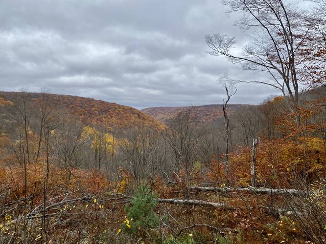
After leaving the first overlook, the hike becomes much more rugged (hence, the moderate difficulty). Here, the trail will head down along the side of these massive rock outcroppings. The terrain can be very steep with slick rocks in some sections. When leaves litter the trail and when it's wet, it makes it even more difficult to hike down this section of trail so take it slow and watch your footing. While making your way downhill, hikers will find one more view of the mountains before you descend to the creek below.
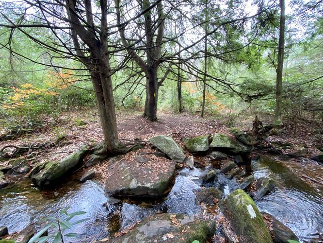
Once you reach what feels like the lowest point in the trail - just after climbing down from the first vista - the trail will trample over rocks as it meanders its way upstream. Hikers will find plenty of small waterfalls within this creek, though none of them are worth noting or stopping at. At the very least, this creek is useful for filtering water.
Around mile 1.6, the trail will cross the creek before heading back uphill. Near the top of the hill, hikers will find the bisecting trail for the two loops along with the 2nd vista - Balancing Rock Overlook. Hikers will continue until they reach the bisecting trail that connects the Lincoln Loop Trail and the Teaberry Loop Trail around mile 1.75. Here, stay right to keep on the outer portion of the main loop - this follows the Teaberry Loop Trail.
2nd Overlook / Vista - "Balancing Rock Overlook"
Around mile 1.85, hikers will reach the the second vista which I've nicknamed the "Balancing Rock Overlook" since hikers get the best view from atop a massive boulder that appears to be balancing on another rock on the mountainside. The view from this second overlook is not as nice as the first overlook, but it's a really nice place to take a break along the trail.
3rd Overlook / Vista (obstructed)
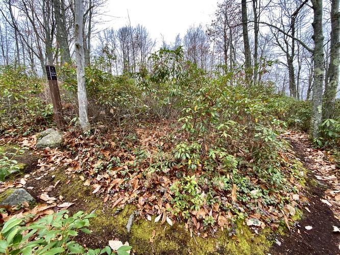
Around mile 2.3, hikers will reach the 3rd and final overlook along this loop hike. This overlook is a bit overgrown, as of October 2020, and has not been maintained in a while, so some treetops are blocking part of the view. Hikers will get the best view here when the leaves are not on the trees (or if a volunteer maintains this vista).
After visiting the third overlook, hikers will head west until they reach a trail junction around mile 3.3. Here, take a right-hand turn to head due-south back toward the Quehanna Highway. Not long after hiking south along the Teaberry Loop, hikers will reach the western terminus for the bisecting trail that connects both the Teaberry Loop and the Lincoln Loop around mile 3.8. Here, stay straight to continue hiking south along the Lincoln Loop toward the Quehanna Highway.
Around mile 4.2, hikers will cross the Quehanna Highway (with a parking lot located nearby). The Lincoln Loop Trail will continue for another 0.1 mile before hikers reach yet another trail junction. Take a left-hand turn here to head directly back to the parking area at the Beaver Run water impoundment.
Difficulty
This trail, for the most part, is easy; however, the section of trail that descends into the ravine / creek area is much more rocky, steep, and annoying. Most hikers should expect a moderate hike.
Blaze Color
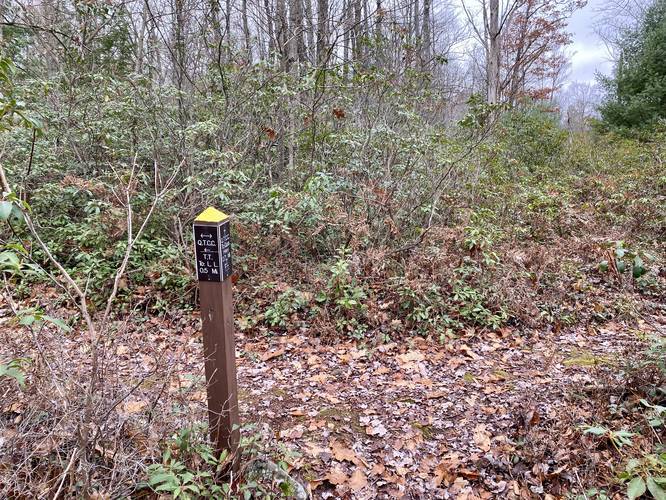
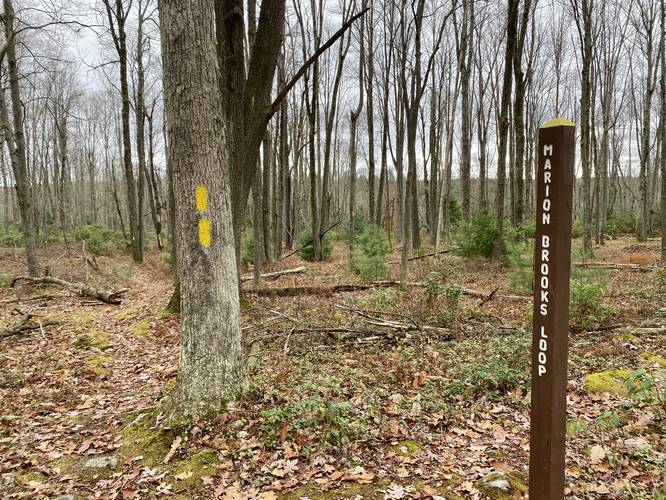
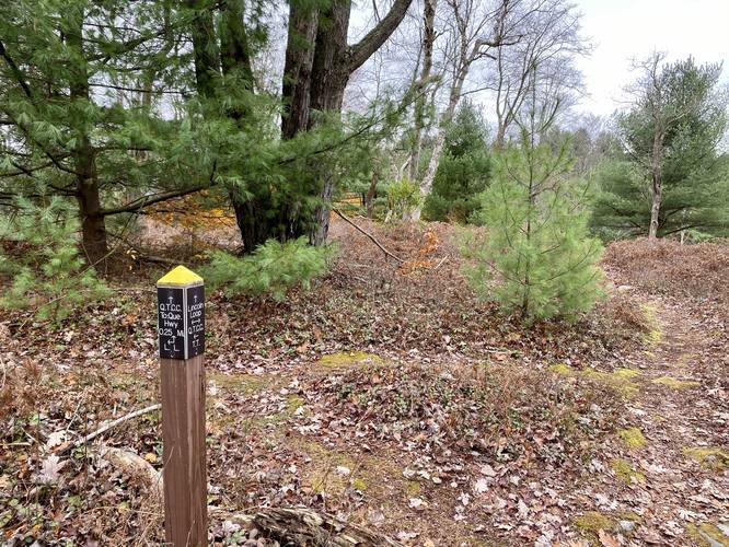
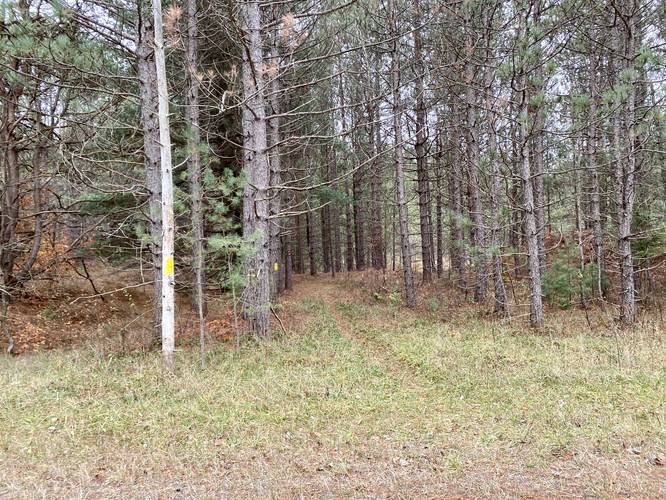
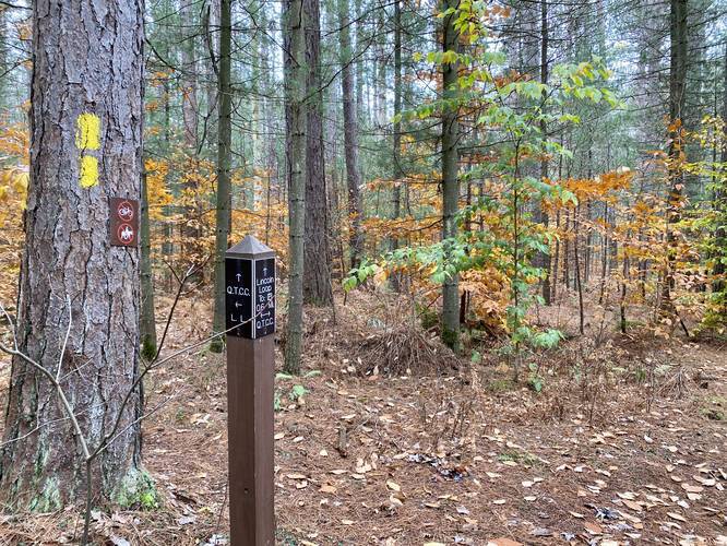
All of the trails along this route follow yellow blazes. Most of the trail junctions have signs, which help. Bring an offline map along with a paper map to ensure you do not get lost.
Parking
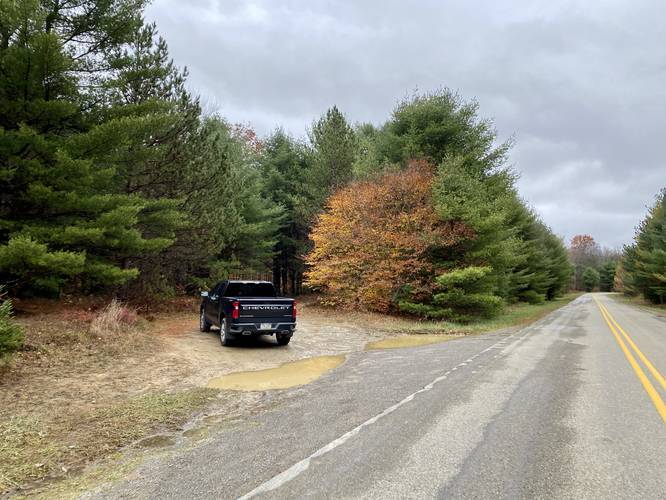
Hikers will find a large parking lot at the Beaver Run shallow water impoundment at the coordinates provided. The lot is large enough to fit about a dozen vehicles, with room for overflow. Hikers will also find two other parking areas along the Quehanna Highway - both where the trail crosses the highway.
Pets
Dogs are allowed if leashed.
Camping and Backpacking
Backpackers will find that there are really no good places to setup camp along this trail. There technically is one small campsite near the western portion of the loop (around mile 4), just north of the Quehanna Highway; however, this campsite is tiny - best for hammocks - and literally sits underneath a massive dead tree that hangs over the campsite. Camp at your own risk and please follow all state forest rules and regulations when dispersed / primitive / backcountry camping.
Trails
Lincoln Loop Trail (southern half), Teaberry Loop Trail (northern half). Note: this specific hike does not include the bisecting trail that connects both the Lincoln Loop to the Teaberry Loop; however, we do include a point-of-interest on the map indicating where the bisecting trail junctions are.
Popularity
This is one of the most popular day hikes in the Quehanna Wild Area and while this hike is very nice, there are plenty of other awesome hikes nearby that see less foot traffic.
Trail Description
This hike begins at the Beaver Run parking area and heads east along Beaver Run Road (technically a trail) before reaching the Quehanna Highway. The trail crosses the Quehanna Highway and follows yellow blazes, past a left-hand turn, before reaching the first vista point.
1st Overlook / Vista
Hikers will reach the first vista around mile 0.6. This is the best view you'll get throughout the entire hike, so if you're stopping by for a short vista hike and do not want to see the entire trail, this is the easiest way to see a beautiful mountainous view of the Quehanna Wild Area. The view from this overlook faces north from the top of massive boulders that sit along the mountain's edge.
After leaving the first overlook, the hike becomes much more rugged (hence, the moderate difficulty). Here, the trail will head down along the side of these massive rock outcroppings. The terrain can be very steep with slick rocks in some sections. When leaves litter the trail and when it's wet, it makes it even more difficult to hike down this section of trail so take it slow and watch your footing. While making your way downhill, hikers will find one more view of the mountains before you descend to the creek below.
Once you reach what feels like the lowest point in the trail - just after climbing down from the first vista - the trail will trample over rocks as it meanders its way upstream. Hikers will find plenty of small waterfalls within this creek, though none of them are worth noting or stopping at. At the very least, this creek is useful for filtering water.
Around mile 1.6, the trail will cross the creek before heading back uphill. Near the top of the hill, hikers will find the bisecting trail for the two loops along with the 2nd vista - Balancing Rock Overlook. Hikers will continue until they reach the bisecting trail that connects the Lincoln Loop Trail and the Teaberry Loop Trail around mile 1.75. Here, stay right to keep on the outer portion of the main loop - this follows the Teaberry Loop Trail.
2nd Overlook / Vista - "Balancing Rock Overlook"
Around mile 1.85, hikers will reach the the second vista which I've nicknamed the "Balancing Rock Overlook" since hikers get the best view from atop a massive boulder that appears to be balancing on another rock on the mountainside. The view from this second overlook is not as nice as the first overlook, but it's a really nice place to take a break along the trail.
3rd Overlook / Vista (obstructed)
Around mile 2.3, hikers will reach the 3rd and final overlook along this loop hike. This overlook is a bit overgrown, as of October 2020, and has not been maintained in a while, so some treetops are blocking part of the view. Hikers will get the best view here when the leaves are not on the trees (or if a volunteer maintains this vista).
After visiting the third overlook, hikers will head west until they reach a trail junction around mile 3.3. Here, take a right-hand turn to head due-south back toward the Quehanna Highway. Not long after hiking south along the Teaberry Loop, hikers will reach the western terminus for the bisecting trail that connects both the Teaberry Loop and the Lincoln Loop around mile 3.8. Here, stay straight to continue hiking south along the Lincoln Loop toward the Quehanna Highway.
Around mile 4.2, hikers will cross the Quehanna Highway (with a parking lot located nearby). The Lincoln Loop Trail will continue for another 0.1 mile before hikers reach yet another trail junction. Take a left-hand turn here to head directly back to the parking area at the Beaver Run water impoundment.
Difficulty
This trail, for the most part, is easy; however, the section of trail that descends into the ravine / creek area is much more rocky, steep, and annoying. Most hikers should expect a moderate hike.
Blaze Color
All of the trails along this route follow yellow blazes. Most of the trail junctions have signs, which help. Bring an offline map along with a paper map to ensure you do not get lost.
Parking
Hikers will find a large parking lot at the Beaver Run shallow water impoundment at the coordinates provided. The lot is large enough to fit about a dozen vehicles, with room for overflow. Hikers will also find two other parking areas along the Quehanna Highway - both where the trail crosses the highway.
Pets
Dogs are allowed if leashed.
Camping and Backpacking
Backpackers will find that there are really no good places to setup camp along this trail. There technically is one small campsite near the western portion of the loop (around mile 4), just north of the Quehanna Highway; however, this campsite is tiny - best for hammocks - and literally sits underneath a massive dead tree that hangs over the campsite. Camp at your own risk and please follow all state forest rules and regulations when dispersed / primitive / backcountry camping.